Category:River Darent
Vai alla navigazione
Vai alla ricerca

river in Kent, England, UK  | |||||
| Carica un file multimediale | |||||
| Istanza di | |||||
|---|---|---|---|---|---|
| Luogo | Kent, Sud Est dell'Inghilterra, Inghilterra | ||||
| Lunghezza |
| ||||
| Foce | |||||
| Affluente | |||||
 | |||||
Sottocategorie
Questa categoria contiene le 11 sottocategorie indicate di seguito, su un totale di 11.
A
- River Darent in art (1 F)
C
D
- Dartford & Crayford Navigation (20 F)
- Dartford Creek Barrier (22 F)
E
- Eynsford Bridge (24 F)
- Eynsford Ford (19 F)
- Eynsford Viaduct (29 F)
F
- Farningham cattle screen (13 F)
S
- South Darenth Viaduct (19 F)
File nella categoria "River Darent"
Questa categoria contiene 120 file, indicati di seguito, su un totale di 120.
-
-
 Air crew of 63 Squadron relax by the Thames, 1917.jpg 900 × 672; 122 KB
-
 Brasted 1906.jpg 1 577 × 989; 367 KB
-

-
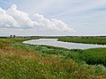
 Darent and Cray.jpg 1 000 × 593; 117 KB
-
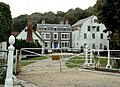
 Dartford Victoria c1900.jpg 1 722 × 1 212; 1,01 MB
-
 DartfordCourtHouse4899.JPG 2 048 × 1 536; 801 KB
-
 DartfordDarent3793.JPG 2 848 × 2 136; 1,32 MB
-
 DartfordDarent3794.JPG 2 848 × 2 136; 1,36 MB
-
 DartfordDarent3795.JPG 2 848 × 2 136; 1,26 MB
-
 DartfordHolyTrinityDarent4890(edited).JPG 2 074 × 1 572; 546 KB
-
 David Leal and the SB Decima at Dartford Lock 8748.jpg 4 608 × 3 456; 3,43 MB
-
 Derelict Dartford Lock 8724.jpg 4 608 × 3 456; 3,3 MB
-
 Derelict Dartford Lock 8725.jpg 4 608 × 3 456; 3,18 MB
-
 Derelict Dartford Lock 8726.jpg 4 608 × 3 456; 3,28 MB
-
 Derelict Dartford Lock 8727.jpg 4 608 × 3 456; 3,23 MB
-
 Derelict Dartford Lock 8730.jpg 4 608 × 3 456; 3,53 MB
-
 European Kingfisher.jpg 800 × 553; 87 KB
-

-
 Ford over the River Darent at Eynsford, Kent.jpg 4 325 × 3 096; 14,88 MB
-
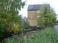 Former mill in South Darenth - geograph.org.uk - 3196515.jpg 4 000 × 3 000; 4,18 MB
-
 Horton Kirby Westminster.jpg 1 583 × 989; 759 KB
-
 Metal Footbridge over River Darenth - geograph.org.uk - 1280549.jpg 640 × 480; 133 KB
-
 Model windmill by the River Darent - geograph.org.uk - 1733032.jpg 640 × 427; 116 KB
-

-
 River Darent - 2020-09-27.jpg 4 474 × 982; 2,91 MB
-
 River Darent - geograph.org.uk - 1278420.jpg 640 × 479; 80 KB
-
 River Darent - geograph.org.uk - 147468.jpg 640 × 480; 122 KB
-
 River Darent - geograph.org.uk - 1720419.jpg 640 × 427; 140 KB
-
 River Darent - geograph.org.uk - 1725163.jpg 640 × 427; 106 KB
-
 River Darent above Dartford Lock 8701.jpg 4 608 × 3 456; 3,52 MB
-
 River Darent above Dartford Lock 8702.jpg 4 608 × 3 456; 3,29 MB
-
 River Darent above Dartford Lock 8703.jpg 4 608 × 3 456; 3,49 MB
-
 River Darent above Dartford Lock 8704.jpg 4 608 × 3 456; 3,2 MB
-
 River Darent above Dartford Lock 8705.jpg 4 608 × 3 456; 3,47 MB
-
 River Darent above Dartford Lock 8706.jpg 4 608 × 3 456; 3,49 MB
-
 River Darent above Dartford Lock 8707.jpg 4 608 × 3 456; 3,45 MB
-
 River Darent above Dartford Lock 8708.jpg 4 608 × 3 456; 3,42 MB
-
 River Darent above Dartford Lock 8709.jpg 4 608 × 3 456; 3,41 MB
-
 River Darent above Dartford Lock 8710.jpg 4 608 × 3 456; 3,44 MB
-
 River Darent above Dartford Lock 8711.jpg 4 608 × 3 456; 3,34 MB
-
 River Darent above Dartford Lock 8712.jpg 4 608 × 3 456; 3,34 MB
-
 River Darent above Dartford Lock 8713.jpg 4 608 × 3 456; 3,33 MB
-

-
 River Darent and the Dartford Creek Barrier from the Dartford Marshes.jpg 4 592 × 3 448; 15,28 MB
-

-

-
 River Darent in Dartford Central Park (01).jpg 4 592 × 3 448; 16,2 MB
-

-
 River Darent Jan 2022 1.jpg 4 032 × 1 960; 2,93 MB
-
 River Darent Jan 2022 2.jpg 4 032 × 1 960; 3,39 MB
-
 River Darent Jan 2022 3.jpg 4 032 × 1 960; 3,01 MB
-
 River Darent Jan 2022 4.jpg 5 600 × 3 776; 7,56 MB
-
 River Darent Jan 2022 5.jpg 4 032 × 1 960; 2,52 MB
-
 River Darent Jan 2022 6.jpg 4 032 × 1 960; 3,03 MB
-
 River Darent Jan 2022 7.jpg 4 032 × 1 960; 3,03 MB
-

-

-
 River Darent near Lullingstone Country Park - geograph.org.uk - 3131111.jpg 4 000 × 3 000; 4,19 MB
-
 River Darent near Lullingstone Roman Villa - geograph.org.uk - 3131114.jpg 4 000 × 3 000; 4,05 MB
-
 River Darent running through Crayford Marshes.jpg 4 592 × 3 448; 14,24 MB
-
 River Darent upstream of Shoreham - geograph.org.uk - 1732002.jpg 640 × 427; 129 KB
-
 River Darent, Church St, Shoreham - geograph.org.uk - 1729429.jpg 640 × 395; 69 KB
-
 River Darent, Eynsford, Kent - geograph.org.uk - 516643.jpg 640 × 427; 131 KB
-
 River Darent, Lullingstone Country Park - geograph.org.uk - 1733165.jpg 640 × 427; 117 KB
-
 River Darent, Lullingstone Country Park - geograph.org.uk - 1733175.jpg 640 × 427; 124 KB
-
 River Darent, Lullingstone Country Park - geograph.org.uk - 1734653.jpg 640 × 427; 129 KB
-
 River Darent, Otford - geograph.org.uk - 1722136.jpg 640 × 427; 96 KB
-
 River Darent, Shoreham, downstream - geograph.org.uk - 1729488.jpg 640 × 427; 102 KB
-
 River Darent, Shoreham, upstream - geograph.org.uk - 1729495.jpg 640 × 427; 110 KB
-
 River Darenth - geograph.org.uk - 1245525.jpg 640 × 480; 131 KB
-
 River Darenth - geograph.org.uk - 191568.jpg 640 × 426; 145 KB
-
 River Darenth near Shoreham - geograph.org.uk - 192245.jpg 640 × 426; 158 KB
-
 SB Decima at Dartford Lock 8714.jpg 4 608 × 3 456; 3,37 MB
-
 SB Decima at Dartford Lock 8715.jpg 4 608 × 3 456; 3,34 MB
-
 SB Decima at Dartford Lock 8716.jpg 4 608 × 3 456; 3,36 MB
-
 SB Decima at Dartford Lock 8717.jpg 3 456 × 4 608; 3,35 MB
-
 SB Decima at Dartford Lock 8718.jpg 4 608 × 3 456; 3,37 MB
-
 SB Decima at Dartford Lock 8719.jpg 4 608 × 3 456; 3,39 MB
-
 SB Decima at Dartford Lock 8722.jpg 4 608 × 3 456; 3,34 MB
-
 SB Decima at Dartford Lock 8723.jpg 4 608 × 3 456; 3,28 MB
-
 SB Decima at Dartford Lock 8728.jpg 4 608 × 3 456; 3,18 MB
-
 SB Decima at Dartford Lock 8729.jpg 4 608 × 3 456; 3,47 MB
-
 SB Decima at Dartford Lock 8735.jpg 4 608 × 3 456; 3,44 MB
-
 SB Decima at Dartford Lock 8737.jpg 4 608 × 3 456; 3,27 MB
-
 SB Decima at Dartford Lock 8738.jpg 4 608 × 3 456; 3,35 MB
-
 SB Decima at Dartford Lock 8739.jpg 3 456 × 4 608; 3,3 MB
-
 SB Decima at Dartford Lock 8740.jpg 4 608 × 3 456; 3,31 MB
-
 SB Decima at Dartford Lock 8741.jpg 3 456 × 4 608; 3,14 MB
-
 SB Decima at Dartford Lock 8742.jpg 3 456 × 4 608; 3,43 MB
-
 SB Decima at Dartford Lock 8743.jpg 4 608 × 3 456; 3,27 MB
-
 SB Decima at Dartford Lock bowsprit topped 8720.jpg 3 456 × 4 608; 3,27 MB
-
 SB Decima at Dartford Lock crab 8736.jpg 4 608 × 3 456; 3,27 MB
-
 SB Decima at Dartford Lock screw steering gear 8732.jpg 4 608 × 3 456; 3,23 MB
-
 SB Decima at Dartford Lock screw steering gear 8733.jpg 4 608 × 3 456; 3,43 MB
-
 SB Decima at Dartford Lock stanliff and muzzel 8744.jpg 3 456 × 4 608; 3,37 MB
-
 SB Decima at Dartford Lock topmast 8747.jpg 3 456 × 4 608; 3,12 MB
-
 SB Decima at Dartford Lock transom 8731.jpg 4 608 × 3 456; 3,13 MB
-
 SB Decima at Dartford Lock transom 8734.jpg 4 608 × 3 456; 3,27 MB
-
 SB Decima at Dartford Lock windlass 8745.jpg 4 608 × 3 456; 3,44 MB
-
 SB Decima at Dartford Lock windlass and bowsprit 8721.jpg 4 608 × 3 456; 3,13 MB
-

-
 St John's Jerusalem across the River Darent - geograph.org.uk - 5062142.jpg 4 217 × 3 163; 2,31 MB
-
 St John's Jerusalem across the River Darent - geograph.org.uk - 5062145.jpg 4 608 × 3 456; 3,36 MB
-
 St John's Jerusalem across the River Darent - geograph.org.uk - 5062148.jpg 4 608 × 3 456; 3,53 MB
-
 Sutton at Hone.jpg 1 577 × 983; 805 KB
-

-
 The River Darent - geograph.org.uk - 201944.jpg 640 × 480; 170 KB
-

-
 The River Darent at Horton Kirby - geograph.org.uk - 412568.jpg 640 × 480; 129 KB
-

-

-

-
 Trees along the River Darent - geograph.org.uk - 1725216.jpg 640 × 427; 71 KB
-

-
 Trees by the River Darent - geograph.org.uk - 1725189.jpg 640 × 427; 81 KB
-
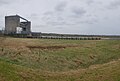
 Twitcher, River Darent and Darent Flood Barrier - geograph.org.uk - 3204460.jpg 4 288 × 3 216; 6,93 MB
-
 View West from Eynsford Castle.jpg 4 592 × 3 448; 16,51 MB
-
 Westerham 1912.jpg 1 577 × 977; 832 KB
-
 River Darent - geograph.org.uk - 609128.jpg 640 × 427; 86 KB


.JPG)


.jpg)


