Category:River Fal
Vai alla navigazione
Vai alla ricerca
fiume inglese, in Cornovaglia  | |||||
| Carica un file multimediale | |||||
| Istanza di | |||||
|---|---|---|---|---|---|
| Luogo |
| ||||
| Lunghezza |
| ||||
| Sorgente |
| ||||
| Foce | |||||
| Bacino di drenaggio |
| ||||
| Affluente | |||||
 | |||||
Sottocategorie
Questa categoria contiene le 5 sottocategorie indicate di seguito, su un totale di 5.
File nella categoria "River Fal"
Questa categoria contiene 114 file, indicati di seguito, su un totale di 114.
-
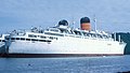 "Carmania" - River Fal (cropped).jpg 2 300 × 1 295; 1,93 MB
-
 "Carmania" - River Fal.jpg 2 909 × 1 976; 3,74 MB
-
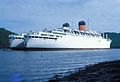
 "Uganda" - River Fal, 1985.jpg 3 599 × 2 399; 1,11 MB
-

-
-
 Admiralty Chart No 32 Falmouth Harbour, Published 1927.jpg 8 543 × 14 372; 52,68 MB
-
 Autumn rainbow over the Fal - geograph.org.uk - 1106159.jpg 566 × 412; 54 KB
-
 Boat House on the Fal - geograph.org.uk - 2542775.jpg 640 × 480; 171 KB
-
 Boating contrasts - geograph.org.uk - 2671611.jpg 640 × 425; 57 KB
-
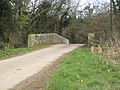
 Bridge over the River Fal - geograph.org.uk - 1234952.jpg 640 × 480; 91 KB
-
 Bridge over the River Fal at Tolgarrick - geograph.org.uk - 1235119.jpg 640 × 480; 107 KB
-
 Cave ^ Canoe on the Fal - geograph.org.uk - 2542803.jpg 640 × 480; 170 KB
-
 Channals Creek - geograph.org.uk - 3216959.jpg 3 072 × 2 048; 1,2 MB
-

-

-
 Coombe. An inlet off Cowlands Creek - geograph.org.uk - 945811.jpg 640 × 427; 52 KB
-
 Cornwall , River Fal - geograph.org.uk - 5375246.jpg 6 000 × 4 000; 5,43 MB
-
 Cornwall , River Fal - geograph.org.uk - 5375265.jpg 6 000 × 4 000; 7,57 MB
-
 Cornwall , River Fal - geograph.org.uk - 5375266.jpg 6 000 × 4 000; 6,16 MB
-
 Cornwall , River Fal - geograph.org.uk - 5375269.jpg 5 750 × 3 834; 6,04 MB
-
 Dona Amelia at anchor on the River Fal - geograph.org.uk - 4432062.jpg 1 600 × 1 062; 463 KB
-
 East bank of the River Fal - geograph.org.uk - 4239030.jpg 640 × 480; 91 KB
-
 East bank, River Fal - geograph.org.uk - 4239032.jpg 640 × 480; 60 KB
-
 East Landing of King Harry Ferry - geograph.org.uk - 2541031.jpg 640 × 480; 178 KB
-
 Fal River view - geograph.org.uk - 4991535.jpg 640 × 480; 120 KB
-
 Fluss Fal von Trelissick Garden - panoramio.jpg 2 560 × 1 920; 2,94 MB
-
 From Gretna Green to Land's End - a literary journey in England (1908) (14595212867).jpg 2 192 × 1 608; 527 KB
-
 Greatwood (25865477570).jpg 2 277 × 3 198; 5,62 MB
-
 Hafen aus der Zeit des D-Days am Flusse Fal - panoramio.jpg 2 560 × 1 920; 2,74 MB
-
 Horizon Geobay.jpg 3 942 × 2 628; 7,27 MB
-
 King Harry Ferry (3848517755).jpg 2 397 × 1 598; 3,37 MB
-
 King Harry Ferry across the River Fal - geograph.org.uk - 4432093.jpg 1 600 × 1 062; 724 KB
-
 King Harry Ferry across the River Fal - geograph.org.uk - 4432102.jpg 1 600 × 1 062; 634 KB
-
 King Harry Ferry at ramp, River Fal, Cornwall.jpg 4 896 × 2 752; 3,68 MB
-
 King Harry Ferry ramp, Trelissick, River Fal, Cornwall.jpg 4 896 × 2 752; 4,16 MB
-
 King Harry Ferry, River Fal, Cornwall.jpg 4 896 × 2 752; 1,74 MB
-
 King Harry Ferry.jpg 3 872 × 2 581; 6,44 MB
-
 Laid up shipping in the River Fal (3849323262).jpg 2 498 × 1 665; 3,11 MB
-
 Large ship in narrow Fal estuary by Trelissick - geograph.org.uk - 4914373.jpg 2 736 × 3 648; 5,59 MB
-
 Latest laid-up shipping in the River Fal - geograph.org.uk - 4076899.jpg 1 024 × 575; 103 KB
-
 Looking across the River Fal - geograph.org.uk - 4239022.jpg 640 × 480; 90 KB
-

-
 Mother and Daughter ? (1556138782).jpg 2 551 × 999; 655 KB
-
 Mussel Farm on the River Fal - geograph.org.uk - 2542733.jpg 640 × 480; 169 KB
-
 Mussel Farm on the River Fal - geograph.org.uk - 4433521.jpg 1 600 × 1 062; 771 KB
-
 Mussel Farm on the River Fal - geograph.org.uk - 4433577.jpg 1 600 × 1 062; 585 KB
-
 Mussel farm, River Fal, Cornwall.jpg 4 600 × 1 896; 1,29 MB
-

-
 Ordnance Survey One-Inch Sheet 146 Land's End & Lizard, Published 1919.jpg 13 990 × 11 254; 13,96 MB
-
 Park and Float (28324753113).jpg 2 206 × 3 089; 5,88 MB
-
 Pipelines at Melbur China Clay Works - geograph.org.uk - 1234937.jpg 480 × 640; 118 KB
-
 Pontoon on the River Fal - geograph.org.uk - 4433607.jpg 1 600 × 1 062; 721 KB
-
 Pontoon on Truro River - geograph.org.uk - 4432031.jpg 1 600 × 1 062; 878 KB
-
 Redundant ships moored on the River Fal - geograph.org.uk - 6456322.jpg 1 799 × 1 199; 342 KB
-
 RestronguetsalingClubCornwallUK.jpg 640 × 427; 62 KB
-
 River Fal (26241821622).jpg 2 698 × 2 698; 5,96 MB
-
 River Fal (28625183964).jpg 4 000 × 2 250; 7,08 MB
-
 River Fal (28628149894).jpg 2 809 × 2 809; 7,27 MB
-
 River Fal (28726392083).jpg 2 857 × 4 000; 9,48 MB
-
 River Fal (28960200150).jpg 3 983 × 2 373; 5,81 MB
-
 River Fal (29078120390).jpg 3 000 × 2 311; 5,84 MB
-
 River Fal (29377991976).jpg 2 013 × 2 818; 5,81 MB
-
 River Fal (34033101381).jpg 3 100 × 2 214; 5,77 MB
-
 River Fal - geograph.org.uk - 2303345.jpg 640 × 488; 103 KB
-
 River Fal - geograph.org.uk - 2671559.jpg 640 × 425; 60 KB
-
 River Fal - geograph.org.uk - 43582.jpg 640 × 427; 56 KB
-
 River Fal - geograph.org.uk - 6277657.jpg 1 024 × 576; 91 KB
-
 River Fal - geograph.org.uk - 945826.jpg 640 × 427; 50 KB
-
 River Fal - geograph.org.uk - 945828.jpg 640 × 427; 69 KB
-
 River Fal and Flushing - geograph.org.uk - 27263.jpg 640 × 480; 117 KB
-
 River Fal and Pill Plantation - geograph.org.uk - 780909.jpg 640 × 363; 66 KB
-
 River Fal Mussel Farm - geograph.org.uk - 2671628.jpg 640 × 425; 53 KB
-
 River Fal shore - geograph.org.uk - 6290395.jpg 800 × 600; 137 KB
-
 River Fal, laid-up shipping - geograph.org.uk - 2162519.jpg 1 024 × 681; 225 KB
-
 River Fal, laid-up shipping, from Roundwood Quay - geograph.org.uk - 2159376.jpg 1 024 × 681; 187 KB
-
 River view from Pill Plantation - geograph.org.uk - 855260.jpg 480 × 640; 100 KB
-
 Sailboat off Turnaware Point, River Fal - geograph.org.uk - 1974893.jpg 1 952 × 2 608; 1,05 MB
-
 Ship in Fal estuary - geograph.org.uk - 4920487.jpg 3 648 × 2 736; 4,24 MB
-
 Shipping on the River Fal - geograph.org.uk - 2671550.jpg 640 × 425; 70 KB
-
 Ships in the River Fal at Halwyn (6083513112).jpg 2 784 × 2 784; 6,55 MB
-
 Ships moored on the River Fal - geograph.org.uk - 5094285.jpg 5 472 × 3 648; 6,28 MB
-
 Stream on Goss Moor - geograph.org.uk - 221774.jpg 640 × 427; 139 KB
-

-

-
 The River Fal - geograph.org.uk - 1378128.jpg 640 × 427; 36 KB
-
 The River Fal - geograph.org.uk - 4180156.jpg 4 000 × 2 664; 2,11 MB
-
 The River Fal - geograph.org.uk - 4239026.jpg 640 × 480; 65 KB
-

-
 The River Fal at Terras - geograph.org.uk - 1235042.jpg 640 × 480; 118 KB
-
 The River Fal at Terras - geograph.org.uk - 1235059.jpg 640 × 480; 110 KB
-
 The River Fal at Tolgarrick - geograph.org.uk - 1235097.jpg 480 × 640; 130 KB
-
 The River Fal at Trerice Bridge - geograph.org.uk - 229069.jpg 640 × 427; 145 KB
-
 The River Fal near Channals Creek - geograph.org.uk - 4433672.jpg 1 600 × 1 062; 796 KB
-
 The River Fal.jpg 4 948 × 3 280; 12,63 MB
-
 The Trelissick Pontoon, River Fal, Cornwall.jpg 4 896 × 2 752; 3,64 MB
-
 Tolcarne Creek on the River Fal - geograph.org.uk - 4433611.jpg 1 600 × 1 062; 1 008 KB
-
 Tolverne (6082955001).jpg 3 771 × 2 601; 8,43 MB
-
 Tregothnan (26140963155).jpg 2 290 × 1 943; 3,56 MB
-
 Trelissick House and grounds - geograph.org.uk - 337043.jpg 640 × 482; 68 KB
-
 Trelissick House from the River Fal - geograph.org.uk - 4433616.jpg 1 600 × 1 062; 475 KB
-
 Trelissick Pontoon, Fal River, Cornwall.jpg 4 448 × 2 750; 2,15 MB
-
 Turnaware Bar at Low Spring tide - geograph.org.uk - 1184308.jpg 640 × 402; 99 KB
-
 View of the River Fal from Loe Beach - geograph.org.uk - 2611836.jpg 800 × 574; 115 KB
-
 View of the River Fal from the front of Trelissick House - geograph.org.uk - 4982509.jpg 1 500 × 1 125; 331 KB
-
 Wooded banks of the River Fal - geograph.org.uk - 3320029.jpg 768 × 1 024; 840 KB
-
 Wooded promontory on the River Fal - geograph.org.uk - 485790.jpg 640 × 480; 92 KB
-
 WWII pontoon anchor, River Fal, Cornwall.jpg 4 421 × 2 259; 1,94 MB
-
 Yacht in Carrick Roads II (1428415677).jpg 1 592 × 1 364; 246 KB
-
 Yacht in Carrick Roads III (1428415685).jpg 1 288 × 1 792; 237 KB
-
 Yacht on the River Fal - geograph.org.uk - 4433788.jpg 1 600 × 1 062; 545 KB
-

-
 Looking towards Ardevora - geograph.org.uk - 584915.jpg 640 × 480; 120 KB
-
 The River Fal - geograph.org.uk - 228796.jpg 640 × 427; 133 KB
-
 View NE upstream of the river Fal - geograph.org.uk - 303451.jpg 640 × 480; 102 KB
.jpg)


_(14595212867).jpg)
.jpg)


.jpg)


.jpg)


.jpg)


.jpg)
.jpg)
.jpg)
.jpg)
.jpg)
.jpg)
.jpg)
.jpg)


.jpg)


.jpg)
.jpg)


.jpg)
.jpg)


.jpg)