Category:River Garry, Perthshire
Zur Navigation springen
Zur Suche springen
Nebenfluss des River Tummel in Schottland  | |||||
| Medium hochladen | |||||
| Ist ein(e) | |||||
|---|---|---|---|---|---|
| Ort |
| ||||
| Länge |
| ||||
| Quelle des Wasserlaufs |
| ||||
| Mündet in |
| ||||
| Nebenfluss | |||||
 | |||||
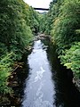
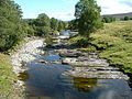
The River Garry is a tributary of the River Tummel in Perth and Kinross.
Unterkategorien
Es werden 4 von insgesamt 4 Unterkategorien in dieser Kategorie angezeigt:
In Klammern die Anzahl der enthaltenen Kategorien (K), Seiten (S), Dateien (D)
C
- Calvine double bridge (5 D)
T
Medien in der Kategorie „River Garry, Perthshire“
Folgende 42 Dateien sind in dieser Kategorie, von 42 insgesamt.
-
 Across the Garry - geograph.org.uk - 1239357.jpg 480 × 640; 92 KB
-
 Between two bridges - geograph.org.uk - 1239384.jpg 481 × 640; 93 KB
-
 Dike in Garry at Dalnacardoch.jpg 4.032 × 3.024; 7,93 MB
-
 Ford on River Garry - geograph.org.uk - 1365427.jpg 640 × 480; 141 KB
-
 Garry Bridge - geograph.org.uk - 1752421.jpg 640 × 480; 95 KB
-
 Ordnance Survey One-Inch Sheet 49 Grampian Mountains & Blair Atholl, Published 1947.jpg 12.244 × 9.338; 13,14 MB
-
 Pitlochry - panoramio (2).jpg 2.432 × 3.648; 3,95 MB
-
 Poor River Garry - geograph.org.uk - 739792.jpg 640 × 480; 88 KB
-
 River Garry - geograph.org.uk - 1239359.jpg 640 × 374; 82 KB
-
 River Garry - geograph.org.uk - 1239365.jpg 480 × 640; 121 KB
-
 River Garry - geograph.org.uk - 1469912.jpg 640 × 480; 106 KB
-
 River Garry - geograph.org.uk - 1752620.jpg 640 × 480; 118 KB
-
 River Garry - geograph.org.uk - 1752629.jpg 640 × 480; 119 KB
-
 River Garry - geograph.org.uk - 35830.jpg 416 × 640; 92 KB
-
 River Garry above Garry Bridge - geograph.org.uk - 948167.jpg 440 × 640; 80 KB
-
 River Garry above water intake - geograph.org.uk - 741524.jpg 480 × 640; 88 KB
-
 River Garry at Killiecrankie - geograph.org.uk - 1014823.jpg 640 × 420; 79 KB
-
 River Garry at the Pass of Killiecrankie - geograph.org.uk - 1239389.jpg 499 × 640; 111 KB
-
 River Garry footbridge (8125809295).jpg 1.280 × 960; 299 KB
-
 River Garry footbridge (8125832280).jpg 1.280 × 960; 315 KB
-

-
 River Garry from Garry Bridge - geograph.org.uk - 1588205.jpg 640 × 480; 94 KB
-
 River Garry from Garry Bridge - geograph.org.uk - 1588212.jpg 640 × 480; 119 KB
-
 River Garry from Garry Bridge - geograph.org.uk - 1659851.jpg 480 × 640; 77 KB
-
 River Garry in winter - geograph.org.uk - 1639900.jpg 640 × 480; 114 KB
-
 River Garry west of Struan - geograph.org.uk - 108146.jpg 640 × 421; 130 KB
-
 The Garry Bridge - geograph.org.uk - 294036.jpg 640 × 480; 87 KB
-
 The Quarterly journal of the Geological Society of London (1904) (14804981853).jpg 2.036 × 3.122; 967 KB
-
 The River Garry and Garry bridge (44968743184).jpg 5.375 × 3.581; 15,27 MB
-
 The River Garry at Old Struan - geograph.org.uk - 755301.jpg 640 × 480; 62 KB
-

-
 Tunnel on River Garry - geograph.org.uk - 739782.jpg 640 × 480; 95 KB
-
 View Along Strathgarry - geograph.org.uk - 555868.jpg 640 × 480; 110 KB
-
 A Well Filled River Garry - geograph.org.uk - 1518455.jpg 480 × 640; 119 KB
-
 Falls on the River Garry - geograph.org.uk - 107725.jpg 640 × 480; 111 KB
-
 River Garry - geograph.org.uk - 108148.jpg 640 × 418; 119 KB
-
 River Garry - geograph.org.uk - 281497.jpg 480 × 640; 152 KB
-
 River Garry - geograph.org.uk - 312752.jpg 448 × 640; 102 KB
-
 River Garry - geograph.org.uk - 515516.jpg 640 × 480; 126 KB
-
 River Garry at Dalnacardoch. - geograph.org.uk - 217937.jpg 640 × 480; 117 KB
-
 River Garry from Garry Bridge - geograph.org.uk - 36171.jpg 640 × 480; 130 KB
-
 River Garry from Garry Bridge - geograph.org.uk - 36172.jpg 640 × 480; 106 KB


.jpg)


.jpg)
.jpg)


_(14804981853).jpg)
.jpg)


