Category:River Mersey
Vai alla navigazione
Vai alla ricerca
fiume della Gran Bretagna   | |||||
| Carica un file multimediale | |||||
| Istanza di | |||||
|---|---|---|---|---|---|
| Luogo |
| ||||
| Lunghezza |
| ||||
| Foce | |||||
| Affluente |
| ||||
| Sostituito da |
| ||||
 | |||||
Media for River Mersey.
Sottocategorie
Questa categoria contiene le 33 sottocategorie indicate di seguito, su un totale di 33.
- River Mersey at Eastham (29 F)
B
C
- Cast Iron Shore (2 F)
- Choppy sea at New Brighton 2020 (11 F)
D
- Deestroyer (ship) (1 F)
- Dingle shore, Liverpool (51 F)
- Dungeon Banks (12 F)
E
- Eastham Locks (13 F)
G
J
- Job's Ferry (3 F)
L
- Liverpool Sailing Club (11 F)
M
- Mersey River Festival 2014 (13 F)
P
- Pemberton & Carlyon (9 F)
S
- Spike Island, Cheshire (25 F)
- Stanlow Island (8 F)
T
- Tranmere oil terminal (25 F)
V
File nella categoria "River Mersey"
Questa categoria contiene 200 file, indicati di seguito, su un totale di 339.
(pagina precedente) (pagina successiva)-
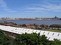
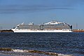 "Royal Princess", River Mersey - geograph.org.uk - 4548181.jpg 1 024 × 683; 161 KB
-
 A late May sunset over the River Mersey - panoramio.jpg 4 288 × 3 216; 3,55 MB
-
 A misty Mersey morning.jpg 4 984 × 3 404; 18,79 MB
-

-
 Aa princes oldwharf.jpg 1 600 × 1 200; 406 KB
-
 Across the Mersey - geograph.org.uk - 1073572.jpg 640 × 480; 114 KB
-
 Across the Mersey to Liverpool from Egremont-by-Sue-Adair.jpg 640 × 480; 57 KB
-
 Across the Mersey to Tranmere - geograph.org.uk - 3565474.jpg 3 648 × 2 736; 4,58 MB
-

-
 Aerial view of Liverpool waterfront.jpg 683 × 911; 188 KB
-
 Albert dock - geograph.org.uk - 799922.jpg 640 × 480; 110 KB
-
 Alfred Dock lock gates, River Mersey (geograph 4544718).jpg 1 024 × 683; 147 KB
-
 AT Brown Mauretania.jpg 400 × 300; 15 KB
-
 Bank of River Mersey - geograph.org.uk - 2864444.jpg 640 × 480; 67 KB
-

-
 Beach and view across the Mersey, Hale - geograph.org.uk - 496188.jpg 640 × 480; 101 KB
-
 Beach combing - geograph.org.uk - 2863241.jpg 640 × 426; 130 KB
-
 Beacon at entrance to Garston Docks.jpg 5 152 × 3 864; 7,16 MB
-
 Benkid77 Birkenhead Skyline.JPG 1 600 × 1 200; 727 KB
-
 Benkid77 Cranes 1, Liverpool 090809.JPG 3 648 × 2 736; 3,65 MB
-
 Benkid77 Promenade, Wallasey 1 090809.JPG 3 648 × 2 736; 3,59 MB
-
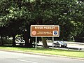 Benkid77 River Mersey sign, A56 250709.JPG 3 648 × 2 736; 3,54 MB
-
 Benkid77 Wind turbines 1, Liverpool 090809.JPG 3 648 × 2 736; 3,59 MB
-
 Benkid77 Wind turbines 2, Liverpool 090809.JPG 3 648 × 2 736; 3,54 MB
-
 Benkid77 Woodside unknown.JPG 2 072 × 1 504; 417 KB
-
 Boatrace-Worcester-Conway.jpg 830 × 415; 42 KB
-
 Buoy, River Mersey (geograph 4548186).jpg 1 024 × 683; 171 KB
-
 Cains Brewery.jpg 3 516 × 2 340; 1 015 KB
-
 CAMMELL LAIRDS SHIPYARD BIRKENHEAD RIVER MERSEY MAY 2013 (8719033329).jpg 4 869 × 2 603; 10,27 MB
-
 Canoe Portage Point - geograph.org.uk - 357140.jpg 640 × 480; 161 KB
-
 Canoeists on Northenden Weir - March 2006 - geograph.org.uk - 354104.jpg 640 × 480; 118 KB
-
 Channel Buoy, River Mersey - geograph.org.uk - 1407022.jpg 480 × 640; 88 KB
-
 Concrete embankment and disused jetty - geograph.org.uk - 210642.jpg 640 × 480; 63 KB
-
 Confluence of River Mersey and Manchester Ship Canal.jpg 6 180 × 2 232; 4,33 MB
-
 Conservation rooflights in historic building.jpg 3 992 × 2 242; 10,09 MB
-
 Cranes at Liverpool docks, as seen from New Brighton - DSCF1050.JPG 4 000 × 3 000; 2,79 MB
-
 Cranes at Liverpool docks, as seen from New Brighton - DSCF1051.JPG 4 000 × 3 000; 2,87 MB
-
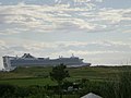 Cruise Ship leaving Liverpool - geograph.org.uk - 911756.jpg 640 × 480; 47 KB
-
 CYCLE ROUTE 56 LIVERPOOL WATERFRONT JAN 2013 (8347785350).jpg 4 603 × 3 456; 10,29 MB
-
 Deeside - Merseyside IMG 3942.jpg 4 032 × 3 024; 1,43 MB
-
 Dereliction of Jetty, River Mersey (geograph 2977715).jpg 1 024 × 683; 109 KB
-
 Devil's Bank and marker buoy - geograph.org.uk - 1368114.jpg 640 × 425; 76 KB
-
 Distant Stanlow Oil Refinery.JPG 3 648 × 2 736; 3,63 MB
-
 EasyJet Airbus coming home to roost - geograph.org.uk - 1310944.jpg 640 × 428; 28 KB
-
 Echo Arena and Anglican Cathedral, Liverpool.JPG 3 648 × 2 736; 3,57 MB
-
 EGG Buoy IMG 3176c-Edit.jpg 1 513 × 2 100; 193 KB
-
 EgremontProm1 2011.jpg 2 048 × 1 536; 1,88 MB
-
 EgremontProm2 2011.jpg 2 048 × 1 536; 1,89 MB
-
 EgremontProm3 2011.jpg 2 048 × 1 536; 1,87 MB
-

-

-
 European Herring Gull, above the River Mersey (geograph 2975184).jpg 1 024 × 683; 22 KB
-
 Fireworks at the opening of the Mersey Gateway Bridge.jpg 4 032 × 3 024; 3,14 MB
-
 Fireworks display, River Mersey (geograph 4556361).jpg 512 × 768; 96 KB
-
 Fireworks display, River Mersey (geograph 4556366).jpg 1 024 × 683; 133 KB
-
 Fireworks display, River Mersey (geograph 4556369).jpg 1 024 × 683; 123 KB
-
 Fireworks display, River Mersey (geograph 4556371).jpg 1 024 × 683; 130 KB
-
 Fireworks display, River Mersey (geograph 4556374).jpg 512 × 768; 73 KB
-
 Fireworks display, River Mersey (geograph 4556376).jpg 512 × 768; 68 KB
-
 Fireworks display, River Mersey (geograph 4556379).jpg 512 × 768; 83 KB
-
 Fireworks display, River Mersey (geograph 4556380).jpg 512 × 768; 85 KB
-
 Fireworks display, River Mersey (geograph 4556382).jpg 512 × 768; 92 KB
-
 Fireworks display, River Mersey (geograph 4556383).jpg 512 × 768; 100 KB
-
 Fireworks display, River Mersey (geograph 4561969).jpg 1 024 × 683; 195 KB
-
 Fishing in the mersey - panoramio.jpg 3 072 × 2 304; 2,37 MB
-
 Fishing Near Hall Road - geograph.org.uk - 734806.jpg 640 × 480; 58 KB
-
 Fort Perch Rock 1991.jpg 1 104 × 596; 560 KB
-
 Fort Perch Rock and Lighthouse From River Mersey-by-Stephen-Nunney.jpg 640 × 532; 131 KB
-
 Fort Perch Rock and the Mersey-by-Nigel-Homer.jpg 640 × 480; 67 KB
-
 Fun on the sands - geograph.org.uk - 1098038.jpg 640 × 426; 39 KB
-
 Groyne at The Black Pearl, New Brighton.jpg 4 982 × 3 320; 16,02 MB
-
 Groyne, Egremont-by-E-Pollock.jpg 640 × 480; 63 KB
-
 Groyne, New Brighton - IMG 1219.JPG 3 240 × 4 320; 3,43 MB
-
 Gulls on the Mersey mudbanks at Liverpool.JPG 4 608 × 3 456; 3,64 MB
-
 H.B. Majesty's steamer Majestic watching the rebel rams in the Mersey - FL 1864.jpg 1 367 × 918; 1,23 MB
-
 Hale - the River Mersey at Small Ends - geograph.org.uk - 226573.jpg 640 × 480; 76 KB
-
 Hale - view from Hale Head - geograph.org.uk - 226569.jpg 640 × 480; 83 KB
-
 Hale Cliff Wharf, River Mersey - geograph.org.uk - 2864445.jpg 640 × 480; 80 KB
-
 Hale Head Shore - geograph.org.uk - 2864492.jpg 640 × 480; 68 KB
-
 Hale Head Shore - geograph.org.uk - 2965253.jpg 640 × 481; 534 KB
-
 Hale vista - geograph.org.uk - 40610.jpg 640 × 480; 180 KB
-

-
 Houses on Grassendale Esplanade (geograph 4563701).jpg 1 024 × 683; 141 KB
-
 Howley Lock - geograph.org.uk - 53862.jpg 640 × 435; 104 KB
-
 Huge plume of smoke, River Mersey (geograph 4548175).jpg 1 024 × 683; 167 KB
-

-
 Incoming High Tide from Clifftop Walk - geograph.org.uk - 683718.jpg 640 × 480; 81 KB
-
 Information boards and the Mersey Mud - geograph.org.uk - 2853980.jpg 4 413 × 2 933; 7,7 MB
-
 Irwell and Mersey Confluence.jpg 3 264 × 2 176; 1,24 MB
-

-
 Kenneth Shoesmith - HM Schoolship 'Conway' off Liverpool with assorted shipping.jpg 2 489 × 2 000; 863 KB
-
 København (ship, 1921) - SLV H27568-249.jpg 622 × 386; 140 KB
-
 Landing Stage, Bromborough - DSC03481.JPG 3 648 × 2 736; 3,59 MB
-
 Landing Stage, Bromborough - DSC03482.JPG 2 736 × 3 648; 3,63 MB
-
 Landing Stage, Bromborough - DSC03485.JPG 3 648 × 2 736; 3,59 MB
-
 Liverpool - River Mersey.JPG 5 464 × 3 072; 2,89 MB
-
 Liverpool aerial photograph.jpg 2 500 × 3 077; 7,37 MB
-
 Liverpool and John Lennon Airport (47216238111).jpg 8 305 × 4 014; 7,9 MB
-
 Liverpool Anglican Cathedral with Mersey.jpg 1 835 × 1 942; 1,33 MB
-
 Liverpool Bay.png 1 278 × 947; 1,84 MB
-
 Liverpool docklands panorama (19th April 2014) 001.JPG 4 912 × 1 080; 2,16 MB
-
 Liverpool docklands panorama (19th April 2014) 002.JPG 4 912 × 1 080; 2,25 MB
-
 Liverpool Lovebirds - geograph.org.uk - 1274060.jpg 640 × 480; 70 KB
-
 Liverpool panorama - DSC09527.JPG 3 648 × 2 736; 3,59 MB
-
 Liverpool skyline from New Brighton - DSCF1056.JPG 4 000 × 3 000; 2,83 MB
-
 Liverpool skyline from New Brighton - DSCF1057.JPG 4 000 × 3 000; 2,83 MB
-
 Liverpool view (30596905294).jpg 4 000 × 3 000; 2,91 MB
-
 Liverpool view (30610965093).jpg 4 000 × 3 000; 2,86 MB
-
 Liverpool view (30610975053).jpg 4 000 × 3 000; 2,61 MB
-
 Liverpool view (31382119826).jpg 4 000 × 3 000; 2,6 MB
-

-
 Liverpool Wheel, Echo Arena and Anglican Cathedral from Woodside.jpg 3 654 × 2 301; 4,21 MB
-

-
 Liverpool, UK - panoramio (14).jpg 3 264 × 2 448; 2,27 MB
-
 Liverpool, UK - panoramio (18).jpg 3 264 × 2 448; 2,03 MB
-
 Liverpool, UK - panoramio (2).jpg 2 816 × 2 112; 665 KB
-
 Liverpool, UK - panoramio (46).jpg 2 592 × 1 944; 1,96 MB
-
 Liverpool, UK - panoramio (48).jpg 2 592 × 1 944; 1,87 MB
-
 Liverpool, UK - panoramio (59).jpg 3 264 × 2 448; 1,71 MB
-
 Liverpool, UK - panoramio - IIya Kuzhekin (45).jpg 3 853 × 2 889; 2,8 MB
-
 Liverpool, UK - panoramio - IIya Kuzhekin (48).jpg 4 000 × 3 000; 2,04 MB
-
 Liverpool, UK - panoramio - IIya Kuzhekin (5).jpg 4 000 × 2 250; 1,42 MB
-
 Liverpool, UK - panoramio - IIya Kuzhekin (51).jpg 4 000 × 2 250; 2,43 MB
-
 Liverpool, UK - panoramio - IIya Kuzhekin (52).jpg 4 000 × 2 250; 2,44 MB
-
 Liverpool-1911.jpg 400 × 650; 93 KB
-

-
 Liverpoolcityskyline.jpg 1 200 × 752; 277 KB
-
-
 Looking at Liverpool - geograph.org.uk - 408335.jpg 640 × 126; 63 KB
-
 Looking down river - geograph.org.uk - 2863235.jpg 4 270 × 2 842; 7,76 MB
-
 Looking Out 2 Liverpool - panoramio.jpg 2 592 × 1 944; 1,57 MB
-

-
 Looking towards Tranmere Oil Terminal from Otterspool Promenade.JPG 4 320 × 3 240; 2,88 MB
-
 LottySleighExplosion1864.jpg 5 137 × 3 634; 5,83 MB
-
 Louis Tauzin - Liverpool.jpg 1 949 × 1 465; 2,15 MB
-
 Low tide on the Mersey - geograph.org.uk - 1368770.jpg 640 × 425; 101 KB
-
 Manchester Ship Canal - geograph.org.uk - 1147213.jpg 640 × 480; 48 KB
-
 Manchester Ship Canal from Ellesmere Port Boat Museum car park (1).JPG 4 608 × 3 456; 3,63 MB
-
 Manchester Ship Canal from Ellesmere Port Boat Museum car park (2).JPG 4 608 × 3 456; 3,6 MB
-
 Manx Maid at Liverpool.jpg 1 652 × 1 081; 419 KB
-
 Marker buoy, Egremont foreshore, River Mersey (geograph 4549758).jpg 1 024 × 683; 148 KB
-
 Megamax quayside cranes - River Mersey - North West England.jpg 5 246 × 3 357; 5,78 MB
-
 Mersey Bore.JPG 4 320 × 3 240; 3 MB
-
 Mersey Buoy - geograph.org.uk - 1822083.jpg 640 × 435; 75 KB
-
 Mersey dawn (geograph 4717885).jpg 640 × 427; 92 KB
-
 Mersey estuary by Bromborough Pool - geograph.org.uk - 221510.jpg 640 × 480; 124 KB
-

-
 Mersey Mudflats - geograph.org.uk - 1073680.jpg 640 × 493; 142 KB
-
 Mersey Promenade - geograph.org.uk - 1368116.jpg 640 × 425; 83 KB
-
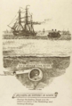 Mersey Railway Tunnel - ventilation and drainage tunnels.png 617 × 910; 741 KB
-
 Mersey river - panoramio - Tanya Dedyukhina.jpg 1 408 × 1 056; 694 KB
-
 Mersey river - panoramio.jpg 1 408 × 1 056; 902 KB
-
 Mersey sunset - geograph.org.uk - 903498.jpg 640 × 466; 82 KB
-
 MERSEY TUNNEL VENTILATION SHAFT WOODSIDE MAY 2013 (8716527957).jpg 1 227 × 1 239; 1,13 MB
-
 Mersey.png 764 × 376; 638 KB
-
 Merseyside Birkenhead-Liverpool - river Mersey IMG 3951.jpg 4 032 × 3 024; 1,73 MB
-
 Merseyside Birkenhead-Liverpool IMG 3946.jpg 4 032 × 3 024; 1,58 MB
-
 Merseyside Birkenhead-Liverpool IMG 3947.jpg 3 991 × 2 526; 1,21 MB
-
 Merseyside Birkenhead-Liverpool IMG 3956.jpg 4 007 × 2 718; 1,32 MB
-
 Merseyside, 6 Oct. 2010 - Flickr - PhillipC.jpg 4 288 × 2 848; 3,9 MB
-
 Merseysunset.JPG 2 736 × 3 648; 4,37 MB
-
 Midstream - geograph.org.uk - 120344.jpg 640 × 426; 94 KB
-
 Monks Ferry area - geograph.org.uk - 220639.jpg 640 × 480; 83 KB
-
 More of the Mersey - geograph.org.uk - 220613.jpg 640 × 480; 65 KB
-
 Mouth of the Mersey from New Brighton - geograph.org.uk - 4282666.jpg 1 600 × 900; 174 KB
-

-
 New Brighton anchorage, River Mersey (geograph 4548170).jpg 1 024 × 683; 165 KB
-
 New Brighton-by-Gerald-England.jpg 640 × 480; 109 KB
-
 New Ferry, Wirral - DSC03022.JPG 3 648 × 2 736; 3,62 MB
-
 New Ferry, Wirral - DSC03024.JPG 3 648 × 2 736; 3,64 MB
-
 New Ferry, Wirral - DSC03030.JPG 3 648 × 2 736; 3,58 MB
-
 New Ferry, Wirral - DSC03034.JPG 3 648 × 2 736; 3,55 MB
-
 New Ferry, Wirral - DSC03050.JPG 3 648 × 2 736; 3,64 MB
-
 Oglet Shore - geograph.org.uk - 930415.jpg 640 × 480; 97 KB
-
 Old Princes Landing Stage, River Mersey (geograph 2977708).jpg 1 024 × 683; 96 KB
-
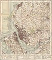 Ordnance Survey One-Inch Sheet 100 Liverpool, Published 1947.jpg 10 933 × 12 775; 16,46 MB
-
 Ordnance Survey One-Inch Sheet 100 Liverpool, Published 1966.jpg 8 244 × 9 891; 11,11 MB
-
 Ordnance Survey One-Inch Sheet 109 Chester, Published 1947.jpg 10 942 × 12 772; 17,37 MB
-
 Ordnance Survey One-Inch Sheet 109 Chester, Published 1963.jpg 8 284 × 9 912; 11,93 MB
-
 Ordnance Survey One-Inch Sheet 43 Chester, Published 1924.jpg 11 809 × 8 809; 44,84 MB
-
 Ox Bow Lake - geograph.org.uk - 1343044.jpg 640 × 480; 129 KB
-

-
Passing Liverpool Cruise Terminal.ogv 31 s, 1 280 × 720; 19,69 MB
-
 Penketh - The Ferry Tavern.jpg 640 × 364; 39 KB
-
 Pier Head, towards Seacombe ferry terminal (133319382).jpg 636 × 360; 92 KB
-
 Pilot boat 'Dunlin' on the River Mersey.jpg 4 320 × 3 240; 3,85 MB
-
 Platform in the River Mersey at Pier Head - DSC06798.JPG 2 736 × 3 648; 3,54 MB
-
 Pluckington Buoy IMG 3467c-Edit.jpg 1 475 × 2 100; 403 KB
-
 Police Helicopter, above the River Mersey (geograph 2975161).jpg 1 024 × 683; 35 KB
-
 Power house of former Runcorn Transporter Bridge.jpg 3 456 × 2 304; 1,77 MB
-
 Princes Dock, towards Seacombe (133318950).jpg 635 × 319; 94 KB
-
 Princes Jetty, River Mersey (geograph 2977712).jpg 1 024 × 683; 104 KB
-
 Princes Jetty, River Mersey, Liverpool (geograph 3146503).jpg 683 × 1 024; 88 KB
-
 Queens Dock towards Birkenhead.jpg 635 × 237; 55 KB
-
 Queens Dock, towards Camel Laird (133319877).jpg 626 × 233; 61 KB
-
 Queens Dock, upriver (133319912).jpg 640 × 480; 116 KB
-
 River Mersey - geograph.org.uk - 196528.jpg 640 × 480; 70 KB
-
 River Mersey - geograph.org.uk - 822914.jpg 640 × 480; 101 KB
-
 River Mersey - Richmond Bank - geograph.org.uk - 40441.jpg 640 × 426; 114 KB
-
 River Mersey - Warrington - geograph.org.uk - 1887784.jpg 4 224 × 3 168; 2,2 MB


.jpg)


.jpg)


.jpg)

.jpg)


.jpg)

.jpg)


.jpg)

.jpg)
.jpg)
.jpg)
.jpg)
.jpg)
.jpg)
.jpg)
.jpg)
.jpg)
.jpg)
.jpg)


.jpg)

.jpg)


_-_SLV_H27568-249.jpg)


.jpg)


.jpg)
.jpg)
.jpg)
.jpg)


.jpg)
.jpg)
.jpg)
.jpg)
.jpg)
.jpg)
.jpg)
.jpg)
.jpg)
.jpg)
.jpg)

.jpg)

.jpg)


.JPG)
.JPG)

.jpg)


.jpg)


.jpg)


.jpg)
.jpg)


.jpg)


.jpg)


.jpg)
.jpg)
.jpg)
.jpg)
.jpg)


_001.JPG)
_002.JPG)
.jpg)