Category:Rivers of South Africa
Przejdź do nawigacji
Przejdź do wyszukiwania
Państwa Afryki: Algieria · Angola · Benin · Botswana · Burkina Faso · Burundi · Czad · Demokratyczna Republika Konga · Egipt‡ · Erytrea · Eswatini · Etiopia · Gabon · Gambia · Ghana · Gwinea · Gwinea Bissau · Gwinea Równikowa · Kamerun · Kenia · Kongo · Lesotho · Liberia · Libia · Madagaskar · Malawi · Mali · Maroko · Mauretania · Mauritius · Mozambik · Namibia · Niger · Nigeria · Południowa Afryka · Republika Środkowoafrykańska · Rwanda · Senegal · Sierra Leone · Somalia · Sudan · Sudan Południowy · Tanzania · Togo · Tunezja · Uganda · Wybrzeże Kości Słoniowej · Wyspy Świętego Tomasza i Książęca · Zambia · Zimbabwe
Inne terytoria: Majotta · Reunion · Wyspy Kanaryjskie
‡: partly located in Africa
Inne terytoria: Majotta · Reunion · Wyspy Kanaryjskie
‡: partly located in Africa
kategoria Wikipedii  | |||||
| Prześlij plik multimedialny | |||||
| Jest to | |||||
|---|---|---|---|---|---|
| Zagadnienia związane z kategorią | |||||
| Kategoria zawiera | |||||
 | |||||
Podkategorie
Poniżej wyświetlono 19 spośród wszystkich 19 podkategorii tej kategorii.
- Quality images of rivers in South Africa (20 plików)
-
B
- Baviaanskloof River (2 pliki)
F
H
- Historical images of rivers in South Africa (31 plików)
M
N
- River name signs in South Africa (3 pliki)
S
- Sounds of rivers and streams of South Africa (5 plików)
T
Strony w kategorii „Rivers of South Africa”
W tej kategorii jest tylko jedna strona.
Pliki w kategorii „Rivers of South Africa”
Poniżej wyświetlono 59 spośród wszystkich 59 plików w tej kategorii.
-
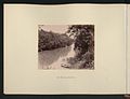
 Afrotemperate forest river valley western cape south africa.JPG 3968 × 2976; 3,11 MB
-
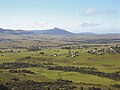
 Baardskeerdersbos view across valley.jpg 1305 × 979; 294 KB
-
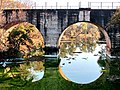
 Bath River Bridge, Bell St, Caledon, South Africa.jpg 3264 × 2448; 3,9 MB
-
 Bath River Bridge.JPG 640 × 480; 153 KB
-
 Baviaans8-wiki.jpg 523 × 350; 164 KB
-
 Bokrivier.jpg 425 × 567; 155 KB
-
 Boyes Drive, Muizenberg - panoramio.jpg 1920 × 1080; 713 KB
-

-
 Dam wall on dry riverbed.jpg 1024 × 768; 207 KB
-
 Doorn River Waterfall, Northern Cape.jpg 2000 × 1450; 1,54 MB
-
 Fangs and Mbundini.jpg 2116 × 744; 738 KB
-
 Graham Maclachlan - Kobonqaba River.jpg 1600 × 1200; 697 KB
-
 Hiking in Cape Nature Reserve.jpg 3240 × 1080; 4,36 MB
-
 Jan du Toit's River, 2012, a.jpg 720 × 540; 70 KB
-
 Lower Silvermine River Wetlands Conservation Area - Cape Town - small.JPG 1024 × 617; 360 KB
-
 Matjies River.jpg 1280 × 960; 182 KB
-
 MPhiti-waterval in mPhiti-rivier, Krantzkloof NR, a.jpg 4000 × 3000; 4,04 MB
-
 Mutlumuvi joining Sand River ... (52791793697).jpg 3825 × 1722; 1,35 MB
-
 Nahoon River.jpg 480 × 782; 89 KB
-
 Nature recycling.jpg 2322 × 4128; 5,18 MB
-
 Nieuwoudtville Wasserfall P1010244.JPG 3264 × 2448; 3,79 MB
-
 Nieuwoudtville Wasserfall P1010249.JPG 3264 × 2448; 4,02 MB
-
 Old Lourens River Bridge 1845.jpg 448 × 336; 63 KB
-
 Old Railway bridge next to the Oberon road - panoramio.jpg 1200 × 900; 669 KB
-
 Olifants River ... (52785323789).jpg 4032 × 1816; 2,26 MB
-
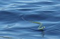 Philothamnus hoplogaster 15152531.jpg 1662 × 1085; 237 KB
-
 RSA R324 nach dem Regen.JPG 2272 × 1704; 1,75 MB
-
 Sand River before confluence with Sabie ... (52792749155).jpg 3740 × 1684; 1,14 MB
-
 Shinwedzi Camp and River ... (52779316931).jpg 4032 × 1816; 1,64 MB
-
 Silvermine River Conservation Area.JPG 1024 × 580; 308 KB
-
 Silvermine River Wetland Reserve.JPG 1024 × 558; 433 KB
-
 Silvermine Wetland Conservation Area.JPG 1024 × 573; 340 KB
-
 Silwerrivier.JPG 1632 × 1224; 900 KB
-
 Smalblaar River-Aerial.jpg 3072 × 2304; 1,98 MB
-
 South Africa-Eastern Cape-Paul Sauer Dam01.jpg 1024 × 683; 558 KB
-
 South Africa-Eastern Cape-Seekoei River causeway-001.jpg 2448 × 3264; 1,73 MB
-
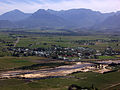
 South African Farm.jpg 3992 × 2242; 5,72 MB
-
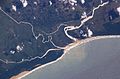 St Lucia Estuary ISS006-E-38182.jpg 3032 × 2006; 1,08 MB
-
 StLuciaWetland L7 07may01.jpg 540 × 540; 102 KB
-
 The National Archives UK - CO 1069-213-72.jpg 730 × 958; 193 KB
-
 The National Archives UK - CO 1069-213-96.jpg 723 × 948; 156 KB
-
 The National Archives UK - CO 1069-214-122.jpg 1072 × 905; 207 KB
-
 The National Archives UK - CO 1069-214-198.jpg 1078 × 899; 198 KB
-
 The National Archives UK - CO 1069-214-62.jpg 1100 × 907; 229 KB
-
 The National Archives UK - CO 1069-220-26.jpg 816 × 629; 93 KB
-
 The National Archives UK - CO 1069-224-14.jpg 1606 × 1226; 264 KB
-
 The National Archives UK - CO 1069-224-31.jpg 1611 × 1223; 367 KB
-
 The Rockeries.jpg 1200 × 1600; 1,21 MB
-
 The Rolling Hills of the Wild Coast.jpg 3992 × 2242; 4,13 MB
-
 Thomas river rock art museum - rsa.jpg 2605 × 3474; 642 KB
-
 Tyhume valley.JPG 3837 × 2877; 1,63 MB
-
 Underberg Views.jpg 3992 × 2242; 3,64 MB
-
 Voortrekker vlotvaart.jpg 1024 × 682; 135 KB
-
 Waterfall on edge of afrotemperate forest westerncape southafrica.JPG 2422 × 2821; 1,68 MB
-
 Wikimania by Rehman - 2018-07-25 - I008 - Post Conference.jpg 4608 × 3456; 4,8 MB
-
 Wikimania by Rehman - 2018-07-25 - I010 - Post Conference.jpg 4608 × 3456; 4,46 MB
-
 Wikimania by Rehman - 2018-07-25 - I012 - Post Conference.jpg 4608 × 3456; 3,23 MB
-
 Wikimania by Rehman - 2018-07-25 - I013 - Post Conference.jpg 3456 × 4608; 2,9 MB
-
 Zaandrivier.JPG 2816 × 2112; 2,16 MB


.jpg)


.jpg)


.jpg)


.jpg)
.jpg)


