Category:Rivière Saint-Charles (Capitale-Nationale)
Zur Navigation springen
Zur Suche springen
Fluss in Québec, Kanada   | |||||
| Medium hochladen | |||||
| Ist ein(e) | |||||
|---|---|---|---|---|---|
| Ort | Quebec, Capitale-Nationale, Québec, Kanada | ||||
| Länge |
| ||||
| Quelle des Wasserlaufs |
| ||||
| Mündet in | |||||
| Einzugsgebiet |
| ||||
| Nebenfluss |
| ||||
| Verschieden von | |||||
 | |||||
Unterkategorien
Es werden 4 von insgesamt 4 Unterkategorien in dieser Kategorie angezeigt:
In Klammern die Anzahl der enthaltenen Kategorien (K), Seiten (S), Dateien (D)
C
- Chute Kabir Kouba (27 D)
P
Medien in der Kategorie „Rivière Saint-Charles (Capitale-Nationale)“
Folgende 76 Dateien sind in dieser Kategorie, von 76 insgesamt.
-

-
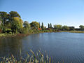
 Bassin de la riviere Saint-Charles.JPG 542 × 484; 161 KB
-

-
 Carte du gouvernement de Québec levée en l'année 1709 - Charlesbourg.jpg 6.743 × 5.839; 5,36 MB
-
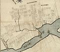
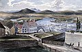
 Charlebourg and the St. Charles River, October 28, 1836.jpg 640 × 447; 120 KB
-
 Chute kabir kouba.jpg 750 × 1.000; 553 KB
-
 Entrance of St. Charles River, Quebec.jpg 640 × 465; 108 KB
-
 General Hospital on the St. Charles from the Quebec Ramparts.jpg 640 × 454; 147 KB
-
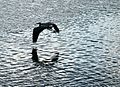 Grand heron - Riviere Saint-Charles, Quebec.jpg 2.047 × 1.490; 1,83 MB
-
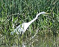 GrandeAigrette.jpg 1.706 × 1.349; 527 KB
-
 Grandheron.jpg 3.888 × 2.592; 5,58 MB
-
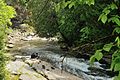
 La rivière Akiawenrahk - Parc de la falaise et de la chute Kabir Kouba..jpg 4.256 × 2.832; 4,55 MB
-
 Le pont de l Aqueduc - Quebec.jpg 960 × 464; 45 KB
-
 Lieu historique national du Canada Cartier-Brébeuf, le bassin d’eau et bicyclable.jpg 5.616 × 3.744; 9,41 MB
-
 Lieu historique national du Canada Cartier-Brébeuf, monument pour Jacques Cartier.jpg 5.616 × 3.744; 4,02 MB
-
 Lieu historique national du Canada Cartier-Brébeuf, sculpture pour designer le bateau.jpg 3.744 × 5.616; 8,41 MB
-
 Lieu historique national du Canada Cartier-Brébeuf, vue générale.jpg 5.616 × 3.744; 10,01 MB
-
 Limoilou du haut des airs, 1948.jpg 731 × 455; 91 KB
-
 N023526a (1945).tif 8.426 × 6.848; 55,06 MB
-
 On my bici.jpg 4.160 × 2.336; 1,51 MB
-
 Parc Cartier-Brébeuf.jpg 1.600 × 1.200; 923 KB
-
 Parc jean-roger-durand.jpg 750 × 1.000; 662 KB
-
 Parc linéaire de la Jacques-Cartier 01.jpg 3.535 × 2.357; 7,64 MB
-
 Parc linéaire de la rivière Saint-Charles.jpg 3.264 × 2.448; 4,24 MB
-
 Parc linéaire-Québec.JPG 1.800 × 1.199; 722 KB
-
 ParcCartierBrébeufB.JPG 1.080 × 766; 336 KB
-
 ParcCartierBrébeufC.JPG 1.620 × 650; 454 KB
-
 Pc Cartier Wiki 46 nuages-reflets AAA.jpg 5.202 × 3.465; 1,61 MB
-
 Pc Cartier Wiki 47 AAA nuages-reflets.jpg 5.202 × 3.465; 1,75 MB
-
 Pc Cartier Wiki 49 AAA nuages-reflets A.jpg 5.202 × 3.465; 1,98 MB
-
 Pont Dorchester - 03.jpg 3.264 × 2.448; 1,96 MB
-
 Pont Dorchester - 05.jpg 3.151 × 2.363; 1,47 MB
-
 Pont Drouin et haute ville de Québec.jpg 3.432 × 2.288; 5,36 MB
-
 Pont Marie-de-l'Incarnation.jpg 3.264 × 2.448; 1,54 MB
-
 Pont riviere st-charles.jpg 750 × 1.000; 797 KB
-
 Pont Scott-QuebecCityJPG.JPG 360 × 267; 81 KB
-
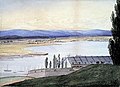
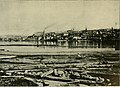
 Quartier Saint-Roch - Riviere Saint-Charles - Panorama BAnQ P560S1P80.jpg 2.422 × 1.476; 649 KB
-
 Quebe city on winter, Canada 02.jpg 4.447 × 3.089; 8,61 MB
-
 Quebe city on winter, Canada 05.jpg 6.000 × 4.000; 15,41 MB
-
 Quebe city on winter, Canada 11.jpg 5.331 × 3.406; 18,38 MB
-
 Quebec and Mouth of the St. Charles River from Point Levi.jpg 760 × 524; 85 KB
-
 Quebec city, Canada, 005.tif 5.675 × 3.527; 114,56 MB
-
 Quebec from St. Charles River, c. 1837-1838.jpg 1.890 × 1.550; 366 KB
-
 Quebec Seen from the West Bank of the St. Charles River.jpg 762 × 500; 233 KB
-
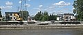
 Quebec-St-Charles.JPG 1.080 × 810; 256 KB
-
 Québec (8917884758).jpg 3.213 × 2.407; 4,01 MB
-
 Québec-ParcChauveau.JPG 1.440 × 1.080; 898 KB
-
 Rio San Carlos (Rivière Saint-Charles (Québec)).jpg 6.246 × 3.573; 10,03 MB
-
 RiviereSt-CharlesQuebec.JPG 1.440 × 1.080; 330 KB
-
 Rivière Akiawenrahk (Rivière à la truite).jpg 3.174 × 2.109; 2,51 MB
-
 Rivière Saint-Charles (8917267683).jpg 3.264 × 2.448; 1,71 MB
-
 Rivière Saint-Charles (Capitale-Nationale) 2.jpg 8.064 × 5.376; 17,32 MB
-
 Rivière Saint-Charles (eaux basses).jpg 3.648 × 2.736; 4,89 MB
-
 Rivière Saint-Charles cartier-brebeuf juin 2011.JPG 3.648 × 2.736; 5,77 MB
-
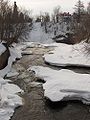
 Rivière Saint-Charles couverte de glace ( Quebec, Canada).jpg 3.040 × 3.040; 2,35 MB
-
 Rivière Saint-Charles parc Chauveau jul 2009.JPG 3.648 × 2.736; 6,11 MB
-
 Rivière Saint-Charles sept 2011 01.JPG 2.736 × 3.648; 5,05 MB
-
 Rivière Saint-Charles sept 2011 02.JPG 3.648 × 2.736; 5,61 MB
-
 Rivière Saint-Charles vue du pont Drouin.jpg 3.888 × 2.592; 7,25 MB
-
 Rivière St-Charles - panoramio.jpg 1.600 × 1.200; 1,16 MB
-
 Roches sédimentaires.jpg 338 × 507; 93 KB
-
 Site archéologique 293.JPG 5.184 × 3.456; 8,78 MB
-
 Sketch of the River St. Charles from above St. John s Gate.jpg 1.280 × 900; 223 KB
-
 St-CharlesRenaturalisation.JPG 1.080 × 457; 169 KB
-
 St. Roch Faubourg and River St. Charles, Millicent Mary Chaplin, 1839.jpg 1.600 × 1.020; 454 KB
-
 Usine Papiers White Birch.jpg 3.264 × 2.448; 1,46 MB
-
 Valley of the St Charles.jpg 1.230 × 913; 459 KB
-
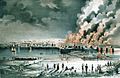 View of Quebec, Shewing the conflagration of June 28th. 1845.jpg 745 × 486; 288 KB
-
 Vue aerienne de Quebec - 1945.jpg 720 × 580; 145 KB
-
 Vue de la tourelle de la prison de Quebec - 01.jpg 3.000 × 2.016; 2,28 MB
-
 Wendake 292.JPG 5.184 × 3.456; 10,26 MB
-
 With fly-rod and camera (1890) (14782556822).jpg 2.416 × 1.754; 913 KB
-
 WPQc-205 Wendake - Chute Kabir Kouba.JPG 5.184 × 3.456; 9,4 MB
-
 WPQc-206 Wendake - Chute Kabir Kouba.JPG 5.184 × 3.456; 7,09 MB
-
 WPQc-209 Wendake - Chute Kabir Kouba.JPG 5.184 × 3.456; 8,87 MB
-
 WPQc-210 Wendake - Chute Kabir Kouba.JPG 5.184 × 3.456; 9,25 MB


.jpg)

).jpg)

.jpg)
.jpg)
_2.jpg)
.jpg)

.jpg)


_(14782556822).jpg)


