Category:Road signs in Ireland
Vai alla navigazione
Vai alla ricerca
Paesi d’Europa: Albania · Andorra · Armenia‡ · Austria · Azerbaigian‡ · Belgio · Bielorussia · Bosnia ed Erzegovina · Bulgaria · Cipro‡ · Croazia · Danimarca · Estonia · Finlandia · Francia‡ · Georgia‡ · Germania · Grecia · Irlanda · Islanda · Italia · Kazakistan‡ · Lettonia · Liechtenstein · Lituania · Lussemburgo · Macedonia del Nord · Malta · Moldavia · Monaco · Montenegro · Norvegia · Paesi Bassi‡ · Polonia · Portogallo‡ · Regno Unito · Repubblica Ceca · Romania · Russia‡ · San Marino · Serbia · Slovacchia · Slovenia · Spagna‡ · Svezia · Svizzera · Turchia‡ · Ucraina · Ungheria
Entità particolari: Fær Øer · Gibilterra · Guernsey · Jersey · isola di Man – Entità a riconoscimento limitato: Cipro del Nord‡ · Kosovo
‡: in parte situato in Europa
Entità particolari: Fær Øer · Gibilterra · Guernsey · Jersey · isola di Man – Entità a riconoscimento limitato: Cipro del Nord‡ · Kosovo
‡: in parte situato in Europa
English: This category is for photographs. For diagrams, see Category:Diagrams of road signs of Ireland.
overview of road signs in Ireland | |||||
| Carica un file multimediale | |||||
| Istanza di |
| ||||
|---|---|---|---|---|---|
| |||||
Sottocategorie
Questa categoria contiene le 29 sottocategorie indicate di seguito, su un totale di 29.
- Road signs in Dublin Airport (5 F)
A
- Additional road signs in Ireland (20 F)
B
D
G
H
K
- Road kilometer signs in Ireland (25 F)
L
M
N
P
R
S
- Slow signs in Ireland (6 F)
T
U
W
File nella categoria "Road signs in Ireland"
Questa categoria contiene 97 file, indicati di seguito, su un totale di 97.
-
 20130808 bru na boinne78.JPG 3 872 × 2 592; 4,25 MB
-
 80kmh speed limit sign with speed camera indicator in Balbriggan, North Co. Dublin.jpg 4 032 × 3 024; 1,92 MB
-
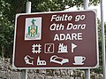 Adare-sign.jpg 926 × 683; 171 KB
-
 An Damhshraith.jpg 592 × 400; 53 KB
-
 Ashbourne City Limits - geograph.org.uk - 568865.jpg 640 × 480; 88 KB
-
 Baile na nGall (Ballynagall) - geograph.org.uk - 275375.jpg 640 × 480; 110 KB
-
 BallickmoylerOnTheR429road4086.jpg 3 888 × 2 592; 1,56 MB
-
 Ballymagauran Castle.jpg 640 × 480; 126 KB
-
 Caution Trains Operating - panoramio.jpg 6 000 × 4 000; 17,89 MB
-
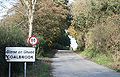 Coalbrook3458.jpg 3 880 × 2 481; 3,92 MB
-
 Corcaigh City Centre (15153272726).jpg 5 184 × 3 456; 17,12 MB
-
 CrossdoneyRoads3427.jpg 3 888 × 2 592; 2,2 MB
-
 Cul de Sac - geograph.org.uk - 1015978.jpg 640 × 480; 103 KB
-
 Cul de Sac, Drumirren - geograph.org.uk - 3025458.jpg 640 × 480; 50 KB
-
 Cul-de-sac lane at Deeps - geograph.org.uk - 1269206.jpg 640 × 480; 105 KB
-
 Culdesac.jpg 2 592 × 1 944; 1,83 MB
-
 Cyclist and pedestrian path sign in Portlaoise.jpg 4 032 × 1 816; 2,45 MB
-
 Derry Stranorlar N13 roadsign.jpg 640 × 479; 63 KB
-
 Dingle-An Daingean graffiti.jpg 3 072 × 2 304; 1,63 MB
-
 Drogheda - St. Laurences Gate (5638815336).jpg 3 056 × 4 592; 9,79 MB
-
 Dunbeggan crossroads - geograph.org.uk - 1302706.jpg 640 × 480; 94 KB
-
 Dungourney.jpg 1 162 × 1 889; 495 KB
-
 E201 signage.JPG 2 386 × 1 442; 675 KB
-
 Glean Cholm Chill Road Sign - geograph.org.uk - 308649.jpg 640 × 480; 51 KB
-
 GreenanWicklow.JPG 2 878 × 2 484; 5,03 MB
-
 IMG 1656w.JPG 2 592 × 1 944; 779 KB
-
 IMG 3245w.jpg 2 592 × 1 944; 1,1 MB
-
 IMG 3337w.JPG 2 592 × 1 944; 1,03 MB
-
 IMG 3996w.JPG 2 592 × 1 944; 1,41 MB
-
 IMG 3997w.JPG 2 592 × 1 944; 2,17 MB
-
 IMG 3999w.JPG 2 592 × 1 944; 2,42 MB
-
 IMG Agher3378c.jpg 2 503 × 1 919; 1,54 MB
-
 IMG Ballinacargy3312c.jpg 1 000 × 765; 273 KB
-
 IMG CplunkettSign.jpg 983 × 670; 230 KB
-
 IMG N52.jpg 2 137 × 904; 369 KB
-
 IMGM50RoadworksSignage 4585w.jpg 2 592 × 1 944; 1 MB
-
 IMGN7LimerickByPass 4710w.jpg 2 592 × 1 944; 962 KB
-
 IMGRedCowRoadworksSign 4586w.jpg 2 592 × 1 944; 804 KB
-
 IMGSingleHollywoodSign 4968w.jpg 2 592 × 1 944; 1,42 MB
-
 Ireland coast sign.jpg 1 162 × 676; 115 KB
-
 Irelandsign.jpg 185 × 290; 14 KB
-
 Irish Nationl road sign for Derry.jpg 3 888 × 2 592; 3,27 MB
-
 Irish road sign.png 799 × 600; 706 KB
-
 Irland Juli 08 234.jpg 1 936 × 2 592; 3,64 MB
-
 Kildare 071.JPG 3 888 × 2 592; 4,89 MB
-
 Kildoagh.jpg 640 × 480; 48 KB
-
 KillaloeR463.jpg 2 964 × 2 228; 1,2 MB
-
 Killorglin7.jpg 2 848 × 2 136; 1,46 MB
-
 Kiltealy142.jpg 3 232 × 1 675; 1 020 KB
-
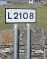 L2108.png 589 × 726; 747 KB
-
 M8 toll junction 14 signage.JPG 4 000 × 3 000; 2,76 MB
-
 New ADS signage.JPG 4 000 × 3 000; 2,9 MB
-
 M18DistanceSignage.JPG 669 × 695; 61 KB
-
 M2 Ireland RCS Sign.jpg 800 × 600; 86 KB
-
 M8 cropped wiki route confirmationBE.JPG 2 737 × 3 000; 1,06 MB
-
 M8 onslip sign.JPG 4 000 × 3 000; 2,08 MB
-
 M8 wiki route confirmation.JPG 4 000 × 3 000; 2,93 MB
-
 Merrion Gates.JPG 3 072 × 2 304; 2,6 MB
-
 Milltown, Co. Kildare.JPG 1 556 × 1 113; 418 KB
-
 N3 sign Northern Ireland.jpg 640 × 429; 90 KB
-
 N4 Eastbound.jpg 2 560 × 1 517; 531 KB
-
 N72roadCork.JPG 2 781 × 2 300; 960 KB
-
 N76road.JPG 3 879 × 2 481; 1,82 MB
-
 NewblissNorth.JPG 3 553 × 2 275; 4,21 MB
-
 NewblissTown.JPG 3 876 × 2 216; 5,16 MB
-
 NewM50Dublin.JPG 2 971 × 2 057; 833 KB
-
 OCBordFailteSignN62 048.jpg 559 × 378; 70 KB
-
 Pay and Display sign with Tironian et for Irish agus.jpg 627 × 1 024; 117 KB
-
 Portroe3736-1.jpg 3 311 × 2 141; 1,06 MB
-
 R148road4458.jpg 3 172 × 1 742; 1,31 MB
-
 R155road.JPG 3 465 × 1 809; 3,68 MB
-
 R245 at east end of Lackagh Bridge - geograph.org.uk - 1326597.jpg 640 × 427; 105 KB
-
 R357road.jpg 2 592 × 1 944; 891 KB
-
 R425road5146.jpg 2 592 × 1 944; 2,66 MB
-
 R482.png 593 × 700; 769 KB
-
 R730road 3800.jpg 3 888 × 2 592; 1,71 MB
-
 R752 4239c.jpg 2 029 × 904; 301 KB
-
 RegionalRoadSignIreland 2825.jpg 949 × 782; 296 KB
-
 Road Sign, Clareabbey, Co Clare - geograph.org.uk - 1804861.jpg 640 × 480; 54 KB
-
 Road signs at Grahamsland - geograph.org.uk - 2918506.jpg 640 × 480; 48 KB
-
 Road signs on a cul-de-sac - geograph.org.uk - 2837812.jpg 640 × 480; 51 KB
-
 Rock of Cashel-14-Kreuzung-1989-gje.jpg 2 636 × 1 697; 1,55 MB
-
 Route confirmation sign on the M4 near Kinnegad.jpg 2 592 × 1 944; 1,1 MB
-
 Scheme NDP signage.JPG 4 000 × 3 000; 2,81 MB
-
 SeatInBrosna3760c.jpg 2 513 × 2 234; 1,88 MB
-
 Sign on the N8 at it's terminus on the M7.jpg 2 589 × 1 643; 793 KB
-
 Sign-1040038, Lucan, Co. Dublin, Ireland.jpg 4 896 × 3 672; 2,57 MB
-
 Sign-1050273, Dingle Peninsula, Co. Kerry, Ireland.jpg 4 896 × 3 672; 4,05 MB
-
 Signage to be put up at M8 sliproad, Cullahill.jpg 1 024 × 1 280; 272 KB
-
 SignR426.jpg 3 430 × 2 374; 1,24 MB
-
 The tea junction DSCF2110.jpg 2 736 × 1 824; 333 KB
-
 ThomastownN9.JPG 2 736 × 1 964; 1,03 MB
-
 Timolin.JPG 3 460 × 2 250; 1,74 MB
-
 Waiting traffic at the level crossing on Sydney Parade (geograph 1973223).jpg 766 × 1 024; 210 KB
-
 Welcome to Lovely Leitrim - geograph.org.uk - 1167577.jpg 640 × 479; 67 KB
-
 M3 Sign, N51 Athboy Road Near Navan - geograph.org.uk - 601309.jpg 480 × 640; 139 KB
-


_-_geograph.org.uk_-_275375.jpg)


.jpg)


.jpg)


.jpg)


