Category:Roads in Oregon
Saltar para a navegação
Saltar para a pesquisa
Estados dos Estados Unidos: Alabama · Alasca · Arizona · Arkansas · Califórnia · Carolina do Norte · Carolina do Sul · Colorado · Connecticut · Dakota do Norte · Dakota do Sul · Delaware · Flórida · Geórgia · Havaí · Idaho · Illinois · Indiana · Iowa · Kansas · Kentucky · Luisiana · Maine · Maryland · Massachusetts · Michigan · Minnesota · Mississippi · Missouri · Montana · Nebraska · Nevada · Nova Hampshire · Nova Iorque · Nova Jérsia · Novo México · Ohio · Oklahoma · Óregon · Pensilvânia · Rhode Island · Tennessee · Texas · Utah · Vermont · Virgínia · Virgínia Ocidental · Washington · Wisconsin · Wyoming – Distrito de Colúmbia: Washington, D.C.
Porto Rico
Porto Rico
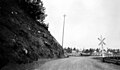
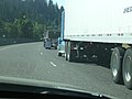
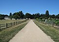
highway system of Oregon, United States | |||||
| Carregar ficheiro | |||||
| Instância de |
| ||||
|---|---|---|---|---|---|
| Localização | Óregon, EUA | ||||
| Proprietário | |||||
| Mantido por | |||||
| Composto de | |||||
| Data inicial |
| ||||
| |||||
Subcategorias
Esta categoria contém as seguintes 28 subcategorias (de um total de 28).
*
B
C
D
- Dirt roads in Oregon (6 F)
F
- Flooded roads in Oregon (19 F)
- Frontage roads in Oregon (1 F)
H
- Huntington Wagon Road (38 F)
I
- Illinois River Road (Oregon) (28 F)
L
- Logging roads in Oregon (2 F)
M
O
R
- Roads near Bandon, Oregon (5 F)
S
- Snowy roads in Oregon (32 F)
Multimédia na categoria "Roads in Oregon"
Esta categoria contém os seguintes 170 ficheiros (de um total de 170).
-
 134 Before Central Linn Elementary (47973735263).jpg 3 264 × 2 448; 3,05 MB
-
 2013 Construction Day - Safety zone (8777558028).jpg 4 256 × 2 832; 3,21 MB
-
 22 - panoramio (3).jpg 2 592 × 1 936; 1,69 MB
-
 2Exit40SBOffRamp note barrier between ramp and bridgeFeb172021 (50956341028).jpg 5 472 × 3 648; 7,49 MB
-
 3-traffic-1 (52119227072).jpg 3 840 × 2 160; 2,39 MB
-
 78 Before Grant Union Junior High (47974649907).jpg 588 × 430; 37 kB
-
 Aerial view of roundabout on OR 57 in Forest Grove (49894716506).jpg 5 472 × 3 648; 8,62 MB
-
 Applying de-icer (31524213972).jpg 2 048 × 1 536; 1,14 MB
-
 Approaching the vehicle (34823415143).jpg 1 798 × 1 200; 2,99 MB
-
 Baldock crew (12487673055).jpg 2 100 × 1 500; 2,95 MB
-
 Barber Street at dusk in Villebois - Wilsonville, Oregon.jpg 3 033 × 2 257; 2,35 MB
-
 Bear camp road warning sign P4368c.jpeg 1 987 × 1 802; 1,11 MB
-
 Bear Creek Greenway 01.jpg 2 048 × 1 536; 947 kB
-
 Beginning of trail to Ki-a-Kuts Falls - Oregon.JPG 3 872 × 2 592; 4 MB
-
 Bell Road Wilsonville Oregon.jpg 640 × 480; 63 kB
-
 Bicycle warning lights (49097217963).jpg 7 360 × 4 912; 15,33 MB
-
 Birch Creek.JPG 2 272 × 1 704; 1,38 MB
-
 Brogan, Oregon, gravel road.jpg 4 000 × 3 000; 4,91 MB
-
 Bull Mountain Road in Tigard Oregon.JPG 3 872 × 2 592; 3,81 MB
-
 Car with fog lights on (5371607642).jpg 2 048 × 1 536; 612 kB
-

-
 Cedar Hills Blvd and Walker Road Beaverton.JPG 3 872 × 2 592; 3,72 MB
-
 Clearing trees in the Coast Range on Dec. 24, 2008 (3133196997).jpg 640 × 480; 90 kB
-
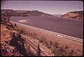 COLUMBIA RIVER GORGE BETWEEN THE DALLES AND THE HOOD RIVER - NARA - 548143.jpg 3 000 × 2 030; 843 kB
-
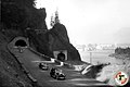 Columbia River Highway (8515604587).jpg 1 125 × 750; 409 kB
-
 Cottage Grove Bridge Tour.jpg 2 816 × 2 112; 1,17 MB
-
 Culvert on Umpqua Highway (32099105424).jpg 1 600 × 1 200; 975 kB
-
 Culvert on Umpqua Highway (32127885173).jpg 1 200 × 1 600; 800 kB
-
 Cycle Oregon 2012 (7996058958).jpg 2 592 × 1 936; 1,36 MB
-
 Deerhorn Road (Lane County, Oregon scenic images) (lanDB3869).jpg 324 × 488; 75 kB
-
 Deerhorn Road (Lane County, Oregon scenic images) (lanDB3871).jpg 488 × 324; 63 kB
-
 Deschutes National Forest, Oregon USA - Ice Cave Road - panoramio.jpg 1 643 × 2 121; 1,08 MB
-
 Detroit - Breitenbush Road (8113404203).jpg 1 789 × 2 912; 603 kB
-
 Diamond Craters 7 (6993600224).jpg 4 752 × 3 168; 8,88 MB
-
 Downtown - Gladstone, Oregon.JPG 3 872 × 2 592; 3,66 MB
-
 Downtown and fire station - Bay City, Oregon.JPG 3 122 × 2 193; 2,09 MB
-
 Downtown Sodaville, OR.jpg 4 032 × 3 024; 6,21 MB
-
 Drewsey Road (Harney County, Oregon scenic images) (harDA0006).jpg 488 × 324; 27 kB
-
 Drewsey Road (Harney County, Oregon scenic images) (harDA0007b).jpg 324 × 488; 28 kB
-
 East of Milton Freewater, OR. (10488992384).jpg 2 048 × 1 536; 799 kB
-
 Elijah Elliott.jpg 292 × 440; 57 kB
-
 Empty street in autumn - Salem, Oregon.JPG 3 214 × 2 228; 2,67 MB
-
-

-
 Following too close (3698868698).jpg 2 048 × 1 536; 736 kB
-
-
 Fullsizeoutput 1c21.jpg 6 000 × 4 000; 4,98 MB
-
 Gang plowing (12487673765).jpg 4 608 × 3 456; 6,36 MB
-
 Gerber Road (Klamath County, Oregon scenic images) (klaDA0096a).jpg 324 × 488; 31 kB
-
 Good roads near McMinnville, Oregon (3230125432).jpg 4 308 × 2 692; 4,88 MB
-
 Grahams Ferry and Clutter roads at Mulloy, Oregon.JPG 3 010 × 1 965; 1,88 MB
-
 Granite Oregon.jpg 2 977 × 2 716; 3,03 MB
-
 Grave of Sarah King Chambers.jpg 3 456 × 2 592; 4,16 MB
-
 Gravel Road (Umatilla County, Oregon scenic images) (umaDA0030).jpg 488 × 324; 38 kB
-
 Harpold Road (Klamath County, Oregon scenic images) (klaDA0050).jpg 488 × 324; 31 kB
-
 Hazards ahead (4174760168).jpg 1 020 × 683; 587 kB
-
 High Water advisory on Oregon 395 (5727476122).jpg 640 × 480; 79 kB
-
 Historic Oregon 66 Greensprings Highway (35334767863).jpg 894 × 747; 431 kB
-
 Ice on the highway March 1, 2012 (6800558822).jpg 1 936 × 2 592; 2,79 MB
-
 Illinois River, Selma - DPLA - cd5d926df907fa371fa8dd9cbe3aaf24.jpg 2 000 × 1 339; 1,29 MB
-
 La Grande road crew (8515604847).jpg 1 125 × 750; 519 kB
-
 Laidlaw at Bethany Boulevard - Oregon.JPG 2 665 × 2 046; 1,72 MB
-

-
 Low visibility (23660084459).jpg 4 256 × 2 832; 2,18 MB
-

-
 McMinnville Oregon farmers market.JPG 2 965 × 1 941; 2,4 MB
-

-
 Meek's Ruts.jpg 3 456 × 2 592; 2,88 MB
-
 Mount Hood from Oregon plains 1953.jpg 3 888 × 2 592; 8,05 MB
-
 Mt. Hood (Wasco County, Oregon scenic images) (wascD0062).jpg 324 × 488; 35 kB
-
 Mt. Jefferson (Wasco County, Oregon scenic images) (wascDA0098a).jpg 488 × 324; 31 kB
-
 Mt. Jefferson (Wasco County, Oregon scenic images) (wascDA0099).jpg 324 × 488; 34 kB
-

-
 Near Lakeview, Oregon (3885005116).jpg 2 272 × 1 704; 763 kB
-
 Near Troy, OR. (10488978825).jpg 2 048 × 1 536; 819 kB
-

-
 New Willamette Highway (7263076652).jpg 1 024 × 607; 155 kB
-
 Northern Oregon Coast Range logging road - Washington and Yamhill counties, Oregon.jpg 3 872 × 2 592; 3,99 MB
-
 NW 23rd at Irving.jpeg 4 032 × 2 268; 3,14 MB
-
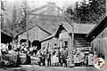
 ODOT Hunter Creek Maintenance Yard (6728133005).jpg 640 × 480; 34 kB
-
 Old Emigrant Hill Road - DPLA - 62d6910bc6e687116ca7fd80f33b698e.jpg 1 339 × 2 000; 1,25 MB
-
 Old Emigrant Hill Road - DPLA - 725c17a999904cc0beab2efbdb9f2979.jpg 1 339 × 2 000; 986 kB
-
 Old Siskiyou Highway south of Ashland, OR. (10242581664).jpg 1 280 × 960; 497 kB
-
 On the Oregon Trail (30972889897).jpg 1 024 × 768; 561 kB
-
 On the way to the Cave, Forest Highway built by Bureau of Public Roads. - NARA - 298949.jpg 3 000 × 1 713; 1,47 MB
-
 OR 30 slide outside of Rainier (23056102974).jpg 4 288 × 2 848; 2,38 MB
-
 OR 30 slide outside of Rainier (23056106364).jpg 4 056 × 2 704; 2,15 MB
-
 OR 30 slide outside of Rainier (23056112684).jpg 4 288 × 2 848; 3,45 MB
-
 OR 30 slide outside of Rainier (23057200773).jpg 4 288 × 2 848; 2,49 MB
-
 OR 30 slide outside of Rainier (23057208493).jpg 4 288 × 2 848; 2,83 MB
-
 OR 30 slide outside of Rainier (23057211153).jpg 4 288 × 2 848; 3,12 MB
-
 OR 30 slide outside of Rainier (23057213653).jpg 4 067 × 2 711; 2,26 MB
-
 OR 30 slide outside of Rainier (23057215683).jpg 3 702 × 2 468; 1,97 MB
-
 OR 30 slide outside of Rainier (23316301969).jpg 4 288 × 2 848; 2,83 MB
-
 OR 30 slide outside of Rainier (23316309689).jpg 4 288 × 2 848; 3,33 MB
-
 OR 30 slide outside of Rainier (23316310639).jpg 4 288 × 2 848; 3,26 MB
-
 OR 30 slide outside of Rainier (23316312019).jpg 4 180 × 2 787; 2,81 MB
-
 OR 30 slide outside of Rainier (23316314439).jpg 4 272 × 2 848; 2,77 MB
-
 OR 30 slide outside of Rainier (23388592980).jpg 3 608 × 2 406; 2,01 MB
-
 OR 30 slide outside of Rainier (23388599430).jpg 4 182 × 2 788; 2,66 MB
-
 OR 30 slide outside of Rainier (23575716452).jpg 4 191 × 2 794; 2,11 MB
-
 OR 30 slide outside of Rainier (23601788861).jpg 4 288 × 2 848; 2,93 MB
-
 OR 30 slide outside of Rainier (23658177346).jpg 4 288 × 2 848; 2,3 MB
-
 OR 30 slide outside of Rainier (23658178466).jpg 3 680 × 2 454; 1,97 MB
-
 OR 30 slide outside of Rainier (23658179126).jpg 3 755 × 2 503; 1,96 MB
-
 OR 30 slide outside of Rainier (23658182816).jpg 4 140 × 2 760; 2,23 MB
-
 OR 30 slide outside of Rainier (23658187586).jpg 4 288 × 2 848; 2,66 MB
-
 OR 30 slide outside of Rainier (23658189966).jpg 3 633 × 2 422; 1,97 MB
-
 OR 30 slide outside of Rainier (23658192636).jpg 4 288 × 2 848; 2,66 MB
-
 OR 30 slide outside of Rainier (23684252375).jpg 4 288 × 2 848; 2,37 MB
-
 OR 30 slide outside of Rainier (23684264825).jpg 4 288 × 2 848; 2,37 MB
-

-

-
 OregonCoastRangeRoad.JPG 2 816 × 2 112; 1,84 MB
-
 Overhead light (3833461405).jpg 1 020 × 683; 408 kB
-
 Parking lot at Farewell Bend (5227854636).jpg 640 × 425; 37 kB
-
 Pick up with fog lights (5371607846).jpg 2 048 × 1 536; 1,83 MB
-

-

-
 PSM V88 D085 Scenic oregon highway for motorists.png 2 145 × 2 996; 1,13 MB
-
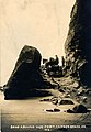
 Road near Bandon, OR (TK2).JPG 5 760 × 3 840; 7,57 MB
-
 Road near Bandon, OR (TK3).JPG 5 760 × 3 840; 8,8 MB
-
 Road near Bandon, OR (TK4).JPG 3 840 × 5 760; 6,6 MB
-
 Road near Bandon, OR (TK5).JPG 5 760 × 3 840; 10,08 MB
-
 Road to be deactivated in years ahead - panoramio.jpg 2 144 × 1 424; 2,28 MB
-
 Roads - General - DPLA - 32f2ec9d779e77a9c8ebef3363a12add.jpg 3 939 × 2 700; 1,07 MB
-
 Roads of Oregon (23294416476).jpg 2 560 × 1 714; 366 kB
-
 Roads of Oregon (23294417916).jpg 2 560 × 1 714; 733 kB
-
 Roads of Oregon (23294420656).jpg 2 560 × 1 522; 562 kB
-
 Roads of Oregon (23320514255).jpg 2 560 × 1 603; 604 kB
-
 Roadside Markers (5242674006).jpg 1 791 × 2 220; 544 kB
-
 Rrgrade.jpg 3 872 × 2 592; 1,7 MB
-

-
 Sherars Bridge.jpg 3 456 × 2 592; 3,17 MB
-
 Sheridan Oregon downtown at Bridge and Sheridan roads.JPG 3 872 × 2 592; 3,83 MB
-
 Skyline drive – poles on banks (5242096677).jpg 2 368 × 1 666; 659 kB
-
 Snow and ice conditions (5124402104).jpg 2 000 × 1 500; 2,39 MB
-
 Snow zone ahead! (49204838362).jpg 7 360 × 4 912; 10,71 MB
-

-
 Steens Mountain in eastern Oregon (9680514565).jpg 5 616 × 3 744; 21,62 MB
-
 Steens Mountain in eastern Oregon (9680515587).jpg 5 616 × 3 744; 18,61 MB
-
 Stone Bridge and Oregon Central Military Road.PNG 426 × 315; 13 kB
-
 Street in autumn - Salem, Oregon.JPG 2 355 × 2 344; 2,38 MB
-
 Street in Shadowood, Oregon.JPG 3 872 × 2 592; 3,93 MB
-
 Subdivision - Bethany, Oregon.JPG 2 488 × 1 881; 1,76 MB
-
 SW Vandermost Road - Oregon.JPG 2 882 × 2 323; 2,02 MB
-
 The open road from Canyonville to Tiller, Oregon (10242677965).jpg 1 280 × 960; 461 kB
-
 The Road Home (5103326403).jpg 3 744 × 5 616; 7,62 MB
-

-

-

-
 Toll gate (8515715869).jpg 1 125 × 750; 573 kB
-
 Trees in bloom off Kruse Way - Lake Oswego, Oregon.JPG 3 872 × 2 592; 3,95 MB
-
 Truck stuck on LoLo Pass Road (12094479076).jpg 1 024 × 768; 732 kB
-
 Tualamere Avenue - Rivergrove, Oregon.JPG 3 872 × 2 592; 3,87 MB
-
 Upper and Lower Table Rock - Flickr - brewbooks.jpg 2 937 × 2 137; 1,91 MB
-
 Video display (4174760586).jpg 1 020 × 634; 643 kB
-
 View from the simulator (4174760712).jpg 1 020 × 677; 600 kB
-
 Villebois Oregon night Barber Street.JPG 3 872 × 2 592; 4,56 MB
-
 Visitors explore the new highway (30479379580).jpg 2 730 × 1 820; 892 kB
-
 Wagon crossing Hug Point, Oregon.jpg 900 × 1 296; 387 kB
-
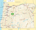
 Wallowa-Whitman National Forest map.gif 600 × 617; 38 kB
-
 Water rushed down onto Macadam Ave (6733255705).jpg 640 × 480; 64 kB
-
 Welcome! (32914135437).jpg 4 374 × 2 916; 1,97 MB
-
 West Salem Oregon commercial district.jpg 3 068 × 2 239; 2,42 MB
-

-

-
 Winter Road (5123800807).jpg 2 250 × 1 464; 4,8 MB
-
 Wpdms na-or cascadelakessb.png 588 × 491; 374 kB
-
 Wpdms na-or mcksantiampasssb.png 588 × 491; 374 kB
.jpg)
.jpg)
.jpg)
.jpg)
.jpg)
.jpg)
.jpg)
.jpg)
.jpg)
.jpg)


.jpg)


.jpg)
_(desDA0055).jpg)


.jpg)

.jpg)
.jpg)
.jpg)
_(lanDB3869).jpg)
_(lanDB3871).jpg)

.jpg)
.jpg)


_(harDA0006).jpg)
_(harDA0007b).jpg)
.jpg)


_(harDA0155).jpg)
.jpg)
.jpg)

.jpg)
_(klaDA0096a).jpg)
.jpg)


_(umaDA0030).jpg)
_(klaDA0050).jpg)
.jpg)
.jpg)
.jpg)
.jpg)

.jpg)

.jpg)
.jpg)
.jpg)


_(wascD0062).jpg)
_(wascDA0098a).jpg)
_(wascDA0099).jpg)
_(colD0006).jpg)
.jpg)
.jpg)

.jpg)


.jpg)


.jpg)
.jpg)

.jpg)
.jpg)
.jpg)
.jpg)
.jpg)
.jpg)
.jpg)
.jpg)
.jpg)
.jpg)
.jpg)
.jpg)
.jpg)
.jpg)
.jpg)
.jpg)
.jpg)
.jpg)
.jpg)
.jpg)
.jpg)
.jpg)
.jpg)
.jpg)
.jpg)
.jpg)
_(polDA0001a).jpg)
_(josD0015c).jpg)

.jpg)
.jpg)
.jpg)
_(harDA0078).jpg)
_(harDA0086).jpg)

.JPG)
.JPG)
.JPG)
.JPG)


.jpg)
.jpg)
.jpg)
.jpg)
.jpg)

.jpg)


.jpg)
.jpg)
.jpg)
_(harDA0158).jpg)
.jpg)
.jpg)


.jpg)
.jpg)
.jpg)
_(washDA0003b).jpg)
_(washDA0004a).jpg)
.jpg)

.jpg)


.jpg)
.jpg)

.jpg)


.jpg)
.jpg)

_(harDA0130a).jpg)
_(harDA0131a).jpg)
.jpg)


.jpg)