Category:Roads in California
Jump to navigation
Jump to search
States of the United States: Alabama · Alaska · Arizona · Arkansas · California · Colorado · Connecticut · Delaware · Florida · Georgia · Hawaii · Idaho · Illinois · Indiana · Iowa · Kansas · Kentucky · Louisiana · Maine · Maryland · Massachusetts · Michigan · Minnesota · Mississippi · Missouri · Montana · Nebraska · Nevada · New Hampshire · New Jersey · New Mexico · New York · North Carolina · North Dakota · Ohio · Oklahoma · Oregon · Pennsylvania · Rhode Island · South Carolina · South Dakota · Tennessee · Texas · Utah · Vermont · Virginia · Washington · West Virginia · Wisconsin · Wyoming – District of Columbia: Washington, D.C.
Puerto Rico
Puerto Rico
Wikimedia category | |||||
| Upload media | |||||
| Instance of | |||||
|---|---|---|---|---|---|
| Category combines topics | |||||
| Category contains | |||||
| California | |||||
state of the United States of America  someja satełitar in avril ,_South_Olive_Street_--_2012_--_4847.jpg)      | |||||
| Pronunciation audio | |||||
| Instance of |
| ||||
| Part of | |||||
| Named after |
| ||||
| Location | Pacific States Region | ||||
| Located in or next to body of water | |||||
| Capital |
| ||||
| Legislative body | |||||
| Executive body | |||||
| Highest judicial authority | |||||
| Official language | |||||
| Anthem | |||||
| Head of government |
| ||||
| Inception |
| ||||
| Highest point | |||||
| Population |
| ||||
| Area |
| ||||
| Elevation above sea level |
| ||||
| Replaces |
| ||||
| Different from | |||||
| Said to be the same as | Golden State | ||||
| Maximum temperature record |
| ||||
| Minimum temperature record |
| ||||
| official website | |||||
 | |||||
Subcategories
This category has the following 41 subcategories, out of 41 total.
*
1
C
- Cave Loop Road (4 F)
D
E
F
- Flooded roads in California (5 F)
- Frontage roads in California (2 F)
H
- Humboldt Wagon Road (3 F)
I
J
L
M
- Mojave Road (6 F)
- Mountain roads in California (21 F)
P
- Pacific Highway (United States) (16 F)
R
- Roadcuts in California (14 F)
S
- California Scenic Byways (6 F)
- Snowy roads in California (9 F)
T
Y
Media in category "Roads in California"
The following 200 files are in this category, out of 231 total.
(previous page) (next page)-
 "Galactic Kaleidoscope" (8583832479).jpg 831 × 1,248; 937 KB
-
 NORTHERN CALIFORNIA - NARA - 543024.jpg 3,000 × 2,041; 1,014 KB
-
 101 North (5212331057).jpg 1,200 × 803; 840 KB
-
 101-280-680 Joe Colla Interchange 1975.jpg 2,638 × 1,461; 1.14 MB
-
 110 freeway exit from US 101 (1950s) (5006703733).jpg 3,292 × 2,128; 2.26 MB
-

-

-
-

-

-

-
 20220618 05 Oakdale, California (52967629071).jpg 3,648 × 2,736; 4 MB
-
 29 Palms looking East on Hwy 62.jpg 3,600 × 2,403; 3.19 MB
-
 35 SAM 2657 (4841900139).jpg 4,592 × 3,056; 2.11 MB
-
 360 Bumpass Hell Overlook (52d27a8b-0ceb-453b-a6b8-be2263c24ee6).JPG 5,376 × 2,688; 3.98 MB
-
 360 Near Emerald Lake in Winter (542a4ca0-d9cb-41c8-a362-bdd135f9deb1).jpg 5,376 × 2,688; 6.16 MB
-
 360 Windy Point in winter (5f5646e1-a78a-48af-91a5-b439bcf9f7b0).jpg 5,376 × 2,688; 6.78 MB
-

-
 A drive through the Fog - panoramio.jpg 2,592 × 1,944; 839 KB
-
 Alleghany.jpg 1,632 × 1,232; 518 KB
-
 Almost to Golden Gate Bridge (21739274372).jpg 2,048 × 1,536; 2.18 MB
-
 Approaching San Luis Obispo, 2003 (10221399284).jpg 1,536 × 1,024; 299 KB
-
 Arrowhead, San Bernardino Mountains.jpg 2,592 × 1,944; 1.09 MB
-
 Back road near Inn at Otter's Crest (21934755465).jpg 2,030 × 1,383; 814 KB
-
 Before it was Interstate 8.jpg 5,184 × 3,456; 15.21 MB
-
 Bunchgrass prairie SRP.jpg 1,632 × 1,224; 868 KB
-
 CA Highway 4 - panoramio.jpg 1,936 × 2,592; 1.15 MB
-
 CA I-5 South - panoramio.jpg 1,936 × 1,399; 641 KB
-
 CA243 near Lake Fulmor after Feb14 Flooding 1.jpg 720 × 960; 129 KB
-
 CA243 near Lake Fulmor after Feb14 Flooding 2.jpg 960 × 720; 99 KB
-
 CA243 near Lake Fulmor after Feb14 Flooding 3.jpg 675 × 900; 83 KB
-
 CA243 near Lake Fulmor after Feb14 Flooding 4.jpg 720 × 960; 105 KB
-
 California - Beach Roads - NARA - 543427.jpg 2,033 × 3,000; 1.4 MB
-
 California - Jolon - NARA - 23934403.jpg 4,459 × 3,400; 7.13 MB
-
 California Highway 193 terminus in Lincoln.jpg 2,048 × 3,072; 3.24 MB
-
 California redwood trees view from car.JPG 2,592 × 1,944; 1.28 MB
-
 California road work-Motoring Magazine-1915-064.jpg 2,269 × 1,449; 1.35 MB
-
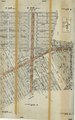
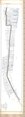
 California Route 165 ROW map 1.pdf 5,852 × 29,872; 3.36 MB
-
 California Route 165 ROW map 2.pdf 7,227 × 29,914; 6.22 MB
-
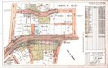
 California Route 187 ROW map (PCH-Venice).pdf 14,945 × 23,958; 4.94 MB
-
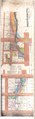 California Route 187 ROW map (Santa Monica).pdf 8,779 × 29,775; 6.43 MB
-
 California Route 26 ROW map (pre-1964).pdf 6,425 × 29,950; 4.09 MB
-
 California Route S134 ROW.pdf 14,600 × 9,233; 1.35 MB
-
 California State Highway Map (1918).jpg 11,537 × 13,955; 24.75 MB
-
 California State Highway Map (1964).jpg 11,451 × 13,941; 24.6 MB
-
 California State Highway Map (1966).jpg 11,442 × 13,881; 25.69 MB
-
 California State Highway Map (1981).jpg 7,410 × 16,145; 30.35 MB
-
 California State Highway Map (2005).jpg 7,956 × 11,822; 16.12 MB
-
 California Streets and Highways Code § 300.pdf 900 × 1,350; 73 KB
-
 California Streets and Highways Code § 302.pdf 900 × 1,350; 80 KB
-
 California Streets and Highways Code § 303.pdf 900 × 1,350; 74 KB
-
 California Streets and Highways Code § 304.pdf 900 × 1,350; 75 KB
-
 California Streets and Highways Code § 305.pdf 900 × 1,350; 72 KB
-
 California Streets and Highways Code § 306.pdf 900 × 1,350; 72 KB
-
 California Streets and Highways Code § 307.pdf 900 × 1,350; 72 KB
-
 California Streets and Highways Code § 308.pdf 900 × 1,350; 74 KB
-
 California Streets and Highways Code § 309.pdf 900 × 1,350; 72 KB
-
 California Streets and Highways Code § 310.pdf 900 × 1,350; 74 KB
-
 California Streets and Highways Code § 311.pdf 900 × 1,350; 72 KB
-
 California Streets and Highways Code § 312.pdf 900 × 1,350; 75 KB
-
 California Streets and Highways Code § 313.pdf 900 × 1,350; 72 KB
-
 California Streets and Highways Code § 314.pdf 900 × 1,350; 74 KB
-
 California Streets and Highways Code § 315.pdf 900 × 1,350; 74 KB
-
 California Streets and Highways Code § 316.pdf 900 × 1,350, 2 pages; 89 KB
-
 California Streets and Highways Code § 317.pdf 900 × 1,350; 72 KB
-
 California Streets and Highways Code § 318.pdf 900 × 1,350; 74 KB
-
 California Streets and Highways Code § 319.pdf 900 × 1,350; 77 KB
-
 California Streets and Highways Code § 320.pdf 900 × 1,350; 74 KB
-
 California Streets and Highways Code § 322.pdf 900 × 1,350; 74 KB
-
 California Streets and Highways Code § 323.pdf 900 × 1,350; 74 KB
-
 California Streets and Highways Code § 324.pdf 900 × 1,350; 74 KB
-
 California Streets and Highways Code § 325.pdf 900 × 1,350; 78 KB
-
 California Streets and Highways Code § 326.pdf 900 × 1,350; 74 KB
-
 California Streets and Highways Code § 327.pdf 900 × 1,350; 72 KB
-
 California Streets and Highways Code § 328.pdf 900 × 1,350; 72 KB
-
 California Streets and Highways Code § 329.pdf 900 × 1,350; 72 KB
-
 California Streets and Highways Code § 332.pdf 900 × 1,350; 74 KB
-
 California Streets and Highways Code § 333.1.pdf 900 × 1,350; 73 KB
-
 California Streets and Highways Code § 333.pdf 900 × 1,350; 76 KB
-
 California Streets and Highways Code § 334.pdf 900 × 1,350; 74 KB
-
 California Streets and Highways Code § 335.pdf 900 × 1,350; 74 KB
-
 California Streets and Highways Code § 336.pdf 900 × 1,350; 72 KB
-
 California Streets and Highways Code § 337.pdf 900 × 1,350; 74 KB
-
 California Streets and Highways Code § 338.pdf 900 × 1,350; 74 KB
-
 California Streets and Highways Code § 339.pdf 900 × 1,350; 87 KB
-
 California Streets and Highways Code § 340.pdf 900 × 1,350; 72 KB
-
 California Streets and Highways Code § 341.pdf 900 × 1,350; 74 KB
-
 California Streets and Highways Code § 343.pdf 900 × 1,350; 74 KB
-
 California Streets and Highways Code § 344.pdf 900 × 1,350; 72 KB
-
 California Streets and Highways Code § 345.pdf 900 × 1,350; 74 KB
-
 California Streets and Highways Code § 346.pdf 900 × 1,350; 74 KB
-
 California Streets and Highways Code § 347.pdf 900 × 1,350; 72 KB
-
 California Streets and Highways Code § 348.pdf 900 × 1,350; 72 KB
-
 California Streets and Highways Code § 349.pdf 900 × 1,350; 77 KB
-
 California Streets and Highways Code § 350.pdf 900 × 1,350; 72 KB
-
 Carmel Valley Road–Boronda Road Eucalyptus Tree Row.jpg 1,024 × 768; 323 KB
-
-
 Coast Highway at Castle Rock, Near Santa Monica, California. (pcard-print-pub-pc-21a).jpg 3,358 × 2,102; 1.82 MB
-
 Corrugated Road - Fremont California.jpg 3,198 × 2,399; 3.34 MB
-
 Covered Bridge, Glen Canyon (Santa Cruz County, California).jpg 477 × 538; 147 KB
-
 Cruising on the road of life.jpg 4,000 × 3,000; 4.73 MB
-
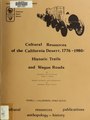 Cultural resources of the California desert, 1776-1880 - historic trails and wagon roads (IA culturalresource4081warr).pdf 1,202 × 1,597, 216 pages; 8.8 MB
-
 De Luz Heights Rd looking north toward Big Rock Ranch.JPG 1,800 × 1,342; 1.15 MB
-
 Death Valley National Park, California, Jubilee Pass Road (3375976203).jpg 2,816 × 2,112; 2.44 MB
-
 Donner Pass Track 1 Grade.jpg 800 × 600; 176 KB
-
 Drive By (5156600890).jpg 1,200 × 803; 872 KB
-
 Drive on (8932465596).jpg 5,760 × 3,433; 11.45 MB
-
 PSM V69 D110 Earthquake fracture crosses a road near bolinas.png 1,673 × 1,307; 524 KB
-
 End of Lee Road access. Near-by is burial site..JPG 2,592 × 1,936; 1.42 MB
-
 Entering Inyo National Forest - Flickr - daveynin.jpg 3,456 × 2,304; 2.77 MB
-
 Far Freeway.jpg 2,560 × 1,268; 917 KB
-
 Farm Security Administration, Migrant worker on California highway - NARA - 196260.tif 1,548 × 2,000; 2.97 MB
-
 FEMA - 43253 - Closed road in California.jpg 4,256 × 2,848; 8.15 MB
-
 Final Destination (5037469397).jpg 1,200 × 803; 990 KB
-
 FJM88NL Death Valley.jpg 7,728 × 4,354; 5.79 MB
-
 Fort Irwin National Training Center - Road - 1.jpg 3,872 × 2,592; 4.15 MB
-
 Foxen.jpg 332 × 366; 25 KB
-
 Highway (2912594897).jpg 3,264 × 2,448; 897 KB
-
 Highway - Sunset Beach, California.JPG 3,398 × 2,592; 3.32 MB
-
 Highway 101 at night in Los Angeles.jpg 3,265 × 4,898; 2.78 MB
-
 Highway 96 dry side of Klamath Mountains (10242847626).jpg 1,280 × 960; 532 KB
-
 Highway Santa Monica (7618053846).jpg 4,268 × 2,845; 2.81 MB
-
 Highway, Death Valley (10131172305).jpg 2,048 × 1,051; 1.61 MB
-
 Historic Route 80 Sign, El Cajon Buolevard and 54th Street.jpg 1,632 × 919; 260 KB
-
 Hot road mirage 2.JPG 3,888 × 2,592; 6.46 MB
-
 Hot road mirage 3.JPG 3,888 × 2,592; 7.56 MB
-
 Into the forest (5082828470).jpg 1,200 × 803; 1.05 MB
-
 Just keep going (5170316879).jpg 1,200 × 803; 930 KB
-
 Just keep moving (5160310680).jpg 1,200 × 803; 999 KB
-
 Just Married (4946673407).jpg 1,200 × 803; 728 KB
-
 Kings Canyon National Park 2019-09-17-1.jpg 5,028 × 3,352; 7.22 MB
-
 La Grange.JPG 3,648 × 2,736; 2.07 MB
-
 LA-IE Freeway System.jpg 1,600 × 952; 158 KB
-
 LakeOfTheWoods.jpg 500 × 369; 35 KB
-
 Lassen Volcanic (32953674675).jpg 3,264 × 2,448; 4.19 MB
-
 LGT MileMarker0 2.jpg 698 × 1,047; 320 KB
-
 Los Gatos, United States Sep 23, 2017 02-13-42 PM.jpeg 4,032 × 3,024; 3.24 MB
-
 Los Gatos, United States Sep 23, 2017 02-13-55 PM.jpeg 4,032 × 3,024; 3.43 MB
-
 Mineral King Road from Tar Gap Trail.jpeg 520 × 390; 305 KB
-
 MistyWalk.jpg 918 × 1,632; 240 KB
-
 Mountain road, Inyo County.jpg 1,776 × 1,184; 1.06 MB
-
 MUSTARD CANYON, DEATH VALLEY, CA.jpg 5,270 × 3,515; 1.48 MB
-

-
 NORTHERN CALIFORNIA - NARA - 542862.jpg 2,024 × 3,000; 3.59 MB
-
 NORTHERN CALIFORNIA - NARA - 542862.tif 2,024 × 3,000; 17.37 MB
-
 NORTHERN CALIFORNIA - NARA - 542918.jpg 3,000 × 1,987; 1.31 MB
-
 A Palm Drive, So, California (NYPL b12647398-68078).tiff 1,599 × 2,408; 11.02 MB
-
 Live Oak Drive, Hope Ranch, Santa Barbara, Calif (NYPL b12647398-74304).tiff 2,416 × 1,616; 11.18 MB
-
 Oak Glen Harvest Time 11-10-12 (8194580644).jpg 1,750 × 1,286; 782 KB
-
 Oak Park MLK.jpg 1,242 × 1,225; 404 KB
-
 Old Mojave Road 1.jpg 2,400 × 1,600; 703 KB
-
 Old Mojave Road 4.jpg 2,400 × 1,600; 841 KB
-
 Old Mountain View - Adviso Road - panoramio.jpg 4,827 × 3,218; 4.67 MB
-
 Old Road (15791645393).jpg 3,840 × 5,760; 9.87 MB
-
 Old Spanish Trail Highway Emigrant Pass.jpg 2,400 × 1,600; 379 KB
-
 Old Spanish Trail Highway west of Nopah Range.jpg 1,800 × 1,200; 283 KB
-
 Old Station, California.jpg 4,032 × 3,024; 5.51 MB
-
 Old US 80 West of Descanso Junction.JPG 640 × 480; 58 KB
-
 Old wagon rd track detail.jpg 1,600 × 1,080; 1.05 MB
-
 Old wagon road downhill to Paradise and MtTom.jpg 2,560 × 1,600; 2.15 MB
-
 Old wagon road up Sherwin Grade to Swall Meadows.jpg 2,560 × 1,600; 2.65 MB
-
 Pacific Ocean Coast of California 2019-09-22-2.jpg 5,681 × 3,788; 8.58 MB
-
 Palm Springs, CA.jpg 5,472 × 3,648; 10.1 MB
-
 Pedro Mtn Road breakdown.jpg 2,592 × 1,944; 2 MB
-
 Pedro Mtn Road trail.jpg 1,944 × 2,592; 1.86 MB
-
 Pines to Palms Scenic Byway, Near Idyllwild, California.jpg 4,000 × 3,000; 3.34 MB
-

-
 Railroad Junction2004 x.JPG 850 × 638; 302 KB
-

-
 Richmond Parkway left side HOV exit.jpg 1,000 × 720; 121 KB
-
 Road across Hills (19556754050).jpg 5,760 × 3,840; 22.82 MB
-
 Road in San francisco - United States (I).jpg 4,000 × 3,000; 4.34 MB
-
 Road in San francisco - United States (III).jpg 4,000 × 3,000; 4.72 MB
-
 Road in San Francisco - United States.jpg 4,000 × 3,000; 4.89 MB
-
 Road into Conglomerate Mesa and Inyo Mountain Wilderness - 49753046958.jpg 8,562 × 5,305; 27.95 MB
-
 Road into Conglomerate Mesa and Inyo Mountain Wilderness.jpg 9,504 × 6,336; 37.53 MB
-
 Road through a cypress grove in Monterey, ca.1908 (CHS-2562).jpg 5,616 × 4,280; 2.33 MB
-
 Road to Mt Morgan.jpg 800 × 600; 84 KB
-
 Road to Palomar Observatory 1.jpg 10,710 × 3,497; 13.99 MB
-
 Road to Palomar Observatory.jpg 5,184 × 3,456; 5.95 MB
-
 Road to the del Norte Campground (35d2573f-a3c7-f086-9dba-4c449d0c0d94).JPG 1,427 × 966; 146 KB
-
 Road, Yucaipa Reg Park 3-10-13 (8551572069).jpg 1,750 × 1,257; 712 KB
-
 Roads in Monterey 1 2017-11-23.jpg 4,032 × 3,024; 3.13 MB
-
 Roads in Monterey 2 2017-11-23.jpg 4,032 × 3,024; 2.68 MB
-
 Roads in Monterey 3 2017-11-23.jpg 4,032 × 3,024; 2.98 MB
-
 Roads in Monterey 4 2017-11-23.jpg 4,032 × 3,024; 2.15 MB
-
 Rubicon Trail Bigsluice.jpg 640 × 463; 95 KB
-
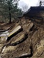
 Sacramento River levee road after.jpg 714 × 257; 29 KB
-
 Sacramento River levee road before.jpg 715 × 396; 64 KB
-
 Salton city airpark road.jpg 1,500 × 1,000; 1.49 MB
-
 San Francisco Skyline with Embarcadero Feb 1982.jpg 2,588 × 1,632; 933 KB
-
 Santa Paula, CA, Autumn, Highway 126 - panoramio.jpg 2,560 × 1,920; 2.84 MB
-

-
 SD-CR-S3 CA-78 junction.jpg 3,872 × 2,592; 6.12 MB
-

-
 Shingletown, California.jpg 4,032 × 3,024; 4.54 MB
-
 Side of the road (4692248280).jpg 1,200 × 803; 900 KB
-
 Smokey Bear Rd - panoramio.jpg 1,872 × 1,447; 472 KB
-
 SocalfreewaysystemWIKI.jpg 1,572 × 1,751; 264 KB
-
 Some road on the bay.jpg 6,000 × 4,000; 3.45 MB
.jpg)

.jpg)

_(5006703733).jpg)


.jpg)


.jpg)

.jpg)
.JPG)
.jpg)
.jpg)
.JPG)


.jpg)
.jpg)

.jpg)


.jpg)
.jpg)
.jpg)
.jpg)
.jpg)


.jpg)

.jpg)


.jpg)

.jpg)
.jpg)


.jpg)


.jpg)


.jpg)
.jpg)
.jpg)


.jpg)
.jpg)
.jpg)
.jpg)


.jpg)


.jpg)


.jpg)


.jpg)


.jpg)
.jpg)
.jpg)


.jpg)


.JPG)
.jpg)


.jpg)


