Category:Roborough, Torridge
Vai alla navigazione
Vai alla ricerca
village and civil parish in the district of Torridge, Devon in the United Kingdom  | |||||
| Carica un file multimediale | |||||
| Istanza di | |||||
|---|---|---|---|---|---|
| Luogo | Torridge, Devon, Sud Ovest dell'Inghilterra, Inghilterra | ||||
 | |||||
Sottocategorie
Questa categoria contiene le 3 sottocategorie indicate di seguito, su un totale di 3.
File nella categoria "Roborough, Torridge"
Questa categoria contiene 114 file, indicati di seguito, su un totale di 114.
-
 A charity event in Roborough with music, cake ^ tea - geograph.org.uk - 6196934.jpg 5 094 × 2 865; 4,51 MB
-
 A hedge topping Triangulation Pillar at Whitsley Barton - geograph.org.uk - 4741287.jpg 4 000 × 3 000; 3,22 MB
-
 Access road for Glenmore Farm - geograph.org.uk - 3453568.jpg 1 024 × 768; 259 KB
-
 Access road to Great Barlington - geograph.org.uk - 5127455.jpg 1 600 × 1 200; 742 KB
-
 Across the Woolleigh Brook valley - geograph.org.uk - 5306033.jpg 3 045 × 1 545; 1,06 MB
-
 Arable field near the two Villavin farms - geograph.org.uk - 4569703.jpg 1 600 × 1 200; 1,39 MB
-
 Beaford Moor, aerial 2018 - geograph.org.uk - 5960638.jpg 640 × 427; 68 KB
-
 Bridge over stream below Ten Oaks farm - geograph.org.uk - 4569759.jpg 1 600 × 1 066; 1,58 MB
-
 Bridleway into Combe Wood - geograph.org.uk - 5127486.jpg 1 200 × 1 600; 815 KB
-
 Castlehill Copse - geograph.org.uk - 5306014.jpg 3 072 × 2 048; 1,49 MB
-
 Combe Wood Ford - geograph.org.uk - 5925866.jpg 4 032 × 3 024; 5,47 MB
-
 Cottage, Roborough (geograph 3426232).jpg 640 × 477; 47 KB
-
 Cottage, Roborough (geograph 3426240).jpg 492 × 640; 86 KB
-
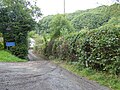
 Country road at Roborough - geograph.org.uk - 551860.jpg 640 × 426; 112 KB
-
 Country road to Rapson - geograph.org.uk - 552312.jpg 426 × 640; 119 KB
-
 Countryside at Parsonage Bridge - geograph.org.uk - 3429073.jpg 640 × 353; 39 KB
-
 Countryside near Parkyns - geograph.org.uk - 3429482.jpg 640 × 430; 78 KB
-
 Countryside near Parkyns - geograph.org.uk - 3429931.jpg 640 × 372; 71 KB
-
 Countryside near Parsonage Bridge - geograph.org.uk - 3429062.jpg 640 × 338; 41 KB
-
 Crossroads at Ten Oaks farm - geograph.org.uk - 4569767.jpg 1 600 × 1 202; 1,03 MB
-
 Davy OfEbberleigh Roborough Devon Arms.png 814 × 933; 78 KB
-
 Ebberley Hill Barton - geograph.org.uk - 5216718.jpg 3 072 × 2 048; 1,23 MB
-
 Ebberly Cross - geograph.org.uk - 5217014.jpg 3 072 × 2 048; 1,47 MB
-
 Ebberly Cross - geograph.org.uk - 554151.jpg 640 × 426; 152 KB
-
 Ebberly Hill - geograph.org.uk - 3453545.jpg 1 024 × 613; 198 KB
-
 Entrance to field near Whitsley Barton - geograph.org.uk - 4569779.jpg 1 600 × 1 200; 1,3 MB
-
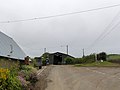
 Farm at Ten Oaks near Roborough - geograph.org.uk - 567562.jpg 640 × 426; 103 KB
-
 Farm building near East Cliston Farm - geograph.org.uk - 3453574.jpg 1 024 × 1 023; 224 KB
-
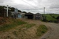
 Farm buildings in Roborough - geograph.org.uk - 554150.jpg 640 × 426; 107 KB
-
 Farm track at Parsonage Bridge - geograph.org.uk - 4569713.jpg 1 600 × 1 200; 1,94 MB
-
 Farm work in progress north of Trigger's Hill - geograph.org.uk - 5127422.jpg 1 600 × 962; 607 KB
-
 Farmland east of Roborough - geograph.org.uk - 3429323.jpg 640 × 409; 93 KB
-
 Farmland near Parkyns - geograph.org.uk - 3429939.jpg 640 × 403; 70 KB
-
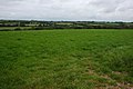 Farmland to the east of Roborough - geograph.org.uk - 550969.jpg 640 × 426; 105 KB
-
 Field above Ten Oaks - geograph.org.uk - 5218038.jpg 3 064 × 1 864; 1,6 MB
-
 Field and wood, Villavin - geograph.org.uk - 3429049.jpg 640 × 362; 51 KB
-
 Field and woodland east of Middle Barlington - geograph.org.uk - 5127439.jpg 1 600 × 1 200; 737 KB
-
 Field at Middle Barlington - geograph.org.uk - 5127428.jpg 1 600 × 1 200; 766 KB
-
 Field by West Road - geograph.org.uk - 3429297.jpg 640 × 480; 82 KB
-
 Field by West Road - geograph.org.uk - 3429334.jpg 640 × 419; 85 KB
-
 Field near Middle Barlington - geograph.org.uk - 5218046.jpg 3 060 × 1 875; 1,68 MB
-
 Field near Parkyns - geograph.org.uk - 3429905.jpg 640 × 414; 76 KB
-
 Field near Roborough - geograph.org.uk - 3429122.jpg 640 × 454; 91 KB
-
 Field near Roborough - geograph.org.uk - 3429127.jpg 640 × 405; 57 KB
-
 Field near Roborough - geograph.org.uk - 3429133.jpg 640 × 380; 70 KB
-
 Field of maize - geograph.org.uk - 4569776.jpg 1 600 × 1 200; 1,29 MB
-
 Field of maize near Ten Oaks farm - geograph.org.uk - 4569774.jpg 1 600 × 1 200; 1,29 MB
-
 Fields near Folly Goyle Cross - geograph.org.uk - 3426238.jpg 640 × 475; 89 KB
-
 Folly Goyle Cross - geograph.org.uk - 3453581.jpg 1 024 × 768; 185 KB
-
 Footbridge and ford in Combe Wood - geograph.org.uk - 5127450.jpg 1 200 × 1 600; 885 KB
-
 Footpath and access road to Down Farm, Roborough Common - geograph.org.uk - 4569686.jpg 1 600 × 1 200; 1,28 MB
-
 Great Barlington - geograph.org.uk - 3429146.jpg 640 × 416; 49 KB
-
 Great Barlington, Roborough - geograph.org.uk - 551856.jpg 640 × 426; 103 KB
-
 Hillside near Parsonage Bridge - geograph.org.uk - 3429083.jpg 640 × 312; 26 KB
-
 House near Natty Cross - geograph.org.uk - 3453559.jpg 1 024 × 768; 220 KB
-
 House on the road south-west of Roborough - geograph.org.uk - 5127496.jpg 1 600 × 1 280; 755 KB
-
 Junction on Roborough Moor - geograph.org.uk - 3426228.jpg 640 × 419; 55 KB
-
 Lane across Sugworthy Moor - geograph.org.uk - 554608.jpg 640 × 480; 112 KB
-
 Lane at Ebberly Arms - geograph.org.uk - 5216594.jpg 3 072 × 2 048; 1,36 MB
-
 Lane from Beara Cross - geograph.org.uk - 5307148.jpg 2 048 × 3 072; 1,52 MB
-
 Lane near Ebberly Cross - geograph.org.uk - 5211604.jpg 3 072 × 2 048; 2,27 MB
-
 Lane to Ebberly Arms - geograph.org.uk - 5216754.jpg 2 015 × 1 546; 691 KB
-
 Lane to Ebberly Cross - geograph.org.uk - 5217099.jpg 3 072 × 2 048; 1,48 MB
-
 Lane to Middle Barlington - geograph.org.uk - 5306027.jpg 2 708 × 1 715; 1,1 MB
-
 Lane to Middlemoor Cross - geograph.org.uk - 3429992.jpg 640 × 386; 49 KB
-
 Lane to Rapson - geograph.org.uk - 5216824.jpg 3 072 × 2 048; 1,46 MB
-
 Lane to Roborough - geograph.org.uk - 3429168.jpg 640 × 462; 39 KB
-
 Lane to Roborough - geograph.org.uk - 5218047.jpg 3 072 × 2 048; 1,44 MB
-
 Lane to Ten Oaks - geograph.org.uk - 5211613.jpg 3 072 × 2 048; 1,49 MB
-
 Lane to Thelbridge - geograph.org.uk - 5216819.jpg 3 072 × 2 048; 1,6 MB
-
 Lane to Thelbridge - geograph.org.uk - 5216828.jpg 2 739 × 1 451; 1 021 KB
-
 Lane to Whitsley Barton - geograph.org.uk - 5218036.jpg 2 048 × 3 072; 1,07 MB
-
 Lych gate for St Peter's church, Roborough - geograph.org.uk - 4569724.jpg 1 600 × 1 200; 1,55 MB
-
 Middle Villavin - geograph.org.uk - 3428936.jpg 640 × 427; 89 KB
-
 Milking cows near Whitsley Barton - geograph.org.uk - 551045.jpg 640 × 426; 104 KB
-
 Narrow road south at Ten Oaks - geograph.org.uk - 4569771.jpg 1 600 × 1 200; 1,29 MB
-
 Narrow road to Roborough - geograph.org.uk - 554585.jpg 640 × 426; 90 KB
-
 Narrow road to Roborough Mill - geograph.org.uk - 5127445.jpg 1 600 × 1 200; 836 KB
-
 Natty Cross - geograph.org.uk - 3453561.jpg 1 024 × 768; 135 KB
-
 New Inn at Roborough - geograph.org.uk - 554148.jpg 640 × 426; 104 KB
-
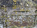 Ordnance Survey Cut Mark - geograph.org.uk - 4741314.jpg 4 000 × 3 000; 4,38 MB
-
 Pasture above Ten Oaks - geograph.org.uk - 5218043.jpg 3 056 × 1 899; 1,94 MB
-
 Path to Owlacombe Wood - geograph.org.uk - 5127479.jpg 1 600 × 1 200; 748 KB
-
 Postbox, Ebberly Arms - geograph.org.uk - 5216667.jpg 2 048 × 3 072; 1,09 MB
-
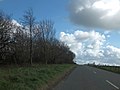
 Road and woodland on Sugworthy Moor - geograph.org.uk - 3453576.jpg 1 024 × 512; 90 KB
-
 Road at Ebberly Arms - geograph.org.uk - 5216634.jpg 3 072 × 2 048; 1,64 MB
-
 Road junction at Rapson - geograph.org.uk - 550981.jpg 640 × 426; 121 KB
-
 Road to Combe Wood from Roborough - geograph.org.uk - 4569733.jpg 1 600 × 1 200; 1,22 MB
-
 Roborough church - geograph.org.uk - 4569721.jpg 1 600 × 1 200; 1,38 MB
-
 Roborough, near Parsonage Bridge - geograph.org.uk - 606515.jpg 640 × 427; 299 KB
-
 Ruin opposite Glebe Farm, Roborough - geograph.org.uk - 5127510.jpg 1 600 × 1 200; 835 KB
-
 Sheep near Thelbridge - geograph.org.uk - 5216808.jpg 2 076 × 1 183; 457 KB
-
 Sheltered road on Roborough Common - geograph.org.uk - 3453599.jpg 1 024 × 768; 136 KB
-
 Sheppaton Lane - geograph.org.uk - 3430161.jpg 640 × 423; 61 KB
-
 Signpost and postbox, Ebberly Arms - geograph.org.uk - 5216648.jpg 2 048 × 3 072; 1,6 MB
-
 Start of a footpath to Combe Wood - geograph.org.uk - 4569754.jpg 1 600 × 1 200; 1,3 MB
-
 Steep hill to Ten Oaks farm - geograph.org.uk - 4569763.jpg 1 600 × 1 202; 1,43 MB
-
 Ten Oaks Wood - geograph.org.uk - 3429159.jpg 640 × 339; 44 KB
-
 The Church of St Peter at Roborough - geograph.org.uk - 4741308.jpg 4 000 × 3 000; 2 MB
-
 The farm at Ten Oaks, west of Roborough - geograph.org.uk - 4569748.jpg 1 600 × 1 198; 1,27 MB
-
 The New Inn, Roborough - geograph.org.uk - 4569738.jpg 1 600 × 1 200; 1,13 MB
-
 Track near Thelbridge - geograph.org.uk - 5216762.jpg 3 021 × 1 887; 1,3 MB
-
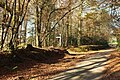
 Track through Coombe Wood, near Roborough - geograph.org.uk - 567560.jpg 426 × 640; 159 KB
-
 Track to Villavin at Parsonage Bridge - geograph.org.uk - 5127514.jpg 1 600 × 1 200; 836 KB
-
 Tree on West Road, west of Roborough - geograph.org.uk - 4569742.jpg 1 600 × 1 200; 1,05 MB
-
 Trees at Ebberly Hill - geograph.org.uk - 3453548.jpg 1 024 × 768; 265 KB
-
 Trees below Great Barlington - geograph.org.uk - 3429152.jpg 640 × 427; 80 KB
-
 Trees, Ebberly Cross - geograph.org.uk - 5217024.jpg 2 030 × 2 972; 1,57 MB
-
 Trigger's Hill Bridge over the Beaford Brook - geograph.org.uk - 5127418.jpg 1 600 × 1 200; 868 KB
-
 Trough near Thelbridge - geograph.org.uk - 5216811.jpg 3 072 × 2 048; 1,13 MB
-
 Village street, Roborough (geograph 3429099).jpg 640 × 446; 41 KB
-
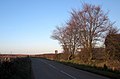
 West Road - geograph.org.uk - 3429349.jpg 640 × 405; 42 KB
-
 West Road, Roborough - geograph.org.uk - 4569730.jpg 1 600 × 1 200; 1,35 MB
-
 Wild flowers on the verge, Roborough Common - geograph.org.uk - 4569694.jpg 1 600 × 1 201; 1,25 MB


.jpg)
.jpg)


.jpg)


