Category:Rochdale Canal
Zur Navigation springen
Zur Suche springen
schiffbarer Kanal in Nordengland  | |||||
| Medium hochladen | |||||
| Ist ein(e) | |||||
|---|---|---|---|---|---|
| Ort |
| ||||
 | |||||
Unterkategorien
Es werden 18 von insgesamt 18 Unterkategorien in dieser Kategorie angezeigt:
In Klammern die Anzahl der enthaltenen Kategorien (K), Seiten (S), Dateien (D)
- Boats on the Rochdale Canal (39 D)
B
- Rochdale Canal, Brearley (1 D)
C
- Rochdale Canal, Chadderton (91 D)
E
F
- Rochdale Canal, Failsworth (84 D)
H
L
M
- Mileposts on the Rochdale Canal (14 D)
- Rochdale Canal, Milnrow (33 D)
R
S
T
W
Medien in der Kategorie „Rochdale Canal“
Folgende 139 Dateien sind in dieser Kategorie, von 139 insgesamt.
-
 A lack water canal (BM 1868,0808.6347).jpg 1.600 × 1.237; 543 KB
-
 A proud mother on the Rochdale Canal - geograph.org.uk - 1904322.jpg 3.872 × 2.592; 3,87 MB
-
 A quiet stretch of the Rochdale Canal - geograph.org.uk - 1928601.jpg 3.872 × 2.494; 3,54 MB
-
 A straight stretch of the Rochdale Canal near Summit - geograph.org.uk - 2780825.jpg 1.600 × 1.198; 393 KB
-

-
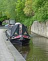
 Barges on the Rochdale Canal (1434747912).jpg 1.608 × 1.132; 1,9 MB
-
 Barges on the Rochdale Canal (2509674512).jpg 2.230 × 1.686; 3,43 MB
-
 Bridge 49.jpg 2.949 × 2.949; 7,68 MB
-
 Broadbottom Bridge, Mytholmroyd - geograph.org.uk - 5344.jpg 640 × 371; 39 KB
-
 Building on a beam, Luddendenfoot - geograph.org.uk - 2445314.jpg 1.500 × 2.000; 1,03 MB
-
 Burnley Road, Mytholmroyd - geograph.org.uk - 77002.jpg 640 × 427; 123 KB
-
 By the Rochdale Canal (1434837122).jpg 1.712 × 2.560; 3,66 MB
-
 Callis Mill - geograph.org.uk - 4109.jpg 640 × 480; 83 KB
-
 Canal at Mytholmroyd - panoramio - PJMarriott (1).jpg 3.072 × 2.304; 1,88 MB
-
 Canal at Mytholmroyd - panoramio - PJMarriott (2).jpg 3.072 × 2.304; 2,03 MB
-
 Canal at Mytholmroyd - panoramio - PJMarriott (3).jpg 3.072 × 2.304; 1,67 MB
-
 Canal at Mytholmroyd - panoramio - PJMarriott (4).jpg 3.072 × 2.304; 1,77 MB
-
 Canal at Mytholmroyd - panoramio - PJMarriott.jpg 3.072 × 2.304; 1,69 MB
-
 Canal at Mytholmroyd - panoramio.jpg 3.072 × 2.304; 1,71 MB
-
 Canoeing Lessons on the Rochdale Canal (7280844552).jpg 3.923 × 2.578; 7,47 MB
-
 Cheshire Ring 2.svg 427 × 439; 259 KB
-
 Chimney and reflection (2517025694).jpg 1.920 × 2.560; 3,99 MB
-
 Colourful barge (2508854463).jpg 1.715 × 2.349; 3,08 MB
-
 Copley Footbridge.jpg 2.913 × 3.641; 11,83 MB
-
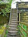 Crooked steps (2509808462).jpg 1.845 × 2.409; 5,89 MB
-
 Defrosting - geograph.org.uk - 1115848.jpg 640 × 480; 51 KB
-
 Ellen Royd Bridge 7, Rochdale Canal - geograph.org.uk - 761867.jpg 640 × 408; 92 KB
-
 Green Barge Brown Water (2511410677).jpg 2.560 × 1.920; 4,07 MB
-

-
 House by the Rochdale Canal (2327625808).jpg 2.305 × 1.875; 4,74 MB
-
 Lady Lily in the Rochdale Canal, Mytholmroyd (27124870810).jpg 1.372 × 980; 1,55 MB
-
 Lady Lily in the Rochdale Canal, Mytholmroyd (27400746245).jpg 3.781 × 2.424; 9,14 MB
-
 Lock 39 (Second Below West Summit).jpg 2.584 × 2.067; 4,91 MB
-
 Luddendenfoot jungle - geograph.org.uk - 825632.jpg 640 × 480; 157 KB
-
 Marge the Barge (and Mike the Bike?) (26664992172).jpg 2.911 × 2.079; 6,24 MB
-
 Milepost on the Rochdale Canal - geograph.org.uk - 1234548.jpg 428 × 640; 124 KB
-

-
 Mill Warehouse, Rochdale Canal - geograph.org.uk - 754300.jpg 640 × 419; 85 KB
-
 Mr Bojangles (17210188724).jpg 2.470 × 3.088; 6,13 MB
-
 Narrowboat "Inertia" in the Rochdale Canal, Walsden (5819174914).jpg 3.656 × 2.775; 6,56 MB
-
 Narrowboat Leicester in the Rochdale Canal (9288205854).jpg 2.376 × 3.326; 7,64 MB
-
 Narrowboats in the Rochdale Canal at Hebden Bridge (12092578065).jpg 4.338 × 2.892; 15,01 MB
-
 Narrowboats in the Rochdale Canal, Hebden Bridge (8109542300).jpg 2.481 × 3.722; 9,16 MB
-
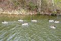 Nonconformist goose (2326789003).jpg 1.965 × 1.312; 2,84 MB
-
 Ordnance Survey Sheet SE 02 Halifax, Published 1955.jpg 5.529 × 5.656; 4,49 MB
-

-
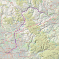 Position map of Rochdale Canal.png 844 × 837; 1,05 MB
-
 Rafting on the Rochdale Canal - geograph.org.uk - 1433571.jpg 640 × 480; 225 KB
-
 Reflections (2513969467).jpg 1.841 × 2.061; 2,65 MB
-
 Reflections in the Rochdale Canal (2872978085).jpg 4.000 × 3.000; 9,82 MB
-
 Reflections in the Rochdale Canal at Luddendenfoot (8197743448).jpg 3.392 × 2.857; 7,23 MB
-
 Reflections in the Rochdale Canal at Luddendenfoot (9396816252).jpg 2.647 × 3.881; 7,28 MB
-
 Rochdale Canal (14982711124).jpg 2.361 × 4.084; 6,89 MB
-
 Rochdale Canal (15311444670).jpg 2.651 × 3.976; 9,54 MB
-
 Rochdale Canal (15475056626).jpg 3.456 × 4.608; 13,18 MB
-
 Rochdale Canal (15738366099).jpg 3.367 × 3.815; 12,32 MB
-
 Rochdale Canal (18586269886).jpg 4.000 × 3.000; 10,34 MB
-
 Rochdale Canal (22806992026).jpg 4.000 × 3.000; 10,14 MB
-
 Rochdale Canal (2517021380).jpg 2.560 × 1.920; 3,42 MB
-
 Rochdale Canal (26151904543).jpg 3.891 × 2.833; 11,26 MB
-
 Rochdale Canal (26292625660).jpg 2.646 × 3.029; 8,8 MB
-
 Rochdale Canal (26705584113).jpg 3.958 × 2.639; 9,8 MB
-
 Rochdale Canal (26758542785).jpg 3.385 × 2.418; 8,66 MB
-
 Rochdale Canal (26793542624).jpg 3.484 × 2.323; 9,53 MB
-
 Rochdale Canal (27216292016).jpg 3.750 × 3.000; 10,53 MB
-
 Rochdale Canal (27532691066).jpg 3.725 × 2.816; 9,62 MB
-
 Rochdale Canal (27854924424).jpg 3.884 × 2.589; 10,65 MB
-
 Rochdale Canal (28017765614).jpg 2.992 × 2.394; 6,7 MB
-
 Rochdale Canal (28556214531).jpg 3.883 × 2.774; 11,26 MB
-
 Rochdale Canal (28602384786).jpg 4.000 × 2.672; 10,13 MB
-
 Rochdale Canal (2886035694).jpg 2.484 × 1.920; 5,26 MB
-
 Rochdale Canal (2929450563).jpg 2.503 × 1.655; 4,12 MB
-
 Rochdale Canal (29365199243).jpg 2.143 × 3.000; 6,69 MB
-
 Rochdale Canal (9167964849).jpg 2.062 × 3.093; 4,88 MB
-
 Rochdale Canal (9170193862).jpg 2.857 × 4.000; 6,79 MB
-
 Rochdale Canal (9211542210).jpg 2.108 × 3.162; 3,53 MB
-
 Rochdale Canal (9404091984).jpg 2.707 × 1.934; 4,5 MB
-
 Rochdale Canal - Bacup Road - geograph.org.uk - 1200079.jpg 640 × 480; 322 KB
-
 Rochdale Canal - Burnley Road - geograph.org.uk - 810141.jpg 640 × 485; 63 KB
-
 Rochdale Canal - Clegg Hall Mill (18387584050).jpg 3.976 × 2.968; 7,81 MB
-
 Rochdale Canal - Flickr - Tim Green aka atoach.jpg 4.238 × 3.327; 13,06 MB
-
 Rochdale Canal - geograph.org.uk - 1152627.jpg 640 × 480; 78 KB
-
 Rochdale Canal - geograph.org.uk - 1154642.jpg 480 × 640; 82 KB
-
 Rochdale Canal - geograph.org.uk - 1398955.jpg 640 × 480; 76 KB
-
 Rochdale Canal - geograph.org.uk - 1398958.jpg 640 × 480; 72 KB
-
 Rochdale Canal - geograph.org.uk - 1462644.jpg 640 × 480; 102 KB
-
 Rochdale Canal - geograph.org.uk - 1770777.jpg 2.816 × 2.112; 1,41 MB
-
 Rochdale Canal - geograph.org.uk - 1831296.jpg 2.816 × 2.112; 956 KB
-
 Rochdale Canal - geograph.org.uk - 2293800.jpg 800 × 600; 257 KB
-
 Rochdale Canal - geograph.org.uk - 480671.jpg 640 × 480; 95 KB
-
 Rochdale Canal - Midgley Road - geograph.org.uk - 810164.jpg 640 × 411; 62 KB
-
 Rochdale Canal - view including Steanor Bottom Toll House (4645362211).jpg 2.816 × 2.112; 1,2 MB
-
 Rochdale Canal 1 (4437676495).jpg 3.648 × 2.432; 7,82 MB
-
 Rochdale Canal 2 (4438451400).jpg 2.341 × 1.637; 3,51 MB
-
 Rochdale Canal at M60 crossing - geograph.org.uk - 1202435.jpg 640 × 480; 111 KB
-
-
 Rochdale Canal between Todmorden and Hebden Bridge (7381031208).jpg 2.295 × 3.443; 7,14 MB
-
 Rochdale Canal between Todmorden and Hebden Bridge (9288189650).jpg 3.488 × 2.434; 6,69 MB
-
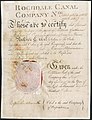 Rochdale Canal Company 1805.jpg 2.196 × 2.855; 655 KB
-

-
 Rochdale Canal Flickr 27 August 2023.jpg 3.024 × 3.780; 10,45 MB
-
 Rochdale Canal in winter - geograph.org.uk - 1151944.jpg 640 × 480; 103 KB
-
 Rochdale Canal near Hollinwood - geograph.org.uk - 1202427.jpg 640 × 480; 133 KB
-
 Rochdale Canal near Middleton Junction - geograph.org.uk - 1201992.jpg 640 × 480; 133 KB
-
 Rochdale Canal near Miles Platting - geograph.org.uk - 1202461.jpg 640 × 480; 124 KB
-
 Rochdale Canal near Miles Platting - geograph.org.uk - 1202466.jpg 640 × 480; 118 KB
-
 Rochdale Canal Smithybridge Flickr 27 August 2023.jpg 2.945 × 2.945; 7,14 MB
-
 Rochdale Canal summit (2438822334).jpg 1.825 × 1.283; 2,22 MB
-
 Rochdale Canal, Bridge 83a - geograph.org.uk - 2293804.jpg 640 × 480; 183 KB
-
 Rochdale Canal, Bridge 83a - geograph.org.uk - 2293840.jpg 640 × 480; 210 KB
-
 Rochdale Canal, by Belfield Mill (17954524453).jpg 2.913 × 3.861; 9,8 MB
-
 Rochdale Canal, Callis Bridge - geograph.org.uk - 881597.jpg 640 × 471; 188 KB
-
 Rochdale Canal, from The Causeway - geograph.org.uk - 1157305.jpg 640 × 480; 59 KB
-
 Rochdale Canal, from The Causeway - geograph.org.uk - 1157308.jpg 640 × 480; 67 KB
-
 Rochdale Canal, Hollinwood - panoramio.jpg 2.048 × 1.536; 1,35 MB
-
 Rochdale Canal, Lock 78 - geograph.org.uk - 2293813.jpg 640 × 480; 201 KB
-
 Rochdale Canal, Luddendenfoot (27846040581).jpg 1.929 × 2.894; 5,73 MB
-
 Rochdale Canal, Mytholmroyd (28417641012).jpg 2.553 × 3.404; 8,21 MB
-
 Rochdale Canal, Mytholmroyd (28417684552).jpg 4.000 × 2.667; 11,71 MB
-
 Rochdale Canal, near Belfield Mill (18387359048).jpg 3.991 × 2.787; 7,57 MB
-
 Rochdale Canal, Newton Heath - panoramio.jpg 4.000 × 3.000; 3,71 MB
-
 Rochdale Canal, Warland (5815922756).jpg 2.608 × 3.795; 7,72 MB
-

-

-
 Stream - Alma Road - geograph.org.uk - 1200047.jpg 480 × 640; 269 KB
-
 Summit Pound of the Rochdale Canal.jpg 4.845 × 3.672; 15,95 MB
-

-
 The Lancashire ^ Yorkshire boundary - geograph.org.uk - 1928551.jpg 3.872 × 2.592; 6,03 MB
-
 The Rochdale Canal goes under the M62 - geograph.org.uk - 2634357.jpg 800 × 600; 323 KB
-
 The Rochdale Canal, Castleton - geograph.org.uk - 3980965.jpg 1.024 × 768; 121 KB
-
 Under the Bridge (2514800070).jpg 1.920 × 2.560; 5,08 MB
-
 Under the Bridge (5487080602).jpg 2.600 × 3.342; 5,66 MB
-
 View from Calderbrook Road - geograph.org.uk - 776348.jpg 640 × 409; 109 KB
-
 Water Stretch - geograph.org.uk - 655609.jpg 640 × 480; 94 KB
-
 Willow tree (1434307089).jpg 1.600 × 1.200; 1,89 MB
-
 Brearley Bridge - geograph.org.uk - 432491.jpg 2.080 × 1.408; 850 KB
-
 Mytholmroyd - geograph.org.uk - 4103.jpg 640 × 480; 81 KB
-
 Rochdale Canal approaching Brearley Locks - geograph.org.uk - 509838.jpg 640 × 480; 164 KB
-
 Rochdale Canal near Castleton - geograph.org.uk - 80876.jpg 640 × 480; 181 KB
.jpg)


.jpg)
.jpg)


.jpg)

.jpg)
.jpg)
.jpg)
.jpg)


.jpg)

.jpg)
.jpg)

.jpg)


.jpg)

.jpg)
.jpg)
.jpg)
.jpg)

_(26664992172).jpg)


.jpg)
.jpg)
.jpg)
.jpg)
.jpg)
.jpg)


.jpg)
.jpg)
.jpg)
.jpg)
.jpg)
.jpg)
.jpg)
.jpg)
.jpg)
.jpg)
.jpg)
.jpg)
.jpg)
.jpg)
.jpg)
.jpg)
.jpg)
.jpg)
.jpg)
.jpg)
.jpg)
.jpg)
.jpg)
.jpg)
.jpg)
.jpg)
.jpg)
.jpg)
.jpg)


.jpg)


.jpg)
.jpg)
.jpg)


.jpg)
.jpg)

_-_geograph.org.uk_-_3838706.jpg)


.jpg)


.jpg)


.jpg)
.jpg)
.jpg)
.jpg)

.jpg)


.jpg)
.jpg)


.jpg)


