Category:Rohr (Mittelfranken)
Vai alla navigazione
Vai alla ricerca
comune tedesco _1699.jpg) _COA.svg) _1696.jpg)  | |||||
| Carica un file multimediale | |||||
| Istanza di |
| ||||
|---|---|---|---|---|---|
| Parte di |
| ||||
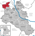
| Luogo | circondario di Roth, Media Franconia, Baviera, Germania | ||||
| Capo del governo |
| ||||
| Popolazione |
| ||||
| Superficie |
| ||||
| Altezza sul mare |
| ||||
| Distinto da | |||||
| sito web ufficiale | |||||
 | |||||
Sottocategorie
Questa categoria contiene le 5 sottocategorie indicate di seguito, su un totale di 5.
A
File nella categoria "Rohr (Mittelfranken)"
Questa categoria contiene 14 file, indicati di seguito, su un totale di 14.
-
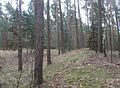 Abschnittswall Kottensdorf.jpg 1 600 × 1 176; 810 KB
-
 Brunnen mit Taubenskulptur - panoramio.jpg 1 859 × 1 337; 773 KB
-
 DEU Rohr (Mittelfranken) COA.svg 979 × 1 068; 14 KB
-
 Förle.jpg 3 975 × 2 236; 7,67 MB
-
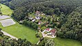
 Rohr (Mittelfranken) 1694.jpg 3 039 × 1 556; 1,09 MB
-
 Rohr (Mittelfranken) 1696.jpg 3 039 × 2 014; 1,33 MB
-
 Rohr (Mittelfranken) 1699.jpg 3 039 × 2 014; 1,2 MB
-
 Rohr im Lk Roth.png 390 × 391; 18 KB
-
 Rohr in RH.svg 592 × 607; 1,05 MB
-
 ROHR MFR DECHENDORF nieder.png 480 × 360; 5 KB
-
 ROHR MFR DECHENDORF nieder.svg 512 × 427; 21 KB
-
 Rohr1.JPG 3 264 × 2 176; 1,09 MB
-
 Scheune Rohr Regelsbach 9422.jpg 4 928 × 3 264; 10,24 MB
-
 Wappen von Rohr.png 1 050 × 1 120; 31 KB


_1694.jpg)


