Category:Roseland Peninsula
Vai alla navigazione
Vai alla ricerca
penisola inglese, situata nella costa più meridionale della Cornovaglia  | |||||
| Carica un file multimediale | |||||
| Istanza di | |||||
|---|---|---|---|---|---|
| Luogo | Cornwall, Sud Ovest dell'Inghilterra, Inghilterra | ||||
 | |||||
Sottocategorie
Questa categoria contiene le 4 sottocategorie indicate di seguito, su un totale di 4.
File nella categoria "Roseland Peninsula"
Questa categoria contiene 26 file, indicati di seguito, su un totale di 26.
-
 A ripening field of barley - geograph.org.uk - 440092.jpg 640 × 480; 52 KB
-

-
 Block House at Pendennis Point - geograph.org.uk - 1467704.jpg 640 × 456; 63 KB
-
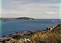
 Carrick Roads from Penarrow Point - geograph.org.uk - 922010.jpg 640 × 427; 75 KB
-
 Corner of a hay field - geograph.org.uk - 714885.jpg 640 × 480; 103 KB
-
 Cornish pasture - geograph.org.uk - 714847.jpg 640 × 359; 75 KB
-
 Drake's Downs - geograph.org.uk - 325680.jpg 640 × 427; 94 KB
-
 Entrance to Penperth Farm - geograph.org.uk - 440089.jpg 640 × 480; 60 KB
-

-
 Freshly cultivated field - geograph.org.uk - 440063.jpg 640 × 427; 59 KB
-
 Grassland and Woodland - geograph.org.uk - 442333.jpg 640 × 480; 100 KB
-
 Harvested field, Roseland Peninsula, Cornwall-8797-99.jpg 9 726 × 2 831; 22,85 MB
-
 Headland near St Mawes - geograph.org.uk - 27432.jpg 640 × 374; 71 KB
-
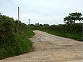
 Lane to Carwarthen - geograph.org.uk - 443040.jpg 640 × 480; 65 KB
-
 Lane to Tolcarne Farm - geograph.org.uk - 443034.jpg 640 × 480; 105 KB
-
 Lane to Tolverne Farm - geograph.org.uk - 443339.jpg 640 × 480; 100 KB
-

-

-
 Roseland Peninsula - 05.jpg 5 496 × 3 670; 10,04 MB
-
 Roseland Peninsula - Aglais io.jpg 2 873 × 1 918; 2,92 MB
-
 Roseland Peninsula - Coast in St Mawes.jpg 5 496 × 3 670; 8,78 MB
-
 Roseland Peninsula - Maniola jurtina.jpg 3 357 × 2 494; 2,64 MB
-
 Roseland Peninsula - Pieris brassicae.jpg 4 425 × 2 955; 5,61 MB
-
 Roseland Peninsula - Vanessa atalanta.jpg 3 899 × 2 603; 3,97 MB
-
 Roseland Peninsula - Zygaenidae.jpg 2 421 × 1 617; 1,32 MB
-


