Category:Rosnay (Indre)
Salti al navigilo
Salti al serĉilo
| Pozicio de la objekto | | Mapo de cxiuj koordinatoj per: OpenStreetMap |
|---|
komunumo en Francio   | |||||
| Alŝuti plurmedion | |||||
| Estas | |||||
|---|---|---|---|---|---|
| Loko |
| ||||
| Loĝantaro |
| ||||
| Areo |
| ||||
| Alia ol | |||||
 | |||||
English: Rosnay is a french city, located in the Indre department, in the region Centre-Val de Loire.
Français : Rosnay est une commune française, située dans le département de l'Indre, en région Centre-Val de Loire.
Subkategorioj
Ĉi tiu kategorio havas la 13 jenajn subkategoriojn, el 13 entute.
A
- Église Saint-André de Rosnay (4 D)
B
C
E
- Étang du Coudreau (2 D)
L
M
- Maps of Rosnay (Indre) (2 D)
S
T
- Town hall of Rosnay (Indre) (1 D)
É
- Étang de la Cure (1 D)
Dosieroj en kategorio “Rosnay (Indre)”
La jenaj 15 dosieroj estas en ĉi tiu kategorio, el 15 entute.
-
 36173-Rosnay-Sols.png 3 270 × 2 598; 2,53 MB
-
 Brenne - Rosnay (36) - RD 32.jpg 3 024 × 4 032; 4,81 MB
-
 Ligne HTB 90 000 V - PS Laferran - Poste RTE Rosnay.jpg 4 032 × 3 024; 2,92 MB
-
 Maison du PNR Brenne - img 51575.jpg 5 616 × 3 744; 6,64 MB
-
 Maison du PNR Brenne - img 51577.jpg 5 616 × 3 744; 7,4 MB
-
 Maison du PNR Brenne - img 51578.jpg 5 616 × 3 744; 8,1 MB
-
 Map commune FR insee code 36173.png 756 × 605; 96 KB
-
 Population - Municipality code 36173.svg 475 × 355; 13 KB
-
 Rosnay (36) - RD 32 et ligne HTA à proximité des Benismes.jpg 3 024 × 4 032; 3,22 MB
-
 Rosnay centre.JPG 3 863 × 1 744; 4,96 MB
-
 Rosnay mémorial.JPG 2 592 × 3 872; 2,26 MB
-
 Rosnay-FR-36-panneau d'agglomération-01.jpg 3 024 × 4 032; 3,04 MB
-
 Rosnay-FR-36-panneau d'agglomération-02.jpg 4 032 × 3 024; 3,05 MB
-
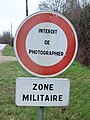
 Rosnay-FR-36-panneau routier-01.jpg 3 024 × 4 032; 3,09 MB
-
 Rosnay-FR-36-panneau routier-02.jpg 2 556 × 3 408; 2,72 MB

_-_RD_32.jpg)


_-_RD_32_et_ligne_HTA_%C3%A0_proximit%C3%A9_des_Benismes.jpg)


