Category:Rottach-Egern
Vai alla navigazione
Vai alla ricerca
comune tedesco    | |||||
| Carica un file multimediale | |||||
| Istanza di |
| ||||
|---|---|---|---|---|---|
| Parte di |
| ||||
| Luogo | circondario di Miesbach, Alta Baviera, Baviera, Germania | ||||
| Situato sul mare / lago / fiume | |||||
| Capo del governo |
| ||||
| Popolazione |
| ||||
| Superficie |
| ||||
| Altezza sul mare |
| ||||
| sito web ufficiale | |||||
 | |||||
Sottocategorie
Questa categoria contiene le 14 sottocategorie indicate di seguito, su un totale di 14.
B
C
D
E
- Economy of Rottach-Egern (4 F)
G
H
- History of Rottach-Egern (9 F)
M
N
S
- Signs in Rottach-Egern (17 F)
T
W
Pagine nella categoria "Rottach-Egern"
Questa categoria contiene un'unica pagina, indicata di seguito.
File nella categoria "Rottach-Egern"
Questa categoria contiene 34 file, indicati di seguito, su un totale di 34.
-
 AK - Egern am Tegernsee - 1909.jpg 1 600 × 1 018; 440 KB
-
 AK - Egern am Tegernsee mit Wallberg - 1928.jpg 1 600 × 2 080; 2,26 MB
-
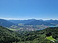
 Ausblick v Gr Paraplui a Rottach-Egern.jpg 12 000 × 4 931; 11,46 MB
-
 Blick auf Rottach-Egern und den Tegernsee von der Riedersteinkapelle aus 2022-07-17.jpg 4 000 × 3 000; 7,74 MB
-

-
-
 Blick-von-der-Riedersteinkapelle-ueber-den-Tegernsee-Panorama.jpg 9 996 × 3 796; 14,06 MB
-
 Bodenalm.jpg 7 810 × 3 936; 6,24 MB
-
 Rottach-Egern, Friedensglocke Die Egerner, 1.jpeg 2 400 × 3 200; 3,98 MB
-
 Rottach-Egern, Friedensglocke Die Egerner, 2.jpeg 2 800 × 3 600; 4,97 MB
-
 Ente auf Tegernsee Bild 1 2023-12-10.jpg 5 472 × 3 648; 6,43 MB
-
 Ente auf Tegernsee Bild 2 2023-12-10.jpg 5 472 × 3 648; 6,51 MB
-
 Kreuzung Leo-Slezak-Straße mit Nördliche Hauptstraße 2023-12-10.jpg 5 472 × 3 648; 6,21 MB
-
 Leo-Slezak-Straße 2 Rottach-Egern mit Moosbrugger 2023-12-10.jpg 5 472 × 3 648; 5,51 MB
-
 Ludwig-Thoma-Straße 1 Rottach-Egern mi KiK 2023-12-10.jpg 5 472 × 3 648; 5,34 MB
-
 Ludwig-Thoma-Straße 4 Rottach-Egern mit Müller Bild 1 2023-12-10.jpg 5 472 × 3 648; 5,17 MB
-
 Ludwig-Thoma-Straße 4 Rottach-Egern mit Müller Bild 2 2023-12-10.jpg 5 472 × 3 648; 4,82 MB
-
 Maibaum und Parkplatz vor Gebäude Nördliche Hauptstraße 7 Rottach-Egern 2023-12-10.jpg 5 472 × 3 648; 4,56 MB
-
 Maibaum vor Gebäude Nördliche Hauptstraße 7 Rottach-Egern 2023-12-10.jpg 5 472 × 3 648; 4,71 MB
-
 Nördliche Hauptstraße Rottach-Egern Richtung Süden 2023-12-10.jpg 5 472 × 3 648; 7,72 MB
-
 Nördliche Hauptstraße Rottach-Egern von Kreuzung mit Leo-Slezak-Straße aus 2023-12-10.jpg 5 472 × 3 648; 6,54 MB
-

-
 Rathaus Nördliche Hauptstraße 9 Rottach-Egern 2023-12-10.jpg 5 472 × 3 648; 4,79 MB
-
 Rottach-Egern, Bayern - Blick vom Leeberg (back) (Zeno Ansichtskarten).jpg 2 169 × 1 414; 105 KB
-
 Rottach-Egern, Bayern - Blick vom Leeberg (Zeno Ansichtskarten).jpg 2 173 × 1 412; 383 KB
-
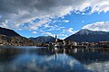
 Rottach-Egern.jpg 5 472 × 3 648; 7,7 MB
-
 SPIEL FOTTO.jpg 2 220 × 1 080; 1,89 MB
-
 Tegernsee from Höhenweg.jpg 3 813 × 2 860; 1,66 MB
-
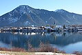
 Tegernsee mit Leeberg im Hintergrund 2023-12-10.jpg 5 472 × 3 648; 6,95 MB
-
 Tegernsee mit Leeberg Park im Hintergrund 2023-12-10.jpg 5 472 × 3 648; 4,58 MB
-
 Tegernsee mit Leeberg Park mit Kleiner Paraplui im Hintergrund 2023-12-10.jpg 5 472 × 3 648; 5,4 MB
-
 Tegernsee mit Leeberg Park und Egern 2023-12-10.jpg 5 472 × 3 648; 4,46 MB
-
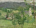 Fritz von Uhde - Rottach am Tegernsee.jpg 2 000 × 1 587; 1,37 MB
-
 Wappen Rottach-Egern.svg 610 × 662; 27 KB


_(Zeno_Ansichtskarten).jpg)
.jpg)


