Category:Route nationale 21 (France)
Zur Navigation springen
Zur Suche springen
Nationalstraße in Frankreich .JPG)  | |||||
| Medium hochladen | |||||
| Ist ein(e) | |||||
|---|---|---|---|---|---|
| Ort | |||||
| Transportnetz | |||||
| Startzeitpunkt |
| ||||
| Länge |
| ||||
| Ersetzt |
| ||||
| |||||
Unterkategorien
Diese Kategorie enthält folgende Unterkategorie:
In Klammern die Anzahl der enthaltenen Kategorien (K), Seiten (S), Dateien (D)
P
Medien in der Kategorie „Route nationale 21 (France)“
Folgende 32 Dateien sind in dieser Kategorie, von 32 insgesamt.
-
 Cancon panneau jumelage.jpg 2.053 × 2.737; 1,99 MB
-
 Castillonnès panneau occitan-jumelage.jpg 1.878 × 2.504; 1,42 MB
-
 Douville 45e parallèle RN21 (1).JPG 3.028 × 2.269; 1,5 MB
-
 Douville 45e parallèle RN21.JPG 3.264 × 2.448; 2,64 MB
-
 Firbeix 08 N21.JPG 4.288 × 2.848; 4,27 MB
-
 Firbeix 18 N21.JPG 4.288 × 2.848; 4,43 MB
-
 Firbeix panneau.JPG 3.264 × 2.448; 1,61 MB
-
 Fleurance 2018 35 - RN 21.jpg 4.896 × 3.672; 5,7 MB
-
 FR-32-Villecomtal-sur-Arros2.JPG 1.600 × 1.200; 432 KB
-
 FR-65-Border.JPG 1.600 × 1.200; 414 KB
-
 Grun-Bordas RN21.JPG 3.264 × 2.448; 2,69 MB
-
 La Coquille panneau.JPG 3.264 × 2.448; 3,38 MB
-
 Lectoure-plaqueRN21-1.jpg 2.000 × 1.325; 566 KB
-
 Lectoure-plaqueRN21-2.jpg 2.000 × 1.325; 478 KB
-
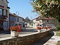 Montestruc 2018 12 - Rue principale.jpg 4.861 × 3.645; 4,55 MB
-
 Montestruc 2018 37 - Sortie nord.jpg 4.896 × 3.672; 6,92 MB
-
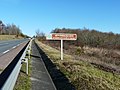
 N 21 Bonhommes Noires.JPG 1.280 × 960; 561 KB
-
 Bergerac - RN21 - Pont sur la Dordogne -1.jpg 3.579 × 2.110; 1,78 MB
-
 RD 6021 Coulounieix-Chamiers vers NE.jpg 3.179 × 2.383; 1,37 MB
-
 RD 6021 Coulounieix-Chamiers vers SW.jpg 3.264 × 2.448; 2,01 MB
-
 RN 21 Creysse (déviation est Bergerac) panneau.JPG 3.264 × 2.448; 3,71 MB
-
 RN 21 Lembras panneau.JPG 3.264 × 2.448; 3,82 MB
-
 RN 21 nord Mavaleix (1).JPG 3.264 × 2.448; 2,52 MB
-
 RN 21 nord Mavaleix.JPG 3.189 × 2.401; 1,31 MB
-
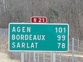
 RN 21 panneau.JPG 2.176 × 1.632; 993 KB
-
 RN21, panneau.JPG 1.650 × 959; 752 KB
-
 Route nationale française 21.svg 250 × 100; 4 KB
-
 Saint-Perdoux 24 vue sur Grande Font.jpg 3.264 × 2.448; 4,66 MB
-
 Saint-Pierre-de-Frugie point culminant routes.JPG 2.768 × 2.075; 929 KB
-
 Seyze Lamonzie aval D21E1.JPG 3.264 × 2.448; 3,78 MB
-
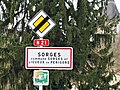 Sorges et Ligueux panneau (2).jpg 3.264 × 2.448; 1,7 MB
-
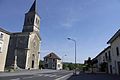
 Séreilhac entrée SW.jpg 2.966 × 2.224; 1,38 MB


.JPG)


_panneau.JPG)


.jpg)
