Category:Rusholme
Zur Navigation springen
Zur Suche springen
area of Manchester, England  | |||||
| Medium hochladen | |||||
| Ist ein(e) | |||||
|---|---|---|---|---|---|
| Ort | Manchester, Greater Manchester, North West England, England | ||||
| Verschieden von | |||||
 | |||||
English: Rusholme is situated in the Manchester City Council ward of Rusholme in the City of Manchester
Unterkategorien
Es werden 4 von insgesamt 4 Unterkategorien in dieser Kategorie angezeigt:
In Klammern die Anzahl der enthaltenen Kategorien (K), Seiten (S), Dateien (D)
B
H
P
S
Medien in der Kategorie „Rusholme“
Folgende 52 Dateien sind in dieser Kategorie, von 52 insgesamt.
-
 1950s Modernism - geograph.org.uk - 6206980.jpg 2.592 × 1.944; 1,07 MB
-
 Banff Road, Rusholme - geograph.org.uk - 4681953.jpg 1.600 × 900; 244 KB
-
 Birchfields Park - geograph.org.uk - 4349206.jpg 5.184 × 3.456; 1,8 MB
-
 Chichester Road - geograph.org.uk - 3163690.jpg 640 × 443; 181 KB
-
 Communication mast, Rusholme - geograph.org.uk - 3312180.jpg 640 × 480; 64 KB
-
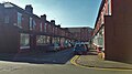
 Dagenham Road, Rusholme - panoramio.jpg 2.048 × 1.536; 1.004 KB
-
 Danger.JPG 4.000 × 3.000; 5,65 MB
-
 Fallowfield Railway Bridge - geograph.org.uk - 6169605.jpg 1.280 × 960; 988 KB
-

-
 Ginnel in Rusholme.jpg 4.320 × 3.240; 5,04 MB
-
 Hardy's Well - geograph.org.uk - 6198691.jpg 6.000 × 2.985; 1,86 MB
-
 Hardy's Well - geograph.org.uk - 6313351.jpg 1.280 × 1.072; 986 KB
-
 Hardy's Well - geograph.org.uk - 6313358.jpg 1.280 × 984; 959 KB
-
 Hardy's Well, An apostrophe conundrum - geograph.org.uk - 6313471.jpg 1.280 × 1.070; 925 KB
-
 Hardy's Well, Doorway - geograph.org.uk - 6313483.jpg 1.280 × 960; 1,01 MB
-
 Heald Place Primary School Recreational Field - geograph.org.uk - 2545388.jpg 3.872 × 2.592; 4,63 MB
-
 Heather near lake in Platt Fields Park, Rusholme,Manchester - panoramio.jpg 960 × 1.280; 930 KB
-
 Huntsman Inn - geograph.org.uk - 6198688.jpg 3.141 × 3.636; 1,68 MB
-
 Keep out gimp.jpg 4.320 × 3.240; 4,62 MB
-
 Leather sofa in a café (Unsplash).jpg 3.644 × 5.466; 7,18 MB
-
 Letchworth Street - geograph.org.uk - 2545339.jpg 3.872 × 2.592; 3,96 MB
-
 Levenshulme - geograph.org.uk - 5909033.jpg 6.000 × 3.260; 1,7 MB
-
 Lloyd Street South.JPG 2.048 × 1.536; 1,21 MB
-
 Maine Place - geograph.org.uk - 4349147.jpg 5.162 × 3.346; 1,92 MB
-
 Maine Place - geograph.org.uk - 4349150.jpg 4.381 × 2.347; 1,85 MB
-
 Memorial stone at Luther King House - geograph.org.uk - 1393187.jpg 640 × 480; 252 KB
-
 Moss lane east, manchester - panoramio.jpg 2.000 × 3.552; 2,93 MB
-
 New Apostolic Church - geograph.org.uk - 6313534.jpg 1.280 × 1.075; 1,19 MB
-
 New housing on the site of Maine Road - geograph.org.uk - 2545328.jpg 3.872 × 2.592; 2,58 MB
-
 Old BBC Playhouse - geograph.org.uk - 330040.jpg 640 × 404; 95 KB
-
 Oxford Place - geograph.org.uk - 5408808.jpg 5.184 × 3.456; 1,8 MB
-
 Plaque - geograph.org.uk - 4025336.jpg 4.896 × 3.672; 6,78 MB
-
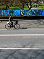 Platt Fields Park Birthday from Wilmslow Road - panoramio.jpg 833 × 1.111; 613 KB
-
 Platt Fields Park, Rusholme, Manchester - panoramio.jpg 960 × 1.280; 1,17 MB
-
 Poem in Oxford road, Manchester - panoramio.jpg 1.763 × 3.132; 841 KB
-
 Railway bridge over Stanley Grove - geograph.org.uk - 4554098.jpg 6.000 × 4.000; 7,59 MB
-
 Red brick wall with white stripes.jpg 3.240 × 4.320; 4,99 MB
-
 Redshaw Close - geograph.org.uk - 3517671.jpg 640 × 480; 85 KB
-
 Rusholme, Albert Inn - geograph.org.uk - 3793009.jpg 1.024 × 767; 108 KB
-
 Shops on Dickenson Road - geograph.org.uk - 6313524.jpg 1.280 × 891; 892 KB
-
 St John's Clock - geograph.org.uk - 5557662.jpg 1.280 × 1.280; 1,37 MB
-
 St John's Green - geograph.org.uk - 2860331.jpg 640 × 562; 244 KB
-
 St John's, Longsight - geograph.org.uk - 5557648.jpg 1.280 × 996; 1,34 MB
-
 St John's, Longsight - geograph.org.uk - 5557654.jpg 1.280 × 2.022; 1,54 MB
-
 Stagecoach bus (102).jpg 4.000 × 3.000; 5,02 MB
-
 Tags and Shadow.JPG 3.264 × 2.448; 920 KB
-
 The Gamecock, Boundary Lane, Manchester - geograph.org.uk - 2780986.jpg 640 × 393; 180 KB
-
 The Toast Rack - geograph.org.uk - 6198909.jpg 5.060 × 3.907; 1,83 MB
-
 Waffles and Coffee (Unsplash).jpg 5.760 × 3.840; 23,28 MB
-
 Waste ground, Upper Park Road, Rusholme - geograph.org.uk - 661756.jpg 640 × 480; 104 KB
-
 Welcome to the Curry Mile - geograph.org.uk - 5682057.jpg 1.280 × 966; 819 KB
-
 Wilmslow Road - geograph.org.uk - 6313338.jpg 1.280 × 1.132; 1.021 KB


_1996_Volvo_Olympian_Alexander_RH,_Rusholme_Gardens,_route_42,_16_June_2007.jpg)


.jpg)


.jpg)


.jpg)


