Category:Sahel
Przejdź do nawigacji
Przejdź do wyszukiwania
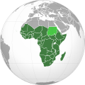
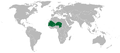
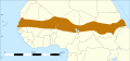
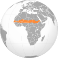
English: The Sahel stretches across the north-central of the African continent between the Atlantic Ocean and the Red Sea.
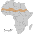
- It is an African ecoclimatic zone, the transition region between the Sahara Desert in the north and the Sudanian Savannas in the south; and a biogeographic ecoregion in the Tropical and subtropical grasslands, savannas, and shrublands terrestrial biome.
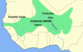
- The Sahel covers parts of the territory (from west to east) of: Senegal, southern Mauritania, Mali, Burkina Faso, southern Algeria, Niger, northern Nigeria, Chad, Sudan (Darfur and southern 'North Sudan'.), northern Ethiopia, and Eritrea.
- Over the history of Africa the region has been home to the Sahelian kingdoms, some of the most advanced kingdoms benefiting from trade across the Sahara desert.
region geograficzny w Afryce     | |||||
| Prześlij plik multimedialny | |||||
| Jest to | |||||
|---|---|---|---|---|---|
| Część |
| ||||
| Miejsce | Afryka, półkula południowa | ||||
| Inne niż | |||||
| Uważa się za to samo co | Sudan | ||||
 | |||||
Podkategorie
Poniżej wyświetlono 22 spośród wszystkich 22 podkategorii tej kategorii.
+
B
C
- Savanna in Cameroon (6 plików)
G
I
S
- Sahel (Chad) (16 plików)
- Securidaca longepedunculata (35 plików)
T
- Tiger bush (12 plików)
Pliki w kategorii „Sahel”
Poniżej wyświetlono 139 spośród wszystkich 139 plików w tej kategorii.
-
 Sahara and Sahel.svg 600 × 600; 563 KB
-
 Sahara Sahel sub-Saharan Africa.svg 600 × 600; 564 KB
-
 Adansonia digitata Bild1139.jpg 2272 × 1704; 1,81 MB
-
 Africa gis 2015 annual rainfall.png 720 × 815; 446 KB
-
 African-American Ancestry Visualized.png 512 × 333; 80 KB
-
 African-American Ancestry.png 393 × 512; 77 KB
-
 AfricaRain TRM 2007264.jpg 540 × 600; 132 KB
-
 AT0713 map.png 1369 × 561; 41 KB
-
 Bamako Kayes road paved 2006.jpg 1280 × 960; 108 KB
-
 Bambara boy in Mali.jpg 2306 × 1356; 1,11 MB
-
 Bambara girls work.jpg 3657 × 2151; 2,36 MB
-
 Baobab trees.jpg 928 × 614; 119 KB
-
 BaobabElephantBandia.JPG 2608 × 1952; 3,83 MB
-
 BaobabGriots.jpg 1628 × 2198; 501 KB
-
 Climate zone.jpg 550 × 297; 41 KB
-
 Combat-Antilopes-Bandia-Senegal.jpg 1600 × 1200; 998 KB
-
 Dogon Country, Bandiagara, Mali, West Africa.jpg 2000 × 1053; 1,83 MB
-
 Dogon Country, Bandiagara.jpg 2000 × 1053; 1,99 MB
-
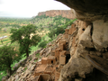
 Falaise de Bandiagara3.jpg 604 × 413; 43 KB
-
 Flickr - stringer bel - The road to Timbuktu, Mali (1).jpg 1722 × 1146; 434 KB
-
 Flickr - stringer bel - The road to Timbuktu, Mali.jpg 1722 × 1146; 303 KB
-
 Flickr - stringer bel - The road to Timbuktu.jpg 1722 × 1146; 270 KB
-
 Gapped Bush Niger Nicolas Barbier.jpg 900 × 764; 307 KB
-
 Great green wall map.svg 512 × 313; 111 KB
-
 Greening Sahel 1982-1999.jpg 949 × 365; 64 KB
-
 Grupo de jinetes e infantería.jpg 2048 × 1365; 160 KB
-
 Harmattan. Dust. Street. Senegal.jpg 864 × 679; 156 KB
-
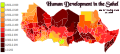 HDI (Sahel).svg 1426 × 631; 801 KB
-
 Inaya at Melech Ha'olam.jpg 2964 × 2223; 6,26 MB
-
 ISS008-E-9649 - View of the Sahel.jpg 3032 × 2064; 595 KB
-
 L'union fait et force.jpg 2256 × 1496; 1,37 MB
-
 Lake Chad’s shrinking waters ESA418540.gif 2802 × 2802; 11,7 MB
-
 Landscape Dogon Mali.png 1024 × 768; 4,01 MB
-
 Le marie.jpg 2256 × 1496; 1,63 MB
-
 Les Falaises de Bandiagara.jpg 1600 × 1200; 759 KB
-
 Libya Sahel (1998).png 476 × 281; 10 KB
-
 Logo UNOWAS.png 363 × 81; 11 KB
-
 Maghreb and Sahel - DPLA - d45bfd17f5a3bd99361c261ffbb27f4c.jpg 2550 × 3270; 5,67 MB
-
 Mali1974-173 hg.jpg 3813 × 2550; 1,89 MB
-
 Mali1974-174 hg.jpg 2667 × 3952; 2,48 MB
-
 Mali1974-180 hg.jpg 3149 × 2495; 1,46 MB
-
 Mali1974-181 hg.jpg 3974 × 2641; 2,11 MB
-
 Mali1974-182 hg.jpg 3805 × 2668; 2,24 MB
-
 Map of CILSS.png 1427 × 628; 29 KB
-
 Map of CILSS.svg 1000 × 1000; 184 KB
-
 Map of the Sahel.png 2000 × 1366; 4,12 MB
-
 Map sahel 2.png 585 × 600; 81 KB
-
 Map sahel 2.svg 1200 × 1230; 37 KB
-
 Map sahel.jpg 2000 × 2050; 272 KB
-
 Mapa mali-pt.svg 512 × 366; 16 KB
-
 Mapa shonghai-es.svg 512 × 442; 22 KB
-
 Mapa shonghai-pt.svg 511 × 441; 20 KB
-
 Massimo Barra Niger 1985.jpeg 4630 × 3072; 4,97 MB
-
 Men carrying straw, Mali.jpg 3504 × 2336; 2,99 MB
-
 Niger, Guesselbodi (8), view of village.jpg 3264 × 968; 568 KB
-
 Operazione Sahel '85. Soccorso in siccità del Niger.jpeg 1994 × 2861; 3,54 MB
-
Responding to the COVID-19 Pandemic Amid Multi-layered Crises in the Sahel.webm 1 min 11 s, 1080 × 1080; 17,45 MB
-
 Rouy -soungouf millet flour porridge basic steps.jpg 504 × 373; 76 KB
-
 Sahel Base Map v2.png 954 × 703; 503 KB
-
 Sahel Base Map.png 4227 × 3136; 641 KB
-
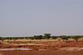
 Sahel forest near Kayes Mali.jpg 1280 × 960; 298 KB
-
 Sahel Map-Africa rough.png 2000 × 925; 291 KB
-
 Sahel Map-Africa rough.svg 1228 × 568; 711 KB
-
 Sahel orthographic map.jpg 8460 × 8900; 25,27 MB
-
 Sahel rain.svg 590 × 197; 988 KB
-
 Sahel Rosas do Deserto.png 12 240 × 12 240; 1,32 MB
-
 Sahel seasonality iotd.jpg 396 × 211; 45 KB
-
 Sahel tunez.svg 512 × 1113; 56 KB
-
 Sahel.svg 600 × 600; 561 KB
-
 Savane-boundiali-edit.jpg 1740 × 1175; 1,08 MB
-
 Savane-boundiali.jpg 1799 × 1199; 124 KB
-
 Seasonal westafrica rainfall mean 20070501 20070930 Ar.gif 800 × 629; 68 KB
-
 Seasonal westafrica rainfall mean 20070501 20070930.gif 800 × 600; 25 KB
-

-
 Secretary Blinken Hosts a Meeting on Multilateralism in the Sahel.jpg 1764 × 1176; 358 KB
-
 Secretary Clinton Delivers Remarks on the Sahel (8029741557).jpg 2000 × 1333; 1,53 MB
-
 Securidaca longepedunculata Bild1199.jpg 1600 × 1200; 832 KB
-
 Senegal dry wet 540.jpg 540 × 176; 62 KB
-
 Senegal1974-04.jpg 5284 × 3286; 3,93 MB
-
 Senegal1974-11.jpg 3535 × 4982; 3,49 MB
-
 Shita01.jpg 2048 × 1536; 1,08 MB
-
 Solartainer in Cinzana-Gare (Segou-region) Mali.jpg 3138 × 1336; 657 KB
-
 SOS SAHEL CARRE sans.jpg 862 × 563; 760 KB
-
 Sunrise @ Inata Gold Mine - panoramio.jpg 3264 × 2448; 1,47 MB
-
 SérèresBandia (44).JPG 2304 × 3072; 1,26 MB
-
 Tiger Bush Niger Corona 1965-12-31.jpg 1000 × 1000; 545 KB
-
 Tigerbusch Seneszenzzone Marco Schmidt 0785.jpg 852 × 1136; 273 KB
-
 Tigerbusch Vegetationsband Marco Schmidt 0773.jpg 1136 × 852; 239 KB
-
 Vegetacao ANGOLA.JPG 800 × 600; 175 KB
-
 Vue de Kong-1892.jpg 760 × 559; 122 KB
-
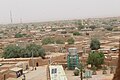
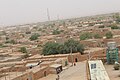
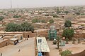
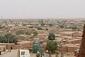
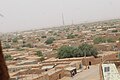
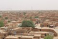
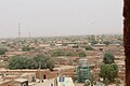
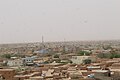
 Vue de la ville d'Agadez 01.jpg 5184 × 3456; 5,57 MB
-
 Vue de la ville d'Agadez 02.jpg 5184 × 3456; 5,4 MB
-
 Vue de la ville d'Agadez 03.jpg 5184 × 3456; 5,43 MB
-
 Vue de la ville d'Agadez 04.jpg 5184 × 3456; 5,5 MB
-
 Vue de la ville d'Agadez 05.jpg 5184 × 3456; 5,38 MB
-
 Vue de la ville d'Agadez 06.jpg 5184 × 3456; 6,18 MB
-
 Vue de la ville d'Agadez 07.jpg 5184 × 3456; 6,3 MB
-
 Vue de la ville d'Agadez 08.jpg 5184 × 3456; 5,68 MB
-
 Vue de la ville d'Agadez 09.jpg 5184 × 3456; 5,11 MB
-
 Vue de la ville d'Agadez 10.jpg 5184 × 3456; 6,14 MB
-
 Vue de la ville d'Agadez 11.jpg 5184 × 3456; 5,73 MB
-
 Vue de la ville d'Agadez 12.jpg 5184 × 3456; 6 MB
-
 Vue de la ville d'Agadez 13.jpg 5184 × 3456; 5,02 MB
-
 Vue de la ville d'Agadez 14.jpg 5184 × 3456; 4,79 MB
-
 Vue de la ville d'Agadez 15.jpg 5184 × 3456; 5,38 MB
-
 Vue de la ville d'Agadez 16.jpg 5184 × 3456; 4,31 MB
-
 Vue de la ville d'Agadez 17.jpg 5184 × 3456; 3,87 MB
-
 Vue de la ville d'Agadez 18.jpg 5184 × 3456; 4,48 MB
-
 Vue de la ville d'Agadez 19.jpg 5184 × 3456; 4,75 MB
-
 Vue de la ville d'Agadez 20.jpg 5184 × 3456; 4,6 MB
-
 Vue de la ville d'Agadez 21.jpg 5184 × 3456; 5,16 MB
-
 Vue de la ville d'Agadez 22.jpg 5184 × 3456; 5,42 MB
-
 Vue de la ville d'Agadez 23.jpg 5184 × 3456; 5,29 MB
-
 Vue de la ville d'Agadez 24.jpg 5184 × 3456; 4,91 MB
-
 Vue de la ville d'Agadez 25.jpg 5184 × 3456; 4,22 MB
-
 Vue de la ville d'Agadez 26.jpg 5184 × 3456; 4,72 MB
-
 Vue de la ville d'Agadez 27.jpg 5184 × 3456; 5,35 MB
-
 Vue de la ville d'Agadez 28.jpg 5184 × 3456; 4,91 MB
-
 Vue de la ville d'Agadez 29.jpg 5184 × 3456; 6,35 MB
-
 Vue de la ville d'Agadez 30.jpg 5184 × 3456; 6,8 MB
-
 Vue de la ville d'Agadez 31.jpg 5184 × 3456; 6,19 MB
-
 Vue de la ville d'Agadez 32.jpg 5184 × 3456; 5,15 MB
-
 Vue de la ville d'Agadez 33.jpg 5184 × 3456; 4,94 MB
-
 Vue de la ville d'Agadez 34.jpg 5184 × 3456; 4,99 MB
-
 Vue de la ville d'Agadez 35.jpg 5184 × 3456; 5,28 MB
-
 Vue de la ville d'Agadez 36.jpg 5184 × 3456; 5,07 MB
-
 Vue de la ville d'Agadez 37.jpg 5184 × 3456; 4,77 MB
-
 Vue de la ville d'Agadez 38.jpg 5184 × 3456; 5,32 MB
-
 WP 35, SDr9776.JPG 2048 × 1536; 1,05 MB
-
 Community of Sahel-Saharan States.png 585 × 600; 53 KB
-
 Coted'Ivoire Savanes.png 499 × 552; 10 KB
-
 Localisation de korhogo.PNG 494 × 546; 20 KB
-
 Maghreb Sahel.png 476 × 281; 10 KB
-
 Odienné Boundiali Korhogo.svg 826 × 464; 3,19 MB
-
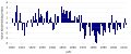 Sahel rainfall timeseries de.svg 1200 × 500; 21 KB
-
 Sahel rainfall timeseries en.svg 630 × 270; 25 KB
-
 Sahel rainfall timeseries.gif 600 × 219; 8 KB
-
 SONGHAI empire map.PNG 1580 × 988; 73 KB
-
 عععن.jpg 864 × 602; 329 KB


.jpg)


.svg)


.png)


.jpg)


_Mali.jpg)


.JPG)


,_view_of_village.jpg)