Category:San Luis Province
Salti al navigilo
Salti al serĉilo
- Provinces of Argentina
- Buenos Aires
- Catamarca
- Chaco
- Chubut
- Córdoba
- Corrientes
- Entre Ríos
- Formosa
- Jujuy
- La Pampa
- La Rioja
- Mendoza
- Misiones
- Neuquén
- Río Negro
- Salta
- San Juan
- San Luis
- Santa Cruz
- Santa Fe
- Santiago del Estero
- Tierra del Fuego
- Tucumán
- Autonomous city
- Buenos Aires
province of Argentina  Catedral de San Luis   -2.svg)  | |||||
| Alŝuti plurmedion | |||||
| Estas | |||||
|---|---|---|---|---|---|
| Loko | Argentino | ||||
| Ĉefurbo | |||||
| Leĝdona aŭtoritato |
| ||||
| Estro |
| ||||
| Dato de fondo aŭ kreo |
| ||||
| Plej alta punkto |
| ||||
| Loĝantaro |
| ||||
| Areo |
| ||||
| Supermara alteco |
| ||||
| oficiala retejo | |||||
 | |||||
Subkategorioj
Ĉi tiu kategorio havas la 17 jenajn subkategoriojn, el 17 entute.
Dosieroj en kategorio “San Luis Province”
La jenaj 64 dosieroj estas en ĉi tiu kategorio, el 64 entute.
-
 164878 San Francisco del Monte de Oro.jpg 2 613 × 1 878; 887 KB
-
 Arbolito (26993663).jpeg 1 365 × 2 048; 1,18 MB
-
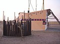
 Arco del ingreso a Zanjitas.JPG 2 048 × 1 536; 828 KB
-
 Balde de la Isla.jpg 2 048 × 1 536; 560 KB
-
 Calor splash.jpg 2 864 × 4 288; 5,18 MB
-
 Camino al salto del tabaquillo.JPG 3 648 × 2 736; 2,36 MB
-
 Caminos al Salto del Tabaquillo.JPG 3 648 × 2 736; 2,23 MB
-
 CAPS Cerro De Oro.jpg 4 000 × 3 000; 2,57 MB
-
 Casa de Gobierno de la Provincia de San Luis.JPG 4 320 × 3 240; 3,03 MB
-
 Casa Ranquel - panoramio.jpg 2 080 × 1 544; 603 KB
-
 Ciudad de San Luis, provincia de San Luis, Argentina.jpg 4 128 × 1 956; 2,91 MB
-
 Colores en la noche.jpg 1 630 × 1 222; 311 KB
-
 Comunidad Ranquel - panoramio.jpg 2 080 × 1 544; 684 KB
-
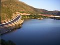
 Dique Luján, San luis.jpg 1 600 × 1 197; 503 KB
-
 Dunas - panoramio - Sosa Araujo Adrian G….jpg 2 048 × 1 536; 1,32 MB
-
 Entrada a Lavaisse.JPG 4 000 × 3 000; 2,33 MB
-

-
 Escuela RUKA GNER - panoramio.jpg 2 080 × 1 544; 657 KB
-
 Escuela Sarmiento SFco del Monte de Oro.JPG 3 264 × 2 448; 1,49 MB
-
 Estadio con sierras.JPG 2 560 × 1 920; 2,14 MB
-
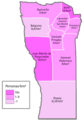
 General Pedernera Department, San Luis Province, Argentina - panoramio.jpg 3 264 × 1 840; 920 KB
-
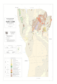 Geologic map of San Luis Province, Argentina.tif 2 981 × 4 421, 2 paĝoj; 13,77 MB
-
 Hito del Bicentenario.JPG 3 072 × 4 608; 2,88 MB
-
 Horno carbonifero - panoramio.jpg 746 × 454; 95 KB
-
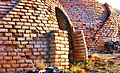 Hornos en reposo - panoramio.jpg 746 × 456; 128 KB
-
 Industria de la sal en Salinas del Bebedero.jpg 2 848 × 2 134; 1,33 MB
-
 Ingreso a RUKA GNER - panoramio.jpg 2 080 × 1 544; 708 KB
-
 Junín Department, San Luis Province, Argentina - panoramio (1).jpg 1 632 × 1 224; 857 KB
-
 Junín Department, San Luis Province, Argentina - panoramio (2).jpg 1 632 × 1 224; 898 KB
-
 Junín Department, San Luis Province, Argentina - panoramio (3).jpg 1 632 × 1 224; 834 KB
-
 Junín Department, San Luis Province, Argentina - panoramio (4).jpg 1 632 × 1 224; 783 KB
-
 Junín Department, San Luis Province, Argentina - panoramio (5).jpg 3 072 × 2 304; 1,85 MB
-
 Junín Department, San Luis Province, Argentina - panoramio (6).jpg 3 072 × 2 304; 1,24 MB
-
 Junín Department, San Luis Province, Argentina - panoramio (7).jpg 2 560 × 1 920; 1,15 MB
-
 Junín Department, San Luis Province, Argentina - panoramio (8).jpg 3 072 × 2 304; 1,38 MB
-
 Junín Department, San Luis Province, Argentina - panoramio.jpg 1 788 × 1 197; 461 KB
-
 Los Molles, San Luis Province, Argentina - panoramio (1).jpg 1 840 × 3 264; 2,18 MB
-
 Merlo San Luis Argentina (40816646).jpeg 2 048 × 1 356; 247 KB
-
 Mimozyganthus carinatus hojas.jpg 4 608 × 3 456; 4,04 MB
-
 Mimozyganthus carinatus.jpg 3 456 × 4 608; 7,74 MB
-
 Mirador del Águila - panoramio.jpg 3 840 × 2 160; 5,99 MB
-
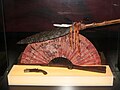
 MUHSALsala1.jpg 1 600 × 1 200; 699 KB
-
 MUHSALsala2.jpg 1 200 × 1 600; 373 KB
-
 MUHSALsala3.jpg 1 600 × 1 200; 601 KB
-
 MUHSALsala5.jpg 1 600 × 1 200; 432 KB
-
 Nuevo Fava - San Luis - Mdp - Argentina.jpg 800 × 600; 112 KB
-
 Paisaje - panoramio - Sosa Araujo Adrian G….jpg 2 048 × 1 536; 1,37 MB
-
 Pirca en San Luis.JPG 4 272 × 2 848; 2,86 MB
-
 Placa conmemorativa embalse La florida, San Luis.jpg 477 × 792; 30 KB
-
 Planos (26991923).jpeg 1 365 × 2 048; 530 KB
-
 Potrero de los Funes, San Luis.JPG 3 648 × 2 736; 2,17 MB
-
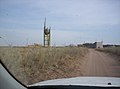
 Rio de santa rosa del conlara, san luis, argentina- 2014.jpg 480 × 360; 36 KB
-
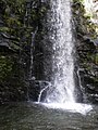 Salto del Tabaquillo, San Luis.JPG 2 736 × 3 648; 2,37 MB
-
 San luis colorfull.jpg 2 048 × 1 366; 297 KB
-
 San luis densidad.png 4 134 × 5 906; 1,11 MB
-
 Sanluix.png 270 × 148; 23 KB
-
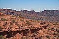 Sierra de las Quijadas rock formations.jpg 850 × 567; 595 KB
-
 Sombras en Nogolí 2.jpg 960 × 720; 36 KB
-
 Tamarisk and cactus.jpg 850 × 567; 780 KB
-
 Valle Amarillo, Cerro Sosneado en el Horizonte - panoramio.jpg 746 × 425; 46 KB
-
 Via Lactea (214765105).jpeg 2 048 × 1 365; 705 KB
-
 Villa del Carmen, provincia de San Luis, Argentina. Cartel de acceso.jpg 960 × 1 280; 140 KB
-
 Vista de Circuito de Formula 1 desde el Hotel - panoramio.jpg 2 080 × 1 544; 750 KB
-
 Vista panorámica del ingreso a Zanjitas por ruta provincial 3.JPG 2 048 × 740; 178 KB

.jpeg)


.jpg)
.jpg)
.jpg)
.jpg)
.jpg)
.jpg)
.jpg)
.jpg)

.jpg)
.jpeg)


.jpeg)


.jpeg)

