Category:San Pablo Bay
Vai alla navigazione
Vai alla ricerca
bay in San Francisco Bay area  | |||||
| Carica un file multimediale | |||||
| Istanza di | |||||
|---|---|---|---|---|---|
| Luogo | California, Stati del Pacifico | ||||
| Connesso con | |||||
| Immissario |
| ||||
 | |||||
Sottocategorie
Questa categoria contiene le 8 sottocategorie indicate di seguito, su un totale di 8.
File nella categoria "San Pablo Bay"
Questa categoria contiene 39 file, indicati di seguito, su un totale di 39.
-
 Breuner Marsh.jpg 500 × 375; 122 KB
-
 Brother Islands from the water.jpg 4 032 × 3 024; 7,44 MB
-
 Brother Islands next to each other, from the water.jpg 3 557 × 2 668; 6,81 MB
-
 Brothers-islands.jpg 1 146 × 715; 388 KB
-
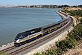 Capitol Corridor Pinole.jpg 1 024 × 687; 536 KB
-
 Deployment of acoustic doppler current profiler.jpg 4 000 × 3 000; 2,68 MB
-
 Detail of Richmond Chevron Refinery with backdrop of San Pablo Bay.jpg 2 048 × 1 365; 2,22 MB
-
 East Brother Island Lighthouse, San Pablo Bay, CA.jpg 1 297 × 910; 1 001 KB
-
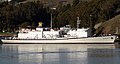 Golden bear (cropped).jpg 1 129 × 601; 140 KB
-
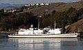 Golden bear.jpg 1 280 × 784; 185 KB
-
 Hercules Regional Intermodal Transit Center render.jpg 1 500 × 843; 381 KB
-
 Hercules Station site 2749 01.JPG 2 048 × 1 536; 741 KB
-
 Hercules Station site 2750 02.JPG 2 048 × 1 536; 889 KB
-
 Hercules Station site 2752 04.JPG 2 048 × 1 536; 819 KB
-
 ISS048-E-6387 - View of California.jpg 4 928 × 3 280; 2,05 MB
-
 NASA Worldwind, USGS imagery map, Island No. 2, California.png 1 990 × 1 900; 4,22 MB
-
 NASA Worldwind, USGS imagery map, Knight Island, California.png 1 900 × 1 900; 3,57 MB
-
 NASA Worldwind, USGS imagery map, Little Island, California.png 1 700 × 1 700; 3,06 MB
-
 NASA Worldwind, USGS imagery map, Neils Island, California.png 900 × 900; 1 021 KB
-
 NASA Worldwind, USGS imagery map, Russ Island, California.png 1 887 × 1 887; 3,45 MB
-
 NASA Worldwind, USGS imagery map, Tubbs Island, California.png 1 870 × 1 870; 3,83 MB
-
 NASA Worldwind, USGS imagery map, Wood Island, California.png 400 × 400; 247 KB
-
 OA-10A and SC-47D (5228426214).jpg 600 × 512; 33 KB
-
 Point San Pedro 07798.JPG 2 560 × 1 920; 1,84 MB
-
 San Pablo Bay (9371106279).png 3 300 × 1 856; 12,43 MB
-
 San Pablo Bay from Mt Tam.jpg 12 526 × 1 820; 2,79 MB
-
 San Pablo Bay Panorama.jpg 13 338 × 2 424; 21,23 MB
-
 San Pablo Bay sunset 2.jpg 1 416 × 944; 662 KB
-
 San Pablo Bay-001.jpg 2 560 × 1 706; 679 KB
-
 San Rafael California Canal Area aerial view (cropped).jpg 1 496 × 706; 811 KB
-
 San Rafael California Canal Area aerial view.jpg 1 500 × 1 000; 900 KB
-
 Southampton Shoals LS.JPG 425 × 382; 50 KB
-
 Suisun Bay, Carquinez Strait, San Pablo Bay (cropped).jpg 837 × 670; 223 KB
-
 Suisun Bay, Carquinez Strait, San Pablo Bay.jpg 1 460 × 2 034; 592 KB
-
 Sunrise-San Pablo Bay.jpg 4 928 × 3 264; 6,9 MB
-
 Tubbs Island, California, 2023-03-07.jpg 4 080 × 3 072; 3,41 MB
-
 West Brother Island from the water.jpg 3 525 × 2 644; 6,81 MB
-
 West Brother Island side from the water.jpg 3 995 × 2 996; 8,2 MB
-
 Wpdms nasa photo san pablo bay.jpg 534 × 467; 91 KB


.jpg)


.jpg)

.png)


.jpg)


.jpg)


