Category:Sandford St Martin
Aller à la navigation
Aller à la recherche
localité britannique du comté anglais d'Oxfordshire  | |||||
| Téléverser des médias | |||||
| Nature de l’élément | |||||
|---|---|---|---|---|---|
| Lieu | West Oxfordshire, Oxfordshire, Angleterre du Sud-Est, Angleterre | ||||
| site officiel | |||||
 | |||||
Sandford St Martin is a village and civil parish in Oxfordshire, about seven miles (about 11 km) east of Chipping Norton and about nine miles (about 14 km) south of Banbury.
Sous-catégories
Cette catégorie comprend seulement la sous-catégorie ci-dessous.
S
Média dans la catégorie « Sandford St Martin »
Cette catégorie comprend 25 fichiers, dont les 25 ci-dessous.
-
 Another field boundary near Great Tew - geograph.org.uk - 2713623.jpg 1 024 × 768 ; 676 kio
-
 Approaching Ledwell - geograph.org.uk - 5462748.jpg 640 × 360 ; 75 kio
-
 Brandon House, and Cross (geograph 7594451).jpg 4 641 × 3 349 ; 3,42 Mio
-
 Cottages around the well head, Ledwell - geograph.org.uk - 5462707.jpg 640 × 360 ; 75 kio
-
 Cottages in Sandford St.Martin - geograph.org.uk - 385953.jpg 640 × 425 ; 244 kio
-
 Farm sign - geograph.org.uk - 1877426.jpg 3 648 × 2 736 ; 2,14 Mio
-
 Flight Hill near Ledwell - geograph.org.uk - 5865846.jpg 2 700 × 2 025 ; 844 kio
-

-
 Ledwell Country Lane - geograph.org.uk - 6194111.jpg 1 600 × 1 200 ; 467 kio
-
 Ledwell Lane heading east - geograph.org.uk - 5865843.jpg 2 700 × 2 025 ; 598 kio
-
 Looking down Ledwell - geograph.org.uk - 5462727.jpg 640 × 360 ; 115 kio
-
 Looking up Ledwell - geograph.org.uk - 5462722.jpg 640 × 360 ; 84 kio
-
 Manor Farm, Ledwell - geograph.org.uk - 5462742.jpg 640 × 360 ; 84 kio
-
 Manor farmhouse, Ledwell - geograph.org.uk - 5462746.jpg 640 × 360 ; 74 kio
-
 Old Painted Gate - geograph.org.uk - 1658129.jpg 480 × 640 ; 117 kio
-
 Raven Hill - geograph.org.uk - 2713632.jpg 1 024 × 768 ; 669 kio
-
 Rural road to Duns Tew - geograph.org.uk - 5865849.jpg 2 700 × 2 025 ; 519 kio
-
 Ancient doorway^ Not as old as it looks^ - geograph.org.uk - 1671350.jpg 840 × 1 516 ; 693 kio
-
 Sandford St Martin - geograph.org.uk - 6194112.jpg 1 600 × 1 200 ; 818 kio
-
 Sandford St. Martin - geograph.org.uk - 6194114.jpg 1 600 × 1 200 ; 527 kio
-
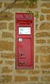 SandfordStMartin VRwallbox.jpg 1 770 × 2 950 ; 1,95 Mio
-
 South end of Ledwell - geograph.org.uk - 5462720.jpg 640 × 360 ; 95 kio
-
 The well close, Ledwell - geograph.org.uk - 5462698.jpg 640 × 360 ; 78 kio
-
 Track to Hobbshole Farm - geograph.org.uk - 1748267.jpg 640 × 480 ; 99 kio
-
 Upper Grove Ash Farm and pond - geograph.org.uk - 3619465.jpg 4 320 × 3 240 ; 4,79 Mio


.jpg)


