Category:Sandiao Cape
Vai alla navigazione
Vai alla ricerca
| Extreme points of the Taiwan Island | ||
|---|---|---|
Easternmost point: Sandiao Cape - Southernmost point: Eluanbi - Westernmost point: Jianziwei - Northernmost point: Fugui Cape
|
||
promontorio di Taiwan  | |||||
| Carica un file multimediale | |||||
| Istanza di | |||||
|---|---|---|---|---|---|
| Luogo |
| ||||
| Situato sul mare / lago / fiume | |||||
 | |||||
English: The Sandiao Cape, also can be spelled as "Shandiaojiao", is the easternmost point of the main islands of Taiwan. The cape was formerly known as "Cape Santiago".
日本語:三貂角は、台湾本島最東端に位置する岬である。
中文(臺灣):三貂角是臺灣本島最東境的岬角。
Sottocategorie
Questa categoria contiene un'unica sottocategoria, indicata di seguito.
S
File nella categoria "Sandiao Cape"
Questa categoria contiene 10 file, indicati di seguito, su un totale di 10.
-
 228, Taiwan, 新北市貢寮區福連里 - panoramio (1).jpg 4 608 × 3 456; 19,34 MB
-
 228, Taiwan, 新北市貢寮區福連里 - panoramio.jpg 4 608 × 3 456; 18,79 MB
-
 Admiralty Chart No 3235 Hua-Lien Po-Ti to San-Tiao Chiao, Published 1963.jpg 11 078 × 16 181; 46,54 MB
-
 BiTou Cape (鼻頭角) - panoramio (2).jpg 1 200 × 800; 711 KB
-
 Bitou Elementary School overview 20160509.jpg 7 360 × 4 912; 14,18 MB
-
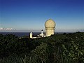
 Lighthouse at Sandiaojiao with Gueishan Island in the hazy background.jpg 3 240 × 2 160; 3,81 MB
-
 Twmemory 010144.jpg 1 499 × 562; 243 KB
-
 View toward Cape San Diego 眺望三貂角 - panoramio.jpg 5 692 × 3 794; 4,97 MB
-
 馬崗海蝕平台海蝕溝 20200704.jpg 1 477 × 1 108; 238 KB
-
 鼻頭國民小學FUJI5129b.jpg 4 896 × 3 264; 1,69 MB
.jpg)


_-_panoramio_(2).jpg)


