Category:Sandown
Gezinti kısmına atla
Arama kısmına atla
seaside resort town and civil parish on the southeast coast of the Isle of Wight, England  | |||||
| Medya yükle | |||||
| Nedir | |||||
|---|---|---|---|---|---|
| Konumu | Wight Adası, Güney Doğu İngiltere, İngiltere | ||||
| Nüfus |
| ||||
| Aynı değil | |||||
| Aynısı olduğu söylenen(ler) | Sandown (yinelenen Wikimedia sayfası, ingiliz semt/köy) | ||||
 | |||||
Sandown is a seaside resort town and civil parish on the south-east coast of the Isle of Wight.
Alt kategoriler
Bu kategoride, aşağıdaki 21 alt kategori dahil toplam 21 alt kategori vardır.
A
- Isle of Wight/Sandown Airport (14 F)
- Avenue Road Church, Sandown (9 F)
B
- Bus stops in Sandown (69 F)
- Buses in Sandown (84 F)
C
H
- High Street, Sandown (50 F)
I
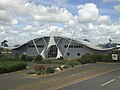
- Isle of Wight Zoo (18 F)
P
- Pubs in Sandown (10 F)
S
- Sandown Barrack Battery (20 F)
- Sandown outdoor gym (13 F)
- Sandown Pier (75 F)
- Sandown railway station (76 F)
- Sandown Town Hall (4 F)
- Sandown War Memorial (24 F)
- Shops in Sandown (34 F)
Y
"Sandown" kategorisindeki ortam dosyaları
Bu kategoride yer alan toplam 488 dosyanın 200 adedi aşağıdadır.
(önceki sayfa) (sonraki sayfa)-
 "Breakwaters" apartments, Sandown, Isle of Wight, England.jpg 3.990 × 2.986; 3,13 MB
-
 'Home of Rest' en Sandown, RP-F-F00869-8.jpg 3.639 × 2.683; 1,91 MB
-
 15, the shortest day- or is it^ - geograph.org.uk - 5632739.jpg 640 × 480; 46 KB
-
 16, the shortest day- or is it^ - geograph.org.uk - 5632753.jpg 640 × 480; 67 KB
-
 A performer at Sandown Carnival 2018.jpg 3.005 × 2.991; 2,36 MB
-
 A right royal road junction - geograph.org.uk - 2579101.jpg 640 × 480; 72 KB
-
 A Southern Vectis bus at Sandown - geograph.org.uk - 6261403.jpg 1.024 × 576; 354 KB
-
 A3055 towards Sandown - geograph.org.uk - 5129711.jpg 640 × 428; 167 KB
-
 Amusement arcade, Sandown - geograph.org.uk - 3313817.jpg 956 × 1.024; 203 KB
-

-
 Anchor stones in Sandown.jpg 2.112 × 2.816; 2,17 MB
-
 Apartments on the Esplanade, Shanklin - geograph.org.uk - 4639127.jpg 1.600 × 1.065; 646 KB
-
 Approaching a B ^ B in Leed Street - geograph.org.uk - 2559335.jpg 480 × 640; 65 KB
-
 Approaching a bend in St John's Road - geograph.org.uk - 2578922.jpg 640 × 480; 69 KB
-

-

-

-

-
 Artwork, Sandown Esplanade - geograph.org.uk - 5522896.jpg 4.000 × 3.000; 2,99 MB
-
 Ashborne Court, Regent Street - geograph.org.uk - 2579127.jpg 640 × 480; 78 KB
-
 Avanti Coach on Culver Parade, Sandown - geograph.org.uk - 4640094.jpg 1.600 × 1.065; 537 KB
-
 B3395 junction with A3055 - geograph.org.uk - 4136206.jpg 2.740 × 1.925; 735 KB
-
 B3395 southwest of the I.O.W. Zoo - geograph.org.uk - 4136160.jpg 3.638 × 2.415; 1,13 MB
-
 Back of club house - geograph.org.uk - 4594571.jpg 2.560 × 1.920; 1.014 KB
-
 Beach at Sandown - geograph.org.uk - 5033307.jpg 640 × 384; 37 KB
-
 Beach at Sandown, Isle of Wight, England.jpg 3.920 × 2.890; 2,73 MB
-
 Beach Gardens on the Esplanade, Sandown - geograph.org.uk - 4639859.jpg 1.600 × 1.065; 523 KB
-
 Beach Hut Hire, Sandown - geograph.org.uk - 5602561.jpg 640 × 424; 69 KB
-
 Beach Huts - geograph.org.uk - 5602564.jpg 640 × 424; 47 KB
-
 Beach huts near Sandown - geograph.org.uk - 5298733.jpg 640 × 427; 203 KB
-
 Beach in Sandown - geograph.org.uk - 5298744.jpg 640 × 427; 175 KB
-
 Borthwood.jpg 2.592 × 1.944; 541 KB
-
 Bottom end of Victoria Road - geograph.org.uk - 2579106.jpg 640 × 480; 102 KB
-
 Brown's Golf Course and the Grand Hotel - geograph.org.uk - 5717297.jpg 3.771 × 2.951; 1,83 MB
-
 Brown's Golf Course in Sandown, May 2022.jpg 5.568 × 3.398; 5,83 MB
-

-
 Building site in Fitzroy Street - geograph.org.uk - 2528749.jpg 640 × 480; 70 KB
-
 Burchett sandown trimmed.jpg 825 × 480; 77 KB
-
 Burchett sandown.jpg 768 × 768; 122 KB
-
 Burlington Hotel, Sandown - geograph.org.uk - 5032092.jpg 640 × 384; 43 KB
-
 Burnt out building - geograph.org.uk - 4590335.jpg 2.560 × 1.920; 1,19 MB
-
 Bus shelter in Victoria Road - geograph.org.uk - 2579103.jpg 640 × 480; 71 KB
-
 Buttercups (5676811632).jpg 2.509 × 1.814; 1,42 MB
-
 Canoe Lake - as was - geograph.org.uk - 5167511.jpg 640 × 480; 76 KB
-
 Caravan park on Red Cliff - geograph.org.uk - 2102637.jpg 640 × 480; 222 KB
-
 Carnival peacock - geograph.org.uk - 5858275.jpg 2.801 × 3.999; 3,34 MB
-
 Caterpillar on the coastal path at Bembridge Down - geograph.org.uk - 4641536.jpg 1.600 × 1.065; 889 KB
-
 Cattle on Culver Down - geograph.org.uk - 1902027.jpg 640 × 427; 204 KB
-
 Caulkheads and Old Bristol - geograph.org.uk - 5602614.jpg 640 × 424; 52 KB
-
 Cliff and Heather - panoramio.jpg 4.362 × 2.907; 10,92 MB
-
 Cliff walk and apartments - geograph.org.uk - 5513483.jpg 2.434 × 2.242; 1,16 MB
-
 Club house, Sandown Bay Holiday Centre - geograph.org.uk - 4554459.jpg 2.560 × 1.920; 1,5 MB
-

-

-
 Coast path past Sandown Bay Holiday Centre - geograph.org.uk - 4554465.jpg 2.560 × 1.920; 1,39 MB
-
 Coast path to Sandown - geograph.org.uk - 4554472.jpg 2.560 × 1.920; 1,57 MB
-
 Coastal path above Red Cliff near Culver Down - geograph.org.uk - 4641451.jpg 1.600 × 1.065; 580 KB
-
 Coastal path above Red Cliff near Culver Down - geograph.org.uk - 4641462.jpg 1.600 × 1.065; 602 KB
-
 Coastal path above Red Cliff near Culver Down - geograph.org.uk - 4641465.jpg 1.600 × 1.065; 564 KB
-
 Coastal path above Red Cliff near Culver Down - geograph.org.uk - 4641482.jpg 1.600 × 1.065; 512 KB
-
 Coastal path at Sandown - geograph.org.uk - 4639111.jpg 1.600 × 1.065; 537 KB
-
 Coastal path at Sandown - geograph.org.uk - 4639113.jpg 1.600 × 1.065; 667 KB
-
 Coastal path heads down to the Esplanade, Sandown - geograph.org.uk - 4639133.jpg 1.600 × 1.065; 583 KB
-
 Coastal Path towards Culver Down - geograph.org.uk - 4641365.jpg 1.600 × 1.065; 506 KB
-
 Coastal Path towards Culver Down - geograph.org.uk - 4641419.jpg 1.600 × 1.065; 503 KB
-
 Coastal Path towards Culver Down - geograph.org.uk - 4641423.jpg 1.600 × 1.065; 965 KB
-
 Congregational church - as was - geograph.org.uk - 5194007.jpg 1.197 × 1.600; 307 KB
-
 Construction of "Breakwaters" apartments, Sandown, Isle of Wight, England.jpg 4.000 × 3.000; 2,98 MB
-
 Coot (Fulica atra) - geograph.org.uk - 4087954.jpg 640 × 480; 522 KB
-

-
 Council offices at Sandown - geograph.org.uk - 2156436.jpg 640 × 480; 240 KB
-
 Cows grazing near Bembridge Down - geograph.org.uk - 4591312.jpg 2.560 × 1.920; 1,3 MB
-
 Cows on The Coastal Path - geograph.org.uk - 3571038.jpg 640 × 481; 271 KB
-
 Crazy Golf Course, Sandown - geograph.org.uk - 504703.jpg 625 × 640; 104 KB
-

-

-

-
 Culver bill1.jpg 1.219 × 830; 139 KB
-
 Culver Cliff - geograph.org.uk - 6240354.jpg 5.423 × 3.615; 4,16 MB
-
 Culver Cliff from Sandown - geograph.org.uk - 1934682.jpg 1.500 × 1.000; 154 KB
-
 Culver Cliff From Sandown Zoo - geograph.org.uk - 1035802.jpg 640 × 480; 30 KB
-
 Culver Cliff viewed from Sandown - geograph.org.uk - 6261406.jpg 1.024 × 576; 282 KB
-
 Culver Cliff wrapped in cloud - geograph.org.uk - 5794960.jpg 3.884 × 2.313; 890 KB
-
 Culver Parade, Sandown (10490279374).jpg 4.896 × 3.672; 5,29 MB
-
 Culver Parade, Sandown - geograph.org.uk - 3313816.jpg 1.024 × 738; 92 KB
-
 Culver Way - geograph.org.uk - 4088059.jpg 640 × 427; 379 KB
-
 Culver Way - geograph.org.uk - 4088062.jpg 640 × 427; 377 KB
-
 Culver Way - geograph.org.uk - 4088065.jpg 640 × 427; 361 KB
-
 Deck chairs on The Esplanade - geograph.org.uk - 2531115.jpg 640 × 480; 54 KB
-

-
 Demolition of the former Rivoli Cinema, Station Avenue - geograph.org.uk - 5550527.jpg 1.578 × 1.419; 575 KB
-
 Demolition of Wight City apartments and leisure complex - geograph.org.uk - 5717340.jpg 3.952 × 2.964; 2,34 MB
-
 Dinosaur Isle - geograph.org.uk - 3570516.jpg 640 × 481; 91 KB
-
 Dinosaur Isle - geograph.org.uk - 4088015.jpg 640 × 419; 326 KB
-
 Dinosaur Isle and the former boating lake, Sandown - geograph.org.uk - 5492728.jpg 2.681 × 1.809; 617 KB
-
 Dinosaur Isle.JPG 3.072 × 2.304; 2,16 MB
-
 Duck Pond - geograph.org.uk - 4087963.jpg 640 × 404; 321 KB
-
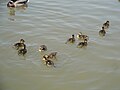 Ducklings at Sandown Culver Parade lake.JPG 4.000 × 3.000; 4,03 MB
-
 Early evening on Sandown Esplanade - geograph.org.uk - 2984650.jpg 1.024 × 768; 118 KB
-
 Elmbank Gardens - geograph.org.uk - 4548078.jpg 4.896 × 3.672; 7,21 MB
-
 Elmbank Gardens, Sandown - geograph.org.uk - 4646784.jpg 800 × 597; 99 KB
-
 End of Sandown Pier - geograph.org.uk - 5677333.jpg 3.185 × 2.423; 1,59 MB
-
 End of season^ - geograph.org.uk - 2680288.jpg 3.264 × 2.448; 4,04 MB
-
 End of the pier - geograph.org.uk - 5298743.jpg 640 × 427; 204 KB
-
 End of the Rivoli Cinema, Station Avenue, Sandown - geograph.org.uk - 5550530.jpg 1.865 × 1.398; 679 KB
-
 English Longhorn cattle - geograph.org.uk - 4591349.jpg 2.560 × 1.920; 1,65 MB
-
 Enjoying Sandown Beach - geograph.org.uk - 5492286.jpg 2.793 × 2.259; 1,15 MB
-
 Entertaining topiary, Cliff Road, Lake - geograph.org.uk - 5492926.jpg 2.074 × 1.675; 1,15 MB
-
 Entrance to The Ocean View - geograph.org.uk - 2579168.jpg 480 × 640; 63 KB
-
 Erosion around sandstone pinnacle at Yaverland - geograph.org.uk - 5867241.jpg 3.264 × 2.448; 2,06 MB
-
 Esplanade and pier, Sandown - geograph.org.uk - 4590347.jpg 2.560 × 1.920; 1,04 MB
-
 Esplanade at Sandown - geograph.org.uk - 2144609.jpg 640 × 480; 201 KB
-
 Esplanade in Sandown - geograph.org.uk - 5298747.jpg 640 × 427; 184 KB
-
 Esplanade Road, Sandown - geograph.org.uk - 2652272.jpg 800 × 600; 207 KB
-
 Esplanade, Sandown - geograph.org.uk - 2528176.jpg 3.419 × 1.920; 988 KB
-
 Esplanade, Sandown - geograph.org.uk - 4590339.jpg 2.560 × 1.920; 1,13 MB
-
 Evening sky over Sandown Bay - geograph.org.uk - 5931609.jpg 2.924 × 3.900; 1,32 MB
-
 Exit path from Sandown railway station - geograph.org.uk - 4667788.jpg 800 × 508; 116 KB
-
 Fat Harry's - geograph.org.uk - 2579207.jpg 480 × 640; 77 KB
-

-
 Flickr - ronsaunders47 - CLIFFTOP WALK . SANDOWN TO SHANKLIN. IOW..jpg 1.600 × 1.206; 815 KB
-
 Flickr - ronsaunders47 - CLIFFTOP WALK SANDOWN IOW..jpg 1.577 × 1.173; 550 KB
-
 Flickr - ronsaunders47 - Clifftop walk, Sandown. Isle of Wight UK..jpg 2.304 × 1.728; 694 KB
-
 Flickr - ronsaunders47 - COASTAL FOOTPATH 1. SANDOWN-SHANKLIN. ISLE OF WIGHT.jpg 2.816 × 2.112; 2,18 MB
-
 Flickr - ronsaunders47 - COASTAL FOOTPATH 2. SANDOWN-SHANKLIN. ISLE OF WIGHT..jpg 2.772 × 2.064; 1,52 MB
-
 Flickr - ronsaunders47 - CULVER CLIFF VIEW. ISLE OF WIGHT.UK..jpg 2.935 × 1.866; 1,39 MB
-
 Flickr - ronsaunders47 - Long walk up for a short ride down..jpg 1.701 × 2.268; 710 KB
-
 Flickr - ronsaunders47 - LOOKING TOWARDS SANDOWN . IOW..jpg 2.804 × 1.864; 831 KB
-
 Flickr - ronsaunders47 - Pier of the realm...jpg 2.597 × 1.948; 718 KB
-
 Flickr - ronsaunders47 - SANDOWN TO SHANKLIN CLIFFTOP WALK. IOW..jpg 3.008 × 2.000; 1,43 MB
-
 Flickr - ronsaunders47 - THE OCEAN DECK. SANDOWN SEAFRONT..jpg 2.640 × 1.980; 1,8 MB
-
 Fog clearing, Sandown Pier - geograph.org.uk - 5493634.jpg 3.869 × 2.901; 1,27 MB
-
 Footpath - geograph.org.uk - 2682906.jpg 3.264 × 2.448; 4,61 MB
-
 Former artillery barracks - geograph.org.uk - 4355376.jpg 1.600 × 1.064; 413 KB
-
 Former cinema in Station Avenue - geograph.org.uk - 2578928.jpg 640 × 480; 90 KB
-
 Former Youth Hostel, Sandown - geograph.org.uk - 2345480.jpg 1.536 × 1.024; 1,1 MB
-
 Foxes Bridge - geograph.org.uk - 2680696.jpg 2.448 × 3.264; 1,53 MB
-

-
 Gate on The Coastal Path - geograph.org.uk - 3570714.jpg 640 × 480; 322 KB
-
 Gateposts and disused pit on Red Cliff - geograph.org.uk - 2102639.jpg 640 × 480; 223 KB
-
 Grand Hotel, Culver Parade, Sandown - geograph.org.uk - 5492192.jpg 3.910 × 2.932; 2,05 MB
-
 Green tunnel leading to rail crossing - geograph.org.uk - 5173203.jpg 1.200 × 1.600; 626 KB
-
 Grove Road, Sandown - geograph.org.uk - 4646844.jpg 640 × 593; 78 KB
-
 H.M.S Eurydice Memorial 1878.jpg 1.940 × 1.504; 626 KB
-
 Hang-gliding over Sandown Pier - geograph.org.uk - 5493586.jpg 3.040 × 2.171; 1,06 MB
-
 Heather and Cliff - panoramio.jpg 5.184 × 3.456; 13,86 MB
-
 Highland cattle in the Isle of Wight - geograph.org.uk - 1967587.jpg 640 × 480; 99 KB
-
 Hill Street, Sandown - geograph.org.uk - 4646779.jpg 800 × 555; 98 KB
-
 Houses in Leed Street - geograph.org.uk - 2559362.jpg 640 × 480; 66 KB
-
 Houses in Victoria Road - geograph.org.uk - 2579087.jpg 640 × 480; 78 KB
-
 HSBC, Sandown - geograph.org.uk - 2579165.jpg 480 × 640; 65 KB
-

-
 IOW Coast Path Sign, Sandown, Isle of Wight.jpg 2.016 × 1.512; 744 KB
-
 Island Line at Sandown, Isle of Wight - geograph.org.uk - 2926182.jpg 4.200 × 2.800; 5,96 MB
-

-
 Jet-skis off Sandown Pier - geograph.org.uk - 5506294.jpg 4.000 × 2.886; 2,41 MB
-
 Jule's Ices van in Sandown - geograph.org.uk - 4646893.jpg 800 × 696; 132 KB
-

-

-

-

-

-

-

-

-

-

-
 June 2011 in St John's Road - geograph.org.uk - 2578927.jpg 640 × 480; 86 KB
-
 Kings House Bar ^ Cafe - geograph.org.uk - 4639624.jpg 1.600 × 1.065; 576 KB
-
 Lake at Sandown - geograph.org.uk - 1902080.jpg 640 × 428; 184 KB
-
 Lake at Sandown - geograph.org.uk - 3564909.jpg 640 × 480; 246 KB
-
 Lamppost in Station Road - geograph.org.uk - 2528668.jpg 640 × 480; 76 KB
-
 Lampposts on The Esplanade - geograph.org.uk - 2531088.jpg 640 × 480; 46 KB
-
 Landslide, between Red Cliff and Whitecliff Ledge - geograph.org.uk - 4590177.jpg 2.560 × 1.920; 1,82 MB
-

-
 Library, Sandown - geograph.org.uk - 5151709.jpg 640 × 480; 174 KB
-
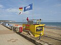 Lifeguards at Sandown, Isle of Wight, England.jpg 3.438 × 2.570; 2,33 MB
-

-

-

-

-

-

-

-
 Looking eastwards up Station Lane - geograph.org.uk - 2528679.jpg 640 × 480; 74 KB
-

-

-

-

-

-

-

-

-
-

-
 Looking north east from Sandown Pier - geograph.org.uk - 3470444.jpg 1.024 × 768; 416 KB
-

-

-

-
 Low tide near Sandown lifeboat station - geograph.org.uk - 5510975.jpg 3.462 × 2.254; 1,53 MB


_(14573984929).jpg)


.jpg)


_-_geograph.org.uk_-_4087954.jpg)


.jpg)


