Category:Sankhuwasabha District
Aller à la navigation
Aller à la recherche
district du Népal   | |||||
| Téléverser des médias | |||||
| Nature de l’élément | |||||
|---|---|---|---|---|---|
| Lieu |
| ||||
| Population |
| ||||
| Superficie |
| ||||
| site officiel | |||||
 | |||||
Sous-catégories
Cette catégorie comprend 18 sous-catégories, dont les 18 ci-dessous.
B
- Baruntse (11 F)
C
- Chainpur, Sankhuwasabha (2 F)
- Chamlang (18 F)
- Cho Polu (11 F)
F
- Festivals in Sankhuwasabha District (129 F)
G
H
- Hongku Chuli (6 F)
K
- Kangchungtse (7 F)
- Khandbari (21 F)
M
- Manakamana, Sankhuwasabha (23 F)
- Minerals of Sonomla (1 F)
P
- Peak 4 (1 F)
S
- Shartse (9 F)
T
- Tumlingtar (16 F)
- Tutse (5 F)
Média dans la catégorie « Sankhuwasabha District »
Cette catégorie comprend 180 fichiers, dont les 180 ci-dessous.
-
 Sankhuwasabha district locator.png 661 × 650 ; 143 kio
-
 A dense rhododendron forest in the beginning of the climb to the pass. - panoramio.jpg 1 936 × 1 296 ; 1,07 Mio
-
 A new temple in Yangle Kharka - panoramio.jpg 1 936 × 1 296 ; 1 Mio
-
 A path leads down from the fourth pass. - panoramio.jpg 1 296 × 1 936 ; 1,01 Mio
-
 A woman doing daily work.JPG 3 648 × 2 736 ; 3,48 Mio
-
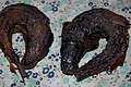 Asalee fish of Shankhuwa river, Shankhuwasabha, Nepal.jpg 2 256 × 1 496 ; 793 kio
-
 Barun River between Yangle Kharka and Mumbuk. - panoramio.jpg 1 800 × 1 200 ; 1,01 Mio
-
 BARUN trekking, pass 4475m, GPS are accurate. - panoramio.jpg 1 936 × 1 296 ; 973 kio
-
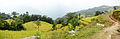
 Beautiful landscape of Tehrathum.jpg 1 080 × 891 ; 63 kio
-
 Bridge and Panton through Arun river. - panoramio.jpg 1 800 × 1 200 ; 997 kio
-
 Bridge over a creek in the Arun valley. - panoramio.jpg 1 936 × 1 296 ; 1,02 Mio
-
 Camp at 4610m. - panoramio.jpg 1 936 × 1 296 ; 1,14 Mio
-
 Camp under a rock. Morning, the 20th day of Barun trekking. GPS exactly. - panoramio.jpg 1 936 × 1 296 ; 996 kio
-
 Camp, GPS. - panoramio.jpg 1 936 × 1 296 ; 1,12 Mio
-
 Chauki NS1.jpg 3 696 × 2 448 ; 3,32 Mio
-
 Chauki NS2.jpg 3 696 × 2 448 ; 2,45 Mio
-
 Chauki NS3.jpg 3 696 × 2 448 ; 3,2 Mio
-
 Chauki NS5.jpg 4 928 × 3 264 ; 5,58 Mio
-
 Children playing with local knife (Khukuri) of Pelumma village.jpg 2 736 × 3 648 ; 1,85 Mio
-
 Descent along the rocky couloir. - panoramio.jpg 1 936 × 1 296 ; 939 kio
-
 Descent into the valley. - panoramio.jpg 1 936 × 1 296 ; 1,15 Mio
-
 Descent to the lake from the pass. This is a comfortable place to camp and rest. - panoramio.jpg 1 936 × 1 296 ; 1,05 Mio
-
 Duphli Kharka. GPS. - panoramio.jpg 1 936 × 1 296 ; 1,08 Mio
-
 Evening in Num. Arun valley towards Hatiya. - panoramio.jpg 1 936 × 1 296 ; 676 kio
-
 Evening in the mountains and the end of the 10th day of the hike. - panoramio.jpg 1 936 × 1 296 ; 1,02 Mio
-
 Fourth watershed. Barun trekking for the people. GPS exactly. - panoramio.jpg 1 800 × 1 200 ; 854 kio
-
 GPS coordinates are exact. - panoramio.jpg 1 936 × 1 296 ; 1,04 Mio
-
 Guphapokhari waking up!.jpg 5 995 × 3 235 ; 4,12 Mio
-
 Guphapokhari, Sankhuwasabha.jpg 6 000 × 4 000 ; 1 019 kio
-
 Guphapokhari.jpg 1 600 × 1 200 ; 934 kio
-
 House near the road in the valley of the Arun river. - panoramio.jpg 1 936 × 1 296 ; 1,14 Mio
-
 Houses at the passages. From here begins the ascent at 720 m in Num. - panoramio.jpg 1 936 × 1 296 ; 1 Mio
-
 Houses in Arun River valley near the Num. - panoramio.jpg 1 936 × 1 296 ; 1,03 Mio
-
 How much is this corner of paradise^ Pathibhara, Nepal. - panoramio.jpg 1 936 × 1 296 ; 1,3 Mio
-
 Humble home near the road. - panoramio.jpg 1 936 × 1 296 ; 1,03 Mio
-
 Humid forest in the valley Saldim Khola. - panoramio.jpg 1 800 × 1 200 ; 831 kio
-
 Hydraena (s.str.) arunensis Skale & Jäch, 2008 (3643666133).jpg 2 529 × 1 969 ; 598 kio
-
 In summer this place was used for pasture of yaks. - panoramio.jpg 1 936 × 1 296 ; 1 023 kio
-
 In this place located several houses. - panoramio.jpg 1 936 × 1 296 ; 1,09 Mio
-
 In this place the trail descends to the river Isuwa Khola. GPS exact coordinates. - panoramio.jpg 1 936 × 1 296 ; 1,07 Mio
-
 It is impossible to look away from the sunrise in the mountains. - panoramio (1).jpg 1 936 × 1 291 ; 1,25 Mio
-
 It is impossible to look away from the sunrise in the mountains. - panoramio.jpg 1 936 × 1 291 ; 1,27 Mio
-
 Jalapadevi prathamik bidyalaya.jpg 3 584 × 2 016 ; 2,02 Mio
-
 Kadum La pass 5070m. View to the side descent. GPS exact coordinates. - panoramio.jpg 1 936 × 1 296 ; 1,02 Mio
-
 Kirat King ( Yalamber ) Sankhuwasabha, Nepal.jpg 1 860 × 1 944 ; 276 kio
-
 Lama village, Sitalpati VDC.jpg 2 464 × 1 632 ; 2,34 Mio
-
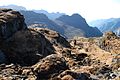
 Landscape at an altitude of 4500m. Weakly visible trail leads to the pass. - panoramio.jpg 1 936 × 1 296 ; 1,03 Mio
-
 Landscape between the first and second pass. - panoramio.jpg 1 936 × 1 296 ; 1,09 Mio
-
 Landscape of the valley Barun River. - panoramio.jpg 1 936 × 1 296 ; 1,05 Mio
-
 Lasiocampidae. Trabala sp. - Flickr - gailhampshire.jpg 650 × 577 ; 203 kio
-
 Last meters ascent to the pass. - panoramio.jpg 1 936 × 1 296 ; 1,17 Mio
-
 Makalu best seen at sunrise. - panoramio.jpg 1 936 × 1 291 ; 980 kio
-
 Moment After the Sunset.jpg 3 264 × 2 448 ; 1,61 Mio
-
 Morning in Yangle Kharka, 3660m, BARUN trekking 2013. - panoramio.jpg 1 936 × 1 291 ; 1,03 Mio
-
 Mumbuk and Shipton La are located on the opposite slope Barun Khola. - panoramio.jpg 1 800 × 1 200 ; 1,09 Mio
-

-
 NepalSankhuwasabhaDistrictmap.png 2 479 × 3 508 ; 286 kio
-
 Num in October 2013. The end of the Barun trekking. - panoramio.jpg 1 936 × 1 296 ; 1,16 Mio
-
 On the pass from valley Isuwa Khola to the Yangle Kharka. 4610m, GPS exact coordinates. - panoramio.jpg 1 936 × 1 296 ; 1 005 kio
-
 Pathivara Devi Bhagawati Temple.jpg 2 610 × 4 640 ; 5,65 Mio
-
 Pathivara devi Temple.jpg 2 610 × 4 640 ; 6,2 Mio
-
 Pathivara devi.jpg 2 610 × 2 610 ; 3,67 Mio
-
 Peepla NP.jpg 2 592 × 1 456 ; 1,6 Mio
-
 Rice paddies on a steep slope. Barun river valley. - panoramio.jpg 1 936 × 1 296 ; 1,15 Mio
-
 Sabhapokhari NS1.jpg 3 696 × 2 448 ; 4,71 Mio
-
 Sabhapokhari NS2.jpg 3 696 × 2 448 ; 4,37 Mio
-
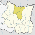
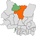
 Sankhuwasabha district location.png 800 × 550 ; 30 kio
-
 Sankhuwasabha, Nepal - panoramio (1).jpg 1 936 × 1 296 ; 1,08 Mio
-
 Sankhuwasabha, Nepal - panoramio (10).jpg 1 936 × 1 296 ; 862 kio
-
 Sankhuwasabha, Nepal - panoramio (11).jpg 1 936 × 1 296 ; 1,03 Mio
-
 Sankhuwasabha, Nepal - panoramio (12).jpg 1 936 × 1 296 ; 1,04 Mio
-
 Sankhuwasabha, Nepal - panoramio (13).jpg 1 936 × 1 296 ; 1,11 Mio
-
 Sankhuwasabha, Nepal - panoramio (14).jpg 1 936 × 1 296 ; 1 Mio
-
 Sankhuwasabha, Nepal - panoramio (15).jpg 1 936 × 1 296 ; 966 kio
-
 Sankhuwasabha, Nepal - panoramio (16).jpg 1 936 × 1 296 ; 1,03 Mio
-
 Sankhuwasabha, Nepal - panoramio (17).jpg 1 936 × 1 296 ; 1,04 Mio
-
 Sankhuwasabha, Nepal - panoramio (18).jpg 1 936 × 1 296 ; 1,17 Mio
-
 Sankhuwasabha, Nepal - panoramio (19).jpg 1 936 × 1 296 ; 1,29 Mio
-
 Sankhuwasabha, Nepal - panoramio (2).jpg 1 936 × 1 291 ; 1 021 kio
-
 Sankhuwasabha, Nepal - panoramio (20).jpg 1 936 × 1 296 ; 1,12 Mio
-
 Sankhuwasabha, Nepal - panoramio (21).jpg 1 936 × 1 296 ; 1,12 Mio
-
 Sankhuwasabha, Nepal - panoramio (22).jpg 1 936 × 1 296 ; 947 kio
-
 Sankhuwasabha, Nepal - panoramio (24).jpg 1 936 × 1 291 ; 1,12 Mio
-
 Sankhuwasabha, Nepal - panoramio (25).jpg 1 936 × 1 296 ; 1,05 Mio
-
 Sankhuwasabha, Nepal - panoramio (26).jpg 1 936 × 1 296 ; 990 kio
-
 Sankhuwasabha, Nepal - panoramio (27).jpg 1 936 × 1 296 ; 1 003 kio
-
 Sankhuwasabha, Nepal - panoramio (28).jpg 1 936 × 1 296 ; 1,16 Mio
-
 Sankhuwasabha, Nepal - panoramio (29).jpg 1 936 × 1 296 ; 1,15 Mio
-
 Sankhuwasabha, Nepal - panoramio (3).jpg 1 936 × 1 296 ; 1,15 Mio
-
 Sankhuwasabha, Nepal - panoramio (30).jpg 1 936 × 1 291 ; 857 kio
-
 Sankhuwasabha, Nepal - panoramio (31).jpg 1 936 × 1 296 ; 965 kio
-
 Sankhuwasabha, Nepal - panoramio (32).jpg 1 936 × 1 296 ; 989 kio
-
 Sankhuwasabha, Nepal - panoramio (33).jpg 1 936 × 1 296 ; 1,01 Mio
-
 Sankhuwasabha, Nepal - panoramio (34).jpg 1 936 × 1 296 ; 1 Mio
-
 Sankhuwasabha, Nepal - panoramio (35).jpg 1 800 × 1 200 ; 886 kio
-
 Sankhuwasabha, Nepal - panoramio (4).jpg 1 936 × 1 291 ; 1,17 Mio
-
 Sankhuwasabha, Nepal - panoramio (5).jpg 1 936 × 1 291 ; 1,02 Mio
-
 Sankhuwasabha, Nepal - panoramio (6).jpg 1 936 × 1 291 ; 1,08 Mio
-
 Sankhuwasabha, Nepal - panoramio (7).jpg 1 936 × 1 296 ; 986 kio
-
 Sankhuwasabha, Nepal - panoramio (8).jpg 1 936 × 1 296 ; 1,03 Mio
-
 Sankhuwasabha, Nepal - panoramio (9).jpg 1 936 × 1 296 ; 1 018 kio
-
 Sankhuwasabha, Nepal - panoramio.jpg 1 936 × 1 296 ; 1 021 kio
-
Sankhuwasabha.ogg 1,8 s ; 95 kio
-
 Sankuwasabha1PratinidhiSabha.svg 2 657 × 2 608 ; 356 kio
-
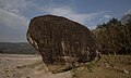 Sati Dhunga (Stone) Tumlingtar Arun River Khadbari Sankhuwasabha Nepal Rajesh Dhungana (1).jpg 4 286 × 2 568 ; 2,88 Mio
-
 Sati Dhunga (Stone) Tumlingtar Arun River Khadbari Sankhuwasabha Nepal Rajesh Dhungana (2).jpg 4 288 × 2 848 ; 4,23 Mio
-
 Sati Dhunga (Stone) Tumlingtar Arun River Khadbari Sankhuwasabha Nepal Rajesh Dhungana (3).jpg 3 865 × 2 326 ; 3,12 Mio
-
 Slopes of the valley Isuwa Khola. - panoramio.jpg 1 936 × 1 296 ; 1,02 Mio
-
 Stone tours help choose the direction of motion. - panoramio.jpg 1 936 × 1 296 ; 953 kio
-
 Suj (20).jpg 4 896 × 3 037 ; 5,39 Mio
-
 Summer pastures in the valley Saldim Khola. Barun Trekking, 20th day of the hike. - panoramio.jpg 1 936 × 1 296 ; 1,16 Mio
-
 Tamku 56900, Nepal - panoramio.jpg 1 936 × 1 296 ; 946 kio
-
 Thakuri village near Khartuwa 2013.jpg 4 187 × 1 365 ; 3,45 Mio
-
 The beginning of descent from the pass. - panoramio.jpg 1 936 × 1 291 ; 1 Mio
-
 The beginning of the descent into the valley Isuwa Khola from the watershed. - panoramio.jpg 1 936 × 1 296 ; 1,04 Mio
-
 The beginning of the descent to the river Saldim Khola. - panoramio.jpg 1 936 × 1 296 ; 870 kio
-
 The descent down the valley Saldim Khola. - panoramio.jpg 1 936 × 1 296 ; 1 021 kio
-
 The easiest way passes on these stones. - panoramio.jpg 1 936 × 1 291 ; 779 kio
-
 The first pass in the river valley. GPS 4522m. - panoramio.jpg 1 936 × 1 296 ; 906 kio
-

-
 The road along the shore Arun River. - panoramio.jpg 1 936 × 1 296 ; 1,18 Mio
-
 The road to Num along the valley Arun river. - panoramio.jpg 1 936 × 1 296 ; 1,07 Mio
-
 The second pass in the valley ...GPS 4395m. - panoramio.jpg 1 936 × 1 296 ; 1,11 Mio
-
 The second pass. 20th day of the trek. Barun trekking for the people. - panoramio.jpg 1 936 × 1 296 ; 1 020 kio
-
 The slopes of the valley Isuwa Khola. - panoramio.jpg 1 936 × 1 296 ; 1,27 Mio
-
 The slopes of the valley Saldim Khola. - panoramio.jpg 1 800 × 1 200 ; 994 kio
-
 The stream on the slope Saldim Khola. Barun trekking. - panoramio.jpg 1 936 × 1 296 ; 895 kio
-
 The third watershed. Barun trekking, 20th day of the hike. GPS exactly. - panoramio.jpg 1 936 × 1 296 ; 778 kio
-
 The trail leads to the upper reaches of the valley Isuwa Khola. - panoramio.jpg 1 936 × 1 296 ; 1 020 kio
-
 The upper reaches of the creek valley that flows in Barun Khola. - panoramio.jpg 1 800 × 1 200 ; 1,01 Mio
-

-
 The valley of the Sankhuwa Khola abruptly goes down. - panoramio.jpg 1 936 × 1 296 ; 906 kio
-
 The Village Simma. - panoramio.jpg 1 936 × 1 296 ; 1,15 Mio
-
 There are no trail in the valley Saldim Khola. - panoramio.jpg 1 936 × 1 296 ; 1,05 Mio
-
 Third local pass in the valley ... GPS 4411m. - panoramio.jpg 1 936 × 1 296 ; 1,17 Mio
-
 This is a very good place for camp. GPS places are accurate. - panoramio.jpg 1 936 × 1 296 ; 1,03 Mio
-
 This is Arun river valley. View towards Hatiya. - panoramio.jpg 1 936 × 1 296 ; 993 kio
-
 This is the crossing to the left bank Saldim Khola. Barun trekking. GPS exactly. - panoramio.jpg 1 936 × 1 291 ; 1,01 Mio
-

-

-
 This route traverses slope from lake to the third pass. - panoramio.jpg 1 936 × 1 296 ; 994 kio
-
 This small lake is situated almost at the pass. - panoramio.jpg 1 936 × 1 296 ; 1,09 Mio
-
 This trail leads to the pass. The dense mixed forest, Makalu Barun National Park. - panoramio.jpg 1 936 × 1 296 ; 1,12 Mio
-
 This valley was occupied by a glacier which has receded. - panoramio.jpg 1 936 × 1 296 ; 921 kio
-
 Tumlintar.jpg 720 × 576 ; 232 kio
-
 Two of the plan. GPS coordinates are exact. 4563m. - panoramio.jpg 1 936 × 1 296 ; 1 Mio
-
 Upper reaches of the valley Isuwa Khola.. - panoramio.jpg 1 936 × 1 296 ; 1,03 Mio
-

-
 Valley Barun River below Yangle Kharka. - panoramio.jpg 1 936 × 1 296 ; 1 Mio
-
 Valley Barun river downstream. 19th day of the hike. - panoramio.jpg 1 800 × 1 200 ; 1 016 kio
-
 Valley Isuwa Khola on the boundary of the forest. - panoramio.jpg 1 936 × 1 291 ; 1,08 Mio
-
 Very rare plant. Our guides explained it to us. - panoramio.jpg 1 936 × 1 296 ; 1,01 Mio
-
 View back at the lake. Barun trekking for the people. - panoramio.jpg 1 936 × 1 296 ; 1,06 Mio
-
 View back on the fourth pass. - panoramio.jpg 1 936 × 1 296 ; 1 003 kio
-
 View from the pass in the direction of the valley Apsua Khola. - panoramio.jpg 1 936 × 1 296 ; 1,2 Mio
-
 View in the direction of descent. - panoramio.jpg 1 936 × 1 296 ; 1,01 Mio
-
 View of the fourth watershed. - panoramio.jpg 1 936 × 1 291 ; 792 kio
-
 View of the village GOLA. - panoramio.jpg 1 936 × 1 296 ; 983 kio
-
 View on Num from the opposite shore Arun river. - panoramio.jpg 1 936 × 1 291 ; 894 kio
-
 View to the pass Kadum La after descending. - panoramio.jpg 1 936 × 1 296 ; 943 kio
-
 View to the second pass on the way from Yangle Kharka to Hatiya. - panoramio.jpg 1 936 × 1 296 ; 1,05 Mio
-
 Waterfall of Khartuwa,Sankhuwasabha,Nepal.JPG 3 000 × 4 000 ; 3,76 Mio
-
 Watershed between the tributaries the river. - panoramio.jpg 1 936 × 1 291 ; 1,03 Mio
-
 Watershed between the valleys. GPS. - panoramio.jpg 1 936 × 1 296 ; 1,15 Mio
-
 Yamphu Rai Gelang Silli Dance In Sankhuwasabha.jpg 720 × 540 ; 191 kio
-
 Yangle Kharka in October 2013. - panoramio.jpg 1 936 × 1 296 ; 934 kio
-
 Yaphu 56900, Nepal - panoramio (1).jpg 1 936 × 1 296 ; 903 kio
-
 Yaphu 56900, Nepal - panoramio (10).jpg 1 936 × 1 296 ; 791 kio
-
 Yaphu 56900, Nepal - panoramio (11).jpg 1 936 × 1 296 ; 1,18 Mio
-
 Yaphu 56900, Nepal - panoramio (12).jpg 1 936 × 1 296 ; 1,18 Mio
-
 Yaphu 56900, Nepal - panoramio (15).jpg 1 936 × 1 296 ; 1 009 kio
-
 Yaphu 56900, Nepal - panoramio (2).jpg 1 936 × 1 296 ; 1,03 Mio
-
 Yaphu 56900, Nepal - panoramio (3).jpg 1 936 × 1 296 ; 956 kio
-
 Yaphu 56900, Nepal - panoramio (4).jpg 1 936 × 1 296 ; 1,04 Mio
-
 Yaphu 56900, Nepal - panoramio (5).jpg 1 936 × 1 296 ; 1,04 Mio
-
 Yaphu 56900, Nepal - panoramio (6).jpg 1 936 × 1 296 ; 1,04 Mio
-
 Yaphu 56900, Nepal - panoramio (7).jpg 1 936 × 1 296 ; 976 kio
-
 Yaphu 56900, Nepal - panoramio (8).jpg 1 936 × 1 296 ; 1,28 Mio
-
 Yaphu 56900, Nepal - panoramio (9).jpg 1 936 × 1 296 ; 1,14 Mio
-
 Yaphu 56900, Nepal - panoramio.jpg 1 936 × 1 296 ; 1,02 Mio


_of_Pelumma_village.jpg)


_arunensis_Skale_%26_J%C3%A4ch,_2008_(3643666133).jpg)


.jpg)


_Sankhuwasabha,_Nepal.jpg)


.jpg)
.jpg)
.jpg)
.jpg)
.jpg)
.jpg)
.jpg)
.jpg)
.jpg)
.jpg)
.jpg)
.jpg)
.jpg)
.jpg)
.jpg)
.jpg)
.jpg)
.jpg)
.jpg)
.jpg)
.jpg)
.jpg)
.jpg)
.jpg)
.jpg)
.jpg)
.jpg)
.jpg)
.jpg)
.jpg)
.jpg)
.jpg)
.jpg)
.jpg)


_Tumlingtar_Arun_River_Khadbari_Sankhuwasabha_Nepal_Rajesh_Dhungana_(1).jpg)
_Tumlingtar_Arun_River_Khadbari_Sankhuwasabha_Nepal_Rajesh_Dhungana_(2).jpg)
_Tumlingtar_Arun_River_Khadbari_Sankhuwasabha_Nepal_Rajesh_Dhungana_(3).jpg)


.jpg)


.jpg)
.jpg)
.jpg)
.jpg)
.jpg)
.jpg)
.jpg)
.jpg)
.jpg)
.jpg)
.jpg)
.jpg)
.jpg)
