Category:Sapcote
Aller à la navigation
Aller à la recherche
English: Sapcote is a small village in the south west of Leicestershire, England, with a population of approximately 2,700. The well-known inland scuba diving site Stoney Cove is nearby.
localité britannique du comté anglais de Leicestershire  | |||||
| Téléverser des médias | |||||
| Nature de l’élément | |||||
|---|---|---|---|---|---|
| Lieu | Blaby, Leicestershire, Midlands de l'Est, Angleterre | ||||
| Réputé identique à | Sapcote (page en doublon, paroisse civile) | ||||
 | |||||
Sous-catégories
Cette catégorie comprend 2 sous-catégories, dont les 2 ci-dessous.
S
- All Saints church, Sapcote (4 F)
- Stoney Cove dive centre (25 F)
Média dans la catégorie « Sapcote »
Cette catégorie comprend 132 fichiers, dont les 132 ci-dessous.
-
 A new orchard - geograph.org.uk - 5570641.jpg 1 600 × 900 ; 485 kio
-
 All Saints church - geograph.org.uk - 5524538.jpg 4 000 × 3 000 ; 2,1 Mio
-
 All Saints' church - geograph.org.uk - 2281634.jpg 640 × 427 ; 73 kio
-

-
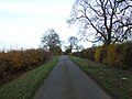
 B4114 Coventry Road towards Sharnford - geograph.org.uk - 4329467.jpg 1 600 × 1 121 ; 549 kio
-
 Bluebells in Freeholt Wood - geograph.org.uk - 1936142.jpg 2 359 × 2 692 ; 2,62 Mio
-
 Bridleway to Sutton Lodge - geograph.org.uk - 5247928.jpg 800 × 647 ; 188 kio
-
 Church Street, Sapcote - geograph.org.uk - 285076.jpg 640 × 480 ; 77 kio
-
 Close up, Elizabeth II postbox on Hinckley Road, Sapcote - geograph.org.uk - 5295490.jpg 1 457 × 2 430 ; 646 kio
-
 Co-operative food store, Sapcote - geograph.org.uk - 5294495.jpg 640 × 414 ; 48 kio
-
 Construction along Grace Road in Sapcote - geograph.org.uk - 4010665.jpg 1 600 × 1 274 ; 464 kio
-
 Construction off Grace Road in Sapcote - geograph.org.uk - 4010674.jpg 1 600 × 1 200 ; 571 kio
-
 Cows grazing near Sapcote - geograph.org.uk - 940421.jpg 640 × 479 ; 91 kio
-
 Croft Quarry on the edge of Narborough - geograph.org.uk - 3558934.jpg 3 264 × 2 448 ; 3,8 Mio
-
 Crossroads on the Fosse Way - geograph.org.uk - 3349773.jpg 640 × 478 ; 65 kio
-
 Elizabeth II postbox on Hinckley Road, Sapcote - geograph.org.uk - 5295488.jpg 2 127 × 2 313 ; 1,06 Mio
-
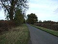
 Entering Hinckley Road (B4669) - geograph.org.uk - 5294493.jpg 640 × 480 ; 71 kio
-
 Entrance to Sapcote Garden Centre - geograph.org.uk - 940409.jpg 640 × 394 ; 65 kio
-
 Farm entrance off Hinckley Road - geograph.org.uk - 5812136.jpg 1 600 × 900 ; 295 kio
-
 Farmland near Sapcote - geograph.org.uk - 4010972.jpg 1 600 × 1 112 ; 348 kio
-
 Field entrance off Fosse Way Roman Road - geograph.org.uk - 5222993.jpg 640 × 480 ; 119 kio
-
 Field entrance off Fosse Way Roman Road - geograph.org.uk - 5223005.jpg 640 × 480 ; 89 kio
-
 Field of corn - geograph.org.uk - 5474139.jpg 480 × 640 ; 57 kio
-
 Field of rape - geograph.org.uk - 5474142.jpg 640 × 480 ; 75 kio
-
 Field of wheat - geograph.org.uk - 5474140.jpg 480 × 640 ; 69 kio
-
 Field view - geograph.org.uk - 5474144.jpg 480 × 640 ; 65 kio
-
 Fields near the River Soar - geograph.org.uk - 5222994.jpg 640 × 480 ; 59 kio
-
 Fields south of Hinckley Road - geograph.org.uk - 4812393.jpg 640 × 580 ; 117 kio
-

-
 Footpath from Hinckley Road to Aston Lane - geograph.org.uk - 5135237.jpg 401 × 518 ; 17 kio
-
 Footpath off Hinckley Road - geograph.org.uk - 5474137.jpg 480 × 640 ; 49 kio
-
 Footpath through Freeholt Wood - geograph.org.uk - 5135234.jpg 449 × 600 ; 73 kio
-
 Footpath to Frolesworth - geograph.org.uk - 211147.jpg 640 × 480 ; 120 kio
-
 Footpath to Leire - geograph.org.uk - 211075.jpg 640 × 480 ; 119 kio
-
 Footpath to Red Hill Farm - geograph.org.uk - 5521532.jpg 4 000 × 3 000 ; 2,9 Mio
-
 Fosse Way - geograph.org.uk - 2280035.jpg 640 × 427 ; 84 kio
-
 Fosse Way - geograph.org.uk - 2280045.jpg 640 × 427 ; 81 kio
-
 Fosse Way - geograph.org.uk - 2280058.jpg 640 × 427 ; 110 kio
-
 Fosse Way - geograph.org.uk - 2280067.jpg 640 × 427 ; 104 kio
-
 Fosse Way north-eastwards - geograph.org.uk - 3349776.jpg 640 × 436 ; 65 kio
-
 Fosse Way north-eastwards on a frosty day - geograph.org.uk - 3349774.jpg 640 × 482 ; 56 kio
-
 Fosse Way passes footpath to Sharnford - geograph.org.uk - 3349777.jpg 640 × 492 ; 69 kio
-
 Fosse Way Roman Road - geograph.org.uk - 5222989.jpg 640 × 480 ; 82 kio
-
 Fosse Way Roman Road - geograph.org.uk - 5223006.jpg 640 × 480 ; 80 kio
-
 Fosse Way south-westwards - geograph.org.uk - 3349778.jpg 640 × 484 ; 61 kio
-
 Fosse Way-former Coventry Road junction - geograph.org.uk - 3349781.jpg 640 × 455 ; 59 kio
-
 Frosty footpath to Sharnford - geograph.org.uk - 3349779.jpg 640 × 578 ; 98 kio
-
 Grace Road - geograph.org.uk - 5295108.jpg 640 × 480 ; 50 kio
-
 Grace Road in Sapcote - geograph.org.uk - 4010482.jpg 1 600 × 1 221 ; 406 kio
-
 Grace Road towards Stoney Stanton - geograph.org.uk - 5248156.jpg 800 × 457 ; 90 kio
-
 Grace Road, Sapcote - geograph.org.uk - 284943.jpg 640 × 480 ; 74 kio
-
 Grassland near Fosse Farm - geograph.org.uk - 5223000.jpg 640 × 480 ; 49 kio
-
 Grazing on the edge of Sapcote - geograph.org.uk - 5294492.jpg 640 × 480 ; 50 kio
-
 Heading south along the Fosse Way - geograph.org.uk - 5247956.jpg 800 × 719 ; 136 kio
-
 Heading south along the Fosse Way - geograph.org.uk - 5247970.jpg 800 × 561 ; 122 kio
-
 Hinckley Road (B4669) - geograph.org.uk - 5294482.jpg 640 × 480 ; 50 kio
-
 Hinckley Road - geograph.org.uk - 5474141.jpg 640 × 480 ; 53 kio
-
 Hinckley Road towards Hinckley - geograph.org.uk - 4812394.jpg 640 × 416 ; 78 kio
-
 Hinckley Road towards Stoney Stanton - geograph.org.uk - 4812395.jpg 640 × 374 ; 62 kio
-
 Hinckley Road, Sapcote - geograph.org.uk - 5295492.jpg 2 848 × 2 136 ; 1,35 Mio
-
 Houses in Sapcote - geograph.org.uk - 5760869.jpg 1 600 × 900 ; 386 kio
-
 Houses on Grace Road, Sapcote - geograph.org.uk - 5295107.jpg 640 × 480 ; 69 kio
-
 Junction 2 bridges, M69 motorway - geograph.org.uk - 3589508.jpg 640 × 480 ; 55 kio
-
 Lane near Sharnford Leicestershire - geograph.org.uk - 1265884.jpg 640 × 480 ; 104 kio
-
 Large lay by on Coventry Road - geograph.org.uk - 867440.jpg 640 × 437 ; 86 kio
-
 Lay-by portable toilet on Coventry Road, Sapcote, Leicestershire.jpg 640 × 480 ; 109 kio
-
 Looking north east on Fosse Way Roman Road - geograph.org.uk - 5222991.jpg 640 × 480 ; 106 kio
-
 Looking north east on Fosse Way Roman Road - geograph.org.uk - 5222996.jpg 640 × 480 ; 115 kio
-
 Looking towards Red Hill Farm - geograph.org.uk - 2654817.jpg 800 × 600 ; 187 kio
-
 Looking towards Red Hill Farm - geograph.org.uk - 2654820.jpg 800 × 600 ; 202 kio
-
 M69 approaching junction 2 - geograph.org.uk - 4589833.jpg 2 185 × 1 449 ; 916 kio
-
 M69 motorway - footbridge near Red Hill farm - geograph.org.uk - 3589503.jpg 640 × 480 ; 57 kio
-
 M69 motorway at junction 2 - geograph.org.uk - 3589506.jpg 640 × 480 ; 53 kio
-
 Milepost in Sapcote - geograph.org.uk - 285764.jpg 480 × 640 ; 96 kio
-
 Milepost on Leicester Road, Sapcote - geograph.org.uk - 5295104.jpg 480 × 640 ; 86 kio
-
 Moss Cottage on Sharnford Road, Sapcote - geograph.org.uk - 4010695.jpg 1 600 × 1 399 ; 665 kio
-
 Netherfield Drive in Sapcote - geograph.org.uk - 6418103.jpg 800 × 418 ; 51 kio
-
 Neville Smith Close - geograph.org.uk - 3569002.jpg 640 × 480 ; 60 kio
-
 New housing estate at Sapcote Lea - geograph.org.uk - 5248133.jpg 800 × 484 ; 84 kio
-
 New housing estate at Sapcote Lea - geograph.org.uk - 5248143.jpg 800 × 600 ; 118 kio
-
 New housing, Sapcote - geograph.org.uk - 5294489.jpg 640 × 419 ; 90 kio
-
 Park in Sapcote - geograph.org.uk - 5760871.jpg 1 600 × 900 ; 240 kio
-
 Path through Freeholt Wood - geograph.org.uk - 1936123.jpg 2 373 × 2 665 ; 2,81 Mio
-
 Pougher Close, Sapcote - geograph.org.uk - 3569013.jpg 640 × 480 ; 51 kio
-
 Public Bridleway to Sapcote - geograph.org.uk - 511402.jpg 640 × 495 ; 172 kio
-
 Pylon and Averley House Farm - geograph.org.uk - 5806153.jpg 1 024 × 768 ; 154 kio
-
 River Soar near Stoney Bridge - geograph.org.uk - 5247952.jpg 800 × 600 ; 210 kio
-
 Roadway to Red Hill Farm - geograph.org.uk - 5846650.jpg 1 024 × 768 ; 158 kio
-
 Santas at Sapcote - geograph.org.uk - 285044.jpg 640 × 480 ; 91 kio
-
 Sapcote - geograph.org.uk - 284934.jpg 640 × 480 ; 73 kio
-
 Sapcote Club - geograph.org.uk - 3227704.jpg 640 × 480 ; 54 kio
-
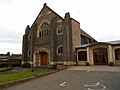 Sapcote Methodist Church - geograph.org.uk - 3218004.jpg 640 × 480 ; 53 kio
-
 Sapcote Methodist Church - geograph.org.uk - 5294533.jpg 640 × 480 ; 48 kio
-
 Sapcote Road, Sapcote - geograph.org.uk - 511483.jpg 640 × 448 ; 109 kio
-
 Sapcote-Calver Hill Cottages - geograph.org.uk - 3227694.jpg 640 × 480 ; 53 kio
-
 Sapcote-The Old Schoolhouse - geograph.org.uk - 3218016.jpg 640 × 491 ; 66 kio
-
 Sharnford Road entering the village of Sapcote - geograph.org.uk - 4010707.jpg 1 600 × 1 188 ; 486 kio
-
 Sharnford Road in Sapcote - geograph.org.uk - 5248114.jpg 800 × 563 ; 86 kio
-
 Sheep in a field near Sapcote - geograph.org.uk - 5248096.jpg 800 × 667 ; 149 kio
-
 Small humpback bridge near Sharnford - geograph.org.uk - 1265883.jpg 640 × 480 ; 57 kio
-
 Stile on Hinckley Road - geograph.org.uk - 5806157.jpg 1 024 × 768 ; 261 kio
-
 Stoney Bridge - geograph.org.uk - 2280566.jpg 640 × 427 ; 97 kio
-
 Stoney Bridge - geograph.org.uk - 3349780.jpg 640 × 466 ; 62 kio
-
 Stoney Bridge crossing the River Soar (geograph 5247946).jpg 800 × 717 ; 260 kio
-
 The B4114 Coventry Road towards Leicester - geograph.org.uk - 618591.jpg 485 × 640 ; 60 kio
-
 The M69 at Junction 2 - geograph.org.uk - 3793676.jpg 1 200 × 900 ; 269 kio
-
 The M69 north east of junction 2 - geograph.org.uk - 5135235.jpg 640 × 480 ; 27 kio
-
 The Red Lion, Sapcote - geograph.org.uk - 285070.jpg 480 × 640 ; 71 kio
-
 The River Soar beneath Stoney Bridge - geograph.org.uk - 2582504.jpg 4 000 × 3 000 ; 2,87 Mio
-
 The River Soar near Sharnford - geograph.org.uk - 5222986.jpg 480 × 640 ; 122 kio
-
 The River Soar, Stoney Bridge - geograph.org.uk - 5223009.jpg 640 × 480 ; 115 kio
-
 The road to Sapcote - geograph.org.uk - 5760868.jpg 1 600 × 900 ; 260 kio
-
 Track to Fosse Farm - geograph.org.uk - 5223002.jpg 640 × 480 ; 68 kio
-
 View towards Sapcote - geograph.org.uk - 940415.jpg 640 × 453 ; 81 kio
-
 View towards the Low Spinney Wind Farm - geograph.org.uk - 4010981.jpg 1 600 × 1 289 ; 347 kio
-
 Wheat field and large circular shed - geograph.org.uk - 5846661.jpg 1 024 × 768 ; 179 kio
-
 Young crop field and hedgerow - geograph.org.uk - 5294479.jpg 640 × 480 ; 50 kio
-
 Farm entrance - geograph.org.uk - 362141.jpg 640 × 480 ; 78 kio
-
 Farmland west of Sapcote - geograph.org.uk - 284955.jpg 480 × 640 ; 121 kio
-

-
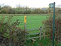
 Footpath crossing - geograph.org.uk - 415119.jpg 640 × 480 ; 68 kio
-
 Footpath over the M69 nr. Hinckley exit J2 - geograph.org.uk - 407692.jpg 640 × 480 ; 102 kio
-
 Footpath to Sharnford - geograph.org.uk - 284926.jpg 640 × 480 ; 111 kio
-
 Frolesworth view - geograph.org.uk - 363710.jpg 640 × 480 ; 95 kio
-
 Gateway to Lodge Farm - geograph.org.uk - 211080.jpg 640 × 480 ; 72 kio
-
 Junction with the B4114 - geograph.org.uk - 618587.jpg 640 × 383 ; 49 kio
-
 Lay-by along the B4114 Coventry Road - geograph.org.uk - 618595.jpg 640 × 382 ; 68 kio
-
 M69 nr. Hinckley - geograph.org.uk - 377324.jpg 640 × 480 ; 119 kio
-
 Stanton Lane, Sapcote - geograph.org.uk - 285776.jpg 640 × 480 ; 101 kio
-
 The B4114 Coventry Road towards Leicester - geograph.org.uk - 618594.jpg 640 × 608 ; 109 kio
-
 The Fosse Way meets Coventry Road - geograph.org.uk - 616184.jpg 640 × 424 ; 66 kio
-
 The Old School, Sapcote - geograph.org.uk - 285083.jpg 640 × 480 ; 100 kio


_-_geograph.org.uk_-_5294493.jpg)


_-_geograph.org.uk_-_5294482.jpg)


.jpg)


