Category:Sativanorte
Vai alla navigazione
Vai alla ricerca
comune colombiano del dipartimento di Boyacá  .svg)  | |||||
| Carica un file multimediale | |||||
| Istanza di | |||||
|---|---|---|---|---|---|
| Luogo |
| ||||
| Lingua dell'opera o del nome |
| ||||
| Data di fondazione o creazione |
| ||||
| Popolazione |
| ||||
| Superficie |
| ||||
| Altezza sul mare |
| ||||
| sito web ufficiale | |||||
 | |||||
Sottocategorie
Questa categoria contiene le 2 sottocategorie indicate di seguito, su un totale di 2.
I
M
- Maps of Sativanorte (3 F)
File nella categoria "Sativanorte"
Questa categoria contiene 22 file, indicati di seguito, su un totale di 22.
-
 Boyacá123municipios etiquetas.svg 1 488 × 1 052; 874 KB
-
 Casa Cural de Sativa.JPG 3 264 × 2 448; 1,67 MB
-
 Casa de Sativanorte.JPG 2 448 × 3 264; 1,97 MB
-
 Casa de Senen Arenas.JPG 3 264 × 2 448; 1,65 MB
-
 Colegio Sagrado Corazon de Sativa.JPG 3 264 × 2 448; 1,64 MB
-
 Concha acustica de Sativanorte.JPG 3 264 × 2 448; 1,82 MB
-
 Don Carlos Miel.JPG 2 448 × 3 264; 1,56 MB
-
 Esquina de sativanorte 1.JPG 2 448 × 3 264; 1,73 MB
-
 Esquina Sativeña.JPG 3 264 × 2 448; 1,55 MB
-
 Flag of Sativanorte (Boyacá).svg 750 × 500; 2 KB
-
 Gato en Sativanorte.JPG 2 448 × 3 264; 2,14 MB
-
 Pajaritos en la calle.JPG 2 448 × 3 264; 1,72 MB
-
 Paraje Páramo de Guinas.JPG 4 608 × 3 456; 4,15 MB
-
 Parque de la fuente en Sativanorte.JPG 2 448 × 3 264; 2,04 MB
-
 Paso libertador por sativa.JPG 2 448 × 3 264; 2,38 MB
-
 Placa a las victimas de Sativanorte.JPG 2 448 × 3 264; 2,61 MB
-
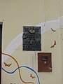 Placa al Doctor Arenas.JPG 2 448 × 3 264; 1,67 MB
-
 Ruinas de la Iglesia de Sativaviejo.JPG 3 264 × 2 448; 1,72 MB
-
 Ruinas de Sativaviejo.JPG 3 264 × 2 448; 2,41 MB
-
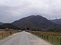 Ruta 55 Páramo de Guinas.JPG 4 608 × 3 456; 3,1 MB
-
 Sativanorte4.jpg 3 738 × 879; 473 KB
-
 Una calle en Sativanorte.JPG 3 264 × 2 448; 1,69 MB


