Category:Scamblesby
Aller à la navigation
Aller à la recherche
localité britannique du comté anglais de Lincolnshire  | |||||
| Téléverser des médias | |||||
| Nature de l’élément | |||||
|---|---|---|---|---|---|
| Lieu | East Lindsey, Lincolnshire, Midlands de l'Est, Angleterre | ||||
 | |||||
Sous-catégories
Cette catégorie comprend 2 sous-catégories, dont les 2 ci-dessous.
C
S
Média dans la catégorie « Scamblesby »
Cette catégorie comprend 194 fichiers, dont les 194 ci-dessous.
-
 "Millstones", a house on Old Main Road - geograph.org.uk - 3792592.jpg 640 × 427 ; 92 kio
-
 "The Lofts" near Scamblesby Thorpe - geograph.org.uk - 3792654.jpg 640 × 427 ; 48 kio
-

-

-
 A shrine to the Wolds sheep^ - geograph.org.uk - 3792892.jpg 640 × 427 ; 66 kio
-
 A153 at Scamblesby, aerial 2014 - geograph.org.uk - 3844311.jpg 640 × 427 ; 49 kio
-
 A153 road at Cawkwell Hill - geograph.org.uk - 3253835.jpg 2 256 × 1 504 ; 1,16 Mio
-
 Approaching Scamblesby - geograph.org.uk - 3090269.jpg 1 024 × 768 ; 236 kio
-
 Bluestone Heath Road - geograph.org.uk - 3817580.jpg 1 024 × 768 ; 202 kio
-
 Bluestone Heath Road above Scamblesby Thorpe - geograph.org.uk - 3884444.jpg 640 × 427 ; 63 kio
-
 Bridge over the beck in Chapel Lane - geograph.org.uk - 3792624.jpg 640 × 427 ; 59 kio
-
 Bridleway to Belchford - geograph.org.uk - 3091282.jpg 1 024 × 768 ; 222 kio
-
 Bridleway to Goulceby - geograph.org.uk - 3091291.jpg 1 024 × 768 ; 198 kio
-
 Cawkwell Hill - geograph.org.uk - 3884591.jpg 1 024 × 683 ; 242 kio
-
 Cawkwell Hill in the cold February of 2009 - geograph.org.uk - 3821859.jpg 640 × 427 ; 61 kio
-
 Cawkwell Hill in the cold February of 2009 - geograph.org.uk - 3821860.jpg 640 × 427 ; 60 kio
-
 Cawkwell Hill in the cold February of 2009 - geograph.org.uk - 3821869.jpg 640 × 427 ; 58 kio
-
 Cawkwell Hill in the cold February of 2009 - geograph.org.uk - 3821878.jpg 640 × 427 ; 50 kio
-
 Cawkwell Hill, aerial 2014 - geograph.org.uk - 3801114.jpg 640 × 427 ; 41 kio
-
 Chalk escarpment of the Lincolnshire Wolds - geograph.org.uk - 3792769.jpg 640 × 427 ; 50 kio
-
 Chapel Lane, Scamblesby - geograph.org.uk - 3090292.jpg 1 024 × 768 ; 140 kio
-
 Church Lane, light at the end of the tunnel - geograph.org.uk - 3792610.jpg 427 × 640 ; 59 kio
-
 Cottage on Mill Lane Scamblesby - geograph.org.uk - 3090103.jpg 1 024 × 768 ; 175 kio
-
 Crossing of the ways - geograph.org.uk - 4371863.jpg 2 000 × 1 333 ; 1 020 kio
-
 Crossroads on Bluestone Heath Road - geograph.org.uk - 3658470.jpg 2 256 × 1 504 ; 2,13 Mio
-

-
 Cultivation Terraces on Gaumer Hill - geograph.org.uk - 3792637.jpg 640 × 427 ; 52 kio
-
 Cultivation Terraces on Gaumer Hill - geograph.org.uk - 3792752.jpg 640 × 427 ; 67 kio
-
 Cultivation Terraces on Gaumer Hill - geograph.org.uk - 3792757.jpg 640 × 427 ; 77 kio
-
 Down the bridleway towards Cawkwell House - geograph.org.uk - 3884572.jpg 1 024 × 683 ; 206 kio
-

-
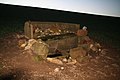
 Earthworks at Cawkwell near Scamblesby, aerial 2019 (2) - geograph.org.uk - 6286820.jpg 1 024 × 683 ; 133 kio
-
 Earthworks at Cawkwell, near Scamblesby, aerial 2019 (1) - geograph.org.uk - 6286818.jpg 1 024 × 683 ; 134 kio
-
 Eden by Scamblesby - geograph.org.uk - 3088467.jpg 1 024 × 768 ; 230 kio
-
 Entering Scamblesby - geograph.org.uk - 3093861.jpg 800 × 600 ; 253 kio
-
 Farm buildings off Mill Lane, Scamblesby - geograph.org.uk - 3088713.jpg 1 024 × 768 ; 215 kio
-
 Farm track off A153 - geograph.org.uk - 3253820.jpg 2 256 × 1 504 ; 1,15 Mio
-
 Footbridge over a drain - geograph.org.uk - 3090397.jpg 1 024 × 768 ; 248 kio
-
 Footpath behind the former Green Man pub at Scamblesby - geograph.org.uk - 6214418.jpg 1 024 × 683 ; 268 kio
-
 Footpath on Flint Hill - geograph.org.uk - 3088727.jpg 1 024 × 768 ; 225 kio
-
 Footpath through a small plantation - geograph.org.uk - 3088720.jpg 1 024 × 768 ; 195 kio
-
 Footpath to Scamblesby - geograph.org.uk - 4378310.jpg 2 000 × 1 333 ; 1,26 Mio
-
 Footpath to Scamblesby - geograph.org.uk - 4378320.jpg 2 000 × 1 333 ; 1,08 Mio
-
 Footpath to Scamblesby - geograph.org.uk - 4378361.jpg 2 000 × 1 333 ; 1,22 Mio
-
 Former War Memorial Hospital, Horncastle - geograph.org.uk - 562379.jpg 640 × 480 ; 82 kio
-
 From valley bottom to chalk hill - geograph.org.uk - 44333.jpg 640 × 480 ; 128 kio
-
 Frost on the ground at Goulceby, aerial 2017 - geograph.org.uk - 5624457.jpg 800 × 533 ; 77 kio
-
 Gaumer Hill and terraces, aerial 2014 - geograph.org.uk - 3800088.jpg 640 × 427 ; 32 kio
-
 Gaumer Hill from Ings Lane - geograph.org.uk - 3792745.jpg 640 × 427 ; 57 kio
-
 Gaumer Hill from the top of the escarpment - geograph.org.uk - 3792780.jpg 640 × 427 ; 33 kio
-
 Gaumer Hill, aerial 2014 - geograph.org.uk - 3800061.jpg 640 × 427 ; 56 kio
-
 Grassland north of Scamblesby - geograph.org.uk - 3792591.jpg 640 × 427 ; 89 kio
-

-
 Hay bales near Scamblesby - geograph.org.uk - 3090400.jpg 1 024 × 768 ; 251 kio
-
 Hay bales, Scamblesby - geograph.org.uk - 3090297.jpg 1 024 × 768 ; 183 kio
-
 Hedge-lined Mill Lane, Scamblesby - geograph.org.uk - 6078728.jpg 4 000 × 3 000 ; 3,88 Mio
-

-
 Home And Away - geograph.org.uk - 449226.jpg 640 × 480 ; 93 kio
-
 Home On The Hill - geograph.org.uk - 449141.jpg 640 × 480 ; 96 kio
-
 House and barn on the corner of Chapel Lane - geograph.org.uk - 3792658.jpg 640 × 427 ; 72 kio
-
 Ings Lane and Mill Lane from Gaumer Hill - geograph.org.uk - 3792800.jpg 640 × 427 ; 49 kio
-
 Juicetrump Hill and Park Hill, aerial 2014 - geograph.org.uk - 3800163.jpg 640 × 427 ; 59 kio
-
 Junction of Bluestone Heath Road with the A153 - geograph.org.uk - 3817586.jpg 1 024 × 567 ; 67 kio
-

-
 Lumps and bumps by Wood Farm - geograph.org.uk - 3792858.jpg 640 × 427 ; 56 kio
-
 Maltby Springs - geograph.org.uk - 418254.jpg 640 × 480 ; 124 kio
-
 Manor Farm, Scamblesby (2) - geograph.org.uk - 3091298.jpg 1 024 × 768 ; 192 kio
-
 Manor Farm, Scamblesby - geograph.org.uk - 3090305.jpg 1 024 × 768 ; 128 kio
-
 Manor Farm, Scamblesby - geograph.org.uk - 3091295.jpg 1 024 × 768 ; 186 kio
-
 Mill Lane and the turnoff into Chapel Lane - geograph.org.uk - 3792615.jpg 640 × 427 ; 62 kio
-
 Mill Lane, Scamblesby - geograph.org.uk - 3792680.jpg 640 × 427 ; 91 kio
-
 Mill Lane, Scamblesby - geograph.org.uk - 4378302.jpg 2 000 × 1 333 ; 1,01 Mio
-
 Mill Street, Scamblesby - geograph.org.uk - 4378291.jpg 2 000 × 1 369 ; 1,35 Mio
-
 Old Main Road, Scamblesby - geograph.org.uk - 6214423.jpg 1 024 × 683 ; 245 kio
-
 Old meets new, Main Roads in Scamblesby - geograph.org.uk - 3792588.jpg 640 × 427 ; 60 kio
-

-
 Ordnance Survey Cut Mark - geograph.org.uk - 3015419.jpg 3 264 × 2 448 ; 2,8 Mio
-
 Ordnance Survey Cut Mark - geograph.org.uk - 3015445.jpg 3 264 × 2 448 ; 2,38 Mio
-
 Ordnance Survey Flush Bracket S0662 - geograph.org.uk - 3015441.jpg 3 264 × 2 448 ; 2,93 Mio
-
 Outbuilding in Scamblesby - geograph.org.uk - 3088897.jpg 1 024 × 768 ; 150 kio
-
 Panorama of Flint Hill - geograph.org.uk - 5164004.jpg 2 080 × 1 104 ; 1,13 Mio
-
 Panoramic view from bridleway to Scamblesby - geograph.org.uk - 4378367.jpg 8 000 × 1 234 ; 7,54 Mio
-
 Park Hill, near Juicetrump Hill - geograph.org.uk - 3792716.jpg 640 × 427 ; 66 kio
-
 Permissive bridleway at Flint Hill - geograph.org.uk - 3091312.jpg 1 024 × 768 ; 194 kio
-

-
 Public Bridleway north from Chapel Lane - geograph.org.uk - 3648171.jpg 2 256 × 1 504 ; 2,07 Mio
-
 Recycling site on Chapel Lane, Scamblesby - geograph.org.uk - 3817568.jpg 1 024 × 768 ; 165 kio
-
 Recycling site, Rowgate Road, Scamblesby - geograph.org.uk - 3090077.jpg 1 024 × 768 ; 315 kio
-
 Riding exercise, in Mill Lane, Scamblesby - geograph.org.uk - 3792669.jpg 640 × 427 ; 96 kio
-
 Road (A153) at Flint Hill - geograph.org.uk - 5755917.jpg 4 000 × 3 000 ; 3,58 Mio
-
 Road junction near The Lofts - geograph.org.uk - 3817576.jpg 1 024 × 624 ; 103 kio
-
 Road to Cadwell Grange - geograph.org.uk - 2989970.jpg 2 256 × 1 504 ; 952 kio
-

-
 Rosin Hill from Ings Farm area (aerial 2014) - geograph.org.uk - 3825965.jpg 427 × 640 ; 32 kio
-
 Rowgate Hill, Lincolnshire Wolds - geograph.org.uk - 3817574.jpg 1 024 × 768 ; 152 kio
-
 Rowgate Road descending Rowgate Hill towards Scamblesby - geograph.org.uk - 6078723.jpg 3 924 × 2 948 ; 2,72 Mio
-
 Rowgate road near to The Grange - geograph.org.uk - 6078725.jpg 4 000 × 3 000 ; 3,46 Mio
-

-
 Saddlers Row, Scamblesby - geograph.org.uk - 3090313.jpg 1 024 × 768 ; 155 kio
-
 Scamblesby - geograph.org.uk - 44325.jpg 640 × 390 ; 67 kio
-
 Scamblesby from the bridleway by Wood Farm - geograph.org.uk - 3792861.jpg 640 × 427 ; 59 kio
-
 Scamblesby Methodist church - geograph.org.uk - 3090092.jpg 1 024 × 768 ; 225 kio
-
 Scamblesby Village - geograph.org.uk - 44440.jpg 640 × 480 ; 64 kio
-
 Scamblesby Village Hall - geograph.org.uk - 3792607.jpg 640 × 427 ; 50 kio
-
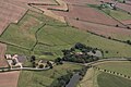
 Scamblesby, aerial 2016 - geograph.org.uk - 5020286.jpg 533 × 800 ; 103 kio
-
 Scamblesby, aerial 2018 - geograph.org.uk - 5640496.jpg 533 × 800 ; 60 kio
-
 Sheep washed here - geograph.org.uk - 3792815.jpg 640 × 427 ; 78 kio
-
 Sign by the bridleway to Belchford - geograph.org.uk - 3792874.jpg 640 × 427 ; 82 kio
-
 Snowdrops - geograph.org.uk - 4378299.jpg 2 000 × 1 333 ; 1,27 Mio
-
 Snowdrops in mid January on South Street Scamblesby - geograph.org.uk - 3817565.jpg 1 024 × 513 ; 149 kio
-

-

-
 Stenigot estate, aerial 2014 - geograph.org.uk - 3844788.jpg 640 × 427 ; 37 kio
-

-
 Stile on the bridleway - geograph.org.uk - 3792896.jpg 640 × 427 ; 52 kio
-
 Storm above Highfield Cadwell - geograph.org.uk - 3092750.jpg 1 024 × 768 ; 92 kio
-
 Stumped - geograph.org.uk - 686378.jpg 427 × 640 ; 143 kio
-
 Sunset over the Wolds - geograph.org.uk - 5163995.jpg 4 000 × 2 992 ; 3,26 Mio
-
 The best time of day at Scamblesby Grove - geograph.org.uk - 3792825.jpg 640 × 427 ; 56 kio
-
 The bridleway beckons - geograph.org.uk - 3792879.jpg 640 × 427 ; 40 kio
-

-
 The footpath from Flint Hill to Mill lane, Scamblesby - geograph.org.uk - 3091276.jpg 1 024 × 768 ; 198 kio
-
 The former Post Office, Scamblesby - geograph.org.uk - 3015435.jpg 3 264 × 2 448 ; 1,58 Mio
-

-
 The Lofts - Cultivation Terraces - geograph.org.uk - 1919292.jpg 640 × 480 ; 60 kio
-
 The Lofts - geograph.org.uk - 519551.jpg 640 × 480 ; 79 kio
-
 The Lofts and Scamblesby Thorpe, aerial 2014 - geograph.org.uk - 3799798.jpg 640 × 348 ; 34 kio
-
 The Viking Way - geograph.org.uk - 4378213.jpg 2 000 × 1 333 ; 1,01 Mio
-
 The Viking Way - geograph.org.uk - 4378225.jpg 1 591 × 2 000 ; 1,34 Mio
-
 The Viking Way - geograph.org.uk - 4378271.jpg 2 000 × 1 333 ; 1,21 Mio
-
 The Viking Way - geograph.org.uk - 4378277.jpg 1 374 × 2 000 ; 1,34 Mio
-
 The Viking Way - geograph.org.uk - 4378286.jpg 2 000 × 1 331 ; 1,26 Mio
-
 The Viking Way crossers over the A153 - geograph.org.uk - 3093871.jpg 800 × 600 ; 243 kio
-
 The Viking Way entering Scamblesby - geograph.org.uk - 3090407.jpg 1 024 × 768 ; 241 kio
-
 The Viking Way heading towards Belchford Wood - geograph.org.uk - 2619453.jpg 4 000 × 3 000 ; 2,87 Mio
-
 The Viking Way on Mill Lane, entering Scamblesby - geograph.org.uk - 2619435.jpg 4 000 × 3 000 ; 2,87 Mio
-
 The Viking Way south of Scamblesby - geograph.org.uk - 2619440.jpg 4 000 × 3 000 ; 2,97 Mio
-
 Tin Roof Blues - geograph.org.uk - 3792840.jpg 640 × 427 ; 116 kio
-
 Toward Horncastle - geograph.org.uk - 5164000.jpg 6 000 × 4 000 ; 7,39 Mio
-
 Towards Goulceby - geograph.org.uk - 5163999.jpg 4 000 × 2 992 ; 3,64 Mio
-
 Track at the end of Mill Lane - geograph.org.uk - 3658563.jpg 2 256 × 1 504 ; 1,74 Mio
-
 Track to Cawkwell Top Farm - geograph.org.uk - 3253828.jpg 2 256 × 1 504 ; 1,56 Mio
-
 Track to Cawkwell Top Farm - geograph.org.uk - 3904453.jpg 640 × 427 ; 40 kio
-
 Trig Point on the old Roman Road near Flint Hill - geograph.org.uk - 3911734.jpg 427 × 640 ; 130 kio
-
 View ENE from bridleway to Scamblesby - geograph.org.uk - 4378376.jpg 2 000 × 1 500 ; 1,44 Mio
-
 View ENE from the bridleway to Scamblesby - geograph.org.uk - 4378371.jpg 2 000 × 1 333 ; 1,04 Mio
-
 View from Cawkwell Hill - geograph.org.uk - 3070228.jpg 640 × 427 ; 55 kio
-
 View from Flint Hill - geograph.org.uk - 5163997.jpg 6 480 × 4 320 ; 6,23 Mio
-
 View from the churchyard, Scamblesby - geograph.org.uk - 3090311.jpg 1 024 × 768 ; 231 kio
-
 View from the Roman road - geograph.org.uk - 3091341.jpg 1 024 × 768 ; 176 kio
-
 View towards Gaumer Hill - geograph.org.uk - 3090273.jpg 1 024 × 768 ; 214 kio
-
 View towards the cultivation terraces on Gaumer Hill - geograph.org.uk - 3090084.jpg 1 024 × 768 ; 241 kio
-
 Viking Way leaving Scamblesby to the south - geograph.org.uk - 3792685.jpg 640 × 427 ; 101 kio
-
 War Memorial Hospital - geograph.org.uk - 382232.jpg 640 × 427 ; 55 kio
-

-
 Woldale Lodge, A153 - geograph.org.uk - 3122338.jpg 640 × 427 ; 60 kio
-
 Woldale Lodge, A153, roof - geograph.org.uk - 3122362.jpg 640 × 427 ; 96 kio
-
 Wolds escarpment from Wood Farm - geograph.org.uk - 3792869.jpg 640 × 427 ; 56 kio
-

-
 Young woodland - geograph.org.uk - 418250.jpg 640 × 480 ; 112 kio
-
 Above Scamblesby Thorpe - geograph.org.uk - 519568.jpg 640 × 480 ; 90 kio
-
 Above Tathwell - geograph.org.uk - 521407.jpg 640 × 480 ; 135 kio
-
 Cadwell Park paddock - geograph.org.uk - 165217.jpg 640 × 436 ; 298 kio
-
 Cadwell Park, start line - geograph.org.uk - 165220.jpg 640 × 439 ; 266 kio
-
 Cadwell Park, top of 'The Mountain' - geograph.org.uk - 165224.jpg 640 × 440 ; 237 kio
-
 Cawkwell Hill - geograph.org.uk - 520300.jpg 480 × 640 ; 113 kio
-
 Coming out of West Ashby on the A153 - geograph.org.uk - 426126.jpg 640 × 480 ; 101 kio
-
 Donkey on Flint Hill - geograph.org.uk - 688095.jpg 640 × 435 ; 184 kio
-
 Flint Hill House - geograph.org.uk - 44413.jpg 640 × 480 ; 146 kio
-
 Footpath to Raithby - geograph.org.uk - 418185.jpg 640 × 480 ; 115 kio
-
 Former GN Branch Line, Donington on Bain - geograph.org.uk - 430543.jpg 640 × 480 ; 96 kio
-
 From the Viking Way to Gaumer Hill - geograph.org.uk - 43861.jpg 640 × 480 ; 86 kio
-
 Gaumer Hill - geograph.org.uk - 521468.jpg 640 × 480 ; 110 kio
-
 Highfield Cadwell - geograph.org.uk - 520277.jpg 640 × 480 ; 160 kio
-
 Highfield Cadwell - geograph.org.uk - 520285.jpg 640 × 480 ; 192 kio
-
 Holiday apartments - geograph.org.uk - 44447.jpg 640 × 436 ; 86 kio
-
 Newly planted hedgerow - geograph.org.uk - 44435.jpg 640 × 459 ; 97 kio
-
 Old farm buildings, Manor Farm - geograph.org.uk - 44425.jpg 640 × 480 ; 95 kio
-
 Pink campions and course car - geograph.org.uk - 439662.jpg 640 × 480 ; 97 kio
-
 Ranyard's Lane - geograph.org.uk - 520312.jpg 640 × 480 ; 115 kio
-
 Ranyard's Lane - geograph.org.uk - 520320.jpg 640 × 480 ; 111 kio
-
 Raynard's Lane - geograph.org.uk - 520324.jpg 480 × 640 ; 144 kio
-
 Rough Grassland on Flint Hill - geograph.org.uk - 688031.jpg 640 × 412 ; 104 kio
-
 Rowgate Hill - geograph.org.uk - 449236.jpg 640 × 480 ; 108 kio
-
 Rowgate Hill - geograph.org.uk - 621241.jpg 640 × 427 ; 59 kio
-
 Rowgate Road - geograph.org.uk - 449168.jpg 640 × 480 ; 101 kio
-
 Scamblesby Grove - geograph.org.uk - 43866.jpg 640 × 374 ; 52 kio
-
 Scamblesby Thorpe - geograph.org.uk - 449159.jpg 640 × 480 ; 118 kio
-
 Scamblesby Thorpe - geograph.org.uk - 519530.jpg 640 × 480 ; 106 kio
-
 Scarecrow on the Wolds - geograph.org.uk - 683470.jpg 640 × 480 ; 79 kio
-
 The paddock, Cadwell Park - geograph.org.uk - 439633.jpg 640 × 480 ; 95 kio
-
 The Southwold Hunt Kennels - geograph.org.uk - 154617.jpg 640 × 412 ; 76 kio
-
 Threewheelers at Cadwell Hairpin, 1988 - geograph.org.uk - 164456.jpg 640 × 424 ; 258 kio
-
 Towards Scamblesby - geograph.org.uk - 449187.jpg 640 × 480 ; 131 kio


_-_geograph.org.uk_-_6286820.jpg)
_-_geograph.org.uk_-_6286818.jpg)


_-_geograph.org.uk_-_3091298.jpg)


_at_Flint_Hill_-_geograph.org.uk_-_5755917.jpg)


_-_geograph.org.uk_-_3825965.jpg)


