Category:Scarcliffe
Vai alla navigazione
Vai alla ricerca
Villaggio in Derbyshire, Inghilterra  | |||||
| Carica un file multimediale | |||||
| Istanza di | |||||
|---|---|---|---|---|---|
| Luogo | Bolsover, Derbyshire, Midlands Orientali, Inghilterra | ||||
 | |||||
Sottocategorie
Questa categoria contiene le 2 sottocategorie indicate di seguito, su un totale di 2.
L
P
- Palterton (9 F)
File nella categoria "Scarcliffe"
Questa categoria contiene 200 file, indicati di seguito, su un totale di 401.
(pagina precedente) (pagina successiva)-
 "Elm Tree Inn", Scarcliffe - geograph.org.uk - 3220553.jpg 4 291 × 2 861; 2,57 MB
-
 "Jacaranda" - bungalow in Scarcliffe - geograph.org.uk - 3220550.jpg 4 105 × 2 932; 2,52 MB
-
 A couple of trees in the fields below Palterton - geograph.org.uk - 2680259.jpg 1 024 × 923; 459 KB
-
 A field laced with poppies - geograph.org.uk - 5007140.jpg 4 000 × 2 992; 3,63 MB
-
 A tree in a large field - geograph.org.uk - 2777339.jpg 777 × 1 024; 396 KB
-
 A view of Langwith Wood - geograph.org.uk - 2241830.jpg 1 600 × 1 200; 608 KB
-
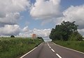
 A632 on Fox Hill - geograph.org.uk - 2044898.jpg 640 × 480; 50 KB
-
 Acute junction on the A632 - geograph.org.uk - 2224450.jpg 900 × 548; 228 KB
-
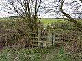
 Alternative tracks on the Stockley Trail - geograph.org.uk - 2418935.jpg 950 × 601; 269 KB
-

-
 Approaching Langwith Wood - geograph.org.uk - 3584444.jpg 1 600 × 1 200; 548 KB
-
-
 Approaching Scarcliffe - geograph.org.uk - 2044913.jpg 640 × 480; 41 KB
-
 Approaching Scarcliffe from Palterton - geograph.org.uk - 2668834.jpg 3 201 × 2 345; 885 KB
-
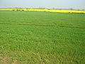
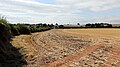
 Arable fields - geograph.org.uk - 4117251.jpg 1 024 × 362; 83 KB
-
 Arable land east of Bolsover - geograph.org.uk - 3379816.jpg 3 648 × 2 736; 4,27 MB
-
 Arable land near Langwith Wood - geograph.org.uk - 3380151.jpg 3 648 × 2 736; 2,87 MB
-
 Arable Land Overlooking Scarcliffe - geograph.org.uk - 2668224.jpg 3 296 × 2 472; 1,41 MB
-

-
 Archaeological Way near Roseland Farm - geograph.org.uk - 1298707.jpg 640 × 480; 109 KB
-
 Archaeology Way near Langwith Junction - geograph.org.uk - 4890088.jpg 4 000 × 2 248; 6,66 MB
-
 Autumn colours by the Stockley trail - geograph.org.uk - 2141465.jpg 900 × 675; 410 KB
-
 Autumnal scene on the Stockley Trail - geograph.org.uk - 2640025.jpg 1 024 × 768; 362 KB
-
 B6417 in Scarcliffe - geograph.org.uk - 2044915.jpg 640 × 480; 45 KB
-
 Back Lane, Palterton - geograph.org.uk - 2187307.jpg 900 × 664; 183 KB
-
 Bend in the track - geograph.org.uk - 4947063.jpg 5 184 × 3 888; 6,69 MB
-
 Beside Roseland Wood - geograph.org.uk - 4890018.jpg 3 912 × 2 076; 5,57 MB
-
 Beside Roseland Wood - geograph.org.uk - 4890020.jpg 4 000 × 2 248; 5,49 MB
-
 Between the woods - geograph.org.uk - 4890044.jpg 4 000 × 2 248; 5,2 MB
-
 Birch Hill Plantation - geograph.org.uk - 3386803.jpg 640 × 427; 74 KB
-
 Birch Hill Plantation - geograph.org.uk - 3643846.jpg 640 × 480; 89 KB
-
 Bolsover - Ace of Clubs - geograph.org.uk - 2300913.jpg 1 600 × 1 224; 392 KB
-
 Broken hedge line and the Doe Lea valley - geograph.org.uk - 2680264.jpg 981 × 748; 373 KB
-
 By the path through Roseland Wood - geograph.org.uk - 4124652.jpg 695 × 1 024; 252 KB
-
 Carr Lane - geograph.org.uk - 3783009.jpg 800 × 533; 123 KB
-
 Carr Lane from the Stockley Trail - geograph.org.uk - 2638301.jpg 1 024 × 993; 491 KB
-
 Carr Lane heading east to Palterton - geograph.org.uk - 3870822.jpg 5 040 × 3 600; 4,6 MB
-
 Carr Lane on a wet day - geograph.org.uk - 2151605.jpg 900 × 593; 364 KB
-
 Carr Lane towards Palterton - geograph.org.uk - 2141484.jpg 675 × 900; 366 KB
-
 Carr Lane under snow - geograph.org.uk - 2185159.jpg 900 × 649; 338 KB
-
 Carr Lane view - geograph.org.uk - 2414141.jpg 950 × 710; 314 KB
-
 Carr Lane view to Bolsover with light snow cover - geograph.org.uk - 3299929.jpg 1 024 × 846; 404 KB
-
 Carr Vale - Water Lane - geograph.org.uk - 2415587.jpg 1 024 × 768; 249 KB
-
 Cat on a garden wall in Palterton - geograph.org.uk - 3220615.jpg 2 902 × 4 352; 3,11 MB
-
 Cautionary notice to dog owners - geograph.org.uk - 2270693.jpg 3 648 × 2 736; 5,7 MB
-
 Choice of paths near Deepdale Farm - geograph.org.uk - 2321063.jpg 3 648 × 2 736; 5,73 MB
-
 Church of St Leonard, Scarcliffe - geograph.org.uk - 2224073.jpg 900 × 642; 382 KB
-
 Countryside near Scarcliffe - geograph.org.uk - 4890063.jpg 4 000 × 2 248; 6,19 MB
-
 Countryside south and west of Palterton - geograph.org.uk - 2418241.jpg 835 × 950; 332 KB
-
 Crops change and storm clouds approach - geograph.org.uk - 1294090.jpg 640 × 480; 111 KB
-
 Crossing the River Doe Lea - geograph.org.uk - 2317748.jpg 3 648 × 2 736; 6,29 MB
-
 Crossroads at Losk Corner - geograph.org.uk - 3013211.jpg 640 × 452; 57 KB
-
 Cut Mark Main Street Scarcliffe - geograph.org.uk - 4600657.jpg 640 × 480; 109 KB
-
 Derbyshire UK parish map highlighting Scarcliffe.svg 888 × 1 308; 2,34 MB
-
 Detail of former industrial area - geograph.org.uk - 2216314.jpg 673 × 900; 413 KB
-

-
 Doe Lea valley from Rylah Hill - geograph.org.uk - 2187346.jpg 900 × 625; 171 KB
-

-
 Doe Lea valley under snow - geograph.org.uk - 2187394.jpg 900 × 589; 244 KB
-
 Doe Lea valley view - geograph.org.uk - 2151565.jpg 900 × 552; 333 KB
-
 Ducks at Hill Top Farm, Palterton - geograph.org.uk - 4947026.jpg 3 888 × 5 184; 5,52 MB
-

-
 Elevated pipeline by the Stockley Trail - geograph.org.uk - 2216325.jpg 900 × 635; 323 KB
-
 Elevated pipeline by the Stockley Trail - geograph.org.uk - 2226789.jpg 900 × 683; 429 KB
-
 Elm Tree Inn, Scarcliffe - geograph.org.uk - 2241841.jpg 3 648 × 2 736; 5,1 MB
-
 English country lane in the spring - geograph.org.uk - 2909250.jpg 774 × 1 024; 276 KB
-
 Entering Palterton - geograph.org.uk - 4113484.jpg 640 × 480; 103 KB
-
 Entering Palterton from the east - geograph.org.uk - 3220605.jpg 4 083 × 2 917; 3,06 MB
-
 Entering Scarcliffe - geograph.org.uk - 3643853.jpg 640 × 480; 75 KB
-

-
 Farm buildings, Rylah Hill - geograph.org.uk - 4113387.jpg 640 × 480; 74 KB
-
 Farm buildings, Stony Houghton - geograph.org.uk - 2648524.jpg 1 024 × 612; 326 KB
-

-
 Farm track east of Scarcliffe - geograph.org.uk - 3380147.jpg 3 456 × 2 550; 2,99 MB
-
 Farm track east of Scarcliffe - geograph.org.uk - 3380168.jpg 3 648 × 2 736; 3,16 MB
-
 Farm track meets the Rotherham Road - geograph.org.uk - 3379824.jpg 3 648 × 2 736; 3,5 MB
-
 Farm track near Scarcliffe - geograph.org.uk - 3380175.jpg 3 648 × 2 736; 3,59 MB
-
 Farm track off Rotherham Road - geograph.org.uk - 3643867.jpg 640 × 480; 66 KB
-
 Farm track towards Bolsover - geograph.org.uk - 2909255.jpg 1 024 × 842; 271 KB
-
 Farming countryside, Doe Lea valley - geograph.org.uk - 2412443.jpg 701 × 950; 350 KB
-
 Farmland by Roseland Wood - geograph.org.uk - 2270718.jpg 3 648 × 2 736; 5,99 MB
-
 Farmland east off Rotherham Road - geograph.org.uk - 3643865.jpg 640 × 480; 62 KB
-
 Farmland near Palterton - geograph.org.uk - 2381737.jpg 950 × 696; 395 KB
-
 Farmland near Stony Houghton - geograph.org.uk - 3643826.jpg 640 × 480; 73 KB
-
 Farmland view from Roseland Wood - geograph.org.uk - 1294085.jpg 640 × 480; 102 KB
-
 Farmland west of Rotherham Road - geograph.org.uk - 3643833.jpg 640 × 480; 61 KB
-
 Farmland west of Rotherham Road - geograph.org.uk - 3643871.jpg 640 × 480; 79 KB
-
 Farmland west off Mansfield Road - geograph.org.uk - 3643852.jpg 640 × 600; 67 KB
-
 Farmland, Rylah Hill - geograph.org.uk - 4113389.jpg 640 × 480; 87 KB
-
 Farmland, Scarcliffe - geograph.org.uk - 3643861.jpg 640 × 480; 83 KB
-
 Field and barn at the edge of Scarcliffe - geograph.org.uk - 2224085.jpg 900 × 675; 387 KB
-
 Field by Carr Lane - geograph.org.uk - 2372866.jpg 950 × 714; 406 KB
-
 Field by Langwith Wood - geograph.org.uk - 2224088.jpg 900 × 643; 389 KB
-

-
 Field edge footpath towards Palterton - geograph.org.uk - 2418247.jpg 950 × 713; 296 KB
-
 Field near Carr Vale in winter - geograph.org.uk - 3305101.jpg 1 024 × 861; 364 KB
-
 Field towards Langwith Wood - geograph.org.uk - 2224138.jpg 699 × 900; 358 KB
-
 Field with distant power station - geograph.org.uk - 2270861.jpg 2 840 × 2 053; 1,26 MB
-
 Field, trees, masts - geograph.org.uk - 2648425.jpg 768 × 1 024; 296 KB
-
 Fields across the Doe Lea valley - geograph.org.uk - 2414109.jpg 950 × 630; 272 KB
-
 Fields and view to Bolsover and the castle - geograph.org.uk - 3968618.jpg 1 024 × 768; 221 KB
-
 Fields around Stockley Farm - geograph.org.uk - 2216290.jpg 900 × 598; 271 KB
-
 Fields below Palterton - geograph.org.uk - 2414130.jpg 950 × 671; 274 KB
-
 Fields by Carr Lane - geograph.org.uk - 2680285.jpg 1 024 × 746; 346 KB
-
 Fields by Roseland Wood - geograph.org.uk - 2270835.jpg 3 648 × 2 736; 5,55 MB
-
 Fields east of Langwith Wood - geograph.org.uk - 2224134.jpg 900 × 711; 402 KB
-
 Fields in the Doe Lea valley under snow - geograph.org.uk - 2188098.jpg 900 × 624; 297 KB
-
 Fields near Scarcliffe - geograph.org.uk - 4124639.jpg 1 024 × 679; 153 KB
-
 Fields near Scarcliffe - geograph.org.uk - 4459686.jpg 4 000 × 3 000; 2,02 MB
-
 Fields near Stony Houghton - geograph.org.uk - 2648526.jpg 1 024 × 750; 370 KB
-
 Fields of yellow north of Scarcliffe - geograph.org.uk - 3379831.jpg 3 648 × 2 736; 4,14 MB
-
 Fields overlooking the Doe Lea valley - geograph.org.uk - 2381744.jpg 950 × 711; 390 KB
-
 Fishing lake, Carr Vale - geograph.org.uk - 2303032.jpg 950 × 667; 403 KB
-
 Fishing lake, Carr Vale - geograph.org.uk - 2680289.jpg 1 024 × 790; 330 KB
-
 Fishing pond at Carr Vale - geograph.org.uk - 2321099.jpg 3 648 × 2 736; 5,73 MB
-
 Footbridge over disused railway - geograph.org.uk - 6107661.jpg 5 343 × 3 005; 5,06 MB
-
 Footbridge over the River Poulter - geograph.org.uk - 2270714.jpg 3 648 × 2 736; 5,96 MB
-
 Footpath along Dean's Plantation - geograph.org.uk - 3584450.jpg 1 600 × 1 200; 836 KB
-
 Footpath and Fields between Bolsover and Palterton - geograph.org.uk - 3366740.jpg 4 000 × 3 000; 2,79 MB
-
 Footpath crosses the Stockley Trail - geograph.org.uk - 2321070.jpg 3 648 × 2 736; 5,71 MB
-
 Footpath crossing Langwith Road - geograph.org.uk - 3220535.jpg 4 608 × 3 072; 3,5 MB
-
 Footpath from the lakes - geograph.org.uk - 2185202.jpg 900 × 847; 499 KB
-
 Footpath in Birch Hill Plantation - geograph.org.uk - 2909319.jpg 768 × 1 024; 443 KB
-
 Footpath near Birch Hill Plantation - geograph.org.uk - 3380397.jpg 3 648 × 2 736; 3,99 MB
-
 Footpath near Hills Town - geograph.org.uk - 3366750.jpg 4 000 × 3 000; 2,61 MB
-
 Footpath near Roseland Wood - geograph.org.uk - 4124635.jpg 1 024 × 628; 164 KB
-
 Footpath to Bolsover - geograph.org.uk - 2412455.jpg 950 × 322; 224 KB
-
 Footpath to Carr Lane - geograph.org.uk - 2141544.jpg 900 × 622; 355 KB
-
 Footpath to Hill Top Farm - geograph.org.uk - 4113362.jpg 640 × 480; 99 KB
-
 Footpath to Scarcliffe - geograph.org.uk - 3380310.jpg 3 648 × 2 736; 4,07 MB
-
 Footpath towards Bolsover - geograph.org.uk - 2141519.jpg 900 × 688; 388 KB
-
 Footpath towards Palterton - geograph.org.uk - 2414147.jpg 950 × 691; 287 KB
-
 Footpath towards Roseland Wood - geograph.org.uk - 3643844.jpg 640 × 480; 91 KB
-
 Former industrial area - geograph.org.uk - 2216303.jpg 900 × 575; 265 KB
-
 Fox Hill - geograph.org.uk - 1930635.jpg 640 × 426; 109 KB
-
 Fox Hill leaving Scarcliffe - geograph.org.uk - 2411646.jpg 950 × 516; 308 KB
-
 From Gang Lane to Scarcliffe - geograph.org.uk - 3220576.jpg 4 263 × 2 558; 2,52 MB
-
 Frosty morning by the fishing lake - geograph.org.uk - 2767008.jpg 1 024 × 895; 458 KB
-
 Gang Lane - geograph.org.uk - 3379346.jpg 3 648 × 2 736; 3,55 MB
-
 Gang Lane approaching Scarcliffe - geograph.org.uk - 3379352.jpg 3 648 × 2 736; 3,43 MB
-
 Gateway to the Stockley trail - geograph.org.uk - 2741508.jpg 640 × 480; 103 KB
-

-
 Gilded pasture near Scarcliffe. - geograph.org.uk - 1291242.jpg 640 × 480; 222 KB
-
 Gildwells Cottages - geograph.org.uk - 2224438.jpg 900 × 575; 356 KB
-
 Grazing off Rotherham Road - geograph.org.uk - 3643839.jpg 640 × 480; 75 KB
-
 Green Lane at Stony Houghton - geograph.org.uk - 3379326.jpg 3 648 × 2 736; 3,85 MB
-
 Greenhouse and Polytunnels - geograph.org.uk - 177165.jpg 640 × 480; 118 KB
-

-
 Harvest time at Scarcliffe - geograph.org.uk - 5051836.jpg 1 107 × 1 200; 450 KB
-
 Heap of farmyard manure at Scarcliffe, Derbyshire, England.jpg 640 × 480; 86 KB
-
 Hen pecked earth - geograph.org.uk - 2317682.jpg 3 648 × 2 736; 6,01 MB
-
 High hedges along the lane - geograph.org.uk - 2044922.jpg 640 × 480; 41 KB
-
 Hill Top Farm, Palterton - geograph.org.uk - 2418229.jpg 950 × 304; 132 KB
-
 Hillside below Palterton - geograph.org.uk - 2372885.jpg 950 × 689; 369 KB
-
 Hillside below Palterton - geograph.org.uk - 2638261.jpg 1 024 × 733; 323 KB
-
 Hillside by Stockley Brook - geograph.org.uk - 2226826.jpg 900 × 631; 313 KB
-
 Hillside east of the Stockley Trail - geograph.org.uk - 2216311.jpg 741 × 900; 317 KB
-
 Hillside field with tree - geograph.org.uk - 2216237.jpg 675 × 900; 377 KB
-
 Hillside fields south of Palterton - geograph.org.uk - 2891824.jpg 1 024 × 689; 266 KB
-
 Hillside south of Bolsover - geograph.org.uk - 2141529.jpg 900 × 658; 332 KB
-
 Hillstown Tower - geograph.org.uk - 1935264.jpg 640 × 480; 52 KB
-
 Hilltop houses in Palterton - geograph.org.uk - 2648560.jpg 1 024 × 765; 370 KB
-
 Hilly grazing near Gildwells Farm - geograph.org.uk - 4302157.jpg 640 × 480; 72 KB
-
 Hoar frost at the fishing lake, Carr Vale - geograph.org.uk - 2767002.jpg 1 024 × 639; 290 KB
-
 Houses on Main Street, Palterton - geograph.org.uk - 4113373.jpg 640 × 480; 54 KB
-
 Houses on Main Street, Scarcliffe - geograph.org.uk - 2224070.jpg 900 × 657; 323 KB
-
 Housing estate, Bolsover - geograph.org.uk - 2151538.jpg 900 × 575; 329 KB
-
 In Birch Hill Plantation - geograph.org.uk - 3220583.jpg 4 608 × 3 072; 3,27 MB
-
 In Langwith Wood - geograph.org.uk - 4890075.jpg 3 956 × 2 940; 7,77 MB
-
 In Roseland Wood - geograph.org.uk - 4027098.jpg 800 × 600; 193 KB
-
 Junction in Palterton - geograph.org.uk - 2044932.jpg 640 × 480; 42 KB
-
 Lane and wall at the top of the hill, Palterton - geograph.org.uk - 2909327.jpg 1 024 × 723; 229 KB
-
 Lane verge and fence, Carr Lane - geograph.org.uk - 2680272.jpg 807 × 1 024; 447 KB
-
 Lane west of Rylah Farm - geograph.org.uk - 2216275.jpg 900 × 661; 302 KB
-
 Lanes Farm - geograph.org.uk - 2044980.jpg 640 × 480; 38 KB
-
 Langwith Road the A632 - geograph.org.uk - 2812207.jpg 640 × 472; 100 KB
-
 Large field east of Palterton - geograph.org.uk - 2909264.jpg 1 024 × 768; 228 KB
-
 Large puddle in field - geograph.org.uk - 2270735.jpg 3 648 × 2 736; 4,59 MB
-
 Lay-by fly-tipping - geograph.org.uk - 2270847.jpg 3 648 × 2 736; 6,13 MB
-
 Lichen - Cladonia portentosa - geograph.org.uk - 2907045.jpg 1 024 × 823; 279 KB
-
 Lichen - Cladonia species - geograph.org.uk - 2907050.jpg 1 024 × 808; 448 KB
-
 Lidget Lane near Scarcliffe - geograph.org.uk - 4459696.jpg 4 000 × 3 000; 2,24 MB
-
 Ling Lane near Palterton - geograph.org.uk - 3366760.jpg 4 000 × 3 000; 1,92 MB
-
 Looking toward Roseland Farm - geograph.org.uk - 6107592.jpg 5 202 × 2 926; 4,08 MB
-
 Looking toward Scarcliffe - geograph.org.uk - 6107642.jpg 5 343 × 3 005; 3,14 MB
-
 Looking west along Carr Lane - geograph.org.uk - 2141508.jpg 900 × 450; 272 KB
-
 Looking west over the Doe Lea valley - geograph.org.uk - 4947011.jpg 5 125 × 3 843; 4,9 MB
-
 Losk Lane - geograph.org.uk - 4113365.jpg 640 × 480; 60 KB
-
 Losk Lane Junction - geograph.org.uk - 2817414.jpg 640 × 480; 37 KB
-

-
 Losk Lane towards Palterton - geograph.org.uk - 2151614.jpg 900 × 522; 286 KB
-
 Main Street in Scarcliffe - geograph.org.uk - 4459691.jpg 4 000 × 3 000; 2,29 MB
-
 Main Street, Palterton - geograph.org.uk - 2187323.jpg 900 × 632; 166 KB
-
 Main Street, Palterton - geograph.org.uk - 2216239.jpg 900 × 643; 322 KB
-
 Main Street, Palterton - geograph.org.uk - 2216244.jpg 746 × 900; 452 KB
-
 Main Street, Palterton - geograph.org.uk - 2317690.jpg 3 648 × 2 736; 4,52 MB
-
 Main Street, Palterton - geograph.org.uk - 3092008.jpg 1 024 × 768; 177 KB
-
 Main Street, Scarcliffe - geograph.org.uk - 2909298.jpg 1 024 × 851; 278 KB
-
 Mansfield Road, Hillstown, after snow - geograph.org.uk - 2187284.jpg 900 × 738; 193 KB
-
 Meadow by houses in Scarcliffe - geograph.org.uk - 2411626.jpg 950 × 536; 328 KB


