Category:Schernfeld
Vai alla navigazione
Vai alla ricerca
comune tedesco    | |||||
| Carica un file multimediale | |||||
| Istanza di |
| ||||
|---|---|---|---|---|---|
| Parte di |
| ||||
| Luogo | circondario di Eichstätt, Alta Baviera, Baviera, Germania | ||||
| Capo del governo |
| ||||
| Popolazione |
| ||||
| Superficie |
| ||||
| Altezza sul mare |
| ||||
| sito web ufficiale | |||||
 | |||||
Sottocategorie
Questa categoria contiene le 4 sottocategorie indicate di seguito, su un totale di 4.
S
- Steinbruch Blumenberg (5 F)
File nella categoria "Schernfeld"
Questa categoria contiene 15 file, indicati di seguito, su un totale di 15.
-
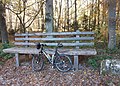 Baumelbank - panoramio.jpg 1 600 × 1 146; 767 KB
-
 DEU Schernfeld COA.svg 979 × 1 068; 67 KB
-
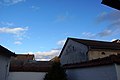
 Haus mit Kalkdach in Schernfeld - geo.hlipp.de - 144.jpg 640 × 427; 209 KB
-
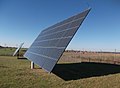 Kollektor des Solarparks - panoramio.jpg 1 947 × 1 431; 724 KB
-
 Plattenkalksteinbruch bei Schernfeld - geo.hlipp.de - 141.jpg 640 × 427; 252 KB
-
 Schernfeld - geo.hlipp.de - 143.jpg 640 × 427; 229 KB
-
 Schernfeld - Lage im Landkreis.png 281 × 185; 32 KB
-
 Schernfeld EI 001.jpg 6 000 × 4 000; 5,33 MB
-
 Schernfeld EI 002.jpg 6 000 × 4 000; 8,16 MB
-
 Schernfeld EI 003.jpg 6 000 × 4 000; 4,64 MB
-
 Schernfeld EI 004.jpg 6 000 × 4 000; 4,55 MB
-
 Schernfeld in EI.svg 804 × 580; 1,12 MB
-
 Schernfelder Wasserturm.jpg 1 000 × 646; 100 KB
-
 Wappen von Schernfeld.png 257 × 280; 12 KB
-
 Wolfsgrube im Walderlebniszentrum Schernfeld.jpg 2 000 × 1 500; 1,23 MB


