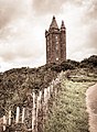
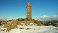
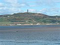
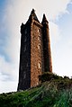
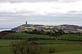
Category:Scrabo Tower
Vai alla navigazione
Vai alla ricerca
|
This is a category about a listed building with HB number HB24/11/031. |
tower in County Down, Northern Ireland  | |||||
| Carica un file multimediale | |||||
| Istanza di | |||||
|---|---|---|---|---|---|
| Luogo | Contea di Down, Irlanda del Nord | ||||
 | |||||
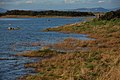
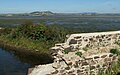
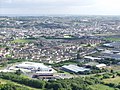
File nella categoria "Scrabo Tower"
Questa categoria contiene 97 file, indicati di seguito, su un totale di 97.
-
 A view from Scrabo - geograph.org.uk - 1324252.jpg 640 × 513; 382 KB
-
 A view from Scrabo - geograph.org.uk - 1324255.jpg 640 × 418; 323 KB
-
 A view from Scrabo - geograph.org.uk - 1324261.jpg 640 × 474; 268 KB
-
 A view from Scrabo - geograph.org.uk - 1325822.jpg 640 × 388; 303 KB
-

-
-
 Barley field, Scrabo near Newtownards - geograph.org.uk - 1398742.jpg 640 × 424; 101 KB
-
 Belfast from Black Mountain - geograph.org.uk - 1254114.jpg 640 × 480; 299 KB
-
 Bluebell near Scrabo Tower - geograph.org.uk - 780504.jpg 640 × 582; 351 KB
-
 Castle Espie - geograph.org.uk - 1491908.jpg 640 × 401; 207 KB
-
 CIMG1475 ScraboAndNewtownards.JPG 2 048 × 1 536; 1,13 MB
-
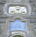 CIMG1476 ScraboPlaque.JPG 1 530 × 1 595; 637 KB
-
 CIMG1481 ScraboViewNewtownardsTown.JPG 2 048 × 1 536; 1,15 MB
-
 CIMG1482 ScraboViewNewtownardsAirport.JPG 2 048 × 1 536; 1,11 MB
-
 CIMG1482 ScraboViewNewtownardsAirportZoom.JPG 1 618 × 894; 1,01 MB
-
 CIMG1495 ScraboHorizView.JPG 2 048 × 1 536; 1,13 MB
-
 CIMG1497 ScraboVertRock.JPG 1 536 × 2 048; 1,14 MB
-
 Creamery, Newtownards - geograph.org.uk - 1094801.jpg 640 × 426; 72 KB
-
 Daisy near Scrabo (1) - geograph.org.uk - 780506.jpg 640 × 513; 416 KB
-
 Daisy near Scrabo (2) - geograph.org.uk - 780510.jpg 640 × 594; 312 KB
-
 Daisy near Scrabo (3) - geograph.org.uk - 780514.jpg 640 × 437; 293 KB
-
 Donaghadee Road, Newtownards - geograph.org.uk - 1607242.jpg 640 × 480; 73 KB
-
 Farming in Co Down. N.Ireland. - panoramio.jpg 2 816 × 1 880; 1,64 MB
-
 Frozen fields near Scrabo - geograph.org.uk - 1654704.jpg 640 × 382; 210 KB
-
 Gate near Newtownards - geograph.org.uk - 1150366.jpg 625 × 331; 106 KB
-
 Glass Moss - geograph.org.uk - 930457.jpg 640 × 456; 38 KB
-
 Londonderry Memorial Tower (project) Watercolour.jpg 371 × 450; 70 KB
-
 Newtownards aerodrome (2) - geograph.org.uk - 742095.jpg 640 × 380; 61 KB
-
 Newtownards Shopping Centre (part) - geograph.org.uk - 642908.jpg 640 × 480; 54 KB
-
 Newtownards Wikivoyage Banner.JPG 2 048 × 294; 359 KB
-

-
-
-
 Path to Scrabo - geograph.org.uk - 1325826.jpg 640 × 444; 318 KB
-
 Path up to Scrabo Tower - geograph.org.uk - 1404408.jpg 640 × 480; 74 KB
-
 Ringneill, Comber, January 2011 (03).JPG 4 272 × 2 848; 6,63 MB
-
 Ringneill, Comber, January 2011 (04).JPG 4 272 × 2 848; 5,6 MB
-
 Ringneill, Comber, January 2011 (08).JPG 4 272 × 2 848; 3,9 MB
-
 Road up to Scrabo - geograph.org.uk - 1404407.jpg 640 × 480; 70 KB
-
 Scrabo Golf Club - Clubhouse - geograph.org.uk - 1404405.jpg 640 × 480; 84 KB
-
 Scrabo Golf Course - geograph.org.uk - 780487.jpg 640 × 445; 431 KB
-
 Scrabo snow scenes, Newtownards (1) - geograph.org.uk - 1150164.jpg 640 × 326; 66 KB
-
 Scrabo snow scenes, Newtownards (2) - geograph.org.uk - 1150189.jpg 631 × 379; 91 KB
-
 Scrabo snow scenes, Newtownards (4) - geograph.org.uk - 1150260.jpg 640 × 424; 93 KB
-
 Scrabo snow scenes, Newtownards (5) - geograph.org.uk - 1150285.jpg 640 × 362; 55 KB
-
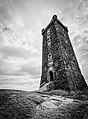
 Scrabo Tower - geograph.org.uk - 3578.jpg 640 × 480; 53 KB
-
 Scrabo Tower - geograph.org.uk - 507810.jpg 480 × 640; 78 KB
-
 Scrabo Tower - geograph.org.uk - 508110.jpg 480 × 640; 75 KB
-
 Scrabo Tower - geograph.org.uk - 508120.jpg 480 × 640; 67 KB
-
 Scrabo Tower - geograph.org.uk - 781345.jpg 536 × 640; 429 KB
-
 Scrabo Tower 01.jpg 3 335 × 5 002; 7,96 MB
-
 Scrabo Tower at dawn.jpg 2 924 × 4 353; 2,22 MB
-
 Scrabo Tower from Craigantlet. Co Down - panoramio.jpg 2 816 × 1 880; 1,35 MB
-
 Scrabo Tower from Craiglantlet Hills. Co Down - panoramio.jpg 2 816 × 1 880; 1,62 MB
-

-
 Scrabo Tower Illustrated London News 1857.jpg 3 350 × 4 835; 1,17 MB
-
 Scrabo Tower near Newtownards (2) - geograph.org.uk - 472889.jpg 640 × 427; 57 KB
-
 Scrabo Tower near Newtownards (3) - geograph.org.uk - 775719.jpg 640 × 452; 88 KB
-
 Scrabo Tower near Newtownards (4) - geograph.org.uk - 837479.jpg 640 × 377; 74 KB
-
 Scrabo Tower near Newtownards (5) - geograph.org.uk - 1094718.jpg 640 × 395; 55 KB
-
 Scrabo Tower near Newtownards (6) - geograph.org.uk - 1398819.jpg 640 × 494; 92 KB
-

-

-

-
 Scrabo Tower near Newtownards (detail) - geograph.org.uk - 347937.jpg 640 × 426; 132 KB
-
 Scrabo Tower near Newtownards - geograph.org.uk - 347929.jpg 640 × 426; 126 KB
-
 Scrabo Tower Sunset.jpg 1 200 × 800; 193 KB
-
 Scrabo Tower up close - geograph.org.uk - 35297.jpg 480 × 640; 81 KB
-
-
 Scrabo Tower.jpg 1 536 × 2 048; 784 KB
-
 Scrabo-Tower.jpg 6 224 × 4 149; 20,53 MB
-
 Scrabo-tower.jpg 6 720 × 4 438; 11,42 MB
-
 ScraboTower.jpg 1 944 × 2 592; 1,32 MB
-
 Scrobo Tower, from across Strangford Lough.JPG 1 944 × 2 592; 2,29 MB
-
 Spring at Scrabo - geograph.org.uk - 742018.jpg 640 × 419; 72 KB
-
 The Ballyhenry Road near Comber - geograph.org.uk - 1654674.jpg 540 × 640; 253 KB
-
 The loughshore near Kircubbin - geograph.org.uk - 265677.jpg 640 × 426; 145 KB
-
 The Moat Road near Newtownards - geograph.org.uk - 1654695.jpg 640 × 407; 223 KB
-
 The Moat Road near Scrabo - geograph.org.uk - 780517.jpg 640 × 480; 510 KB
-
 The Moat Road, Newtownards (3) - geograph.org.uk - 742566.jpg 640 × 410; 75 KB
-
 The Moate Road near Comber - geograph.org.uk - 243425.jpg 640 × 426; 134 KB
-
 The view from Scrabo (1) - geograph.org.uk - 1295419.jpg 640 × 388; 88 KB
-
 Towards Scrabo Tower - geograph.org.uk - 973351.jpg 640 × 499; 260 KB
-
 View from Castle Espie - geograph.org.uk - 1493350.jpg 640 × 400; 241 KB
-
 Whins at Scrabo near Newtownards - geograph.org.uk - 1295343.jpg 619 × 367; 74 KB
-
 A Golden harvest from Scrabo Tower - geograph.org.uk - 508099.jpg 640 × 480; 121 KB
-
 A view from Scrabo - geograph.org.uk - 780494.jpg 640 × 470; 400 KB
-
 A view from Scrabo - geograph.org.uk - 780503.jpg 640 × 616; 557 KB
-
 Kiltonga nature reserve, Newtownards (5) - geograph.org.uk - 411256.jpg 640 × 426; 126 KB
-
 Newtownards - geograph.org.uk - 508107.jpg 640 × 480; 116 KB
-
 Newtownards Air Field - geograph.org.uk - 508113.jpg 640 × 480; 108 KB
-
 Scrabo Golf Course, Newtownards - geograph.org.uk - 347978.jpg 640 × 426; 113 KB
-
 Scrabo Tower from Milecross Road - geograph.org.uk - 602250.jpg 640 × 480; 81 KB
-

-
 The Moate Road, Newtownards (1) - geograph.org.uk - 472898.jpg 640 × 427; 81 KB
-
 The Moate Road, Newtownards (2) - geograph.org.uk - 472916.jpg 640 × 427; 72 KB
-
 The West Winds, Newtownards - geograph.org.uk - 347950.jpg 640 × 426; 169 KB


_with_Scrabo_Tower_and_hill_in_the_distance_-_geograph.org.uk_-_869639.jpg)


_-_geograph.org.uk_-_780506.jpg)
_-_geograph.org.uk_-_780510.jpg)
_-_geograph.org.uk_-_780514.jpg)


_Watercolour.jpg)
_-_geograph.org.uk_-_742095.jpg)
_-_geograph.org.uk_-_642908.jpg)
_Scrabo_Hill_Scrabo_Newtownards_Co_Down_Bt23_-_20200904133216.jpg)
_Scrabo_Hill_Scrabo_Newtownards_Co_Down_Bt23_-_20200905132714.jpg)
_Scrabo_Hill_Scrabo_Newtownards_Co_Down_Bt23_-_20200905133216.jpg)


.JPG)
.JPG)
.JPG)


_-_geograph.org.uk_-_1150164.jpg)
_-_geograph.org.uk_-_1150189.jpg)
_-_geograph.org.uk_-_1150260.jpg)
_-_geograph.org.uk_-_1150285.jpg)


_-_geograph.org.uk_-_472889.jpg)
_-_geograph.org.uk_-_775719.jpg)
_-_geograph.org.uk_-_837479.jpg)
_-_geograph.org.uk_-_1094718.jpg)
_-_geograph.org.uk_-_1398819.jpg)
_(2)_-_geograph.org.uk_-_875910.jpg)
_(3)_-_geograph.org.uk_-_875986.jpg)
_(4)_-_geograph.org.uk_-_876007.jpg)
_-_geograph.org.uk_-_347937.jpg)


_-_geograph.org.uk_-_742566.jpg)

_-_geograph.org.uk_-_1295419.jpg)


_-_geograph.org.uk_-_411256.jpg)


_-_geograph.org.uk_-_472898.jpg)
_-_geograph.org.uk_-_472916.jpg)
