Category:Sea-floor spreading
Vai alla navigazione
Vai alla ricerca
process at mid-ocean ridges, where new oceanic crust is formed through volcanic activity and then gradually moves away from the ridge | |||||
| Carica un file multimediale | |||||
| Istanza di |
| ||||
|---|---|---|---|---|---|
| Sottoclasse di | |||||
| |||||
Sottocategorie
Questa categoria contiene le 8 sottocategorie indicate di seguito, su un totale di 8.
File nella categoria "Sea-floor spreading"
Questa categoria contiene 36 file, indicati di seguito, su un totale di 36.
-
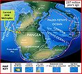
237 mya continental collision.JPG 429 × 387; 55 KB
-
Caspian Sea Gas Seepage.png 1 278 × 750; 1,24 MB
-
Charlie-gibbs-full-extent.png 1 020 × 626; 310 KB
-
Charliegibbstransform.svg 1 020 × 609; 424 KB
-
ColoradoDesertRegionOfCA.jpg 1 024 × 722; 650 KB
-
Earth seafloor crust age 1996 - 2.png 1 624 × 1 020; 1,2 MB
-
Earth's global heat flow map.png 5 240 × 2 930; 1,6 MB
-
Earth's seafloor age.png 5 585 × 2 742; 3,63 MB
-
ISS-36 Salton Trough.jpg 4 256 × 2 832; 2,82 MB
-
Kermadec Plate map-fr.png 497 × 441; 150 KB
-
Mid-ocean ridge topography.gif 240 × 180; 1,06 MB
-
Ocean Spreading Sediments.svg 512 × 251; 7 KB
-
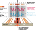
Oceanic magnetic striping example sk.gif 285 × 190; 15 KB
-
Oceanic spreading ca.png 750 × 451; 118 KB
-
Oceanic spreading de.svg 600 × 450; 35 KB
-
Oceanic spreading of the Atlantic Ocean during the Jurassic.jpg 592 × 465; 32 KB
-
Oceanic Stripe Magnetic Anomalies Scheme He.jpg 255 × 187; 23 KB
-
Oceanic.Stripe.Magnetic.Anomalies.Scheme cs version.svg 1 052 × 744; 257 KB
-
Oceanic.Stripe.Magnetic.Anomalies.Scheme mk.svg 1 052 × 744; 288 KB
-
Oceanic.Stripe.Magnetic.Anomalies.Scheme-fr.svg 1 052 × 744; 251 KB
-
Oceanic.Stripe.Magnetic.Anomalies.Scheme.fr.gif 260 × 190; 17 KB
-
Oceanic.Stripe.Magnetic.Anomalies.Scheme.gif 255 × 187; 15 KB
-
Oceanic.Stripe.Magnetic.Anomalies.Scheme.svg 1 052 × 744; 292 KB
-
OceanSpreadingMagnetism-N.svg 512 × 251; 18 KB
-
OSCed.svg 792 × 612; 1,57 MB
-
Propagating Rift.png 840 × 696; 60 KB
-
Ridge render-ja.jpg 350 × 179; 23 KB
-
Ridge Render.svg 349 × 177; 25 KB
-
RISE project region.svg 916 × 793; 3,94 MB
-
Schematic evolution 1114.png 1 027 × 508; 65 KB
-
Seafloor Spreading Sediments Animation.gif 571 × 280; 39 KB
-
SeafloorSpreadingMagAnimation.gif 1 920 × 942; 317 KB
-
Sistema tectônico.png 524 × 287; 130 KB
-
Spreading center and strips.png 403 × 197; 57 KB


