Category:Sedlescombe
Vai alla navigazione
Vai alla ricerca

village in the United Kingdom  | |||||
| Carica un file multimediale | |||||
| Istanza di | |||||
|---|---|---|---|---|---|
| Luogo | Rother, East Sussex, Sud Est dell'Inghilterra, Inghilterra | ||||
| Superficie |
| ||||
| sito web ufficiale | |||||
 | |||||
English: Sedlescombe is a village and civil parish about six miles (10 Km) north of Hastings in the Rother District of East Sussex, England
Sottocategorie
Questa categoria contiene le 8 sottocategorie indicate di seguito, su un totale di 8.
D
- Durhamford Manor (1 F)
M
- Manor Cottages, Sedlescombe (2 F)
O
- Oasts in Sedlescombe (19 F)
Q
S
- Sedlescombe Methodist Chapel (3 F)
File nella categoria "Sedlescombe"
Questa categoria contiene 200 file, indicati di seguito, su un totale di 1 236.
(pagina precedente) (pagina successiva)-

-
 'Beehive' structure at Brambles in Hurst Lane - geograph.org.uk - 6358220.jpg 2 207 × 1 966; 982 KB
-
 'Dormers' at the junction of Paygate Road and the A21 - geograph.org.uk - 5566082.jpg 2 889 × 1 894; 2,26 MB
-
 'Woodlands', Churchland Lane - geograph.org.uk - 5173687.jpg 3 297 × 2 196; 2,64 MB
-
 1 Gorselands in spring - geograph.org.uk - 5340861.jpg 4 532 × 3 094; 4,19 MB
-
 1 ^ 2 The Stables in Sedlescombe - geograph.org.uk - 5309370.jpg 4 373 × 2 280; 3,61 MB
-
 1, The Old Tanyard - geograph.org.uk - 4478837.jpg 3 570 × 2 678; 2,99 MB
-
 1-3, The Old Tanyard - geograph.org.uk - 4478843.jpg 4 000 × 3 000; 3,31 MB
-
 14 Gorselands from the field to the north - geograph.org.uk - 5306228.jpg 3 627 × 2 612; 2,46 MB
-
 2 ^ 3, The Old Tanyard - geograph.org.uk - 4478839.jpg 6 905 × 2 800; 3,48 MB
-
 2, The Old Tanyard - geograph.org.uk - 4478838.jpg 4 000 × 3 000; 3,11 MB
-
 20 and 22 Park Shaw with skip - geograph.org.uk - 5307178.jpg 4 032 × 2 724; 2,89 MB
-
 24 Park Shaw with steps - geograph.org.uk - 5213339.jpg 4 517 × 3 387; 3,91 MB
-
 3 Red Barn Cottages - geograph.org.uk - 5182625.jpg 2 490 × 1 919; 1,11 MB
-
 4, The Old Tanyard - geograph.org.uk - 4478841.jpg 3 632 × 2 724; 2,36 MB
-
 4, The Old Tanyard - geograph.org.uk - 4478842.jpg 3 744 × 2 808; 2,09 MB
-
 95 East View Terrace - geograph.org.uk - 5292651.jpg 1 518 × 1 102; 698 KB
-
 A banded centipede, Churchland Lane - geograph.org.uk - 5435817.jpg 1 996 × 1 452; 700 KB
-
 A fine example of the corkscrew willow at Park View - geograph.org.uk - 5488978.jpg 2 272 × 1 704; 1,33 MB
-

-
 A grassy Sussex field - geograph.org.uk - 3702429.jpg 640 × 430; 65 KB
-
 A High Weald landscape - geograph.org.uk - 3710756.jpg 640 × 430; 52 KB
-
 A male ghost moth, Churchland Lane, Sedlescombe - geograph.org.uk - 5558063.jpg 2 117 × 1 854; 1,44 MB
-
 A pill millipede, Churchland Lane, Sedlescombe - geograph.org.uk - 5443671.jpg 1 436 × 1 060; 202 KB
-
 A Sedlescombe footpath - geograph.org.uk - 4780772.jpg 1 280 × 928; 1,06 MB
-
 A snail-killing beetle, Churchland Lane - geograph.org.uk - 5483986.jpg 1 036 × 1 484; 458 KB
-

-
 A spring cranefly in Churchland Lane, Sedlescombe - geograph.org.uk - 5503825.jpg 1 386 × 1 320; 291 KB
-
 A terse but effective 'Beware of the Bull' sign - geograph.org.uk - 5963660.jpg 4 359 × 3 269; 3,83 MB
-

-
 A twenty-plume moth on a window pane at night - geograph.org.uk - 5503837.jpg 1 164 × 966; 205 KB
-
 A weeping willow in late winter - geograph.org.uk - 5306531.jpg 2 675 × 2 320; 2,04 MB
-
 A weevil near Churchland Lane, Sedlescombe - geograph.org.uk - 5433547.jpg 1 336 × 984; 246 KB
-
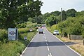
 A21 - B2244 junction - geograph.org.uk - 3289974.jpg 640 × 430; 68 KB
-
 A21 - B2244 junction - geograph.org.uk - 5835454.jpg 1 024 × 681; 129 KB
-
 A21 - geograph.org.uk - 5835443.jpg 1 024 × 895; 341 KB
-
 A21 heading north - geograph.org.uk - 2697709.jpg 640 × 458; 105 KB
-
 A21 in the Line Valley - geograph.org.uk - 3289983.jpg 640 × 462; 70 KB
-
 A21 towards Hastings - geograph.org.uk - 4429137.jpg 720 × 1 080; 312 KB
-
 A21 towards London - geograph.org.uk - 6141058.jpg 1 024 × 684; 812 KB
-
 A21 towards Whatlington - geograph.org.uk - 4429138.jpg 1 333 × 2 000; 1,83 MB
-
 A21, northbound - geograph.org.uk - 5982243.jpg 1 024 × 681; 207 KB
-
 A21, northbound - geograph.org.uk - 5982250.jpg 1 024 × 681; 193 KB
-
 A21, northbound - geograph.org.uk - 5982252.jpg 1 024 × 681; 157 KB
-
 A21, Sedlescombe, East Sussex - geograph.org.uk - 1042356.jpg 640 × 480; 123 KB
-
 A21, southbound - geograph.org.uk - 5965145.jpg 1 024 × 681; 236 KB
-
 Abandoned brick pit, Killingan Wood, Sedlescombe - geograph.org.uk - 5589040.jpg 4 738 × 3 553; 6,33 MB
-
 Acorn Chalet, Churchland Lane - geograph.org.uk - 5204856.jpg 3 683 × 2 524; 1,97 MB
-
 Adder at Tresco in Churchland Lane - geograph.org.uk - 5500593.jpg 1 407 × 963; 445 KB
-
 Alder buckthorn berries, Churchland Lane - geograph.org.uk - 5523285.jpg 4 347 × 3 225; 4,24 MB
-
 Alder buckthorn in autumn - geograph.org.uk - 4730477.jpg 640 × 617; 204 KB
-
 Ambleside, Balcombe Green - geograph.org.uk - 5227119.jpg 3 503 × 2 308; 2,97 MB
-
 Ambulance call in Churchland Lane - geograph.org.uk - 5298724.jpg 1 993 × 1 677; 1,09 MB
-
 An ash-black slug, Churchland Lane - geograph.org.uk - 5492376.jpg 2 272 × 1 704; 807 KB
-
 An early thorn moth on ivy, Churchland Lane - geograph.org.uk - 5324592.jpg 2 012 × 1 588; 722 KB
-
 Ancient meadow - geograph.org.uk - 4764834.jpg 1 024 × 768; 841 KB
-
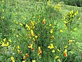 André's broom, Sedlescombe Heath - geograph.org.uk - 5231775.jpg 2 816 × 2 112; 2,12 MB
-
 Anemones in wood - geograph.org.uk - 4764722.jpg 1 024 × 768; 842 KB
-
 Animal track through the bluebells, Killingan Wood - geograph.org.uk - 5344230.jpg 4 297 × 3 223; 6,24 MB
-
 Anti tank devices at Sedlescombe Organic Vineyard (geograph 5762815).jpg 5 184 × 3 456; 6,12 MB
-
 Apple blossom in Churchland Lane - geograph.org.uk - 5364758.jpg 3 650 × 3 024; 3 MB
-
 Arable Field - geograph.org.uk - 6245172.jpg 640 × 480; 66 KB
-
 Ariel Cottage in spring, Churchland Lane - geograph.org.uk - 5312434.jpg 3 486 × 2 537; 3,53 MB
-
 Ariel Cottage, Churchland Lane - geograph.org.uk - 5176236.jpg 4 499 × 3 373; 5,25 MB
-
 Array of roadside signs by B2244 - geograph.org.uk - 5262647.jpg 2 224 × 1 475; 1,11 MB
-
 Array of signs in Churchland Lane, Sedlescombe - geograph.org.uk - 5751388.jpg 4 896 × 3 672; 7,14 MB
-

-
 Arum rust on cuckoopint leaves, Churchland Lane - geograph.org.uk - 5500553.jpg 1 254 × 1 293; 649 KB
-

-
 Ash tree plantation in Tithe Wood, Sedlescombe - geograph.org.uk - 5670674.jpg 2 816 × 2 112; 3,28 MB
-
 Ash tree with ash dieback disease - geograph.org.uk - 5170819.jpg 4 896 × 3 672; 6,94 MB
-
 Ashdene, Gorselands estate - geograph.org.uk - 5289354.jpg 3 998 × 2 575; 2,73 MB
-
 Ashdown Cottage, Cottage Lane, Sedlescombe - geograph.org.uk - 4402251.jpg 1 620 × 1 080; 1,26 MB
-
 Asselton House, The Green - geograph.org.uk - 4112363.jpg 1 024 × 768; 308 KB
-
 At the corner of Footland Wood - geograph.org.uk - 3064209.jpg 640 × 480; 145 KB
-
 Atlas cedar at the Pestalozzi International Village - geograph.org.uk - 5341899.jpg 1 464 × 1 352; 585 KB
-
 Austford Straight in Brede High Woods - geograph.org.uk - 5314243.jpg 2 204 × 1 609; 1,95 MB
-
 Autumn across Churchland Fields. - geograph.org.uk - 5193547.jpg 1 600 × 1 189; 577 KB
-
 Autumn stubble, Devil's Brook Valley - geograph.org.uk - 6284437.jpg 4 896 × 3 672; 6,12 MB
-
 Autumn-sown corn - geograph.org.uk - 4718947.jpg 800 × 544; 136 KB
-
 Autumnal oak trees on the Hurst House estate - geograph.org.uk - 5589051.jpg 3 541 × 2 567; 2,9 MB
-
 B2244 - A21 junction - geograph.org.uk - 2697699.jpg 640 × 430; 74 KB
-
 B2244 - A21 junction - geograph.org.uk - 6018652.jpg 1 024 × 778; 235 KB
-
 B2244 enters Sedlescombe - geograph.org.uk - 2598693.jpg 3 419 × 2 341; 1,64 MB
-
 B2244 enters Sedlescombe - geograph.org.uk - 3475958.jpg 3 514 × 2 671; 2,17 MB
-
 B2244 enters Sedlescombe from the north - geograph.org.uk - 6137450.jpg 1 024 × 684; 293 KB
-
 B2244 in the centre of Sedlescombe - geograph.org.uk - 2709605.jpg 3 648 × 2 534; 1,36 MB
-
 B2244 joins A21 - geograph.org.uk - 5982248.jpg 1 024 × 681; 173 KB
-
 B2244 north of junction with Compasses Lane - geograph.org.uk - 3475955.jpg 3 648 × 2 736; 2,01 MB
-
 B2244 north of junction with Hurst Lane - geograph.org.uk - 3475957.jpg 3 377 × 2 441; 1,58 MB
-
 B2244 off A21 - geograph.org.uk - 5959874.jpg 1 024 × 733; 239 KB
-
 B2244 passes The Pump House - geograph.org.uk - 3475959.jpg 3 593 × 2 687; 1,38 MB
-
 Balcombe Green, south end, Sedlescombe Street - geograph.org.uk - 5216449.jpg 4 150 × 2 644; 2,27 MB
-
 Banded centipede, Churchland Lane - geograph.org.uk - 5297887.jpg 640 × 637; 176 KB
-
 Barn at Stream Farm - geograph.org.uk - 4413809.jpg 1 440 × 1 080; 864 KB
-
 Barn-shed south east of Castlemans - geograph.org.uk - 4780212.jpg 1 280 × 959; 710 KB
-
 Barnes Farm - geograph.org.uk - 3719817.jpg 640 × 430; 64 KB
-
 Barnes Wood - geograph.org.uk - 5762818.jpg 4 905 × 3 270; 5,41 MB
-
-
 Barren strawberry in a crack between kerb and drive - geograph.org.uk - 5340956.jpg 2 732 × 2 123; 2,3 MB
-
 Beanford Farm - geograph.org.uk - 4429129.jpg 2 000 × 674; 646 KB
-
 Beanford Farm - geograph.org.uk - 6244336.jpg 640 × 523; 98 KB
-

-
 Bede High Woods muddy path - geograph.org.uk - 5777250.jpg 1 920 × 1 080; 754 KB
-
 Bee fly at rest, Churchland Lane - geograph.org.uk - 5353698.jpg 834 × 625; 187 KB
-
 Beech Farm Rd - geograph.org.uk - 3711271.jpg 640 × 430; 87 KB
-
 Beech hedge in winter, Balcombe Green - geograph.org.uk - 5289721.jpg 4 896 × 2 897; 5,98 MB
-

-
 Beefsteak fungus in Killingan Wood - geograph.org.uk - 5312310.jpg 2 272 × 1 704; 968 KB
-
 Betony at Compasses Gate - geograph.org.uk - 5249769.jpg 2 816 × 2 112; 3,18 MB
-
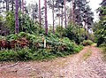
 Big gate on footpath Brede High Woods - geograph.org.uk - 5776840.jpg 1 920 × 1 080; 670 KB
-
 Birch leaves on snow - geograph.org.uk - 5252131.jpg 2 816 × 2 112; 1,6 MB
-
 Birch scrubbing in Holman Wood Field, Brede High Woods - geograph.org.uk - 5311505.jpg 2 224 × 1 652; 1,44 MB
-
 Birch tree with 'witch's brooms' - geograph.org.uk - 5253284.jpg 1 642 × 2 138; 1,64 MB
-
 Black stemmed thistles in Churchland Fields - geograph.org.uk - 5471821.jpg 2 643 × 2 459; 3,42 MB
-
 Black-headed cardinal beetle, Brede High Woods - geograph.org.uk - 5211021.jpg 1 829 × 1 238; 816 KB
-
 Blackbrook Garden Centre - geograph.org.uk - 5959873.jpg 1 024 × 681; 181 KB
-
 Blackbrook Garden Centre - geograph.org.uk - 5965144.jpg 1 024 × 681; 192 KB
-
 Blackbrooks Garden Centre, New Road - geograph.org.uk - 6245029.jpg 640 × 431; 57 KB
-
 Blackcap, Churchland Lane - geograph.org.uk - 5297928.jpg 549 × 436; 151 KB
-

-
 Bluebells among felled trees, Churchland Wood - geograph.org.uk - 5359896.jpg 4 896 × 3 672; 7,66 MB
-
 Bluebells and ferns in chestnut coppice, Thorp's Wood - geograph.org.uk - 5640544.jpg 2 816 × 2 112; 3,46 MB
-
 Bluebells and yellow archangel, Killingan Wood - geograph.org.uk - 5267082.jpg 2 816 × 2 112; 2,55 MB
-
 Bluebells around an oak, Churchland Wood - geograph.org.uk - 5282103.jpg 2 585 × 1 939; 2,2 MB
-
 Bluebells in Hoads Wood - geograph.org.uk - 4478971.jpg 3 000 × 3 000; 3,64 MB
-
 Bluebells in Killingan Wood. - geograph.org.uk - 5176257.jpg 3 420 × 2 566; 2,62 MB
-
 Bog beacon fungi, Sedlescombe Heath, Brede High Woods - geograph.org.uk - 5640460.jpg 2 160 × 1 556; 852 KB
-
 Boulders on lawn - geograph.org.uk - 5203166.jpg 3 452 × 2 121; 1,77 MB
-
 Bourne Farm, Brede Lane - geograph.org.uk - 5243816.jpg 3 614 × 2 410; 3,36 MB
-
 Box hedge in spring, Park Shaw - geograph.org.uk - 5383650.jpg 3 224 × 2 413; 3,3 MB
-

-
 Brambles off Hurst Lane - geograph.org.uk - 5203524.jpg 4 084 × 2 175; 2,22 MB
-
 Bramlea, Balcombe Green - geograph.org.uk - 5179522.jpg 3 353 × 2 357; 1,72 MB
-
 Brass plaque on seat, Churchland Fields - geograph.org.uk - 5260782.jpg 2 749 × 2 061; 1,21 MB
-
 Brede High Wood - geograph.org.uk - 3702165.jpg 640 × 430; 138 KB
-
 Brede High Wood - geograph.org.uk - 3702178.jpg 640 × 430; 114 KB
-
 Brede High Wood - geograph.org.uk - 3711277.jpg 640 × 430; 73 KB
-
 Brede Lane - geograph.org.uk - 2299977.jpg 640 × 480; 96 KB
-
 Brede Lane - geograph.org.uk - 2802742.jpg 640 × 480; 101 KB
-
 Brede Lane - geograph.org.uk - 2802880.jpg 640 × 480; 92 KB
-
 Brede Lane - geograph.org.uk - 5243813.jpg 4 000 × 3 000; 3,88 MB
-
 Brede Lane at Balcombe Green - geograph.org.uk - 2709608.jpg 3 648 × 2 499; 1,43 MB
-
 Brede Lane east of Lower Jacobs Farm - geograph.org.uk - 2709619.jpg 3 648 × 2 302; 1,4 MB
-
 Brede Lane east of Sedlescombe - geograph.org.uk - 3038518.jpg 1 600 × 1 280; 577 KB
-
 Brede Lane north of Bournes Farm - geograph.org.uk - 2709612.jpg 3 648 × 2 345; 1,4 MB
-
 Brede Lane, Sedlescombe - geograph.org.uk - 1194787.jpg 640 × 424; 107 KB
-
 Brede Lane, Sedlescombe Street - geograph.org.uk - 5208455.jpg 3 101 × 2 219; 2,53 MB
-
 Brede Lane, Sedlescombe, East Sussex - geograph.org.uk - 946027.jpg 640 × 427; 85 KB
-
 Breeze block shed - geograph.org.uk - 5172493.jpg 4 896 × 3 672; 5,78 MB
-
 Brick shed, Balcombe Green - geograph.org.uk - 5289732.jpg 3 010 × 2 661; 2,25 MB
-
 Brick wall by footpath - geograph.org.uk - 5341314.jpg 4 749 × 3 563; 6,39 MB
-
 Brickwall Cottage, The Street, Sedlescombe - geograph.org.uk - 5469457.jpg 4 896 × 3 672; 5,55 MB
-

-
 Bridge over stream - geograph.org.uk - 4781531.jpg 1 262 × 1 280; 1,05 MB
-
 Bridge over the Powdermill Stream, Brede High Woods - geograph.org.uk - 5798724.jpg 2 706 × 1 962; 1,88 MB
-
 Brimstone butterfly, Churchland Lane - geograph.org.uk - 5298730.jpg 1 014 × 757; 355 KB
-
 Broad buckler-fern in Churchland Wood - geograph.org.uk - 5359883.jpg 4 369 × 3 220; 6,99 MB
-
 Brook Hopgarden - geograph.org.uk - 6245816.jpg 640 × 480; 72 KB
-
 Broom and hawthorn in flower, Brede High Woods - geograph.org.uk - 5210902.jpg 4 896 × 3 672; 5,71 MB
-
 Broom Field - geograph.org.uk - 6245160.jpg 640 × 480; 85 KB
-
 Broom Field - geograph.org.uk - 6245809.jpg 640 × 480; 67 KB
-
 Broom in flower, Brede High Woods - geograph.org.uk - 5293628.jpg 2 199 × 1 547; 1,68 MB
-
 Broom in flower, Sedlescombe Heath - geograph.org.uk - 5230425.jpg 4 539 × 3 404; 6,35 MB
-
 Buds and young leaves on wild service tree - geograph.org.uk - 5267072.jpg 1 533 × 1 319; 473 KB
-
 Bugle, Churchland Lane - geograph.org.uk - 5298778.jpg 2 239 × 1 653; 1,52 MB
-
 Building site, Sedlescombe Street - geograph.org.uk - 5215066.jpg 2 902 × 1 920; 1,58 MB
-
 Bulmer House - geograph.org.uk - 4112362.jpg 1 024 × 768; 276 KB
-

-
 Bungalow with solar panels, Gorselands - geograph.org.uk - 5307142.jpg 3 157 × 2 181; 2,4 MB
-
 Bungalow, Sedlescombe Street - geograph.org.uk - 5216167.jpg 2 400 × 1 410; 1,27 MB
-
 Butcher's broom hedge - geograph.org.uk - 5229498.jpg 4 896 × 3 672; 6,46 MB
-
 Butcher's broom in flower, Churchland Wood - geograph.org.uk - 5321968.jpg 2 272 × 1 704; 719 KB
-

-
 Buying sweets at Sedlescombe village fete, 2009 - geograph.org.uk - 5989197.jpg 1 367 × 1 318; 401 KB
-
 Cabbage tree, Gorselands - geograph.org.uk - 5229442.jpg 3 241 × 2 405; 2,05 MB
-
 Cake and jam at village fete - geograph.org.uk - 5262257.jpg 2 660 × 2 041; 1,21 MB
-
 Caldbec Hill, Battle from Churchland Lane, Sedlescombe - geograph.org.uk - 5365309.jpg 4 726 × 2 641; 2,14 MB
-
 Caldbeck Hill, Battle from Churchland Lane Sedlescombe - geograph.org.uk - 6160167.jpg 2 816 × 2 112; 1,63 MB
-
 Caper spurge, Churchland Lane - geograph.org.uk - 5264727.jpg 2 012 × 2 080; 1,43 MB
-
 Car park at Sedlescombe Sports Field - geograph.org.uk - 5297836.jpg 2 701 × 2 025; 2,32 MB
-
 Cart horse enjoying a feed of hay, Churchland Fields - geograph.org.uk - 5492312.jpg 1 738 × 1 282; 855 KB
-
 Castlemans Oast, Church Hill, Sedlescombe - geograph.org.uk - 5820745.jpg 5 184 × 3 456; 5,31 MB
-
 Castlemans Oast, Church Hill, Sedlescombe - geograph.org.uk - 5820747.jpg 5 184 × 3 456; 4,99 MB
-

-
 Cat on tabletop grave, Sedlescombe churchyard - geograph.org.uk - 6144849.jpg 4 587 × 3 441; 4,88 MB
-
 Caterpillar D2 with cultivator, Rural Pastimes.jpg 3 229 × 2 236; 1,77 MB
-
 Catkins on goat willow, Churchland Lane - geograph.org.uk - 5297923.jpg 2 816 × 2 112; 2,67 MB
-
 Catslide roof ^ tile hung wall, Sedlescombe Street - geograph.org.uk - 5228481.jpg 4 591 × 3 443; 3,71 MB
-
 Catt's Shaw near East View Terrace - geograph.org.uk - 5255254.jpg 2 043 × 1 162; 932 KB
-
 Cattle at hay feeder, Churchland Fields - geograph.org.uk - 6005467.jpg 3 834 × 2 712; 3,73 MB
-
 Cattle in Churchland Fields in the snow - geograph.org.uk - 5256269.jpg 1 924 × 1 322; 871 KB
-
 Cattle trough at the side of the 'Queen's Head' Sedlescombe - geograph.org.uk - 2554154.jpg 3 241 × 2 111; 5,31 MB
-
 Causeway on footpath from Hurst Lane - geograph.org.uk - 5300980.jpg 4 896 × 3 672; 5,42 MB
-
 Celandines on bank - geograph.org.uk - 5174264.jpg 4 583 × 3 437; 5,11 MB
-
 Celery-leaved buttercup, Brede High Woods - geograph.org.uk - 5249160.jpg 2 009 × 2 081; 627 KB
-
 Cereals in the Line Valley - geograph.org.uk - 5965142.jpg 1 024 × 681; 146 KB
-
 Charcoal burning off Marley Lane - geograph.org.uk - 5267358.jpg 1 600 × 1 199; 487 KB
-
 Cherry plum blossom, Brede High Woods - geograph.org.uk - 5252951.jpg 2 816 × 2 112; 2,04 MB
-
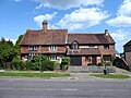
 Cherry Tree Cottage, Sedlescombe Street - geograph.org.uk - 5227854.jpg 4 896 × 3 672; 4,59 MB


,_Churchland_Lane_-_geograph.org.uk_-_5299310.jpg)


.jpg)


_in_field_pond_near_Great_Sanders_House,_Sedlescombe_-_geograph.org.uk_-_4718797.jpg)


