Category:Seething
Vai alla navigazione
Vai alla ricerca
English: Seething is a small village in Norfolk, England, about 9 1/2 miles south east of Norwich. It covers an area of and had a population of 341 in 141 households as of the 2001 census.
village and civil parish in Norfolk, United Kingdom  | |||||
| Carica un file multimediale | |||||
| Istanza di | |||||
|---|---|---|---|---|---|
| Luogo | South Norfolk, Norfolk, Est dell'Inghilterra, Inghilterra | ||||
| Popolazione |
| ||||
| Superficie |
| ||||
 | |||||
Sottocategorie
Questa categoria contiene le 3 sottocategorie indicate di seguito, su un totale di 3.
S
W
File nella categoria "Seething"
Questa categoria contiene 200 file, indicati di seguito, su un totale di 431.
(pagina precedente) (pagina successiva)-
 448th Bomb Group Memorial - geograph.org.uk - 4491724.jpg 640 × 543; 613 KB
-
 448th Bomb Group war memorial - geograph.org.uk - 6065156.jpg 4 032 × 2 268; 5,67 MB
-
 A hangar once used to stand here - geograph.org.uk - 4791639.jpg 640 × 480; 262 KB
-
 A house in The Ling - geograph.org.uk - 1570506.jpg 640 × 480; 144 KB
-
 A natural arch in Wheelers Lane - geograph.org.uk - 1582483.jpg 640 × 541; 191 KB
-
 A WW2 relic - geograph.org.uk - 6073942.jpg 800 × 561; 653 KB
-
 Abandoned building - geograph.org.uk - 1406951.jpg 640 × 515; 141 KB
-
 Abandoned car body repair centre - geograph.org.uk - 1731991.jpg 800 × 531; 119 KB
-
 Abandoned car body repair centre - geograph.org.uk - 1731995.jpg 800 × 531; 117 KB
-
 Access road to Fen Farm - geograph.org.uk - 4491776.jpg 640 × 480; 539 KB
-
 Access road to Manor Farm - geograph.org.uk - 6073952.jpg 800 × 590; 121 KB
-

-
 Approaching Seething on Mill Lane - geograph.org.uk - 3374332.jpg 640 × 480; 120 KB
-

-
 Autumn Colours on the small road - geograph.org.uk - 1571003.jpg 640 × 480; 124 KB
-
 Autumn Colours on the small road - geograph.org.uk - 1571005.jpg 640 × 480; 125 KB
-
 Autumn Colours on the small road - geograph.org.uk - 1571017.jpg 640 × 480; 128 KB
-
 Barn and Goods van, Mundham - geograph.org.uk - 156728.jpg 640 × 480; 114 KB
-
 Barn at Manor Farm - geograph.org.uk - 6073941.jpg 800 × 565; 103 KB
-
 Barn conversions at Manor Farm - geograph.org.uk - 6073946.jpg 800 × 559; 149 KB
-
 Barn owl Near Honeypot Lane (right) - geograph.org.uk - 967598.jpg 640 × 480; 96 KB
-
 Beech hedge in autumn colours - geograph.org.uk - 1582482.jpg 480 × 640; 212 KB
-
 Bends on Mill Lane, north of Seething - geograph.org.uk - 3374352.jpg 640 × 480; 223 KB
-
 Bigotts Lane sign - geograph.org.uk - 4118774.jpg 2 965 × 2 228; 879 KB
-
 Blocked track - geograph.org.uk - 6073935.jpg 800 × 573; 583 KB
-
 BR container - geograph.org.uk - 1169221.jpg 640 × 480; 150 KB
-
 Brambles on the old Technical site - geograph.org.uk - 4791638.jpg 640 × 480; 458 KB
-
 Brick-built blast shelter - geograph.org.uk - 4791647.jpg 640 × 612; 506 KB
-
 Bridleway approaching Fen Farm - geograph.org.uk - 4491808.jpg 640 × 480; 466 KB
-
 Bridleway past Fen Farm - geograph.org.uk - 4491802.jpg 640 × 480; 445 KB
-
 Brooke Road past cottages in The Ling - geograph.org.uk - 1570511.jpg 640 × 480; 102 KB
-
 Brooke Road sign - geograph.org.uk - 4163148.jpg 3 072 × 2 242; 2,12 MB
-
 Brooke Road through The Ling - geograph.org.uk - 1570502.jpg 640 × 505; 122 KB
-
 Brooke Road ^ Bridge - geograph.org.uk - 4163177.jpg 3 072 × 2 304; 1,76 MB
-
 Brooke Road ^ Seething Lings Postbox - geograph.org.uk - 4163190.jpg 3 072 × 2 304; 1,97 MB
-
 Brooke Road ^ Seething Lings Postbox - geograph.org.uk - 4163198.jpg 3 072 × 2 304; 1,88 MB
-
 Brooke Road, Seething - geograph.org.uk - 4163146.jpg 3 072 × 2 304; 1,84 MB
-
 Brooke Road, Seething - geograph.org.uk - 4163197.jpg 3 072 × 2 304; 1,73 MB
-
 Brooke Road, Seething - geograph.org.uk - 4163222.jpg 3 072 × 2 304; 2 MB
-
 Brooke Road, Seething - geograph.org.uk - 4163234.jpg 3 072 × 2 304; 670 KB
-
 Burnt out goods van - geograph.org.uk - 1732009.jpg 800 × 531; 158 KB
-
 Busseybridge Farm, Mundham - geograph.org.uk - 3374359.jpg 640 × 480; 211 KB
-

-

-
 Church of St Margaret ^ St Remigius, Seething - geograph.org.uk - 6065157.jpg 4 032 × 2 268; 4,22 MB
-
 Church School Farm - geograph.org.uk - 1587399.jpg 640 × 480; 44 KB
-
 Clearing on the old Technical site - geograph.org.uk - 4791643.jpg 640 × 480; 411 KB
-
 Collapsed wall - geograph.org.uk - 4791652.jpg 640 × 480; 554 KB
-
 Colourful beech hedge in Wheelers Lane - geograph.org.uk - 1582474.jpg 640 × 461; 191 KB
-
 Construction buildings - geograph.org.uk - 1587211.jpg 640 × 480; 49 KB
-
 Cottage in Wheelers Lane - geograph.org.uk - 1582520.jpg 640 × 480; 158 KB
-
 Cow parsley beside the path to Mill Lane - geograph.org.uk - 4491825.jpg 640 × 480; 497 KB
-

-
 Cow parsley by Fen Farm - geograph.org.uk - 4491829.jpg 640 × 480; 467 KB
-
 Deep wheel ruts on Hobb's Lane - geograph.org.uk - 6277810.jpg 800 × 450; 165 KB
-

-

-
 Driveway to Mundham Grange - geograph.org.uk - 1057557.jpg 640 × 480; 76 KB
-
-
 Entering Seething on Brooke Road - geograph.org.uk - 4163271.jpg 2 931 × 2 201; 753 KB
-
 Entering Seething on Brooke Road - geograph.org.uk - 4163311.jpg 2 914 × 2 189; 784 KB
-
 Entering Seething on Seething Street - geograph.org.uk - 4118762.jpg 3 011 × 2 262; 998 KB
-
 Entering Seething on Wheelers Lane - geograph.org.uk - 4118743.jpg 3 030 × 2 276; 1,37 MB
-
 Enterprise House sign - geograph.org.uk - 4126418.jpg 2 251 × 3 004; 1,07 MB
-
 Entrance into a blast shelter - geograph.org.uk - 4791649.jpg 640 × 545; 522 KB
-
 Entrance to Enterprise House - geograph.org.uk - 4126414.jpg 3 072 × 2 304; 1,86 MB
-
 Entrance to Fen Farm - geograph.org.uk - 4491783.jpg 640 × 480; 275 KB
-
 Entrance to Priory Barn - geograph.org.uk - 4163281.jpg 3 072 × 2 304; 1,1 MB
-

-
 Ex council houses, Seething - geograph.org.uk - 1068405.jpg 640 × 480; 46 KB
-
 Exiting Seething - geograph.org.uk - 1057550.jpg 640 × 480; 30 KB
-
 Farm buildings in Harvey's Lane - geograph.org.uk - 6277802.jpg 800 × 450; 118 KB
-
 Farm buildings in Harvey's Lane - geograph.org.uk - 6277804.jpg 800 × 450; 136 KB
-

-
 Farm off Harvey Lane - geograph.org.uk - 4126422.jpg 3 072 × 2 304; 1,82 MB
-
 Farm track past a crop of maize - geograph.org.uk - 1570754.jpg 640 × 450; 105 KB
-
 Farm track south to Brooke Road - geograph.org.uk - 1570745.jpg 640 × 435; 74 KB
-
 Farm track to Harvey's Lane - geograph.org.uk - 4802416.jpg 640 × 480; 295 KB
-
 Farmland at The Ling - geograph.org.uk - 4406301.jpg 2 592 × 1 944; 1,45 MB
-
 Farmland off Wheelers Lane - geograph.org.uk - 4118697.jpg 3 072 × 2 304; 1,13 MB
-
 Fen Farm - geograph.org.uk - 1569589.jpg 640 × 480; 72 KB
-
 Fen Farm - geograph.org.uk - 1569634.jpg 640 × 480; 55 KB
-

-
 Field east of Wheelers Lane - geograph.org.uk - 1582517.jpg 640 × 455; 156 KB
-
 Fields and houses - geograph.org.uk - 1055042.jpg 640 × 480; 68 KB
-
 Fields at Upgate - geograph.org.uk - 6073938.jpg 800 × 565; 114 KB
-
 Fields by Fen Farm, Mundham - geograph.org.uk - 3374333.jpg 640 × 431; 186 KB
-
 Fields by Manor Farm - geograph.org.uk - 6073948.jpg 800 × 555; 134 KB
-
 Fields west of Eight Acre Wood - geograph.org.uk - 1570767.jpg 640 × 438; 130 KB
-

-
 Footpath from The Ling to Seething - geograph.org.uk - 1570681.jpg 640 × 434; 74 KB
-
 Footpath from The Ling to Seething - geograph.org.uk - 1570686.jpg 640 × 457; 122 KB
-
 Footpath in the countryside - geograph.org.uk - 1587299.jpg 640 × 480; 39 KB
-
 Footpath Marker - geograph.org.uk - 1587313.jpg 480 × 640; 147 KB
-
 Footpath marker by hedgerow - geograph.org.uk - 1570759.jpg 640 × 456; 162 KB
-
 Footpath on unmade road - geograph.org.uk - 1587228.jpg 640 × 480; 68 KB
-
 Footpath past Mundham church - geograph.org.uk - 6065173.jpg 4 032 × 2 268; 4,29 MB
-
 Footpath through a crop of maize - geograph.org.uk - 1570763.jpg 480 × 640; 156 KB
-
 Footpath through the fields - geograph.org.uk - 1587388.jpg 640 × 480; 52 KB
-
 Footpath to Market Lane - geograph.org.uk - 1313341.jpg 640 × 480; 90 KB
-
 Footpath ^ entrance to St.Margaret ^ St.Remigius Church - geograph.org.uk - 4164736.jpg 3 072 × 2 304; 1,92 MB
-
 Freestones Stores ^ Seething Post Office - geograph.org.uk - 4164888.jpg 3 011 × 2 262; 1,3 MB
-
 Frozen over Seething Pond - geograph.org.uk - 1114765.jpg 640 × 480; 67 KB
-
 Game bird feeder and water dish - geograph.org.uk - 1570780.jpg 640 × 480; 116 KB
-
 Game bird feeder beside farm track - geograph.org.uk - 1570757.jpg 640 × 444; 117 KB
-
 Game bird feeder on farm track - geograph.org.uk - 4802453.jpg 640 × 592; 471 KB
-
 Game bird feeder on unmarked track - geograph.org.uk - 1570778.jpg 640 × 455; 121 KB
-
 Gate into cattle pasture - geograph.org.uk - 1570716.jpg 640 × 449; 110 KB
-
 Gnarled trees - geograph.org.uk - 4791634.jpg 640 × 480; 484 KB
-
 Grazing Land - geograph.org.uk - 1569616.jpg 640 × 480; 125 KB
-
 Harvey Lane, Kirstead Green - geograph.org.uk - 4124950.jpg 3 072 × 2 264; 978 KB
-
 Harvey Lane, Kirstead Green - geograph.org.uk - 4124966.jpg 3 072 × 2 304; 703 KB
-
 Harvey Lane, Kirstead Green - geograph.org.uk - 4124969.jpg 3 072 × 2 304; 549 KB
-
 Harvey Lane, Upgate - geograph.org.uk - 4126413.jpg 3 072 × 2 212; 1,07 MB
-
 Harvey Lane, Upgate - geograph.org.uk - 4126424.jpg 3 072 × 2 304; 1,7 MB
-
 Harveys Lane sign - geograph.org.uk - 4118815.jpg 2 983 × 2 241; 1,75 MB
-
 Hidden underneath ivy - geograph.org.uk - 5245468.jpg 640 × 480; 229 KB
-
 Hobb's Lane - geograph.org.uk - 6277807.jpg 800 × 450; 166 KB
-
 Honeypot Lane sign - geograph.org.uk - 4118709.jpg 2 888 × 2 170; 2,11 MB
-
 Honeypot Lane sign - geograph.org.uk - 4163237.jpg 3 072 × 2 304; 1,14 MB
-
 Honeypot Lane, Seething - geograph.org.uk - 4118707.jpg 2 965 × 2 305; 621 KB
-
 Honeypot Lane, Seething - geograph.org.uk - 4163229.jpg 3 072 × 2 304; 1,88 MB
-
 House by Fen Farm - geograph.org.uk - 4491779.jpg 640 × 480; 436 KB
-
 House in Seething - geograph.org.uk - 1114773.jpg 640 × 480; 40 KB
-
 Houses in Seething Road - geograph.org.uk - 1582528.jpg 640 × 453; 161 KB
-
-

-

-
-

-

-

-

-
-

-

-

-
 Ivy-clad building in the woods - geograph.org.uk - 5245465.jpg 640 × 480; 184 KB
-
 Kirstead Ling sign - geograph.org.uk - 4163153.jpg 3 049 × 2 290; 2,04 MB
-
 Kirstead Ling, Seething - geograph.org.uk - 4163157.jpg 3 072 × 2 197; 715 KB
-
 Late Evening and the Day is Dying - geograph.org.uk - 1737180.jpg 800 × 531; 18 KB
-
 Line of Trees - geograph.org.uk - 1587327.jpg 640 × 480; 116 KB
-
 Lone Tree Stands Still while the Earth Rotates - geograph.org.uk - 1852095.jpg 4 288 × 2 848; 6,22 MB
-
 Looking onto the old airfield - geograph.org.uk - 1226533.jpg 640 × 480; 34 KB
-
 Looking over the fields - geograph.org.uk - 1587284.jpg 640 × 480; 50 KB
-

-
 Looking over the frozen fields - geograph.org.uk - 1114807.jpg 640 × 480; 43 KB
-
 Looking to 8 acre wood - geograph.org.uk - 1587274.jpg 640 × 480; 34 KB
-
 Looking towards Seething Fen - geograph.org.uk - 1569644.jpg 640 × 480; 67 KB
-
 Looking towards the edge of TM3298 - geograph.org.uk - 1569598.jpg 640 × 480; 93 KB
-
 Main road through Seething - geograph.org.uk - 1057541.jpg 640 × 480; 85 KB
-
 Main street through Seething - geograph.org.uk - 1680131.jpg 800 × 531; 148 KB
-
 Maize crop left for game cover - geograph.org.uk - 1587377.jpg 640 × 480; 56 KB
-
 Marked path - geograph.org.uk - 1587257.jpg 640 × 480; 47 KB
-
 Memorial to 448th Bomb Group - geograph.org.uk - 4164764.jpg 2 304 × 3 072; 1,89 MB
-
 Mill Lane looking towards Seething Fen - geograph.org.uk - 1569657.jpg 640 × 480; 102 KB
-

-
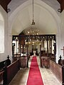
 Nave of the Church of St Margaret ^ St Remigius, Seething - geograph.org.uk - 6065159.jpg 4 032 × 2 268; 2,49 MB
-
 New Trees - geograph.org.uk - 1338139.jpg 640 × 480; 52 KB
-

-
 Oak trees in the fields - geograph.org.uk - 1587351.jpg 480 × 640; 89 KB
-
 Observing the heavens - geograph.org.uk - 1814793.jpg 800 × 544; 25 KB
-
 Obstacle on the bridlepath - geograph.org.uk - 4491805.jpg 640 × 480; 414 KB
-
 Obstacle on the bridleway past Fen Farm - geograph.org.uk - 4491814.jpg 640 × 480; 499 KB
-

-
 Old airfield-Seething - geograph.org.uk - 1431254.jpg 640 × 480; 49 KB
-
 Old concrete track - geograph.org.uk - 6073944.jpg 800 × 573; 678 KB
-

-
 Old field gate - geograph.org.uk - 6277800.jpg 800 × 450; 156 KB
-
 Old fuel pumps at Seething - geograph.org.uk - 1048131.jpg 640 × 480; 127 KB
-
 Old goods Vans rotting away - geograph.org.uk - 1732030.jpg 800 × 531; 138 KB
-
 Old Petrol Pumps on Seething Street - geograph.org.uk - 4164871.jpg 3 072 × 2 304; 1,86 MB
-
 Old railway carriage - geograph.org.uk - 1338012.jpg 640 × 480; 152 KB
-
 On the old Technical site - geograph.org.uk - 4791657.jpg 480 × 640; 444 KB
-
 Open Countryside - geograph.org.uk - 1587366.jpg 640 × 480; 50 KB
-
 Out out of Seething - geograph.org.uk - 1587218.jpg 640 × 480; 44 KB
-
 Pastures south of Busseybridge Farm - geograph.org.uk - 3374355.jpg 640 × 480; 197 KB
-
 Path across cultivated field - geograph.org.uk - 1570783.jpg 640 × 480; 139 KB
-
 Path leading south from Brooke Road - geograph.org.uk - 1570495.jpg 640 × 440; 91 KB
-
 Path marker on Small telephone poles - geograph.org.uk - 1587346.jpg 480 × 640; 73 KB
-
 Path marker through the woods - geograph.org.uk - 1587268.jpg 480 × 640; 124 KB
-
 Path through the small wood - geograph.org.uk - 1587395.jpg 640 × 480; 121 KB
-
 Path to the Ling - geograph.org.uk - 1571020.jpg 640 × 480; 76 KB
-
 Path-drive to Fen Farm - geograph.org.uk - 1569593.jpg 640 × 480; 129 KB
-
 Pheasant in a field - geograph.org.uk - 1571022.jpg 640 × 480; 56 KB
-

-

-
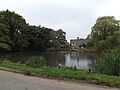 Pond off Seething Road - geograph.org.uk - 4164912.jpg 3 072 × 2 304; 1,93 MB
-
 Pond ^ Sething Street - geograph.org.uk - 4164917.jpg 3 072 × 2 304; 1,93 MB
-
 Poor old BR goods Van - geograph.org.uk - 1569587.jpg 640 × 480; 114 KB
-
 Possibly Langhale House - geograph.org.uk - 1338103.jpg 640 × 480; 85 KB
-
 Possibly the old Glebe land - geograph.org.uk - 1680137.jpg 800 × 531; 140 KB
-
 Possibly the old Glebe land - geograph.org.uk - 1680138.jpg 800 × 531; 148 KB
-

-

-
 Public Footpath - geograph.org.uk - 1587220.jpg 640 × 480; 102 KB
-
 Public footpath north from The Ling - geograph.org.uk - 1570660.jpg 640 × 451; 81 KB
-

-
 RAF Seething bomb storage area - geograph.org.uk - 4012844.jpg 640 × 480; 178 KB
-
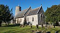 Rear of the Church of St Margaret ^ St Remigius, Seething - geograph.org.uk - 6065170.jpg 4 032 × 2 268; 4,77 MB


_-_geograph.org.uk_-_967598.jpg)


_-_geograph.org.uk_-_5068537.jpg)
_-_geograph.org.uk_-_5068538.jpg)
_-_geograph.org.uk_-_5068539.jpg)
_-_geograph.org.uk_-_5068557.jpg)
_-_geograph.org.uk_-_5068540.jpg)
_-_geograph.org.uk_-_5068541.jpg)
_-_geograph.org.uk_-_5068542.jpg)
_-_geograph.org.uk_-_5068543.jpg)
_-_geograph.org.uk_-_5068544.jpg)
_-_geograph.org.uk_-_5068545.jpg)
_-_geograph.org.uk_-_5068546.jpg)
_-_geograph.org.uk_-_5068547.jpg)


