Category:Selkirk
Zur Navigation springen
Zur Suche springen
English: Selkirk is a town in the Eildon committee area of the Scottish Borders district, southeastern Scotland. It is located in the Eildon Hills, on the Ettrick Water, a tributary of the River Tweed and is the former seat of the historic county of Selkirkshire.
Gàidhlig: Salcraig.
Stadt in Schottland  | |||||
| Medium hochladen | |||||
| Ist ein(e) |
| ||||
|---|---|---|---|---|---|
| Ort |
| ||||
| Einwohnerzahl |
| ||||
| Verschieden von | |||||
| offizielle Website | |||||
 | |||||
Unterkategorien
Es werden 18 von insgesamt 18 Unterkategorien in dieser Kategorie angezeigt:
In Klammern die Anzahl der enthaltenen Kategorien (K), Seiten (S), Dateien (D)
A
- Aikwood Tower (2 D)
B
C
- County Buildings, Selkirk (10 D)
- Craig Hill (26 D)
F
- Foulshiels Hill (25 D)
- Foulshiels, Scottish Borders (6 D)
L
M
- Mungo Park Memorial, Selkirk (19 D)
P
- Peat Law, Selkirk (26 D)
S
- Selkirk Bannock (3 D)
- Shops in Selkirk (6 D)
- Sir Walter Scott Statue, Selkirk (12 D)
T
- The Three Brethren (13 D)
Medien in der Kategorie „Selkirk“
Folgende 200 Dateien sind in dieser Kategorie, von 334 insgesamt.
(vorherige Seite) (nächste Seite)-
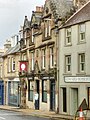
 1 High Street, Selkirk deli.jpg 3.456 × 4.608; 4,42 MB
-
 10 Market Place, Selkirk Lindsay and gilmour.jpg 3.456 × 4.608; 4,97 MB
-
 109 High Street, Selkirk.jpg 4.608 × 3.456; 4,14 MB
-
 12 Market Place, Selkirk pharmacy.jpg 3.456 × 4.608; 4,37 MB
-
 13 High Street, Selkirk.jpg 3.456 × 4.608; 5,05 MB
-
 15, 17 High Street, Selkirk.jpg 3.456 × 4.608; 4,25 MB
-
 15-16 Market Place, Selkirk.jpg 3.456 × 4.608; 4,24 MB
-
 18 Market Place, Selkirk Scotts.jpg 3.456 × 4.608; 4,56 MB
-
 23 High Street, Selkirk three hills coffee.jpg 3.456 × 4.608; 4,97 MB
-
 25 High Street, Selkirk grey door is 25.jpg 3.456 × 4.608; 4,92 MB
-
 27 High Street, Selkirk mccuddens.jpg 3.456 × 4.608; 4,79 MB
-
 29 High Street, Selkirk Haircraft.jpg 3.456 × 4.608; 4,41 MB
-
 32 Hillside Terrace & Gatepiers, Selkirk.jpg 3.456 × 4.608; 4,85 MB
-
 32 Hillside Terrace & the Gatepiers, Selkirk.jpg 4.608 × 3.456; 4,84 MB
-
 34-35 Market Place, Selkirk.jpg 3.120 × 4.160; 3,49 MB
-
 35 Back Row (former Volunteer Hall), Selkirk 2021.jpg 4.608 × 3.456; 5,36 MB
-
 35 Back Row (former Volunteer Hall), Selkirk.jpg 4.608 × 3.456; 4,81 MB
-
 36-37 Market Place, Selkirk.jpg 3.120 × 4.160; 3,15 MB
-
 38 High Street, Selkirk Rocks.jpg 3.456 × 4.608; 4,56 MB
-
 4 Ettrick Terrace, Selkirk.jpg 3.456 × 4.608; 4,08 MB
-
 40 - 44, 46 High St, Selkirk.jpg 4.864 × 2.736; 3,55 MB
-
 40, 41 Market Place, Selkirk.jpg 3.120 × 4.160; 3,19 MB
-
 42 Market Place, Selkirk.jpg 3.120 × 4.160; 3,14 MB
-
 50 52 High Street Selkirk.jpg 2.736 × 4.864; 3,34 MB
-
 51 High Street, Selkirk.jpg 3.456 × 4.608; 4,56 MB
-
 54, 56 High Street, Selkirk.jpg 3.456 × 4.608; 4,32 MB
-
 55 High Street, Selkirk.jpg 3.456 × 4.608; 4,63 MB
-
 57 High Street, Selkirk.jpg 3.456 × 4.608; 4,42 MB
-
 6 Russell Place, Selkirk.jpg 3.120 × 4.160; 3,18 MB
-
 62-70 High Street, Selkirk from end.jpg 4.608 × 3.456; 3,94 MB
-
 62-70 High Street, Selkirk front.jpg 4.608 × 3.456; 3,81 MB
-
 62-70 High Street, Selkirk viewed from Back Row.jpg 3.456 × 4.608; 4,12 MB
-
 69 Tower Street & Gatepiers, Selkirk.jpg 3.120 × 4.160; 3,02 MB
-
 9Market Place, 8, Selkirk.jpg 3.456 × 4.608; 4,26 MB
-
 A beech avenue - geograph.org.uk - 244814.jpg 640 × 480; 74 KB
-
 A cat at Forest Road, Selkirk - geograph.org.uk - 2187440.jpg 640 × 429; 171 KB
-
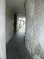
 A close in Selkirk.jpg 1.920 × 2.560; 2,53 MB
-
 A colourful fish in Selkirk - geograph.org.uk - 2509576.jpg 640 × 438; 228 KB
-
 A detail on the Caulks Well - geograph.org.uk - 1266652.jpg 427 × 640; 133 KB
-
 A footbridge over the Ettrick Water - geograph.org.uk - 727076.jpg 480 × 640; 134 KB
-
 A Line of Beech Trees and old Dyke - geograph.org.uk - 760155.jpg 640 × 480; 100 KB
-
 A model charity sheep dog in Selkirk - geograph.org.uk - 2509585.jpg 427 × 640; 219 KB
-
 A view over the pastures of Selkirk - geograph.org.uk - 3389396.jpg 640 × 480; 73 KB
-

-
 A7 near Selkirk - geograph.org.uk - 800004.jpg 640 × 480; 50 KB
-
 Abbotsford Ferry station site geograph-3222680-by-Ben-Brooksbank.jpg 2.395 × 1.358; 3,28 MB
-
 An old road at Selkirk - geograph.org.uk - 1756849.jpg 640 × 427; 147 KB
-

-
 Back Row, Selkirk ...is it this?.jpg 4.608 × 3.456; 4,31 MB
-
 Bath in a field - geograph.org.uk - 567047.jpg 640 × 480; 100 KB
-
 Baxter's, Selkirk - geograph.org.uk - 3065968.jpg 640 × 479; 247 KB
-
 Bernat Klein Studio, Selkirk.jpg 3.557 × 5.335; 6,43 MB
-
 Big Wood Plantation - geograph.org.uk - 340013.jpg 640 × 480; 123 KB
-
 Bikers' break at Selkirk - geograph.org.uk - 2866371.jpg 3.264 × 2.448; 3,49 MB
-
 Border Abbeys Way at Salenside, Roxburghshire - geograph-2323496.jpg 800 × 530; 210 KB
-
-

-
 Breezy Point Rd ^ Red River, Selkirk - panoramio (1).jpg 4.124 × 2.320; 2,63 MB
-
 Breezy Point Rd ^ Red River, Selkirk - panoramio.jpg 5.112 × 2.875; 3,56 MB
-
 Breezy Point Rd, Selkirk - panoramio (1).jpg 5.150 × 2.897; 4,1 MB
-
 Breezy Point Rd, Selkirk - panoramio.jpg 4.701 × 2.645; 3,59 MB
-
 Bridgelands Farm - geograph.org.uk - 821932.jpg 640 × 480; 115 KB
-
 Buildings at Heatherlie Terrace, Selkirk - geograph.org.uk - 3594357.jpg 640 × 437; 189 KB
-
 Buildings at Heatherlie Terrace, Selkirk - geograph.org.uk - 3594362.jpg 640 × 418; 193 KB
-
 Bus, Selkirk (geograph 7725512).jpg 4.032 × 3.024; 2,86 MB
-
 Buttercup Dairy advertisement - geograph.org.uk - 3543484.jpg 473 × 640; 84 KB
-
 Buttercup Dairy Company - geograph.org.uk - 3407464.jpg 640 × 480; 270 KB
-
 Buttercup Dairy Company - geograph.org.uk - 3428670.jpg 480 × 640; 72 KB
-
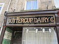 Buttercup Dairy Company - geograph.org.uk - 3428673.jpg 640 × 480; 281 KB
-
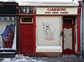 Camerons Bakers, Selkirk - geograph.org.uk - 2187552.jpg 640 × 473; 169 KB
-
 Camerons is 42.jpg 2.736 × 4.864; 3 MB
-

-
 Chapel Street, Selkirk - geograph.org.uk - 3576274.jpg 3.264 × 2.448; 3,49 MB
-
 Children's play area - geograph.org.uk - 1204131.jpg 640 × 480; 67 KB
-

-
 Corby Linn car park, Selkirk - geograph.org.uk - 1757915.jpg 640 × 424; 167 KB
-
 Council Selkirk.jpg 4.864 × 2.736; 3,11 MB
-
 County Hotel, 3-11 High Street, Selkirk.jpg 3.456 × 4.608; 4,24 MB
-
 County Hotel, Selkirk - geograph.org.uk - 1878413.jpg 1.024 × 683; 144 KB
-
 Cross Keys Inn - geograph.org.uk - 1878380.jpg 1.024 × 683; 150 KB
-
 Curror Street, Selkirk - geograph.org.uk - 1713321.jpg 640 × 420; 143 KB
-
-
 Dunhog Moss - geograph.org.uk - 235747.jpg 640 × 480; 97 KB
-

-
 Entrance to Bernat Klein Studio, Selkirk.jpg 3.029 × 4.544; 2,82 MB
-
 Eriothrix rufomaculata (male) - Flickr - S. Rae.jpg 1.161 × 1.152; 472 KB
-
 Eristalis sp - Flickr - S. Rae (1).jpg 1.078 × 804; 292 KB
-
 Eristalis sp - Flickr - S. Rae.jpg 1.078 × 880; 311 KB
-
 Etterick - Tweed confluence - geograph.org.uk - 624074.jpg 640 × 480; 70 KB
-

-
 Farmland at Friarshawmuir - geograph.org.uk - 502739.jpg 640 × 480; 120 KB
-
 Fleece Hotel Selkirk.jpg 4.864 × 2.736; 3,42 MB
-
 Footbridge near Newark Castle - geograph.org.uk - 3153930.jpg 800 × 600; 202 KB
-

-
 Footbridge over the mill lade, Selkirk - geograph.org.uk - 1949976.jpg 800 × 530; 282 KB
-
 Former mill building, Selkirk - geograph.org.uk - 3036608.jpg 800 × 530; 104 KB
-

-

-
 Frosted pasture - geograph.org.uk - 1094731.jpg 640 × 427; 134 KB
-
 Gateway to Selkirk Hill - geograph.org.uk - 1194674.jpg 480 × 640; 133 KB
-
 Hainingrig Cottage - geograph.org.uk - 1732657.jpg 4.000 × 3.000; 3,04 MB
-
 Hainingrig Cottage - geograph.org.uk - 1732671.jpg 4.000 × 3.000; 3,02 MB
-
 Hainingrig Cottage Selkirk - geograph.org.uk - 1513876.jpg 640 × 480; 71 KB
-
 Hall on the hill - geograph.org.uk - 2414454.jpg 640 × 426; 69 KB
-
-
 Halliwell's Close. Selkirk - geograph.org.uk - 1756826.jpg 427 × 640; 123 KB
-
 Hartleap - geograph.org.uk - 282511.jpg 640 × 480; 102 KB
-
 Heatherley House Hotel.jpg 6.000 × 8.000; 12,37 MB
-
 Hendersons Grass Machinery Ltd, Selkirk - geograph.org.uk - 1756655.jpg 640 × 400; 141 KB
-
 High Street , Selkirk - geograph.org.uk - 2369436.jpg 2.048 × 1.536; 1,49 MB
-
 High Street, Selkirk - geograph.org.uk - 3407379.jpg 640 × 480; 287 KB
-
 Houses at Muthag Street, Selkirk - geograph.org.uk - 2905206.jpg 640 × 461; 234 KB
-
 Houses at Selkirk - geograph.org.uk - 695385.jpg 640 × 480; 135 KB
-
 Industrial estate, Selkirk - geograph.org.uk - 1048683.jpg 640 × 480; 65 KB
-
 Inside Halliwell's House.jpg 3.144 × 2.280; 5,86 MB
-

-
 Interior Courthouse Selkirk.jpg 3.152 × 2.355; 7,01 MB
-
 Jackie Lunn, Selkirk - geograph.org.uk - 1756829.jpg 640 × 427; 152 KB
-
 Japanese Butterbur (Petasites japonicus) - geograph.org.uk - 726083.jpg 640 × 480; 159 KB
-

-
 Junction of Tower Street and High Street, Selkirk - geograph.org.uk - 3578753.jpg 4.608 × 3.456; 5,91 MB
-
 Kirk Wynd, Selkirk - geograph.org.uk - 2214559.jpg 800 × 530; 141 KB
-
 Kit body selkirkrfc.png 38 × 59; 369 Bytes
-
 Ladylands area of Selkirk - geograph.org.uk - 1194170.jpg 640 × 480; 85 KB
-

-
 Linglie Footbridge over the Ettrick Water - geograph.org.uk - 813261.jpg 480 × 640; 129 KB
-
 Looking East on the Nature Reserve - geograph.org.uk - 1732843.jpg 4.000 × 3.000; 3 MB
-

-
 Looking South, Lindean Reservoir - geograph.org.uk - 1603252.jpg 480 × 640; 79 KB
-
 Lord Selkirk School, Manitoba - panoramio (1).jpg 2.048 × 1.151; 783 KB
-
 Lord Selkirk School, Manitoba - panoramio.jpg 2.048 × 1.312; 890 KB
-
 Maniola jurtina (Meadow Brown) - Flickr - S. Rae (3).jpg 1.584 × 1.228; 615 KB
-
 Marine Museum, Selkirk - panoramio.jpg 2.536 × 1.902; 923 KB
-
 Market Place - geograph.org.uk - 3543402.jpg 640 × 480; 51 KB
-
 Market Place, Selkirk - geograph.org.uk - 1756707.jpg 427 × 640; 140 KB
-
 Market Place, Selkirk.jpg 4.608 × 3.456; 4,5 MB
-
 Marshland, Linglie farm - geograph.org.uk - 1474901.jpg 640 × 480; 108 KB
-
 Marshland,Linglie Farm - geograph.org.uk - 1474897.jpg 640 × 480; 94 KB
-
 Masonic Lodge, Selkirk - geograph.org.uk - 3578741.jpg 4.608 × 3.456; 6,1 MB
-
 Megoura viciae (Vetch aphids) - Flickr - S. Rae.jpg 1.359 × 1.557; 635 KB
-
 Melanogaster sp. (female) - Flickr - S. Rae (5).jpg 1.228 × 1.012; 436 KB
-
 Melanogaster sp. (female) - Flickr - S. Rae (6).jpg 1.504 × 1.268; 544 KB
-
 Melanogaster sp. (female) - Flickr - S. Rae (7).jpg 1.856 × 1.604; 822 KB
-
 Melanogaster sp. (female) - Flickr - S. Rae (8).jpg 1.760 × 1.440; 676 KB
-
 Melanogaster sp. (female) - Flickr - S. Rae (9).jpg 1.524 × 1.248; 539 KB
-
 Melanogaster sp. (male) - Flickr - S. Rae (4).jpg 1.528 × 1.276; 529 KB
-
 Mill buildings, Selkirk - geograph.org.uk - 2848016.jpg 800 × 533; 68 KB
-
 Mucilago crustacea (a Slime mould sp.) - Flickr - S. Rae (1).jpg 1.200 × 852; 356 KB
-
 Muthag Street Selkirk - geograph.org.uk - 3478474.jpg 1.024 × 768; 203 KB
-
 National Cycle Network route 1 - geograph.org.uk - 1569438.jpg 640 × 359; 100 KB
-

-

-
 New tree planting at the Haining Estate - geograph.org.uk - 695390.jpg 640 × 480; 147 KB
-
 Oedemera cf. virescens - Flickr - S. Rae.jpg 1.900 × 1.552; 841 KB
-
 Old pub in Selkirk 01.jpg 2.560 × 1.920; 1,6 MB
-
 Old pub in Selkirk 02.jpg 1.920 × 2.560; 1,38 MB
-
 Old pub in Selkirk 03.jpg 1.920 × 2.560; 1,33 MB
-
 Old pub in Selkirk 04.jpg 1.920 × 2.560; 1,91 MB
-
 Open space, Selkirk - geograph.org.uk - 2693304.jpg 640 × 360; 243 KB
-
 Ordnance Survey One-Inch Sheet 69 Selkirk, Published 1964.jpg 8.606 × 10.665; 21,44 MB
-
 Ordnance Survey One-Inch Sheet 80 Peebles and Galashiels, Published 1925.jpg 12.148 × 9.289; 14,7 MB
-
 Pasture at Selkirk - geograph.org.uk - 2866455.jpg 3.264 × 2.448; 4,64 MB
-
 Path, east side of Haining Loch, Selkirk - geograph.org.uk - 2008222.jpg 800 × 530; 234 KB
-
 Picnic place, Selkirk - geograph.org.uk - 799994.jpg 640 × 480; 100 KB
-
 Pizza Hut, Main St, Selkirk - panoramio.jpg 2.048 × 1.365; 793 KB
-

-
 Plaque, Muthag Street Selkirk - geograph.org.uk - 2877021.jpg 800 × 572; 247 KB
-

-
 Platycheirus (Pyrophaena) granditarsis - female - Flickr - S. Rae (4).jpg 1.152 × 1.110; 413 KB
-
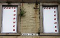
 Poets' Corner, Selkirk - geograph.org.uk - 2554652.jpg 640 × 399; 311 KB
-
 Poets' Corner, Selkirk - geograph.org.uk - 2554661.jpg 640 × 405; 208 KB
-
 Poets' Corner, Selkirk - geograph.org.uk - 2554665.jpg 640 × 439; 261 KB
-
 Poets' Corner, Selkirk - geograph.org.uk - 2554669.jpg 424 × 640; 200 KB
-
 Public toilets - geograph.org.uk - 1614967.jpg 640 × 480; 78 KB
-

-

-
 Riverside Road, Selkirk - geograph.org.uk - 1881581.jpg 1.024 × 683; 280 KB
-
 Rosemount, 28 Hillside Terrace, Selkirk.jpg 3.456 × 4.608; 6,09 MB
-
 Sawfly larva - Flickr - S. Rae (3).jpg 1.704 × 1.584; 752 KB
-
 SCO-Selkirk-High Street with Mungo Park monument 2018.jpg 2.048 × 1.536; 1,37 MB
-
 Scottish red postbox at The Glen Café, St Mary's Loch, Selkirkshire.jpg 720 × 1.280; 305 KB
-
 Selkirk - August 2014 (1) (15043411915).jpg 4.608 × 3.072; 3,58 MB
-
 Selkirk - August 2014 (2) (15020491936).jpg 4.608 × 3.072; 3,51 MB
-
 Selkirk - August 2014 (3) (14856910387).jpg 4.608 × 3.072; 3,56 MB
-
 Selkirk - geograph.org.uk - 1193077.jpg 640 × 480; 64 KB
-
 Selkirk and beyond - geograph.org.uk - 746891.jpg 640 × 397; 29 KB
-
 Selkirk bank of Scotland.jpg 4.864 × 2.736; 3,18 MB
-
 Selkirk Fire Station - geograph.org.uk - 1211369.jpg 476 × 640; 108 KB
-
 Selkirk from the air - geograph.org.uk - 3176288.jpg 640 × 480; 131 KB
-
 Selkirk from the air - geograph.org.uk - 3176289.jpg 640 × 480; 134 KB
-
 Selkirk from the carpark on the A699 - geograph.org.uk - 1191750.jpg 640 × 480; 74 KB
-
 Selkirk from the golf course - geograph.org.uk - 649771.jpg 640 × 480; 127 KB
-
 Selkirk from The Haining Estate - geograph.org.uk - 695399.jpg 640 × 480; 135 KB
-
 Selkirk from the northeast - geograph.org.uk - 2847992.jpg 800 × 533; 75 KB
-
 Selkirk Game ^ Fish - panoramio.jpg 3.264 × 2.448; 2,56 MB
-
 Selkirk Golf Club - geograph.org.uk - 936704.jpg 640 × 427; 122 KB
-
 Selkirk Golf Course - geograph.org.uk - 936697.jpg 640 × 427; 134 KB
-
 Selkirk High School.jpg 4.608 × 3.456; 4,18 MB
-
 Selkirk High Street - geograph.org.uk - 1878363.jpg 1.024 × 683; 127 KB
-
 Selkirk Hill - geograph.org.uk - 760152.jpg 640 × 480; 66 KB


,_Selkirk_2021.jpg)
,_Selkirk.jpg)


.jpg)

.jpg)


.jpg)


_-_Flickr_-_S._Rae.jpg)
.jpg)


_-_geograph.org.uk_-_726083.jpg)
_by_the_Yarrow_Water_-_geograph.org.uk_-_726089.jpg)


.jpg)

_-_Flickr_-_S._Rae_(3).jpg)


_-_Flickr_-_S._Rae.jpg)
_-_Flickr_-_S._Rae_(5).jpg)
_-_Flickr_-_S._Rae_(6).jpg)
_-_Flickr_-_S._Rae_(7).jpg)
_-_Flickr_-_S._Rae_(8).jpg)
_-_Flickr_-_S._Rae_(9).jpg)
_-_Flickr_-_S._Rae_(4).jpg)

_-_Flickr_-_S._Rae_(1).jpg)


_granditarsis_-_female_-_Flickr_-_S._Rae_(3).jpg)
_granditarsis_-_female_-_Flickr_-_S._Rae_(4).jpg)


.jpg)


_(15043411915).jpg)
_(15020491936).jpg)
_(14856910387).jpg)


