Category:Sermersooq
Naar navigatie springen
Naar zoeken springen
gemeente in Groenland    | |||||
| Media uploaden | |||||
| Is een | |||||
|---|---|---|---|---|---|
| Locatie | Groenland, Koninkrijk Denemarken | ||||
| Hoofdplaats | |||||
| Officiële taal | |||||
| Datum van oprichting of creatie |
| ||||
| Inwonertal |
| ||||
| Oppervlakte |
| ||||
| officiële website | |||||
 | |||||
Ondercategorieën
Deze categorie bevat de volgende 36 subcategorieën, van de 36 in totaal.
A
- Arsuk (2 B)
F
- Fonfjord (2 B)
G
- Greenland Telescope (4 B)
- Gunnbjørn Fjeld (6 B)
I
- Ikateq (277 B)
- Ikka Fjord (2 B)
- Isortoq (5 B)
K
- Kangeq (5 B)
- Kangilinnguit (7 B)
- Kapisillit (10 B)
N
O
- Ofjord (2 B)
P
- Polhem Fjeld (124 B)
Q
- Qeqertarsuatsiaat (5 B)
- Qoornoq (3 B)
R
- Rode Fjord (8 B)
S
- Sermiligaaq (3 B)
- Sermitsiaq (mountain) (12 B)
- Skjoldungen (3 B)
- Symbols of Sermersooq (3 B)
T
- Tiniteqilaaq (15 B)
U
- Umivik Bay (9 B)
V
- Vegas Fjeld (8 B)
Media in categorie "Sermersooq"
Deze categorie bevat de volgende 28 bestanden, van in totaal 28.
-
 A demain (29528557967).jpg 5.149 × 2.896; 2,25 MB
-
 ADM-Aeolus-Greenland-Hires.jpg 1.560 × 1.170; 396 kB
-
 Aerial photograph of Sermersooq Municipality 2.jpg 2.787 × 3.714; 2,46 MB
-
 Aerial photograph of Sermersooq Municipality 3.jpg 3.388 × 2.542; 1,95 MB
-
 Aerial photograph of Sermersooq Municipality.jpg 2.849 × 3.799; 2,66 MB
-
 Approaching Kulusuk Airport, East Greenland.jpg 5.973 × 3.360; 12,64 MB
-
 ArsuupUummannaa.png 1.915 × 964; 1,65 MB
-
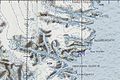
 Bredefjord-Ikersuaq-Greenland-onc d 16-map-section.jpg 907 × 686; 351 kB
-
 Cloudy with a touch of frost (45282985472).jpg 5.265 × 2.961; 2,79 MB
-
 East coast of Greenland, just S of 64N.jpg 5.383 × 3.155; 8,83 MB
-
 Flag of Sermersooq, Denmark.svg 512 × 341; 5 kB
-
 G-Sermersooq-name.svg 300 × 500; 12 kB
-
 G-Sermersooq.svg 300 × 500; 29 kB
-
 Greenland Sermersooq (West) adm location map.svg 624 × 967; 249 kB
-
 Iceberg close to Tasiilaq, East Greenland - 31535160867.jpg 5.395 × 3.035; 8,96 MB
-
 Iceberg close to Tasiilaq, East Greenland - 31535167617.jpg 5.733 × 3.225; 8,06 MB
-
 Kattertooq-ONC D-16.jpg 611 × 398; 168 kB
-
 Kommuneqarfik Sermersooq locator map.svg 1.008 × 2.075; 5 kB
-
 Lindenow-Greenland-onc d 16-map-section.jpg 745 × 497; 210 kB
-
 Lookout (44496988782).jpg 4.736 × 3.157; 1,7 MB
-
 Mountain in the Clouds, East Greenland.jpg 5.973 × 3.360; 7,62 MB
-
 Sermersooq in Greenland 2018.svg 1.181 × 1.669; 846 kB
-
 Sermersooq-montage.jpg 5.368 × 3.011; 3,52 MB
-
 Sermersooq-municipality-greenland.svg 300 × 500; 20 kB
-
 Sermersooq.png 434 × 646; 15 kB
-
 Simssee Am Morgen 1 (124682781).jpeg 1.920 × 1.272; 864 kB
-
 The power of water (44705247222).jpg 5.401 × 3.038; 2,89 MB
-
 Undercover (43514683694).jpg 5.444 × 3.063; 1,84 MB
.jpg)


.jpg)


_adm_location_map.svg)


.jpg)


.jpeg)
.jpg)
.jpg)