Category:Sevier County, Utah
Saltar para a navegação
Saltar para a pesquisa
Counties of Utah: Beaver · Box Elder · Cache · Carbon · Daggett · Davis · Duchesne · Emery · Garfield · Grand · Iron · Juab · Kane · Millard · Morgan · Piute · Rich · Salt Lake · San Juan · Sanpete · Sevier · Summit · Tooele · Uintah · Utah · Wasatch · Washington · Wayne · Weber
county in south-central Utah, United States   | |||||
| Carregar ficheiro | |||||
| Instância de | |||||
|---|---|---|---|---|---|
| Nomeado em referência a | |||||
| Localização | Utah, EUA | ||||
| Capital | |||||
| Data de criação ou fundação |
| ||||
| População |
| ||||
| Área |
| ||||
| Diferente de | |||||
| sítio web oficial | |||||
 | |||||
English: Media related to Sevier County, Utah, a county in central Utah, United States.
Subcategorias
Esta categoria contém as seguintes 12 subcategorias (de um total de 12).
Multimédia na categoria "Sevier County, Utah"
Esta categoria contém os seguintes 24 ficheiros (de um total de 24).
-
 Watershed work plan, Monroe-Annabella Watershed, Sevier and Piute Counties, Utah (IA CAT91955286).pdf 1 129 × 1 541, 111 páginas; 5,72 MB
-
 Cathedral Rock - Pahvant Narrows DyeClan.com - panoramio.jpg 1 952 × 3 264; 1,28 MB
-
 Fall in Utah (15719143625).jpg 5 456 × 3 632; 8,32 MB
-
 Hunting Petroglyph - DyeClan.com - panoramio.jpg 4 000 × 3 000; 4,7 MB
-
 Juniper - panoramio.jpg 3 264 × 4 928; 12,69 MB
-
 Michelle Whelan, Forest Prevention Officer ET5A7467 (29783127664).jpg 5 760 × 3 840; 8,69 MB
-
 Michelle Whelan, Forest Prevention Officer ET5A7471 (30327517121).jpg 5 760 × 3 840; 8,59 MB
-
 Michelle Whelan, Forest Prevention Officer ET5A7472 (30116650090).jpg 5 760 × 3 840; 7,25 MB
-
 Monroe Canyon in the Fall dyeclan.com - panoramio.jpg 2 448 × 3 264; 5,03 MB
-
 Monrovian Park Sign, DyeClan.com - panoramio.jpg 4 000 × 3 000; 4,99 MB
-
 NRCSUT03012 - Utah (6395)(NRCS Photo Gallery).jpg 1 500 × 2 100; 6,06 MB
-
 NRCSUT03012 - Utah (6395)(NRCS Photo Gallery).tif 1 500 × 2 100; 12,02 MB
-
 Potholes in the Pahvant Narrows - panoramio.jpg 2 448 × 3 264; 1,04 MB
-
 Richfield - panoramio.jpg 4 928 × 3 264; 13,64 MB
-
 Rock that Looks Like a Face - panoramio.jpg 3 000 × 4 000; 3,75 MB
-
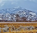 Sevier - panoramio.jpg 2 984 × 2 662; 7,59 MB
-
 Somewhere near Salina - (6293975441).jpg 2 121 × 1 414; 1,01 MB
-
 Somewhere near Salina - (6293976037).jpg 2 121 × 1 414; 3,16 MB
-
 Sunset in Monroe Canyon dyeclan.com - panoramio.jpg 3 264 × 2 448; 2,3 MB
-
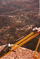 Surveying in the Utah Mountains - panoramio.jpg 667 × 965; 383 kB
-
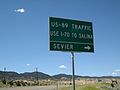 US-89 Traffic-Use I-70 to Salina - panoramio.jpg 3 648 × 2 736; 2,3 MB
-
 USA Sevier County, Utah age pyramid.svg 520 × 600; 8 kB
-
 Utah State Route 118 Between Joseph and Monroe.jpg 4 000 × 3 000; 3,34 MB
-
 Waterfall on Monroe Creek, DyeClan.com - panoramio.jpg 3 000 × 4 000; 4,2 MB

.jpg)


.jpg)
.jpg)
.jpg)


(NRCS_Photo_Gallery).jpg)


.jpg)
.jpg)


