Category:Garfield County, Utah
Jump to navigation
Jump to search
Counties of Utah: Beaver · Box Elder · Cache · Carbon · Daggett · Davis · Duchesne · Emery · Garfield · Grand · Iron · Juab · Kane · Millard · Morgan · Piute · Rich · Salt Lake · San Juan · Sanpete · Sevier · Summit · Tooele · Uintah · Utah · Wasatch · Washington · Wayne · Weber
county in southern Utah, United States   | |||||
| Upload media | |||||
| Instance of | |||||
|---|---|---|---|---|---|
| Named after | |||||
| Location | Utah | ||||
| Capital | |||||
| Inception |
| ||||
| Highest point | |||||
| Population |
| ||||
| Area |
| ||||
| official website | |||||
 | |||||
English: Media related to Garfield County, Utah, a county in southern Utah, United States.
Subcategories
This category has the following 14 subcategories, out of 14 total.
B
E
G
H
M
N
P
S
T
Media in category "Garfield County, Utah"
The following 79 files are in this category, out of 79 total.
-

-

-
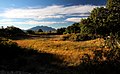
 Boulder Mountain Overlook dyeclan.com - panoramio (1).jpg 3,088 × 2,056; 3.46 MB
-
 Boulder Mountain Overlook dyeclan.com - panoramio.jpg 3,088 × 2,056; 3.08 MB
-
 Boulder Mt. - panoramio.jpg 2,160 × 1,440; 947 KB
-
 Boulder Mt. Trees - panoramio.jpg 2,160 × 1,440; 1.23 MB
-
 Canyon scenes S of Boulder on scenic byway 1668 (6293932123).jpg 1,414 × 2,121; 1.36 MB
-
 Canyon scenes S of Boulder on scenic byway 1668 (6293933447).jpg 2,121 × 1,414; 3.31 MB
-
 Canyon scenes S of Boulder on scenic byway 1668 (6293934097).jpg 2,121 × 1,414; 3.17 MB
-
 Canyon scenes S of Boulder on scenic byway 1668 (6294458590).jpg 2,121 × 1,414; 1.82 MB
-
 Cercocarpusintricatus.jpg 798 × 600; 576 KB
-
 Desert Flowers, Cannonvile, UT9-09 (16205956686).jpg 2,450 × 1,417; 1.62 MB
-
-
 ESCALANTE RIVER - NARA - 544863.jpg 2,022 × 3,000; 914 KB
-
 ESCALANTE RIVER - NARA - 545301.jpg 2,026 × 3,000; 1.16 MB
-
 Garfield County ambulance at Garfield Memorial Hospital, Oct 17.jpg 2,592 × 1,944; 2.38 MB
-
 Garfield County, UT, USA - panoramio (26).jpg 3,264 × 2,448; 2.95 MB
-
 Garfield County, UT, USA - panoramio (27).jpg 3,264 × 2,448; 3.1 MB
-
 Garfield County, UT, USA - panoramio (28).jpg 3,264 × 2,448; 3.11 MB
-
 Garfield county1 ut sr12s.jpg 1,536 × 1,024; 696 KB
-
 Garfield county5 ut sr12s.jpg 1,536 × 1,024; 655 KB
-
 Garfield county6 ut sr12s.jpg 1,536 × 1,024; 561 KB
-
 Garfield Smelter LCCN2007662818.tif 4,096 × 3,288; 12.85 MB
-
-
 Grand Staircase-Escalante National Monument DyeClan.com - panoramio.jpg 3,264 × 2,448; 5.45 MB
-
 HANKSVILLE AREA, GARFIELD CO, UTAH - 2016-10-02 - Poison Springs Canyon -01 (30394308821).jpg 5,184 × 3,456; 18.63 MB
-
 HANKSVILLE AREA, GARFIELD CO, UTAH - 2016-10-02 - Poison Springs Canyon -02d (30806778104).jpg 4,693 × 3,134; 18.08 MB
-
 HANKSVILLE AREA, GARFIELD CO, UTAH - 2016-10-02 - Poison Springs Canyon -03 (30480778175).jpg 5,184 × 3,456; 17.78 MB
-
 HANKSVILLE AREA, GARFIELD CO, UTAH - 2016-10-02 - Poison Springs Canyon -03e (31532392131).jpg 3,363 × 2,578; 11.12 MB
-
 HANKSVILLE AREA, GARFIELD CO, UTAH - 2016-10-02 - Poison Springs Canyon -06 (31501921322).jpg 5,184 × 3,456; 15.36 MB
-
 HANKSVILLE AREA, GARFIELD CO, UTAH - 2016-10-02 - Poison Springs Canyon -11 (30394322581).jpg 3,456 × 5,184; 12.62 MB
-
 HANKSVILLE AREA, GARFIELD CO, UTAH - 2016-10-02 - Poison Springs Canyon -12 (30394330271).jpg 4,740 × 3,126; 12.94 MB
-
 HANKSVILLE AREA, GARFIELD CO, UTAH - 2016-10-02 - Poison Springs Canyon -13 (30480774055).jpg 5,184 × 3,456; 23.55 MB
-
-
 Hell's Backbone - panoramio.jpg 5,184 × 3,456; 4.97 MB
-

-

-

-

-

-
-

-
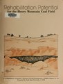 Henry Mountain Coal Field, Garfield County, Utah - energy mineral rehabilitation inventory and analysis (IA henrymountain864300utah).pdf 1,225 × 1,622, 358 pages; 16.19 MB
-
 Home away from home (39785105830).jpg 2,048 × 1,435; 3.96 MB
-
 Ken, S.R. 12, Grand Staircase-Escalante National Monument (2519212817).jpg 1,108 × 739; 529 KB
-
 Lake powell utah.jpg 773 × 1,000; 193 KB
-
 Last light (43101981640).jpg 2,048 × 1,140; 2.4 MB
-
 Mammoth Creek Rd. - panoramio.jpg 1,600 × 1,200; 433 KB
-
 MCR-UT-143 Junction - panoramio.jpg 1,600 × 1,200; 492 KB
-
 Mouth of Zebra Slot Canyon Looking Back DyeClan.com - panoramio.jpg 2,448 × 3,264; 5.43 MB
-

-
 Near Bryce - panoramio.jpg 7,332 × 2,074; 3.31 MB
-
 Near Bryce Again - panoramio.jpg 17,162 × 2,914; 14.27 MB
-
 Once a Ranch, Panquitch, UT 9-09 (21053816012).jpg 2,800 × 1,387; 1.46 MB
-
 Ranch, Escalante-Grand Staircase, UT 9-09 (21220095705).jpg 1,941 × 927; 787 KB
-

-
 Striped Rock on the Hike to Zebra Slot Canyon DyeClan.com - panoramio.jpg 3,264 × 2,448; 6.21 MB
-
 TAMARISK TREE BESIDE THE ESCALANTE RIVER - NARA - 544912.jpg 2,029 × 3,000; 1.13 MB
-
 Tropic Reservoir - panoramio.jpg 9,523 × 2,035; 6.49 MB
-
 USA Garfield County, Utah age pyramid.svg 520 × 600; 8 KB
-
 Ut escalante canyons1.jpg 1,536 × 1,024; 747 KB
-
 Ut escalante canyons2.jpg 1,536 × 1,024; 540 KB
-
 Ut escalante canyons3.jpg 1,536 × 1,024; 619 KB
-
 UTAH - 01 - Hite Crossing (6-15-11) - 06 (5895451212).jpg 4,752 × 3,168; 709 KB
-
 UTAH - 01 - Hite Crossing (6-15-11) - 07 (5895454690).jpg 4,752 × 2,768; 6.75 MB
-
 UTAH - 01 - Hite Crossing (6-15-11) - 10 (5895458576).jpg 4,752 × 3,168; 8.13 MB
-
 UTAH - 01 - Hite Crossing (6-15-11) - 13 (5894891553).jpg 4,287 × 2,796; 552 KB
-
 UTAH - 01 - Hite Crossing (6-15-11) - 15 (5894892167).jpg 3,168 × 4,752; 1.16 MB
-
 UTAH - 01 - Hite Crossing (6-15-11) - 16 (5894892747).jpg 3,168 × 4,752; 1.3 MB
-
 UTAH - Hite Crossing (1) (11117971216).jpg 4,752 × 2,952; 907 KB
-
 UTAH - Hite Crossing (2) (11117972106).jpg 4,752 × 3,120; 559 KB
-
 UTAH - Hite Crossing (4) (11117939315).jpg 3,168 × 4,752; 1.2 MB
-
 UTAH - Hite Crossing (5) (11117941265).jpg 4,752 × 3,052; 1.42 MB
-
 UTAH - Hite Crossing (7) (11117944595).jpg 3,168 × 4,752; 2.18 MB
-
 Utah Scenic Byway 12 (28784994365).jpg 4,714 × 2,991; 10.66 MB
-
 Vast (44475383812).jpg 2,048 × 1,328; 1.96 MB
-
 West u.s.a 5 095 (14333026395).jpg 6,000 × 4,000; 8.1 MB
-
 West u.s.a 5 096 (14329701431).jpg 6,000 × 4,000; 10.28 MB
-
 West u.s.a 5 100 (14146423200).jpg 6,000 × 4,000; 9.42 MB


.jpg)


.jpg)
.jpg)
.jpg)
.jpg)

.jpg)


.jpg)
.jpg)
.jpg)


.jpg)

.jpg)
.jpg)
.jpg)
.jpg)
.jpg)
.jpg)
.jpg)
.jpg)


.jpg)
.jpg)
.jpg)
.jpg)
.jpg)
.jpg)
.jpg)
.jpg)
.jpg)

.jpg)


_(30829794713).jpg)
.jpg)
.jpg)


_-_06_(5895451212).jpg)
_-_07_(5895454690).jpg)
_-_10_(5895458576).jpg)
_-_13_(5894891553).jpg)
_-_15_(5894892167).jpg)
_-_16_(5894892747).jpg)
_(11117971216).jpg)
_(11117972106).jpg)
_(11117939315).jpg)
_(11117941265).jpg)
_(11117944595).jpg)
.jpg)
.jpg)
.jpg)
.jpg)
.jpg)