Category:Shedfield
Aller à la navigation
Aller à la recherche
village britannique  | |||||
| Téléverser des médias | |||||
| Nature de l’élément | |||||
|---|---|---|---|---|---|
| Lieu | cité de Winchester, Hampshire, Angleterre du Sud-Est, Angleterre | ||||
 | |||||
English: Shedfield is a village and civil parish in the City of Winchester district of Hampshire, England
Sous-catégories
Cette catégorie comprend 7 sous-catégories, dont les 7 ci-dessous.
J
N
- New Place, Shedfield, Hampshire (14 F)
S
- Samuel's Rest pub, Shedfield (3 F)
W
- Wheatsheaf pub, Shedfield (2 F)
Média dans la catégorie « Shedfield »
Cette catégorie comprend 143 fichiers, dont les 143 ci-dessous.
-
 2016, a year on Geograph (Day 83) - geograph.org.uk - 4876928.jpg 640 × 480 ; 53 kio
-
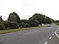
 A334 approaching The Wheatsheaf Shedfield - geograph.org.uk - 3428014.jpg 640 × 349 ; 69 kio
-
 A334 eastbound - geograph.org.uk - 5161446.jpg 640 × 480 ; 53 kio
-
 A334 eastbound - geograph.org.uk - 5161483.jpg 640 × 480 ; 68 kio
-
 A334 eastbound - geograph.org.uk - 5161604.jpg 640 × 480 ; 132 kio
-
 A334 junction at Shedfield Common - geograph.org.uk - 3425178.jpg 640 × 461 ; 95 kio
-
 A334 westbound - geograph.org.uk - 5161454.jpg 640 × 480 ; 92 kio
-
 A334 westbound - geograph.org.uk - 5161488.jpg 640 × 480 ; 89 kio
-
 A334 westbound - geograph.org.uk - 5174038.jpg 640 × 480 ; 118 kio
-

-

-

-
 B2177 entering Waltham Chase - geograph.org.uk - 3425155.jpg 640 × 429 ; 80 kio
-
 B2177 looking south - geograph.org.uk - 3113179.jpg 640 × 480 ; 66 kio
-
 B2177 Winchester Road through Waltham Chase - geograph.org.uk - 5804133.jpg 1 024 × 684 ; 221 kio
-
 Bench on Shedfield Common - geograph.org.uk - 3181535.jpg 640 × 482 ; 101 kio
-
 Bend south of Waltham Chase between the pubs - geograph.org.uk - 3425167.jpg 640 × 358 ; 57 kio
-
 Biddenfield Lane - geograph.org.uk - 5161493.jpg 640 × 480 ; 141 kio
-
 Biddenfield Lane - geograph.org.uk - 5161497.jpg 640 × 480 ; 150 kio
-
 Biddenfield Lane junction on A334 - geograph.org.uk - 3428010.jpg 640 × 430 ; 93 kio
-
 Bin day in Blackhorse Lane - geograph.org.uk - 2380847.jpg 640 × 480 ; 118 kio
-
 Bin day in High Street - geograph.org.uk - 2380999.jpg 640 × 480 ; 87 kio
-
 Birch woodland - geograph.org.uk - 77209.jpg 640 × 480 ; 198 kio
-
 Birch woodland - geograph.org.uk - 77220.jpg 640 × 480 ; 214 kio
-
 Blackhorse Lane in late April - geograph.org.uk - 2380846.jpg 640 × 480 ; 86 kio
-
 Bluebells in Silford Copse - geograph.org.uk - 2383950.jpg 640 × 480 ; 133 kio
-
 Bus shelter on the B2177 - geograph.org.uk - 2384693.jpg 640 × 480 ; 110 kio
-
 Clewers Hill - geograph.org.uk - 5786143.jpg 640 × 432 ; 108 kio
-
 Crossroads on B2177, Waltham Chase - geograph.org.uk - 5804145.jpg 1 024 × 684 ; 209 kio
-

-
 Dead end footpath starting at Kitnocks Hill - geograph.org.uk - 2387635.jpg 640 × 480 ; 95 kio
-

-
 Footpath from Sandy Lane to the A334 - geograph.org.uk - 5720950.jpg 3 125 × 2 435 ; 2,79 Mio
-

-

-
 Footpath near Shedfield - geograph.org.uk - 1358929.jpg 640 × 480 ; 160 kio
-
 Footpath througfh Silford Copse - geograph.org.uk - 2387797.jpg 640 × 480 ; 152 kio
-
 Footpath towards Winchester Road, Shedfield - geograph.org.uk - 2546675.jpg 640 × 480 ; 168 kio
-
 Gate leading off from Blackhorse Lane - geograph.org.uk - 2380829.jpg 640 × 480 ; 65 kio
-

-
 Goods for sale in High Street - geograph.org.uk - 2381013.jpg 640 × 480 ; 66 kio
-
 Heading northwards from Shirrell Heath - geograph.org.uk - 2380878.jpg 480 × 640 ; 66 kio
-
 Horses grazing just off Blackhorse Lane - geograph.org.uk - 2380821.jpg 640 × 480 ; 61 kio
-
 Houses in Upper Church Road - geograph.org.uk - 2384699.jpg 640 × 480 ; 77 kio
-
 Junction of Blackhorse and Solomons Lanes - geograph.org.uk - 2380851.jpg 640 × 480 ; 84 kio
-
 Junction of Hearne Gardens and Hospital Road - geograph.org.uk - 2380866.jpg 640 × 480 ; 84 kio
-
 Junction of High Street and Hospital Road - geograph.org.uk - 2380911.jpg 640 × 480 ; 82 kio
-
 Junction of High Street and Twynams Hill - geograph.org.uk - 2381041.jpg 640 × 480 ; 81 kio
-
 Late April in Twyhams Hill - geograph.org.uk - 2381034.jpg 480 × 640 ; 126 kio
-
 Looking down Blackhorse Lane towards the B2177 - geograph.org.uk - 2380796.jpg 640 × 480 ; 104 kio
-
 Looking from Hall Court towards the vineyard - geograph.org.uk - 2387659.jpg 640 × 480 ; 53 kio
-
 Looking northwards up St Johns Lane - geograph.org.uk - 1475349.jpg 640 × 480 ; 117 kio
-
 Looking towards the cemetery gates at Shedfield - geograph.org.uk - 1475367.jpg 480 × 640 ; 153 kio
-
 Looking westwards along Solomons Lane - geograph.org.uk - 2380857.jpg 640 × 480 ; 78 kio
-
 Meon Valley Hotel and Country Club - geograph.org.uk - 5720957.jpg 4 000 × 3 000 ; 2,27 Mio
-
 Mid section of Blackhorse Lane - geograph.org.uk - 2380836.jpg 640 × 480 ; 94 kio
-
 Mid section of High Street, Shirrell Heath - geograph.org.uk - 2380989.jpg 640 × 480 ; 75 kio
-
 Mount Pleasant, Sandy Lane - geograph.org.uk - 4269714.jpg 640 × 480 ; 143 kio
-
 Murray Cottages, Shedfield - geograph.org.uk - 3181554.jpg 640 × 482 ; 82 kio
-
 New Place, De Vere Hotel - Shirrell Heath (1) - geograph.org.uk - 4173837.jpg 478 × 640 ; 395 kio
-
 New Place, De Vere Hotel - Shirrell Heath (2) - geograph.org.uk - 4173840.jpg 478 × 640 ; 411 kio
-
 Nightingale Crescent - geograph.org.uk - 2381051.jpg 640 × 480 ; 99 kio
-

-
 Part of Shedfield Common - geograph.org.uk - 4269510.jpg 640 × 480 ; 192 kio
-
 Path from Kitnocks Hill to Silford Copse - geograph.org.uk - 2383930.jpg 640 × 480 ; 66 kio
-
 Phone and post boxes in Shirrell Heath - geograph.org.uk - 2380994.jpg 640 × 480 ; 67 kio
-
 Playpark in Waltham Chase Recreation Ground - geograph.org.uk - 1480360.jpg 640 × 480 ; 97 kio
-
 Postbox in Upper Church Road - geograph.org.uk - 2384673.jpg 640 × 480 ; 83 kio
-
 Poult coops in Silford Copse - geograph.org.uk - 2383958.jpg 640 × 480 ; 91 kio
-
 Pub in Upper Church Road - geograph.org.uk - 2384687.jpg 640 × 480 ; 64 kio
-
 Road junction - geograph.org.uk - 5161611.jpg 640 × 480 ; 122 kio
-
 Road junction - geograph.org.uk - 5786145.jpg 640 × 400 ; 69 kio
-
 Road signs in Upper Church Road - geograph.org.uk - 2384695.jpg 640 × 480 ; 89 kio
-
 Sammuels Rest - geograph.org.uk - 5161629.jpg 640 × 480 ; 102 kio
-
 Sandy Lane - geograph.org.uk - 4269531.jpg 640 × 480 ; 174 kio
-
 Sandy Lane - geograph.org.uk - 4269540.jpg 640 × 480 ; 185 kio
-
 Sandy Lane junction by Shedfield House - geograph.org.uk - 3428026.jpg 640 × 480 ; 95 kio
-
 Semi circular building in Blackhorse Lane - geograph.org.uk - 2380806.jpg 640 × 480 ; 56 kio
-
 Shadows on Shedfield Rec - geograph.org.uk - 2387646.jpg 640 × 480 ; 59 kio
-
 Shedfield - Common - geograph.org.uk - 1229251.jpg 640 × 480 ; 95 kio
-
 Shedfield - Houses On The Edge Of The Common - geograph.org.uk - 1229230.jpg 640 × 480 ; 115 kio
-
 Shedfield - Reading Room And Social Club - geograph.org.uk - 1229084.jpg 640 × 480 ; 69 kio
-
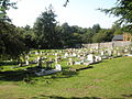
 Shedfield cemetery in late afternoon sunlight - geograph.org.uk - 3181543.jpg 640 × 482 ; 140 kio
-
 Shedfield Church - geograph.org.uk - 5161637.jpg 640 × 480 ; 96 kio
-
 Shedfield Common - geograph.org.uk - 1094307.jpg 640 × 480 ; 120 kio
-
 Shedfield Common - geograph.org.uk - 4269517.jpg 640 × 480 ; 129 kio
-
 Shedfield Common - geograph.org.uk - 4269524.jpg 640 × 480 ; 125 kio
-
 Shedfield Equestrian and Nursery - geograph.org.uk - 3428020.jpg 640 × 466 ; 96 kio
-
 Shedfield Equestrian centre - geograph.org.uk - 5071737.jpg 2 048 × 1 536 ; 780 kio
-
 Shedfield Reading Room, Church Road, Shedfield (July 2019).JPG 3 000 × 1 600 ; 1,65 Mio
-
 Shedfield recreation ground - geograph.org.uk - 1294442.jpg 640 × 480 ; 91 kio
-
 Shirrell Heath, Hampshire - geograph.org.uk - 2251653.jpg 3 504 × 2 336 ; 489 kio
-
 Sign for the Black Dog - geograph.org.uk - 2450922.jpg 480 × 640 ; 93 kio
-
 Silverlake Garage on A334 - geograph.org.uk - 3428040.jpg 640 × 347 ; 44 kio
-

-

-

-

-

-

-

-

-

-
-

-

-
 St John the Baptist church - geograph.org.uk - 5720964.jpg 4 000 × 3 000 ; 3,23 Mio
-
 Telephone box, Shirrell Heath - geograph.org.uk - 2450913.jpg 640 × 480 ; 63 kio
-
 The A334 west of Shedfield - geograph.org.uk - 5071740.jpg 2 048 × 1 536 ; 1,53 Mio
-
 The A334 west of Shedfield - geograph.org.uk - 5071741.jpg 2 048 × 1 536 ; 1,39 Mio
-
 The A334, Shedfield - geograph.org.uk - 5071738.jpg 2 048 × 1 536 ; 1,51 Mio
-
 The A334, Shedfield - geograph.org.uk - 5071739.jpg 2 016 × 1 509 ; 1,35 Mio
-
 The Black Dog, Waltham Chase - geograph.org.uk - 2450947.jpg 640 × 480 ; 68 kio
-
 The Old Forge Inn on the B2177 - geograph.org.uk - 3425171.jpg 640 × 453 ; 73 kio
-
 The Wheatsheaf Inn - geograph.org.uk - 5161473.jpg 640 × 480 ; 70 kio
-

-
 Van heading along Kitnocks Hill - geograph.org.uk - 2387636.jpg 640 × 480 ; 61 kio
-
 War Memorial - geograph.org.uk - 5161625.jpg 640 × 480 ; 91 kio
-
 Wickham Vineyard entrance from A334 - geograph.org.uk - 3428034.jpg 640 × 436 ; 64 kio
-
 Winchester Road - geograph.org.uk - 5786138.jpg 640 × 480 ; 82 kio
-
 Winchester Road - geograph.org.uk - 5786139.jpg 640 × 480 ; 93 kio
-
 Winchester Road at Shedfield Common - geograph.org.uk - 3113231.jpg 640 × 480 ; 85 kio
-
 Winchester Road at the Black Dog - geograph.org.uk - 3113211.jpg 640 × 480 ; 62 kio
-
 Winchester Road at Waltham Chase boundary - geograph.org.uk - 3113187.jpg 640 × 481 ; 61 kio
-
 Winchester Road, Shedfield - geograph.org.uk - 5071731.jpg 1 849 × 1 329 ; 1 004 kio
-
-
 Bridge in West Walk, Forest of Bere - geograph.org.uk - 234449.jpg 640 × 427 ; 197 kio
-

-
 Cemetery opposite St John's, Shedfield - geograph.org.uk - 1475350.jpg 640 × 480 ; 111 kio
-
 Chase Cycles in Waltham Chase - geograph.org.uk - 1480330.jpg 480 × 640 ; 96 kio
-
 Chase Grove - geograph.org.uk - 1480346.jpg 640 × 480 ; 102 kio
-
 Frith Lane, approaching Frith Lane End - geograph.org.uk - 235085.jpg 640 × 427 ; 111 kio
-
 Golf course pond - geograph.org.uk - 77204.jpg 640 × 480 ; 166 kio
-
-
 Kingsmead - geograph.org.uk - 1576.jpg 640 × 427 ; 35 kio
-
 Landfill site south of Frith Lane, nr Wickham - geograph.org.uk - 235065.jpg 640 × 427 ; 120 kio
-
 McCarthys Market Garden - geograph.org.uk - 81893.jpg 640 × 421 ; 89 kio
-
 Sandy Lane crossing a stream, nr Waltham Chase - geograph.org.uk - 220541.jpg 640 × 427 ; 194 kio
-
 Smithy Cottage, Bull Lane - geograph.org.uk - 447524.jpg 640 × 480 ; 138 kio
-
 Track from Woodend into West Walk, Forest of Bere - geograph.org.uk - 234462.jpg 427 × 640 ; 146 kio
-
 Unsanitised Field - geograph.org.uk - 80076.jpg 640 × 480 ; 132 kio
-
 Wickham Park Golf Course - geograph.org.uk - 81938.jpg 640 × 363 ; 58 kio
-
 Woodend Cottage, Woodend, Forest of Bere - geograph.org.uk - 234457.jpg 640 × 427 ; 157 kio
_-_geograph.org.uk_-_4876928.jpg)


_-_geograph.org.uk_-_4173837.jpg)
_-_geograph.org.uk_-_4173840.jpg)


.JPG)


_-_geograph.org.uk_-_2890273.jpg)
_-_geograph.org.uk_-_2890266.jpg)
_-_geograph.org.uk_-_2890268.jpg)
_-_geograph.org.uk_-_2890272.jpg)
_-_geograph.org.uk_-_2890278.jpg)
_-_geograph.org.uk_-_2890404.jpg)
_-_geograph.org.uk_-_2890409.jpg)
_-_geograph.org.uk_-_2890410.jpg)
_-_geograph.org.uk_-_2890412.jpg)
_-_geograph.org.uk_-_2890423.jpg)
_-_geograph.org.uk_-_2890426.jpg)
_-_geograph.org.uk_-_2890428.jpg)


