Category:Sheffield
Pereiti į navigaciją
Jump to search

Main Wikipedia article: Sheffield.
city in South Yorkshire, England, United Kingdom   | |||||
| Įkelti mediją | |||||
| Spoken text audio | |||||
|---|---|---|---|---|---|
| Tarimas (garso failas) | |||||
| Tai yra | |||||
| Vieta |
| ||||
| Oficiali kalba | |||||
| Pradžia |
| ||||
| Gyventojų skaičius |
| ||||
| Plotas |
| ||||
| Aukštis virš jūros lygio |
| ||||
| Skiriasi nuo | |||||
| oficiali svetainė | |||||
 | |||||
Subkategorijos
Rodoma 30 subkategorijų (iš viso yra 30 subkategorijų).
B
- Burbage Rocks (15 F)
C
- Cityscapes of Sheffield (13 F)
- Coats of arms of Sheffield (5 F)
D
E
H
I
L
N
P
R
- Rivelin Rocks (7 F)
S
- Signs in Sheffield (13 F)
T
U
W
- Wharncliffe Crags (10 F)
Daugialypės terpės rinkmenos kategorijoje „Sheffield“
Rodoma 200 šios kategorijos rinkmenų (iš viso kategorijoje yra 13 548 rinkmenos).
(ankstesnis puslapis) (kitas puslapis)-
 "As Thyme Goes By" Cafe in Crookes - geograph.org.uk - 5790083.jpg 5 038 × 3 680; 3,62 MiB
-
 "Bird and Boy" rusting sculpture, Rutland Road, Sheffield - geograph.org.uk - 2662644.jpg 1 952 × 2 608; 2,16 MiB
-
 "Bird and Boy" sculpture, Rutland Road, Sheffield - geograph.org.uk - 2662640.jpg 2 407 × 1 806; 2,03 MiB
-
 "City of Sheffield" stone marker on Hopwood Lane - geograph.org.uk - 3846974.jpg 5 182 × 3 702; 5,8 MiB
-
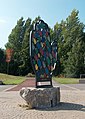
 "Comfort Blanket" by Grayson Perry (2014) - geograph.org.uk - 6297391.jpg 5 034 × 3 552; 2,87 MiB
-
 "Cricket Inn" framed by a football goalpost - geograph.org.uk - 4398548.jpg 4 799 × 3 504; 4,05 MiB
-
 "Cricket Inn", Totley Bents - geograph.org.uk - 4398552.jpg 4 960 × 3 624; 3,57 MiB
-
 "Cutting Edge" Sculpture, Sheffield - geograph.org.uk - 5844233.jpg 1 024 × 683; 190 KiB
-
 "Embrace" - narrowboat name plate - geograph.org.uk - 5243118.jpg 3 782 × 5 096; 3,48 MiB
-
 "Enchanted Chairs" on Centenary Green - geograph.org.uk - 3107557.jpg 800 × 600; 172 KiB
-
 "Eves Fruit Stores", Middlewood Road, Hillsborough - geograph.org.uk - 5239794.jpg 4 963 × 3 592; 4,01 MiB
-
 "Eyecatching" - mural by Rocket01 ^ Faunagraphic - geograph.org.uk - 4813130.jpg 5 060 × 3 694; 4,49 MiB
-
 "Gripple" spider and Sheffield fork - geograph.org.uk - 4711281.jpg 2 637 × 3 501; 2,65 MiB
-
 "Gusts of Wind Tickle" - geograph.org.uk - 4736579.jpg 4 995 × 3 550; 4,49 MiB
-
 "Hallam View" and Swinglee Farm - geograph.org.uk - 5843116.jpg 5 039 × 3 663; 4,8 MiB
-
 "Kelham Island Tavern", Russell Street, Sheffield - geograph.org.uk - 6024359.jpg 3 566 × 4 727; 3,43 MiB
-

-
 "Made in Sheffield" Shadow - geograph.org.uk - 4711267.jpg 4 888 × 3 429; 4,7 MiB
-
-
 "Mi Amigo" crew in Endcliffe Park - geograph.org.uk - 6067556.jpg 4 388 × 3 415; 2,33 MiB
-
 "Salty" on The Sheffield and Tinsley Canal - geograph.org.uk - 6283092.jpg 4 620 × 3 614; 2,62 MiB
-
 "Save me" - geograph.org.uk - 5836254.jpg 1 024 × 683; 163 KiB
-
-
 "Stanch" trade mark - geograph.org.uk - 3535405.jpg 1 024 × 768; 124 KiB
-
 "Stanley" works and offices, Europa Park, Sheffield - geograph.org.uk - 2620559.jpg 2 608 × 1 952; 1,68 MiB
-
 "Steelworker" (1986) - geograph.org.uk - 6237198.jpg 1 024 × 768; 147 KiB
-
 "The Bubble Man" in Fargate - geograph.org.uk - 5963275.jpg 640 × 480; 97 KiB
-
 "The Chantrey Arms", Woodseats - geograph.org.uk - 5263409.jpg 3 729 × 4 824; 3,5 MiB
-
 "The Cheese-Grater", Sheffield, Charles Street car park - geograph.org.uk - 3037892.jpg 1 064 × 1 600; 358 KiB
-

-
 "The Cheesegrater", Sheffield - geograph.org.uk - 3759440.jpg 4 858 × 3 886; 4,67 MiB
-
 "The Cherry Tree", Carter Knowle, Sheffield - geograph.org.uk - 4837690.jpg 5 020 × 3 765; 4,26 MiB
-
 "The Church House", Sheffield - geograph.org.uk - 3968251.jpg 1 864 × 2 330; 1,44 MiB
-
 "The Coach House", St Mark's Crescent, Broomhall - geograph.org.uk - 6259216.jpg 4 940 × 3 660; 4,06 MiB
-
 "The Cricket Inn" at Totley Bents - geograph.org.uk - 5237859.jpg 5 067 × 3 801; 3,99 MiB
-
 "The Cricket Inn" Totley - geograph.org.uk - 2515727.jpg 2 590 × 3 454; 1,77 MiB
-
 "The Devonshire Arms", Dore - geograph.org.uk - 5245023.jpg 4 782 × 3 454; 3,5 MiB
-
 "The Fat Cat", Alma Street, Kelham Island - geograph.org.uk - 6024356.jpg 3 666 × 4 730; 3,47 MiB
-
 "The Hammer and Pincers" pub at Bents Green - geograph.org.uk - 4816907.jpg 3 745 × 4 799; 5,05 MiB
-
 "The Manor Castle". Manor Lane, Sheffield - geograph.org.uk - 5305929.jpg 5 007 × 3 623; 4,01 MiB
-
 "The Museum" public house, Sheffield - geograph.org.uk - 3968250.jpg 1 700 × 2 380; 868 KiB
-
 "The Nottingham House", Broomhill - geograph.org.uk - 5945069.jpg 4 971 × 3 580; 3,72 MiB
-
 "The Old Crown", Owlerton, Sheffield - geograph.org.uk - 3967787.jpg 2 432 × 1 622; 1,05 MiB
-
 "The Plough" at Sandygate - geograph.org.uk - 5285171.jpg 4 750 × 3 416; 3,29 MiB
-
 "The Porter Cottage", Sharrowvale, Sheffield - geograph.org.uk - 4272083.jpg 4 825 × 3 607; 3,99 MiB
-
 "The Rivelin" pub seen from Coppice Road - geograph.org.uk - 6105176.jpg 5 095 × 3 779; 5,67 MiB
-
 "The Rivelin" public house at Undertofts below Stannington - geograph.org.uk - 2106072.jpg 1 952 × 2 608; 1,68 MiB
-
 "The Sheaf View" public house, Sheffield - geograph.org.uk - 4337512.jpg 4 980 × 3 678; 4,62 MiB
-
 "The Snog" by Pete McKee - geograph.org.uk - 5946089.jpg 5 018 × 3 708; 3,48 MiB
-
 "The Soundhouse", Gell Street, Sheffield - geograph.org.uk - 5139607.jpg 4 970 × 3 389; 2,89 MiB
-
 "The Three Merry Lads" in March 2014 - geograph.org.uk - 3875979.jpg 2 481 × 1 861; 1,26 MiB
-
 "The Union Hotel", Nether Edge - geograph.org.uk - 3711714.jpg 4 935 × 3 290; 3,91 MiB
-
 "The White Hart" in Greenhill - geograph.org.uk - 5594665.jpg 5 183 × 3 667; 4,27 MiB
-
 "The White Swan" in Greenhill - geograph.org.uk - 5594656.jpg 5 127 × 3 721; 4,32 MiB
-
 "Trick" graffiti at Park Hill Flats - geograph.org.uk - 6369816.jpg 4 929 × 3 486; 5,2 MiB
-
 "Ye Old Shakespeare Inn", Heeley - geograph.org.uk - 4337504.jpg 3 694 × 4 991; 4,21 MiB
-
 "You'll Thank Me One Day" - Sheffield graffiti - geograph.org.uk - 3243104.jpg 4 260 × 2 840; 2,65 MiB
-
 'Angry Woman' at Upper Chapel - geograph.org.uk - 3165927.jpg 768 × 1 024; 270 KiB
-

-
 'Challenge' at The Ponderosa, Upperthorpe, Sheffield - geograph.org.uk - 2094448.jpg 2 057 × 1 372; 723 KiB
-
 'Crossroads' at The Ponderosa, Upperthorpe, Sheffield - geograph.org.uk - 2094462.jpg 1 077 × 1 622; 389 KiB
-
 'Enchanted Chairs' - geograph.org.uk - 3385425.jpg 1 024 × 948; 257 KiB
-
 'Enchanted Chairs' - geograph.org.uk - 3385495.jpg 701 × 1 024; 168 KiB
-

-
 'Owd Shevvield'.jpg 1 273 × 943; 442 KiB
-
 'Posh Pillar and her Daughters' - geograph.org.uk - 3385504.jpg 798 × 1 024; 294 KiB
-

-
 -i---i- (5568581301).jpg 4 752 × 3 168; 5,29 MiB
-
 1-13 Angel Street, Sheffield - geograph.org.uk - 3898067.jpg 640 × 506; 170 KiB
-
 100-102 Gell Street, Sheffield - geograph.org.uk - 3886853.jpg 525 × 640; 240 KiB
-
 102, Gell St - geograph.org.uk - 4962687.jpg 640 × 426; 108 KiB
-
 11 Leopold Street, Sheffield - geograph.org.uk - 3881485.jpg 521 × 640; 171 KiB
-
 111 Matilda Street, Sheffield - geograph.org.uk - 3895663.jpg 640 × 487; 153 KiB
-
 117 Norfolk Street, Sheffield - geograph.org.uk - 3874154.jpg 640 × 577; 191 KiB
-
 12 East Parade, Sheffield - geograph.org.uk - 3875067.jpg 502 × 640; 217 KiB
-
 12-18 Cambridge Street, Sheffield - geograph.org.uk - 3862849.jpg 481 × 640; 156 KiB
-
 14 Ecclesall Road South - geograph.org.uk - 4225204.jpg 800 × 533; 144 KiB
-
 14 Fig Tree Lane, Sheffield - geograph.org.uk - 3876787.jpg 497 × 640; 177 KiB
-
 14-26 Paradise Square, Sheffield - geograph.org.uk - 3877001.jpg 640 × 469; 176 KiB
-
 15 St James's Row, Sheffield - geograph.org.uk - 3912744.jpg 550 × 640; 211 KiB
-
 15-17 Bridge Street, Sheffield - geograph.org.uk - 3898130.jpg 483 × 640; 151 KiB
-
 15-33 Regent Terrace, Sheffield - geograph.org.uk - 3887436.jpg 640 × 496; 163 KiB
-
 158 Charles Street, Sheffield - geograph.org.uk - 3894149.jpg 587 × 640; 178 KiB
-
 16 Claremont Crescent, Broomhill, Sheffield - geograph.org.uk - 3816288.jpg 3 550 × 2 557; 1,91 MiB
-
 16 George Street, Sheffield - geograph.org.uk - 3881661.jpg 640 × 507; 179 KiB
-
 17 North Church Street, Sheffield - geograph.org.uk - 3876990.jpg 466 × 640; 160 KiB
-
 173 Camelot, Cupola - geograph.org.uk - 4985332.jpg 640 × 426; 75 KiB
-
 18-20 Bank Street, Sheffield - geograph.org.uk - 3876797.jpg 461 × 640; 156 KiB
-
-
 192 Rockingham Street, Sheffield - geograph.org.uk - 3886695.jpg 640 × 446; 169 KiB
-
 2 Claremont Place, Broomhill, Sheffield - geograph.org.uk - 3816304.jpg 2 613 × 2 233; 1,82 MiB
-
 2 Haymarket, Sheffield - geograph.org.uk - 3904215.jpg 640 × 472; 192 KiB
-
 2 High Street and 9 Fargate, Sheffield - geograph.org.uk - 3883059.jpg 640 × 567; 221 KiB
-
 2 Surrey Place, Sheffield - geograph.org.uk - 3866396.jpg 469 × 640; 173 KiB
-
 20 Arundel Gate, Sheffield - geograph.org.uk - 3881635.jpg 640 × 487; 157 KiB
-
 20, Furnival St - geograph.org.uk - 5010692.jpg 640 × 436; 73 KiB
-
 2018 Snooker World Championship Qualifiers - geograph.org.uk - 6348158.jpg 1 024 × 576; 112 KiB
-
 21 and 23 Claremont Crescent, Broomhill, Sheffield - geograph.org.uk - 3816280.jpg 3 015 × 2 106; 1,44 MiB
-
 21 Haymarket, Sheffield - geograph.org.uk - 3904180.jpg 471 × 640; 159 KiB
-
 216 Solly Street, Sheffield - geograph.org.uk - 3906323.jpg 640 × 505; 171 KiB
-
 21eme Regiment d’infanterie de Ligne - geograph.org.uk - 3620486.jpg 2 848 × 2 144; 1,52 MiB
-
 22 Wilkinson Street, Sheffield - geograph.org.uk - 3918307.jpg 640 × 461; 209 KiB
-
 22, Blake Grove Rd - geograph.org.uk - 4987990.jpg 640 × 426; 79 KiB
-
 22-24 Dixon Lane, Sheffield - geograph.org.uk - 3904193.jpg 507 × 640; 175 KiB
-
 22-42 Bank Street, Sheffield - geograph.org.uk - 3876796.jpg 640 × 466; 171 KiB
-
 23 Filey Street, Broomhall, Sheffield - geograph.org.uk - 3775864.jpg 3 149 × 2 476; 2,03 MiB
-
 23 ^ 25 Filey Street, Broomhall, Sheffield - geograph.org.uk - 3775856.jpg 4 116 × 2 708; 2,86 MiB
-
 246 West Street, Sheffield - geograph.org.uk - 3889677.jpg 640 × 485; 190 KiB
-
 25 Filey Street, Broomhall, Sheffield - geograph.org.uk - 3775879.jpg 4 608 × 3 072; 3,48 MiB
-
 252-254 West Street, Sheffield - geograph.org.uk - 3889701.jpg 640 × 585; 220 KiB
-
 267-285 Glossop Road, Sheffield - geograph.org.uk - 3918012.jpg 640 × 464; 133 KiB
-
 271 Glossop Road, Sheffield - geograph.org.uk - 3917993.jpg 621 × 640; 223 KiB
-
 28-32 Trippet Lane, Sheffield - geograph.org.uk - 3878162.jpg 640 × 548; 245 KiB
-
 2d 1935 Sheffield commercial overprint stamps.jpg 2 100 × 1 218; 842 KiB
-
 30 Mowbray Street, Sheffield - geograph.org.uk - 3917853.jpg 616 × 640; 193 KiB
-
 305 Glossop Road, Sheffield - geograph.org.uk - 3918023.jpg 640 × 516; 206 KiB
-
 32-40 Pinstone Street, Sheffield - geograph.org.uk - 3853871.jpg 640 × 525; 180 KiB
-
 33-43 Lambert Street, Sheffield - geograph.org.uk - 3912819.jpg 640 × 493; 129 KiB
-
 338-356 Glossop Road, Sheffield - geograph.org.uk - 3918016.jpg 640 × 455; 152 KiB
-
 34 Gell Street, Sheffield - geograph.org.uk - 3886858.jpg 640 × 450; 165 KiB
-
 35 and a half year-old graffiti - geograph.org.uk - 2234373.jpg 1 394 × 707; 215 KiB
-
 35-37 Suffolk Road, Sheffield - geograph.org.uk - 3895681.jpg 640 × 469; 143 KiB
-
 375-385 Glossop Road, Sheffield - geograph.org.uk - 3918028.jpg 553 × 640; 265 KiB
-
 4 Claremont Place, Broomhill, Sheffield - geograph.org.uk - 3816302.jpg 3 163 × 2 539; 2,66 MiB
-
 4 Peacock butterflies on Blacka Moor - geograph.org.uk - 3588498.jpg 3 776 × 1 771; 4,33 MiB
-
 4-12 and 1-5 Paradise Square, Sheffield - geograph.org.uk - 3877011.jpg 640 × 358; 132 KiB
-
 4-14 Canning Street, Sheffield - geograph.org.uk - 3886719.jpg 640 × 584; 161 KiB
-
 46-48 Wicker, Sheffield - geograph.org.uk - 3905871.jpg 534 × 640; 174 KiB
-
 49 West Street, Sheffield - geograph.org.uk - 3878169.jpg 640 × 458; 169 KiB
-
 5 Church Street, Sheffield - geograph.org.uk - 3874960.jpg 640 × 594; 197 KiB
-
 5-15 Paternoster Row, Sheffield - geograph.org.uk - 3896014.jpg 640 × 348; 129 KiB
-
 50 High Street, Sheffield - geograph.org.uk - 3898050.jpg 640 × 458; 160 KiB
-
 55 Surrey Street, Sheffield - geograph.org.uk - 3874160.jpg 640 × 466; 157 KiB
-
 55-66 Campo Lane, Sheffield - geograph.org.uk - 3877288.jpg 577 × 640; 183 KiB
-
 59-73 Commercial Street, Sheffield - geograph.org.uk - 3883019.jpg 640 × 491; 168 KiB
-
 6 Claremont Place, Broomhill, Sheffield - geograph.org.uk - 3816299.jpg 2 970 × 2 197; 1,87 MiB
-
 6 Garden Street, Sheffield - geograph.org.uk - 3906302.jpg 640 × 396; 137 KiB
-
 64 Garden Street, Sheffield - geograph.org.uk - 3906315.jpg 640 × 470; 163 KiB
-
 72-76 Sidney Street, Sheffield - geograph.org.uk - 3897061.jpg 640 × 464; 166 KiB
-
 79-81 Hollis Croft, Sheffield - geograph.org.uk - 3907085.jpg 485 × 640; 144 KiB
-
 8 Claremont Place, Broomhill, Sheffield - geograph.org.uk - 3816295.jpg 2 633 × 2 218; 2,29 MiB
-
 8 St James's Street, Sheffield - geograph.org.uk - 3877038.jpg 436 × 640; 176 KiB
-
 8 weeks after the storm, Brightside Bridge - geograph.org.uk - 6359294.jpg 3 648 × 1 744; 1,88 MiB
-
 8 weeks after the storm, Brightside Bridge - geograph.org.uk - 6359298.jpg 3 648 × 1 744; 2,33 MiB
-
 8-26 Norfolk Row, Sheffield - geograph.org.uk - 3881505.jpg 640 × 516; 175 KiB
-
 87 Division Street, Sheffield - geograph.org.uk - 3886703.jpg 640 × 507; 141 KiB
-
 87-91 Wicker, Sheffield - geograph.org.uk - 3905878.jpg 640 × 474; 170 KiB
-
 89-93 Division Street, Sheffield - geograph.org.uk - 3886709.jpg 640 × 499; 146 KiB
-
 9 York Street, Sheffield - geograph.org.uk - 3881809.jpg 640 × 469; 164 KiB
-
 9-11 Castle Street, Sheffield - geograph.org.uk - 3904112.jpg 486 × 640; 179 KiB
-
 9-11 East Parade, Sheffield - geograph.org.uk - 3875167.jpg 523 × 640; 242 KiB
-
 92-94 Arundel Street, Sheffield - geograph.org.uk - 3894364.jpg 640 × 475; 152 KiB
-
 94 Gell Street, Sheffield - geograph.org.uk - 3886849.jpg 640 × 504; 213 KiB
-
 94, Gell St - geograph.org.uk - 4962691.jpg 640 × 426; 78 KiB
-
 A 3 pounder cannon - geograph.org.uk - 3620637.jpg 2 848 × 2 144; 1,52 MiB
-
-
-
 A bend in Norwood Road - geograph.org.uk - 4315416.jpg 640 × 480; 78 KiB
-
 A brick mural on Castle Street - geograph.org.uk - 2552394.jpg 600 × 800; 262 KiB
-
 A brilliant water feature - geograph.org.uk - 5522082.jpg 2 000 × 1 333; 2,13 MiB
-
 A cascading Porter Brook Sheffield - geograph.org.uk - 4824306.jpg 768 × 1 024; 332 KiB
-
 A cherry tree outside the Cherry Tree - geograph.org.uk - 5553363.jpg 800 × 600; 208 KiB
-
 A child's grave at Christ Church, Fulwood - geograph.org.uk - 3689633.jpg 3 597 × 5 036; 5,23 MiB
-
 A cluster of cranes - geograph.org.uk - 5619363.jpg 2 848 × 2 144; 1,5 MiB
-
 A complexity of bridges, Meadowhall - geograph.org.uk - 6128662.jpg 1 024 × 576; 252 KiB
-
 A distant Sheffield City centre from Fulwood Lane - geograph.org.uk - 4451212.jpg 1 024 × 738; 214 KiB
-
 A distant view of Sheffield - geograph.org.uk - 4885943.jpg 4 836 × 3 647; 4,18 MiB
-
 A final sunset over Tinsley cooling towers - geograph.org.uk - 1856748.jpg 3 072 × 2 304; 1,4 MiB
-
 A fishy seat - geograph.org.uk - 4946714.jpg 640 × 426; 95 KiB
-
 A footpath off Soughley Lane - geograph.org.uk - 3078570.jpg 800 × 600; 83 KiB
-
 A forest of cranes - geograph.org.uk - 2306747.jpg 1 024 × 768; 240 KiB
-
 A glimpse of the peace fountains - geograph.org.uk - 2989245.jpg 640 × 480; 98 KiB
-
 A Glossary of Words Used In the Neighbourhood of Sheffield - Addy - 1888.djvu 2 696 × 4 224, 504 puslapiai; 14,82 MiB
-
 A grave in Sheffield Sheffield General Cemetery - geograph.org.uk - 4301108.jpg 1 024 × 716; 237 KiB
-
 A green education - geograph.org.uk - 2890570.jpg 1 024 × 768; 202 KiB
-
 A grindstone and Mother Cap - geograph.org.uk - 1947361.jpg 2 848 × 2 144; 1,51 MiB
-
 A hand down the alley - geograph.org.uk - 3051424.jpg 427 × 640; 88 KiB
-
-

-
-
 A line of trees near Avenue Farm - geograph.org.uk - 5245018.jpg 3 693 × 4 874; 5,17 MiB
-

-
 A look at the carriage storage area - geograph.org.uk - 1924590.jpg 800 × 600; 121 KiB
-
 A Lost View - Whirlow Grange, Sheffield - geograph.org.uk - 3727473.jpg 1 600 × 1 200; 763 KiB
-
 A mass of Crocus in bloom in Sheffield - geograph.org.uk - 4824299.jpg 768 × 1 024; 348 KiB
-
 A Message on a Bin - Love God - geograph.org.uk - 4237329.jpg 1 600 × 1 200; 745 KiB
-
 A misty Hurkling Stones - geograph.org.uk - 1573042.jpg 640 × 446; 51 KiB
-
 A misty Long Causeway - geograph.org.uk - 6141545.jpg 480 × 640; 67 KiB
-
 A new footbridge over the Don - geograph.org.uk - 2058820.jpg 2 848 × 2 144; 1,51 MiB
-
 A new gate on Wharncliffe Crag edge path - geograph.org.uk - 713930.jpg 640 × 480; 101 KiB
-
 A new view of Langsett Reservoir - geograph.org.uk - 2226814.jpg 640 × 480; 71 KiB
-
-
 A nice perch^ - geograph.org.uk - 3428033.jpg 2 343 × 1 625; 1,19 MiB
-

-
 A pair of autumn leaves in The Limb Valley - geograph.org.uk - 5583271.jpg 2 502 × 3 417; 1,48 MiB
-
 A path into Rollestone Wood - geograph.org.uk - 3960675.jpg 1 600 × 1 064; 755 KiB
-
 A path on Burbage Moor - geograph.org.uk - 3078641.jpg 800 × 600; 89 KiB
-
 A Peaceful Protest - geograph.org.uk - 2304903.jpg 3 648 × 2 736; 5,32 MiB
-
 A peaceful view of the gardens - geograph.org.uk - 5522219.jpg 1 333 × 2 000; 3,8 MiB
-


._On_the_plinth_of_the_statue_of_Queen_Victoria_in_Endcliffe_Park_-_geograph.org.uk_-_2004835.jpg)

_on_plinth_of_Endcliffe_Park_statue_of_Queen_Victoria_-_geograph.org.uk_-_2004828.jpg)


_-_geograph.org.uk_-_6237198.jpg)


,_Winter_Street,_Sheffield_-_geograph.org.uk_-_2040540.jpg)
.jpg)


.JPG)
.JPG)


.JPG)
.JPG)
.JPG)


.JPG)

.JPG)


_-_geograph.org.uk_-_2983149.jpg)
_-_geograph.org.uk_-_6297391.jpg)