Category:Shellingford
Aller à la navigation
Aller à la recherche
localité britannique du comté anglais d'Oxfordshire  | |||||
| Téléverser des médias | |||||
| Nature de l’élément | |||||
|---|---|---|---|---|---|
| Lieu | Vale of White Horse, Oxfordshire, Angleterre du Sud-Est, Angleterre | ||||
 | |||||
English: Shellingford is a village and civil parish in the Vale of White Horse, about three miles southeast of Faringdon, Oxfordshire, England. In 1974 it was transferred from Berkshire.
Sous-catégories
Cette catégorie comprend 2 sous-catégories, dont les 2 ci-dessous.
C
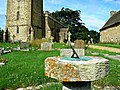
- St Faith's church, Shellingford (13 F)
S
Média dans la catégorie « Shellingford »
Cette catégorie comprend 74 fichiers, dont les 74 ci-dessous.
-
 A417 approaches junction with B4508 - geograph.org.uk - 4012092.jpg 3 648 × 2 634 ; 1,36 Mio
-
 A417 north of Wichwood - geograph.org.uk - 4012170.jpg 3 570 × 2 643 ; 2,08 Mio
-
 A417 south of Chinham Farm - geograph.org.uk - 4012140.jpg 3 648 × 2 736 ; 1,96 Mio
-
 A417-Fernham Road junction - geograph.org.uk - 3131475.jpg 640 × 481 ; 50 kio
-
 Ashbrook Monument, Church of St Faith, Church Street, Shellingford - geograph.org.uk - 3044434.jpg 2 112 × 2 816 ; 1,56 Mio
-
 B4508 from Shellingford towards the A417 - geograph.org.uk - 6267801.jpg 800 × 600 ; 129 kio
-
 Bridleway near Little Newbury Farm - geograph.org.uk - 6226880.jpg 4 000 × 3 000 ; 4,84 Mio
-
 Bridleway to Baulking - geograph.org.uk - 4218591.jpg 1 500 × 999 ; 213 kio
-

-

-

-
 Chinham Cottages and the entrance to Chinham Farm - geograph.org.uk - 6226832.jpg 4 000 × 3 000 ; 4,9 Mio
-
 Church Cottage, Shellingford - geograph.org.uk - 3984631.jpg 640 × 480 ; 133 kio
-

-
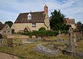
 Church of St Faith, Shellingford, Oxfordshire - geograph.org.uk - 4520755.jpg 572 × 800 ; 112 kio
-
-
 Cows in the Evening, Shellingford - geograph.org.uk - 3664520.jpg 1 024 × 521 ; 127 kio
-
 Cyclists at the Faringdon Road junction - geograph.org.uk - 6226854.jpg 4 000 × 3 000 ; 4,62 Mio
-
 Faringdon Road looking towards Stanford in the Vale - geograph.org.uk - 4225788.jpg 1 500 × 999 ; 145 kio
-
 Faringdon Road to Stanford in the Vale - geograph.org.uk - 4225792.jpg 1 500 × 999 ; 150 kio
-
 Farm buildings, Shellingford - geograph.org.uk - 2816122.jpg 640 × 480 ; 97 kio
-
 Farmland off Fernham Road (B4508) - geograph.org.uk - 6267787.jpg 800 × 600 ; 120 kio
-
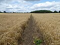
 Farmland, Shellingford - geograph.org.uk - 2678378.jpg 640 × 480 ; 147 kio
-
 Farmland, Shellingford - geograph.org.uk - 2815976.jpg 640 × 480 ; 188 kio
-
 Farmland, Shellingford - geograph.org.uk - 6080538.jpg 1 024 × 768 ; 236 kio
-
 Farmland, Shellingford - geograph.org.uk - 6186836.jpg 1 024 × 683 ; 167 kio
-
 Farmland, Shellingford - geograph.org.uk - 6186838.jpg 1 024 × 683 ; 210 kio
-
 Farmland, Shellingford - geograph.org.uk - 6190576.jpg 1 024 × 683 ; 216 kio
-
 Fernham Road (B4508) - geograph.org.uk - 6267791.jpg 800 × 600 ; 112 kio
-
 Fernham Road (B4508), Shellingford - geograph.org.uk - 6267796.jpg 800 × 600 ; 133 kio
-
 Fernham Road into Shellingford - geograph.org.uk - 4218593.jpg 1 500 × 999 ; 183 kio
-
 Fernham Road through Shellingford - geograph.org.uk - 4225764.jpg 1 500 × 999 ; 185 kio
-

-

-
 Goodlake Barns, Shellingford - geograph.org.uk - 3664514.jpg 3 568 × 2 072 ; 1,14 Mio
-
 Hannes monument, Church of St Faith, Church Street, Shellingford - geograph.org.uk - 3044809.jpg 2 112 × 2 816 ; 1,47 Mio
-
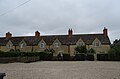
 Home Farm, Shellingford - geograph.org.uk - 1125236.jpg 640 × 427 ; 56 kio
-
 Houses on Fernham Road (B4508), Shellingford - geograph.org.uk - 6267793.jpg 800 × 527 ; 81 kio
-
 Junction of farm tracks - geograph.org.uk - 2829556.jpg 1 024 × 683 ; 178 kio
-

-

-

-

-
 Nearing the A417 - geograph.org.uk - 4225785.jpg 1 500 × 999 ; 138 kio
-

-

-
 Packer Monument, Church of St Faith, Church Street, Shellingford - geograph.org.uk - 3044440.jpg 2 112 × 2 816 ; 1,85 Mio
-
 Pastures, Stanford in the Vale - geograph.org.uk - 6080539.jpg 1 024 × 768 ; 219 kio
-

-
 Public bridleway to Wickwood Copse - geograph.org.uk - 6226884.jpg 4 000 × 3 000 ; 4,52 Mio
-
 RAF Shellingford Remnant - geograph.org.uk - 2283584.jpg 2 722 × 1 833 ; 911 kio
-
 Road junction in Shellingford - geograph.org.uk - 1125214.jpg 640 × 427 ; 66 kio
-
 Road signs at the junction - geograph.org.uk - 3984660.jpg 640 × 428 ; 75 kio
-
 Sand quarry near Shellingford - geograph.org.uk - 6226859.jpg 4 000 × 3 000 ; 2,83 Mio
-
 Sands, Farm, Shellingford - geograph.org.uk - 2815973.jpg 640 × 480 ; 113 kio
-
 B4508 in Shellingford - geograph.org.uk - 1125225.jpg 640 × 427 ; 90 kio
-
 Shellingford ChurchCottage ESE.jpg 1 024 × 731 ; 473 kio
-
 Shellingford School and Community Hall - geograph.org.uk - 1125143.jpg 640 × 427 ; 104 kio
-
 Stanford Road (A417) - geograph.org.uk - 6267806.jpg 800 × 600 ; 84 kio
-
 Stanford Road near Wichwood - geograph.org.uk - 3131493.jpg 640 × 481 ; 53 kio
-
 Stanford Road, Faringdon - geograph.org.uk - 6307202.jpg 1 856 × 1 176 ; 1,22 Mio
-

-

-
 The B4508 heading towards the A417 - geograph.org.uk - 4225777.jpg 1 500 × 999 ; 151 kio
-
 The B4508 out of Shellingford - geograph.org.uk - 4225772.jpg 1 500 × 999 ; 172 kio
-

-
 Timber Yard Cottages, Shellingford - geograph.org.uk - 6226879.jpg 4 000 × 3 000 ; 5,11 Mio
-
 Track and farmland, Shellingford - geograph.org.uk - 2816106.jpg 640 × 480 ; 131 kio
-
 Village house, Shellingford, Oxfordshire - geograph.org.uk - 4520784.jpg 800 × 546 ; 155 kio
-
 Village street in Shellingford - geograph.org.uk - 1125201.jpg 640 × 427 ; 93 kio
-
 Flat fields of the Vale - geograph.org.uk - 307341.jpg 640 × 480 ; 69 kio
-
 Little Newbury Farm - geograph.org.uk - 307336.jpg 640 × 480 ; 81 kio
-
 Vale Of White Horse - geograph.org.uk - 307339.jpg 640 × 480 ; 77 kio
-
 Village Street, Shellingford - geograph.org.uk - 307343.jpg 640 × 480 ; 97 kio


_-_geograph.org.uk_-_3043671.jpg)
_-_geograph.org.uk_-_3044443.jpg)


_-_geograph.org.uk_-_6267787.jpg)


_-_geograph.org.uk_-_6267791.jpg)
,_Shellingford_-_geograph.org.uk_-_6267796.jpg)


_-_geograph.org.uk_-_6267790.jpg)


,_Shellingford_-_geograph.org.uk_-_6267793.jpg)

,_Shellingford_-_geograph.org.uk_-_6267799.jpg)

_-_geograph.org.uk_-_3043668.jpg)
_-_geograph.org.uk_-_3043670.jpg)

_-_geograph.org.uk_-_3044813.jpg)
_-_geograph.org.uk_-_3044814.jpg)


_-_geograph.org.uk_-_6267806.jpg)


