Category:Shepton Montague
Vai alla navigazione
Vai alla ricerca
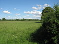
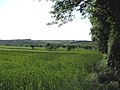
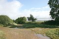
English: Shepton Montague is a village and civil parish in Somerset, England. It is situated on the River Pitt in the South Somerset district midway between Wincanton, Bruton and Castle Cary.
village in the United Kingdom  | |||||
| Carica un file multimediale | |||||
| Istanza di | |||||
|---|---|---|---|---|---|
| Luogo | South Somerset, Somerset, Sud Ovest dell'Inghilterra, Inghilterra | ||||
| Considerato essere uguale a | Shepton Montague (pagina Wikimedia duplicata, parrocchia civile dell'Inghilterra) | ||||
 | |||||
Sottocategorie
Questa categoria contiene un'unica sottocategoria, indicata di seguito.
P
File nella categoria "Shepton Montague"
Questa categoria contiene 33 file, indicati di seguito, su un totale di 33.
-
 B3081 heading north-west - geograph.org.uk - 5806008.jpg 1 024 × 684; 272 KB
-
 B3081 heading north-west - geograph.org.uk - 5806018.jpg 1 024 × 684; 380 KB
-
 Caryedge Lane at the junction of the A359 - geograph.org.uk - 5781097.jpg 2 164 × 1 599; 1,52 MB
-

-
 Direction Sign - Signpost near Shepton Montague - geograph.org.uk - 6102200.jpg 1 121 × 1 648; 320 KB
-

-
 Lane around former Redlynch Park - geograph.org.uk - 5806159.jpg 1 024 × 684; 293 KB
-
 Lane around former Redlynch Park - geograph.org.uk - 5806177.jpg 1 024 × 684; 275 KB
-
 Looking south in Shepton Montague - geograph.org.uk - 5086343.jpg 1 600 × 1 065; 594 KB
-

-

-
 Shepton Montague church - geograph.org.uk - 5806141.jpg 1 024 × 768; 344 KB
-
 Shepton Montague village hall - geograph.org.uk - 5806472.jpg 1 024 × 768; 321 KB
-
 Shepton Montague, Church of Saint Peter - geograph.org.uk - 2998054.jpg 900 × 614; 502 KB
-
 Small valley next to the A359 - geograph.org.uk - 2541255.jpg 800 × 600; 114 KB
-
 St. Peters, Lower Shepton - geograph.org.uk - 132840.jpg 640 × 480; 83 KB
-

-
 Stoney Stoke, View towards Redlynch - geograph.org.uk - 2998084.jpg 900 × 596; 519 KB
-
 The Forge, Higher Shepton - geograph.org.uk - 5086355.jpg 1 600 × 1 065; 812 KB
-
 The Montague Inn, Shepton Montague - geograph.org.uk - 2389188.jpg 640 × 480; 150 KB
-
 The Montague Inn, Shepton Montague - geograph.org.uk - 5086058.jpg 1 600 × 1 065; 504 KB
-
 The Montague Inn, Shepton Montague - geograph.org.uk - 5086061.jpg 1 290 × 1 600; 378 KB
-

-
 Be aware free range children - geograph.org.uk - 459962.jpg 640 × 477; 95 KB
-
 Caryedge Lane - geograph.org.uk - 528457.jpg 640 × 480; 77 KB
-
 Cottages at Castle Hill - geograph.org.uk - 133066.jpg 640 × 480; 105 KB
-
 Field adjacent to minor road - geograph.org.uk - 449496.jpg 640 × 480; 98 KB
-
 Field by Wood - geograph.org.uk - 449609.jpg 640 × 480; 92 KB
-
 Knowle Park Farm - geograph.org.uk - 449527.jpg 640 × 480; 111 KB
-
 Minor road - geograph.org.uk - 449494.jpg 480 × 640; 88 KB
-
 Old barns - geograph.org.uk - 449518.jpg 640 × 480; 87 KB
-
 Stump Cross - geograph.org.uk - 567643.jpg 640 × 426; 88 KB
-
 View from road - geograph.org.uk - 449503.jpg 640 × 480; 113 KB


