Category:Sherborne, Gloucestershire
Vai alla navigazione
Vai alla ricerca
village and civil parish in Gloucestershire, UK  | |||||
| Carica un file multimediale | |||||
| Istanza di | |||||
|---|---|---|---|---|---|
| Luogo | Cotswold, Gloucestershire, Sud Ovest dell'Inghilterra, Inghilterra | ||||
 | |||||
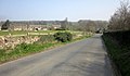
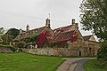
English: Sherborne is a village and civil parish almost east of Northleach in Gloucestershire. It is named after Sherborne Brook, a tributary of the River Windrush. Sherborne is a linear village, extending more than a mile along the valley of the brook.
Sottocategorie
Questa categoria contiene le 4 sottocategorie indicate di seguito, su un totale di 4.
C
- Cheltenham Lodges (3 F)
S
File nella categoria "Sherborne, Gloucestershire"
Questa categoria contiene 200 file, indicati di seguito, su un totale di 315.
(pagina precedente) (pagina successiva)-
 A row of cottages in Sherborne - geograph.org.uk - 2742716.jpg 2 592 × 1 944; 1,48 MB
-
 A40 - Aldsworth junction - geograph.org.uk - 2512777.jpg 640 × 480; 66 KB
-
 A40 - Sherborne crossroads - geograph.org.uk - 2512771.jpg 640 × 480; 66 KB
-
 A40 - Sherborne junction - geograph.org.uk - 2512778.jpg 640 × 480; 55 KB
-

-
 A40 at Budgehill - geograph.org.uk - 2512779.jpg 640 × 480; 77 KB
-
 A40 at Sherborne Park - geograph.org.uk - 2512776.jpg 640 × 480; 69 KB
-
 Across the Carpark - geograph.org.uk - 3966848.jpg 1 024 × 683; 95 KB
-
 Across the valley - geograph.org.uk - 2966992.jpg 8 000 × 1 852; 4,39 MB
-
 Allotments, Sherborne - geograph.org.uk - 4669269.jpg 1 920 × 1 403; 713 KB
-
 Along the Course - geograph.org.uk - 3968105.jpg 1 024 × 683; 123 KB
-
 Along the river bank - geograph.org.uk - 2971616.jpg 4 320 × 3 240; 4,94 MB
-
 Alongside the wood - geograph.org.uk - 2968385.jpg 4 320 × 3 240; 4,86 MB
-
 Approaching Haycroft Farm - geograph.org.uk - 3193262.jpg 640 × 458; 240 KB
-
 Approaching Haycroft Farm - geograph.org.uk - 3193266.jpg 640 × 427; 227 KB
-
 Approaching Sherborne - geograph.org.uk - 1564487.jpg 640 × 427; 76 KB
-
 Approaching Sherborne - geograph.org.uk - 4669046.jpg 1 920 × 1 115; 437 KB
-
 Arable Cotswold land - geograph.org.uk - 3011505.jpg 1 024 × 680; 260 KB
-
 Arable land near Broadmoor Farm - geograph.org.uk - 3194549.jpg 640 × 427; 198 KB
-
 Back of the Gates - geograph.org.uk - 3967149.jpg 1 024 × 683; 147 KB
-
 Barley field near Sherborne - geograph.org.uk - 3011182.jpg 1 024 × 680; 217 KB
-
 Barn at Haycroft Farm - geograph.org.uk - 3193354.jpg 640 × 427; 203 KB
-
 Bend in the road - geograph.org.uk - 1564477.jpg 640 × 427; 122 KB
-
 Between the plantations - geograph.org.uk - 2968350.jpg 4 320 × 3 240; 5,99 MB
-
 Bridge over Sherborne Brook - geograph.org.uk - 3193356.jpg 640 × 427; 182 KB
-
 Bridge over Sherborne Brook - geograph.org.uk - 3193357.jpg 640 × 460; 265 KB
-
 Bridge over the Brook - geograph.org.uk - 3193269.jpg 640 × 476; 230 KB
-
 Bridge, ford and weir, Sherborne Brook - geograph.org.uk - 4418962.jpg 640 × 480; 166 KB
-
 Broadmoor Farm (1) - geograph.org.uk - 2966932.jpg 4 320 × 3 240; 4,72 MB
-
 Broadmoor Farm (2) - geograph.org.uk - 2966964.jpg 4 320 × 3 240; 4,88 MB
-
 Broadmoor Farm - geograph.org.uk - 3194567.jpg 640 × 427; 177 KB
-
 Broadmoor Farmhouse, Clapton-on-the-Hill.jpg 3 456 × 2 304; 1,79 MB
-
 Building at Sherborne - geograph.org.uk - 4669259.jpg 1 920 × 1 440; 610 KB
-
 Buildings by Sherborne House - geograph.org.uk - 4670374.jpg 1 920 × 1 316; 520 KB
-

-
 Byway crosses minor road (1) - geograph.org.uk - 5778962.jpg 4 320 × 3 240; 4,22 MB
-
 Byway crosses minor road (2) - geograph.org.uk - 5778964.jpg 4 320 × 3 240; 3,13 MB
-
 Byway crosses minor road (3) - geograph.org.uk - 5778965.jpg 4 320 × 3 240; 3,83 MB
-
 Byway crosses minor road (4) - geograph.org.uk - 5778968.jpg 3 933 × 2 950; 2,57 MB
-
 Byway meets the road - geograph.org.uk - 5778974.jpg 4 320 × 3 240; 3,87 MB
-
 Caravans, Radbutt's Corner - geograph.org.uk - 4429560.jpg 1 920 × 1 206; 971 KB
-

-
 Cattle at Sherborne - geograph.org.uk - 3194501.jpg 640 × 453; 211 KB
-
 Cemetery wall, Sherborne - geograph.org.uk - 4670921.jpg 2 816 × 2 112; 1,48 MB
-
 Cemetery wall, Sherborne - geograph.org.uk - 4671239.jpg 1 920 × 2 560; 1,11 MB
-
 Cemetery, Sherborne - geograph.org.uk - 4671011.jpg 1 920 × 1 444; 986 KB
-
 Chimneys on the roof - geograph.org.uk - 3966923.jpg 1 024 × 683; 125 KB
-
 Climb the hill - geograph.org.uk - 2966629.jpg 4 320 × 3 240; 4,86 MB
-
 Coat of Arms - geograph.org.uk - 3968089.jpg 1 024 × 683; 127 KB
-
 Cotswold , Grassy Field - geograph.org.uk - 6113406.jpg 6 000 × 4 000; 6,57 MB
-
 Cotswold , Grassy Roadside - geograph.org.uk - 6113398.jpg 6 000 × 4 000; 4,03 MB
-
 Cotswold , The A40 - geograph.org.uk - 6113401.jpg 6 000 × 4 000; 3,74 MB
-
 Cotswold , The A40 - geograph.org.uk - 6113405.jpg 6 000 × 4 000; 7,1 MB
-
 Cotswold , The A40 - geograph.org.uk - 6113408.jpg 6 000 × 4 000; 7,77 MB
-
 Cotswold , Tight Lane - geograph.org.uk - 6113404.jpg 6 000 × 4 000; 7,83 MB
-
 Cotswold farmland - geograph.org.uk - 3011520.jpg 1 024 × 680; 205 KB
-
 Cotswold scenery in Spring - Gates and Greenery - panoramio.jpg 1 200 × 1 600; 616 KB
-
 Cotswold view - geograph.org.uk - 1485194.jpg 640 × 427; 38 KB
-
 Cottages and Haystore - geograph.org.uk - 2966977.jpg 4 320 × 3 240; 4,84 MB
-
 Crocus ^ Daffodils - geograph.org.uk - 3966936.jpg 1 024 × 683; 276 KB
-
 Crossroads in Sherborne - geograph.org.uk - 1246584.jpg 640 × 427; 67 KB
-
 Crossroads west of Sherborne - geograph.org.uk - 2449780.jpg 640 × 480; 72 KB
-
 Cutting the verges - geograph.org.uk - 3193396.jpg 640 × 427; 203 KB
-
 Daffodils at the Park - geograph.org.uk - 3967139.jpg 1 024 × 683; 205 KB
-
 Dairy Farm, Sherborne - geograph.org.uk - 4671290.jpg 1 920 × 1 229; 673 KB
-
 Dairy Farm, Sherborne - geograph.org.uk - 4671291.jpg 1 920 × 1 370; 697 KB
-
 Deer Park - geograph.org.uk - 3966930.jpg 1 024 × 683; 165 KB
-
 Desirable residences - geograph.org.uk - 2968407.jpg 4 320 × 3 240; 5,1 MB
-

-
 Drive to Woeful Lane Farm - geograph.org.uk - 3011504.jpg 1 024 × 680; 185 KB
-
 Dry stone walling work in progress - geograph.org.uk - 3193207.jpg 640 × 427; 228 KB
-
 Dry stone walling work in progress - geograph.org.uk - 3193209.jpg 427 × 640; 239 KB
-
 Duckleston Mill - geograph.org.uk - 3193378.jpg 640 × 427; 197 KB
-

-
 Edge of Quarry Wood, Sherborne Park - geograph.org.uk - 2831063.jpg 480 × 640; 110 KB
-
 End of the Course - geograph.org.uk - 3966841.jpg 1 024 × 683; 114 KB
-
 Estate wall - geograph.org.uk - 2968310.jpg 4 320 × 3 240; 5,02 MB
-
 Evening at Lodge Park - geograph.org.uk - 4428015.jpg 1 920 × 1 440; 945 KB
-
 Ewe Pen Barn - geograph.org.uk - 3201547.jpg 4 320 × 3 240; 5,04 MB
-
 Fallen giant - geograph.org.uk - 2968341.jpg 4 320 × 3 240; 4,91 MB
-
 Farmland near Radbutt's Corner - geograph.org.uk - 4668881.jpg 1 920 × 1 223; 586 KB
-
 Farmland track - geograph.org.uk - 3011524.jpg 1 024 × 680; 239 KB
-
 Field at Lodge Park - geograph.org.uk - 4592150.jpg 2 482 × 1 433; 487 KB
-
 Field edge path - geograph.org.uk - 2966985.jpg 4 320 × 3 240; 4,62 MB
-
 Fields east of Lodge Park, thunder shower passing - geograph.org.uk - 4135744.jpg 1 600 × 1 064; 446 KB
-
 Fields south-west of Woeful Lake Farm - geograph.org.uk - 4135738.jpg 1 600 × 1 064; 453 KB
-
 Fireplace in the Entrance - geograph.org.uk - 3968203.jpg 600 × 800; 65 KB
-
 Fireplace in the Kitchen - geograph.org.uk - 3968205.jpg 1 024 × 768; 115 KB
-
 Flowers by the church, Sherborne - geograph.org.uk - 4429604.jpg 1 920 × 1 504; 1,1 MB
-
 Flowers by the church, Sherborne - geograph.org.uk - 4669664.jpg 1 920 × 2 273; 1,77 MB
-
 Footbridge and seat - geograph.org.uk - 2071384.jpg 640 × 427; 106 KB
-
 Footbridge and waymarks - geograph.org.uk - 2072494.jpg 640 × 474; 145 KB
-
 Footpath at Haycroft Bottom - geograph.org.uk - 3193257.jpg 640 × 427; 223 KB
-
 Footpath by the bridge - geograph.org.uk - 2966609.jpg 4 320 × 3 240; 5,07 MB
-
 Footpath from Broadmoor Farm - geograph.org.uk - 3194592.jpg 640 × 427; 217 KB
-
 Footpath north of Northfield Copse - geograph.org.uk - 3194519.jpg 640 × 427; 203 KB
-

-
 Footpath to Broadmoor Farm - geograph.org.uk - 3194542.jpg 640 × 427; 186 KB
-
 Footpath towards Broadmoor Farm - geograph.org.uk - 3194598.jpg 640 × 427; 202 KB
-
 Ford on the Sherborne Brook - geograph.org.uk - 5636042.jpg 4 032 × 3 024; 5,66 MB
-
 Gate at Clark's Copse - geograph.org.uk - 3194510.jpg 640 × 427; 262 KB
-
 Gates and piers, Lodge Park - geograph.org.uk - 4428119.jpg 1 920 × 1 961; 973 KB
-
 Gates, Lodge Park - geograph.org.uk - 4592169.jpg 1 920 × 2 560; 1,29 MB
-
 Gently flows the river - geograph.org.uk - 2966559.jpg 4 320 × 3 240; 4,71 MB
-
 Gently flows the river - geograph.org.uk - 2971609.jpg 4 320 × 3 240; 4,83 MB
-
 Grass triangle, Sherborne - geograph.org.uk - 4669086.jpg 1 920 × 1 185; 446 KB
-
 Grove Barn - geograph.org.uk - 3193215.jpg 640 × 427; 176 KB
-
 Grove Barn - geograph.org.uk - 3193216.jpg 640 × 427; 231 KB
-
 Grove Barn - geograph.org.uk - 3193219.jpg 640 × 427; 193 KB
-
 Grove Barn - geograph.org.uk - 3193221.jpg 640 × 427; 199 KB
-
 Grove Barn - geograph.org.uk - 3193222.jpg 640 × 427; 229 KB
-
 Grove Barn Nr Sherborne - geograph.org.uk - 2315027.jpg 2 592 × 1 944; 977 KB
-
 Haycroft Bottom - geograph.org.uk - 3193240.jpg 532 × 640; 326 KB
-
 Haycroft Road - geograph.org.uk - 3193417.jpg 640 × 431; 222 KB
-
 Head Above - geograph.org.uk - 3966845.jpg 1 024 × 683; 204 KB
-
 In the Sherborne Brook valley - geograph.org.uk - 4669148.jpg 1 920 × 1 213; 696 KB
-
 In the Sherborne Brook valley - geograph.org.uk - 4669164.jpg 1 920 × 1 329; 563 KB
-
 Information board - geograph.org.uk - 2968411.jpg 4 320 × 3 240; 4,9 MB
-
 Inside the Lodge - geograph.org.uk - 3968201.jpg 1 600 × 594; 174 KB
-
 Junction with the A40 - geograph.org.uk - 3011184.jpg 1 024 × 680; 204 KB
-
 King-Phillips-Overlook.jpg 4 032 × 3 024; 4,51 MB
-
 Lane at Duckleston Mill - geograph.org.uk - 3193383.jpg 640 × 427; 222 KB
-
 Lane from Sherborne to Windrush - geograph.org.uk - 4418967.jpg 640 × 480; 106 KB
-
 Lane from the A40 down to Sherborne village - geograph.org.uk - 4135757.jpg 1 081 × 1 600; 523 KB
-
 Lane near Haycroft House and Farm - geograph.org.uk - 4418948.jpg 640 × 480; 192 KB
-
 Lane to Great Rissington - geograph.org.uk - 4671641.jpg 1 920 × 1 427; 948 KB
-
 Lane to Radbutt's Corner - geograph.org.uk - 4667734.jpg 1 920 × 1 440; 1 MB
-
 Lay-by on the A40 - geograph.org.uk - 1246592.jpg 640 × 427; 50 KB
-

-
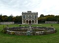
 Lodge Park (Sherborne Estate), Gloucestershire - geograph.org.uk - 2087807.jpg 2 304 × 1 728; 2,45 MB
-
 Lodge Park (Sherborne Estate), Gloucestershire - geograph.org.uk - 2087816.jpg 2 304 × 1 728; 2,4 MB
-
 Lodge Park (Sherborne Estate), Gloucestershire - geograph.org.uk - 2087822.jpg 1 200 × 1 600; 360 KB
-
 Lodge Park - Chimneys, roof and stair cupola - geograph.org.uk - 4714289.jpg 1 267 × 1 000; 902 KB
-
 Lodge Park - Deer Coursing course - geograph.org.uk - 4714298.jpg 1 333 × 1 000; 1,04 MB
-
 Lodge Park - gallery façade - geograph.org.uk - 4714279.jpg 1 000 × 1 333; 1,15 MB
-
 Lodge Park - geograph.org.uk - 2449159.jpg 640 × 480; 85 KB
-
 Lodge Park - geograph.org.uk - 3011508.jpg 1 024 × 680; 199 KB
-
 Lodge Park - geograph.org.uk - 3892394.jpg 1 024 × 683; 214 KB
-
 Lodge Park - geograph.org.uk - 4427749.jpg 1 874 × 2 302; 829 KB
-
 Lodge Park - geograph.org.uk - 4428085.jpg 1 901 × 1 393; 627 KB
-
 Lodge Park - View ESE from the gallery - geograph.org.uk - 4714273.jpg 1 206 × 1 000; 934 KB
-
 Lodge Park from the rear - geograph.org.uk - 4427850.jpg 1 920 × 1 388; 860 KB
-
 Lodge Park from the south - geograph.org.uk - 4427884.jpg 1 920 × 1 326; 480 KB
-
 Lodge Park seen over its circular pond - geograph.org.uk - 4714246.jpg 1 377 × 1 000; 978 KB
-
 Lodge through the Gate - geograph.org.uk - 3968090.jpg 1 024 × 683; 157 KB
-
 Lodge, Lodge Park - geograph.org.uk - 4592123.jpg 1 920 × 1 074; 309 KB
-
 Lodges at Lodge Park - geograph.org.uk - 4697371.jpg 1 822 × 1 161; 427 KB
-
 Lodges at the Gates - geograph.org.uk - 3967155.jpg 1 024 × 683; 125 KB
-
 Lodges, Lodge Park - geograph.org.uk - 4592244.jpg 1 920 × 1 010; 415 KB
-
 Look Here - geograph.org.uk - 3968119.jpg 600 × 800; 138 KB
-
 Looking down on the Finish - geograph.org.uk - 3966852.jpg 1 024 × 683; 83 KB
-
 Looking to the Start - geograph.org.uk - 3968096.jpg 1 024 × 683; 116 KB
-
 Looking towards Sherborne Brook, Sherborne, Gloucestershire - geograph.org.uk - 6091978.jpg 4 000 × 3 000; 4,72 MB
-
 Marquee at Duckleston Mill - geograph.org.uk - 3193388.jpg 640 × 427; 214 KB
-
 Meadow and footpath by the River Windrush - geograph.org.uk - 6265446.jpg 1 024 × 768; 259 KB
-
 Meadow at Haycroft Road - geograph.org.uk - 3193404.jpg 640 × 427; 234 KB
-
 Meadow by the River Windrush - geograph.org.uk - 6265443.jpg 1 024 × 768; 244 KB
-
 Middle Barn - geograph.org.uk - 3193246.jpg 640 × 425; 202 KB
-
 Middle Barn - geograph.org.uk - 3193248.jpg 640 × 427; 221 KB
-
 Middle Barn - geograph.org.uk - 3193250.jpg 640 × 404; 214 KB
-
 Middle Barn Haycroft Bottom Sherborne - geograph.org.uk - 2315109.jpg 2 592 × 1 944; 1,1 MB
-
 Middle Barn Sherborne - geograph.org.uk - 2315133.jpg 2 592 × 1 944; 781 KB
-
 Minor road - geograph.org.uk - 1594896.jpg 640 × 480; 132 KB
-
 Minor road near New Bridge - geograph.org.uk - 1594915.jpg 640 × 480; 141 KB
-
 Muddy arable field - geograph.org.uk - 3781340.jpg 1 024 × 680; 204 KB
-
 My First Find - geograph.org.uk - 3968117.jpg 1 024 × 768; 290 KB
-
 National Trust Sign near Sherborne - geograph.org.uk - 4535370.jpg 3 648 × 2 736; 2,38 MB
-
 Nearing Sherbourne - geograph.org.uk - 1246575.jpg 640 × 427; 44 KB
-
 New garage - geograph.org.uk - 3193423.jpg 449 × 640; 286 KB
-
 New wooden sluice gates - geograph.org.uk - 2831021.jpg 640 × 480; 124 KB
-
 North of Northfield Copse - geograph.org.uk - 3194518.jpg 640 × 427; 192 KB
-
 Northfield Barn (1) - geograph.org.uk - 2967057.jpg 4 320 × 3 240; 4,54 MB
-
 Northfield Barn (2) - geograph.org.uk - 2967065.jpg 4 320 × 3 240; 4,76 MB
-
 Northfield Barn (3) - geograph.org.uk - 2967076.jpg 4 320 × 3 240; 4,45 MB
-
 Northfield Barn (4) - geograph.org.uk - 2968321.jpg 4 320 × 3 240; 4,56 MB
-
 Northfield Barn - geograph.org.uk - 3781343.jpg 1 024 × 680; 239 KB
-
 Northfield Barn, Sherborne - geograph.org.uk - 215011.jpg 640 × 480; 90 KB
-
 Northfield Barn, Sherborne.jpg 3 456 × 2 304; 3,54 MB
-
 Old Coltswold Barn Broadmoor Farm - geograph.org.uk - 2308327.jpg 2 592 × 1 944; 635 KB
-
 Old fingerpost - geograph.org.uk - 3194527.jpg 640 × 411; 204 KB
-
 One of the Gatehouses - geograph.org.uk - 3967158.jpg 1 024 × 683; 127 KB
-
 Over the ditch - geograph.org.uk - 2968371.jpg 4 320 × 3 240; 4,95 MB
-
 Over the river - geograph.org.uk - 2968427.jpg 4 320 × 3 240; 4,71 MB
-
 Parking area on the A40 near Sherborne - geograph.org.uk - 5863349.jpg 2 048 × 1 536; 1,51 MB
-
 Parkland, Sherborne (1) - geograph.org.uk - 4259311.jpg 640 × 364; 155 KB
-
 Parkland, Sherborne (2) - geograph.org.uk - 4259312.jpg 640 × 463; 187 KB
-
 Past the Copse - geograph.org.uk - 2967040.jpg 4 320 × 3 240; 4,7 MB
-
 Pasture north of Sherborne - geograph.org.uk - 3194505.jpg 640 × 440; 232 KB
-
 Path at Haycroft Bottom - geograph.org.uk - 3193230.jpg 640 × 427; 284 KB
-
 Path at Haycroft Bottom - geograph.org.uk - 3193233.jpg 640 × 459; 243 KB
-
 Path leaves the road - geograph.org.uk - 5778970.jpg 4 320 × 3 240; 4,82 MB
-
 Path meets road - geograph.org.uk - 2967001.jpg 4 320 × 3 240; 5,02 MB
-
 Path through Haycroft Bottom - geograph.org.uk - 3193236.jpg 640 × 405; 210 KB
-
-
 Permitted path - geograph.org.uk - 2968418.jpg 4 320 × 3 240; 4,93 MB
-
 Please keep to the path - geograph.org.uk - 5778972.jpg 4 320 × 3 240; 4,1 MB
-
 Pond and Grandstand - geograph.org.uk - 3966933.jpg 1 024 × 683; 157 KB
-
 Poppy field, Sherborne Park - geograph.org.uk - 2477121.jpg 1 024 × 683; 682 KB
-
 Rainbow by the A40, Windrush - geograph.org.uk - 5866906.jpg 3 264 × 2 448; 1,6 MB
-


_-_geograph.org.uk_-_2966932.jpg)
_-_geograph.org.uk_-_2966964.jpg)


_-_geograph.org.uk_-_5778962.jpg)
_-_geograph.org.uk_-_5778964.jpg)
_-_geograph.org.uk_-_5778965.jpg)
_-_geograph.org.uk_-_5778968.jpg)


,_Gloucestershire_-_geograph.org.uk_-_2087807.jpg)
,_Gloucestershire_-_geograph.org.uk_-_2087816.jpg)
,_Gloucestershire_-_geograph.org.uk_-_2087822.jpg)


_-_geograph.org.uk_-_2967057.jpg)
_-_geograph.org.uk_-_2967065.jpg)
_-_geograph.org.uk_-_2967076.jpg)
_-_geograph.org.uk_-_2968321.jpg)


_-_geograph.org.uk_-_4259311.jpg)
_-_geograph.org.uk_-_4259312.jpg)


