Category:Sheriffhales
Aller à la navigation
Aller à la recherche
English: Sheriffhales (or Sheriff Hales) is a scattered village in Shropshire, England, 6km (4 miles) north-east of Telford, 3km (2 miles) north of Shifnal and 5km (3 miles) south of Newport.
village britannique  | |||||
| Téléverser des médias | |||||
| Nature de l’élément | |||||
|---|---|---|---|---|---|
| Lieu | Shropshire, Midlands de l'Ouest, Angleterre | ||||
 | |||||
Sous-catégories
Cette catégorie comprend 3 sous-catégories, dont les 3 ci-dessous.
L
- Lilleshall Hall (11 F)
S
- Sheriffhales Manor House (2 F)
Média dans la catégorie « Sheriffhales »
Cette catégorie comprend 192 fichiers, dont les 192 ci-dessous.
-
 A disused track through Big Wood - geograph.org.uk - 2757251.jpg 979 × 734 ; 352 kio
-
 A little way off the footpath - geograph.org.uk - 2757242.jpg 1 142 × 857 ; 395 kio
-
 A41 approaching Gorsey Bank - geograph.org.uk - 2774367.jpg 640 × 480 ; 53 kio
-
 A41 approaching the B4379 junction - geograph.org.uk - 2774391.jpg 640 × 480 ; 60 kio
-
 A41 at Bloomsbury Garage - geograph.org.uk - 2774390.jpg 640 × 480 ; 53 kio
-
 A41 at Bloomsbury Nursery - geograph.org.uk - 2774387.jpg 640 × 480 ; 74 kio
-
 A41 at Damson Lane crossroads - geograph.org.uk - 2774381.jpg 640 × 480 ; 70 kio
-
 A41 at King's Street crossroads - geograph.org.uk - 2774379.jpg 640 × 480 ; 47 kio
-
 A41 at the plateau north of Gorsey Bank - geograph.org.uk - 2774376.jpg 640 × 480 ; 41 kio
-
 A41 north of Chatwell Lane - geograph.org.uk - 2774370.jpg 640 × 480 ; 54 kio
-
 A41 southbound at Bloomsbury - geograph.org.uk - 3552202.jpg 640 × 481 ; 58 kio
-
 A41 southbound at Damson Lane - geograph.org.uk - 3552212.jpg 640 × 481 ; 68 kio
-
 A41 towards Whitchurch - geograph.org.uk - 6157102.jpg 800 × 600 ; 110 kio
-
 A41 towards Wolverhampton - geograph.org.uk - 6236954.jpg 800 × 600 ; 114 kio
-
 A5 at Burlington Farm - geograph.org.uk - 3518846.jpg 640 × 423 ; 83 kio
-
 A5 just east of Redhill - geograph.org.uk - 3518829.jpg 640 × 452 ; 106 kio
-
 A5, Redhill - geograph.org.uk - 6157069.jpg 800 × 600 ; 174 kio
-
 Along the Lilleshall Hall access road - geograph.org.uk - 2760019.jpg 1 240 × 930 ; 348 kio
-
 Along the track towards Ferndale Farm - geograph.org.uk - 2757277.jpg 1 142 × 857 ; 423 kio
-
 Along the track towards Middle Wood - geograph.org.uk - 2757279.jpg 1 142 × 857 ; 367 kio
-
 Alongside Burlington Wood - geograph.org.uk - 5235500.jpg 640 × 480 ; 59 kio
-
 Artificial hockey pitches at the National Sports Centre - geograph.org.uk - 2760051.jpg 1 404 × 1 099 ; 313 kio
-
 B4379 - Lilyhurst Road junction - geograph.org.uk - 2713655.jpg 640 × 480 ; 52 kio
-
 B4379 approaching Heath Hill - geograph.org.uk - 2713657.jpg 640 × 480 ; 59 kio
-
 B4379 approaching Marsh Road, Sheriffhales - geograph.org.uk - 3484382.jpg 640 × 480 ; 205 kio
-
 B4379 at Woodcote Hill - geograph.org.uk - 3484384.jpg 640 × 480 ; 140 kio
-
 B4379 meets the A41 - geograph.org.uk - 2713665.jpg 640 × 480 ; 218 kio
-
 B4379 near Crackleybank Lodge - geograph.org.uk - 2713636.jpg 640 × 480 ; 162 kio
-
 B4379 towards Sheriffhales - geograph.org.uk - 6236939.jpg 800 × 600 ; 86 kio
-
 Barn at Cross Roads Farm - geograph.org.uk - 3674830.jpg 1 600 × 1 064 ; 560 kio
-
 Big Wood cottages - geograph.org.uk - 2757246.jpg 1 142 × 857 ; 419 kio
-
 Brewer's Oak Farm - geograph.org.uk - 6157081.jpg 800 × 600 ; 83 kio
-
 Bridleway at Heath Hill - geograph.org.uk - 1817449.jpg 717 × 538 ; 167 kio
-
 Bridleway into Childpit Lane - geograph.org.uk - 2757676.jpg 1 306 × 979 ; 360 kio
-
 Bridleway near Heath Hill - geograph.org.uk - 5235463.jpg 640 × 480 ; 94 kio
-
 Bridleway near Heath Hill - geograph.org.uk - 5235464.jpg 640 × 480 ; 111 kio
-
 Bridleway near Heath Hill - geograph.org.uk - 5235465.jpg 640 × 480 ; 109 kio
-
 Bridleway near Heath Hill - geograph.org.uk - 5235468.jpg 640 × 480 ; 41 kio
-
 Bridleway to Watling Street - geograph.org.uk - 461421.jpg 600 × 450 ; 192 kio
-
 Bridleway towards Woodcote Hill - geograph.org.uk - 5235492.jpg 640 × 480 ; 64 kio
-
 Burlington Barns - geograph.org.uk - 917512.jpg 640 × 480 ; 74 kio
-
 Burlington Ford - geograph.org.uk - 6157092.jpg 800 × 600 ; 186 kio
-
 Burlington Ford from the north side - geograph.org.uk - 917510.jpg 640 × 480 ; 96 kio
-
 Burlington Pool - geograph.org.uk - 1307462.jpg 640 × 480 ; 81 kio
-
 Burlington Pool - geograph.org.uk - 6157099.jpg 800 × 600 ; 143 kio
-
 Bus stop near the Post office - geograph.org.uk - 832619.jpg 640 × 480 ; 89 kio
-
 Caravan in Field Near White Sitch - geograph.org.uk - 2588879.jpg 640 × 428 ; 81 kio
-
 Chadwell Court - geograph.org.uk - 2462188.jpg 768 × 1 024 ; 310 kio
-
 Chadwell Grange house - geograph.org.uk - 2462190.jpg 1 280 × 960 ; 316 kio
-
 Chadwell Mill - geograph.org.uk - 3674731.jpg 1 600 × 1 200 ; 383 kio
-
 Chatwell Lane, Cross Roads - geograph.org.uk - 6237204.jpg 2 848 × 2 136 ; 1,38 Mio
-
 Childpit Farm - geograph.org.uk - 2760011.jpg 1 306 × 979 ; 317 kio
-
 Corner of the potato field - geograph.org.uk - 460477.jpg 600 × 450 ; 179 kio
-
 Cottage at Heath Hill - geograph.org.uk - 415978.jpg 640 × 480 ; 135 kio
-
 Cottage at the end of the track - geograph.org.uk - 2757418.jpg 1 142 × 857 ; 406 kio
-
 Cottage by the woods - geograph.org.uk - 461459.jpg 600 × 450 ; 283 kio
-

-
 Crop field near Burlington Farm - geograph.org.uk - 6157096.jpg 800 × 540 ; 98 kio
-
 Crop field near Crackleybank - geograph.org.uk - 6157076.jpg 800 × 600 ; 100 kio
-
 Crop field, Crackleybank - geograph.org.uk - 6157080.jpg 800 × 561 ; 69 kio
-
 Crossroads on the B5314, Cross Roads - geograph.org.uk - 6237000.jpg 640 × 480 ; 77 kio
-
 Cyclist's seat - geograph.org.uk - 3500006.jpg 1 600 × 1 064 ; 656 kio
-

-
 Disused stone gatepost - geograph.org.uk - 4058553.jpg 734 × 979 ; 526 kio
-
 Driveway to Drayton Lodge Farm - geograph.org.uk - 747952.jpg 640 × 480 ; 80 kio
-
 Edge of the wood - geograph.org.uk - 461433.jpg 600 × 450 ; 202 kio
-
 Elizabeth II postbox on Chatwell Lane, Cross Roads - geograph.org.uk - 6237201.jpg 2 136 × 2 848 ; 1,24 Mio
-
 Entering Crackleybank - geograph.org.uk - 6157083.jpg 800 × 513 ; 77 kio
-
 Entering Heath Hill - geograph.org.uk - 2725973.jpg 800 × 600 ; 256 kio
-
 Entering Sheriffhales from the south - geograph.org.uk - 3484380.jpg 640 × 480 ; 193 kio
-
 Exit from Crematorium onto A5 at Redhill - geograph.org.uk - 4378372.jpg 640 × 463 ; 48 kio
-
 Farm road for PDM Salad traffic - geograph.org.uk - 3674805.jpg 1 600 × 1 064 ; 194 kio
-
 Farm track near Woodside Farm - geograph.org.uk - 6236931.jpg 800 × 600 ; 94 kio
-
 Farm track off Lilyhurst Road - geograph.org.uk - 6236313.jpg 800 × 600 ; 113 kio
-
 Farmhouse, Yew Tree Farm - geograph.org.uk - 6157087.jpg 800 × 600 ; 108 kio
-
 Farmland beside the A41 - geograph.org.uk - 5951973.jpg 2 592 × 1 944 ; 1,66 Mio
-
 Farmland near Middle Wood - geograph.org.uk - 2757395.jpg 1 142 × 857 ; 373 kio
-
 Farmland, Weston Heath - geograph.org.uk - 6236959.jpg 800 × 600 ; 94 kio
-
 Field, Sheriffhales - geograph.org.uk - 6236944.jpg 640 × 480 ; 62 kio
-
 Footbridge, Burlington Ford - geograph.org.uk - 6157093.jpg 800 × 600 ; 198 kio
-
 Footpath across Upper Gallops Wood - geograph.org.uk - 460387.jpg 600 × 450 ; 356 kio
-
 Ford at Burlington - geograph.org.uk - 4041692.jpg 3 872 × 2 592 ; 4,77 Mio
-
 From Middle Wood to Big Wood - geograph.org.uk - 2757262.jpg 1 306 × 979 ; 453 kio
-
 Garage on the A5 - geograph.org.uk - 6157068.jpg 800 × 600 ; 155 kio
-
 Gatehouse outside the National Sports Centre - geograph.org.uk - 2760035.jpg 1 240 × 930 ; 343 kio
-
 Grazing off Lilyhurst Road - geograph.org.uk - 6236317.jpg 800 × 600 ; 87 kio
-
 Hare and Hounds on Watling Street - geograph.org.uk - 416973.jpg 640 × 480 ; 100 kio
-
 Heath Hill - geograph.org.uk - 2725985.jpg 800 × 600 ; 303 kio
-
 Heath Hill - geograph.org.uk - 415970.jpg 640 × 480 ; 157 kio
-
 Heath Hill Butter Cross - geograph.org.uk - 917548.jpg 480 × 640 ; 110 kio
-
 Heath Hill Farm - geograph.org.uk - 2713661.jpg 640 × 480 ; 119 kio
-
 Heath Hill off the B4379 - geograph.org.uk - 5235462.jpg 640 × 480 ; 64 kio
-
 Hedgerow beside the B4379, Sheriffhales - geograph.org.uk - 6236942.jpg 800 × 600 ; 96 kio
-
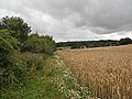
 Hillside cereal crop near Woodside Farm - geograph.org.uk - 6236932.jpg 800 × 600 ; 74 kio
-
 House on King Street - geograph.org.uk - 6236948.jpg 800 × 600 ; 93 kio
-
 Houses on the B4379 near Sheriffhales - geograph.org.uk - 6236937.jpg 640 × 480 ; 79 kio
-
 Irrigation equipment at PDM salads - geograph.org.uk - 3674783.jpg 1 600 × 1 064 ; 368 kio
-
 Irrigation pool at Heath Hill - geograph.org.uk - 1817479.jpg 1 024 × 768 ; 152 kio
-
 It's the Butter Cross again^ - geograph.org.uk - 1072927.jpg 640 × 480 ; 105 kio
-
 Kettlemore Lane, Sheriffhales - geograph.org.uk - 1868321.jpg 640 × 480 ; 78 kio
-
 King Street - geograph.org.uk - 6236949.jpg 800 × 600 ; 85 kio
-
 Kingstreet Grange - geograph.org.uk - 1703987.jpg 1 024 × 768 ; 172 kio
-
 Kingstreet Pool - geograph.org.uk - 1703962.jpg 819 × 614 ; 167 kio
-
 Kingstreet Pool from the field above it - geograph.org.uk - 1703959.jpg 1 024 × 768 ; 175 kio
-
 Lay-by on Plough Bank (B5314) - geograph.org.uk - 6236961.jpg 800 × 600 ; 112 kio
-
 Lilleshall - geograph.org.uk - 2263262.jpg 640 × 427 ; 224 kio
-
 Lillieshall - geograph.org.uk - 2263267.jpg 640 × 427 ; 293 kio
-
 Lilyhurst Road - geograph.org.uk - 6236928.jpg 800 × 600 ; 89 kio
-
 Lilyhurst Road near Woodside Farm - geograph.org.uk - 6236934.jpg 800 × 600 ; 116 kio
-
 Lizard Hill - geograph.org.uk - 460392.jpg 600 × 450 ; 322 kio
-
 Looking across the A41 towards King's Street - geograph.org.uk - 2725966.jpg 800 × 600 ; 287 kio
-
 Looking down the drive - geograph.org.uk - 1982316.jpg 623 × 480 ; 81 kio
-
 Manor Farm - geograph.org.uk - 464432.jpg 600 × 450 ; 168 kio
-
 Marsh Lane towards Sheriffhales - geograph.org.uk - 6157090.jpg 800 × 600 ; 172 kio
-
 Marsh Road, Sherriffhales - geograph.org.uk - 5235496.jpg 640 × 480 ; 84 kio
-
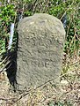
 Milestone - geograph.org.uk - 4948719.jpg 1 024 × 768 ; 286 kio
-
 Milestone on A5 road.jpg 778 × 1 024 ; 340 kio
-
 Model aircraft aerodrome, Crackleybank - geograph.org.uk - 1640642.jpg 640 × 480 ; 96 kio
-
 New House Farm at Plough Bank - geograph.org.uk - 2725936.jpg 800 × 600 ; 304 kio
-
 New House Farm, Cross Roads - geograph.org.uk - 6236997.jpg 800 × 600 ; 103 kio
-
 Obstacle Course - geograph.org.uk - 460331.jpg 600 × 450 ; 332 kio
-
 Old cross in St Mary's churchyard, Sheriffhales (geograph 6049154).jpg 445 × 640 ; 349 kio
-
 On Sherriffhales Common - geograph.org.uk - 5235502.jpg 640 × 480 ; 73 kio
-
 OS benchmark - Heath Hill Farm barn - geograph.org.uk - 4292438.jpg 734 × 979 ; 459 kio
-
 OS benchmark - Heath Hill former pumping station - geograph.org.uk - 4283169.jpg 909 × 682 ; 332 kio
-
 OS benchmark - Heath Hill, gatepost - geograph.org.uk - 4285102.jpg 734 × 979 ; 485 kio
-
 OS benchmark - Hungerhill Farm house - geograph.org.uk - 4429388.jpg 979 × 734 ; 312 kio
-
 OS benchmark - Lilyhurst, gatelodge - geograph.org.uk - 4505258.jpg 857 × 1 142 ; 461 kio
-
 OS benchmark - Sheriffhales main road - geograph.org.uk - 4202398.jpg 857 × 1 142 ; 532 kio
-
 OS benchmark - Sheriffhales, cottage - geograph.org.uk - 4283160.jpg 1 142 × 857 ; 579 kio
-
 OS benchmark - Sheriffhales, pumping station - geograph.org.uk - 4502994.jpg 1 142 × 857 ; 492 kio
-
 OS benchmark - Weston Heath Farm dairy - geograph.org.uk - 4429405.jpg 1 142 × 857 ; 518 kio
-
 OS benchmark - Woodcote Hill roadside wall - geograph.org.uk - 4285131.jpg 734 × 979 ; 465 kio
-
 OS Flush Bracket 2491 -Gorsey Bank Farm - geograph.org.uk - 3563262.jpg 979 × 1 306 ; 535 kio
-
 Outbuildings and stores at the National Sports Centre - geograph.org.uk - 2760029.jpg 1 142 × 857 ; 347 kio
-
 Overgrown footpath to Middle Wood - geograph.org.uk - 1982307.jpg 640 × 480 ; 121 kio
-
 Parkland east of Lilleshall Hall - geograph.org.uk - 2760048.jpg 979 × 734 ; 415 kio
-
 PDM Salads - geograph.org.uk - 3674771.jpg 1 600 × 1 064 ; 318 kio
-

-

-

-
 Private driveway - geograph.org.uk - 832596.jpg 640 × 480 ; 121 kio
-
 Remains of OS rivet and arrow mark - geograph.org.uk - 5367367.jpg 1 632 × 1 224 ; 1 009 kio
-
 Rock outcrop in the edge of Woodcote Hill woods - geograph.org.uk - 1817456.jpg 655 × 492 ; 196 kio
-
 Rook heaven - geograph.org.uk - 1395222.jpg 640 × 480 ; 114 kio
-
 Sharp left turn on the bridleway - geograph.org.uk - 460318.jpg 600 × 450 ; 255 kio
-
 Sheriffhales Lodge - geograph.org.uk - 460368.jpg 600 × 450 ; 254 kio
-

-
 Sherriffhales - B4379 at Church Lane - geograph.org.uk - 2713648.jpg 640 × 480 ; 143 kio
-
 Sherriffhales - B4379 at Kettlemore Lane - geograph.org.uk - 2713654.jpg 640 × 480 ; 144 kio
-
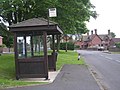
 Sherriffhales - phone box by the B4379 - geograph.org.uk - 2713651.jpg 640 × 480 ; 60 kio
-
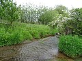 Stream, Burlington Ford - geograph.org.uk - 6157094.jpg 800 × 600 ; 200 kio
-
 Stubble field near New House Farm, Cross Roads - geograph.org.uk - 6236999.jpg 800 × 600 ; 119 kio
-
 Stump Lane at the B4379, near Heath Hill - geograph.org.uk - 2725961.jpg 800 × 600 ; 228 kio
-
 Stump Lane towards Weston Heath and the A41 - geograph.org.uk - 6236947.jpg 800 × 600 ; 86 kio
-
 T-Junction in Sherriffhales - geograph.org.uk - 5235495.jpg 640 × 480 ; 68 kio
-
 Telford Model Car Club - geograph.org.uk - 6236950.jpg 800 × 600 ; 95 kio
-
 The A41 flirts with the county boundary - geograph.org.uk - 2774363.jpg 640 × 480 ; 38 kio
-
 The B4379 towards the A41 - geograph.org.uk - 2725988.jpg 800 × 600 ; 318 kio
-
 The bridleway towards Childpit Lane - geograph.org.uk - 2757670.jpg 1 142 × 857 ; 383 kio
-
 The Burlington milestone - detail - geograph.org.uk - 1913564.jpg 570 × 760 ; 183 kio
-
 The Burlington milestone in its setting - geograph.org.uk - 1913558.jpg 1 037 × 778 ; 181 kio
-
 The Butter Cross at Heath Hill - geograph.org.uk - 917543.jpg 640 × 480 ; 64 kio
-
 The Shepherd's Cottage - Redhill Farm - geograph.org.uk - 1640630.jpg 640 × 480 ; 117 kio
-
 The turning point at the end of the gallops - geograph.org.uk - 2757404.jpg 1 142 × 857 ; 341 kio
-
 The upper millpool at Chadwell - geograph.org.uk - 2462184.jpg 1 024 × 768 ; 344 kio
-
 This way to Hungerhill Plantation - geograph.org.uk - 1982309.jpg 640 × 480 ; 81 kio
-
 Towards Child Pit Farm - geograph.org.uk - 5235471.jpg 640 × 480 ; 95 kio
-
 Towards Middle Wood - geograph.org.uk - 461449.jpg 600 × 450 ; 212 kio
-
 Towards Sherriffhales - geograph.org.uk - 5235503.jpg 640 × 480 ; 60 kio
-
 Towards Sherriffhales - geograph.org.uk - 5235504.jpg 640 × 480 ; 74 kio
-
 Training Gallop - geograph.org.uk - 460338.jpg 600 × 450 ; 197 kio
-
 Turn left at the marker post - geograph.org.uk - 1982311.jpg 640 × 480 ; 107 kio
-
 Unidentified winter crops - geograph.org.uk - 1073031.jpg 640 × 480 ; 90 kio
-
 Upper Millpool at Chadwell Mill - geograph.org.uk - 3674745.jpg 1 600 × 1 064 ; 529 kio
-
 Victorian postbox at Weston Heath Farm - geograph.org.uk - 4429423.jpg 857 × 1 142 ; 578 kio
-
 Watling Street (A5) - geograph.org.uk - 6157074.jpg 800 × 600 ; 84 kio
-
 Watling Street (A5) - geograph.org.uk - 6157097.jpg 800 × 600 ; 106 kio
-

-
 Watling Street (A5), Crackleybank - geograph.org.uk - 6157088.jpg 800 × 600 ; 110 kio
-
 Winged guardians - geograph.org.uk - 2195350.jpg 2 592 × 1 944 ; 1,93 Mio
-
 Access road to Redhill Farm - geograph.org.uk - 1072881.jpg 640 × 480 ; 84 kio
-
 Back Road, Crackleybank - geograph.org.uk - 251343.jpg 640 × 480 ; 121 kio
-
 Burlington Ford - geograph.org.uk - 697059.jpg 640 × 480 ; 131 kio
-
 Cottage Between The Trees - geograph.org.uk - 739402.jpg 640 × 480 ; 48 kio
-
 Footpath to Coppice Green - geograph.org.uk - 747932.jpg 640 × 480 ; 106 kio
-
 Ford - geograph.org.uk - 311780.jpg 640 × 480 ; 132 kio
-
 Heading for the gallops - geograph.org.uk - 464393.jpg 600 × 480 ; 297 kio
-
 Horses by the gallops - geograph.org.uk - 464386.jpg 600 × 470 ; 272 kio
-
 Lane off Watling Street - geograph.org.uk - 747964.jpg 640 × 480 ; 52 kio
-
 Redhill Farm - geograph.org.uk - 416980.jpg 640 × 480 ; 121 kio
-
 Woodgreen. - geograph.org.uk - 443201.jpg 640 × 480 ; 77 kio


_-_geograph.org.uk_-_6236961.jpg)


.jpg)


_-_geograph.org.uk_-_6157074.jpg)
_-_geograph.org.uk_-_6157097.jpg)
_crosses_the_B4379_at_Crackleybank_-_geograph.org.uk_-_2713630.jpg)
,_Crackleybank_-_geograph.org.uk_-_6157088.jpg)


