Category:Shilton, Warwickshire
Aller à la navigation
Aller à la recherche
village britannique  | |||||
| Téléverser des médias | |||||
| Nature de l’élément | |||||
|---|---|---|---|---|---|
| Lieu | Shilton and Barnacle, Rugby, Warwickshire, Midlands de l'Ouest, Angleterre | ||||
 | |||||
English: Shilton is a village and former civil parish in the English county of Warwickshire. The parish of Shilton also includes the nearby hamlet of Barnacle, and in the 2001 census had a population of 826.
Sous-catégories
Cette catégorie comprend 2 sous-catégories, dont les 2 ci-dessous.
Média dans la catégorie « Shilton, Warwickshire »
Cette catégorie comprend 54 fichiers, dont les 54 ci-dessous.
-

-
 Ansty Hall Hotel - geograph.org.uk - 568715.jpg 640 × 480 ; 141 kio
-
 Ansty Hall hotel entrance barrier - geograph.org.uk - 568713.jpg 640 × 625 ; 165 kio
-
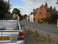
 B4065 Church Road in Shilton - geograph.org.uk - 4180884.jpg 1 600 × 1 180 ; 519 kio
-
 B4065 Leicester Road in Shilton - geograph.org.uk - 4183347.jpg 1 600 × 1 142 ; 708 kio
-
 Bend on Withybrook Lane near Shilton - geograph.org.uk - 2344121.jpg 1 024 × 768 ; 215 kio
-
 Church Road in the village of Shilton - geograph.org.uk - 4183267.jpg 1 600 × 1 200 ; 449 kio
-
 Church Road, Shilton - geograph.org.uk - 1251971.jpg 640 × 427 ; 72 kio
-
 Church Road, Shilton - geograph.org.uk - 1613195.jpg 640 × 480 ; 78 kio
-
 Church Road, Shilton, Warwickshire - geograph.org.uk - 3853525.jpg 1 600 × 938 ; 269 kio
-
 Close up, Elizabeth II postbox on Leicester Road, Shilton - geograph.org.uk - 5219629.jpg 1 262 × 2 383 ; 558 kio
-
 Double entrance - geograph.org.uk - 1139879.jpg 640 × 480 ; 177 kio
-
 Elizabeth II postbox on Hallway Drive, Shilton - geograph.org.uk - 5304014.jpg 2 136 × 2 848 ; 1,5 Mio
-
 Elizabeth II postbox on Leicester Road, Shilton - geograph.org.uk - 5219627.jpg 2 136 × 2 848 ; 1,2 Mio
-
 Entering Shilton - geograph.org.uk - 5303481.jpg 640 × 480 ; 89 kio
-
 Farmland near Shilton - geograph.org.uk - 3651894.jpg 640 × 430 ; 47 kio
-
 Farmland south of Shilton - geograph.org.uk - 2842067.jpg 640 × 460 ; 33 kio
-
 Graffiti at Hopswood Aqueduct - geograph.org.uk - 201523.jpg 640 × 480 ; 82 kio
-
 Grazing near Shilton - geograph.org.uk - 4199903.jpg 1 024 × 768 ; 97 kio
-
 Hallway Drive, Shilton - geograph.org.uk - 5304016.jpg 640 × 480 ; 59 kio
-
 Houses on Church Road, Shilton - geograph.org.uk - 5219270.jpg 640 × 480 ; 45 kio
-
 Leicester Road in the village of Shilton - geograph.org.uk - 4183336.jpg 1 600 × 1 200 ; 519 kio
-
 Leicester Road, Shilton - geograph.org.uk - 5219630.jpg 2 848 × 2 136 ; 1,14 Mio
-
 M69 about to cross railway near Shilton - geograph.org.uk - 4592804.jpg 2 256 × 1 496 ; 870 kio
-
 Narrowboat on Hopswood Aqueduct - geograph.org.uk - 201518.jpg 640 × 480 ; 58 kio
-
 Narrowboats at Ansty Northern Oxford Canal - geograph.org.uk - 433010.jpg 640 × 480 ; 136 kio
-
 No Problem on the Oxford Canal, near Bedworth - geograph.org.uk - 1117659.jpg 640 × 480 ; 157 kio
-
 On Hopsford Aqueduct - geograph.org.uk - 200813.jpg 640 × 479 ; 81 kio
-
 Open fields near Shilton - geograph.org.uk - 5235168.jpg 4 128 × 2 322 ; 4,43 Mio
-
 Oxford Canal, Ansty - geograph.org.uk - 190256.jpg 640 × 480 ; 100 kio
-
 Postbox along Leicester Road in Shilton - geograph.org.uk - 4183322.jpg 1 600 × 1 200 ; 484 kio
-
 Ridge and Furrow at Shilton - geograph.org.uk - 2039894.jpg 1 024 × 768 ; 184 kio
-
 Shilton Garage - geograph.org.uk - 1965694.jpg 640 × 480 ; 56 kio
-
 Shilton traffic lights - geograph.org.uk - 1120015.jpg 640 × 305 ; 41 kio
-
 Shilton village entrance - geograph.org.uk - 2152121.jpg 640 × 480 ; 89 kio
-
 Shilton Village Hall - geograph.org.uk - 1967258.jpg 640 × 402 ; 51 kio
-
 Shilton Village Hall - geograph.org.uk - 5303484.jpg 640 × 480 ; 53 kio
-
 Shilton, aerial 2018, geograph 5845975 by Chris.jpg 800 × 533 ; 111 kio
-
 Shilton-Church Road - geograph.org.uk - 1965662.jpg 640 × 480 ; 56 kio
-
 Shilton-West Coast Mainline - geograph.org.uk - 1965646.jpg 640 × 480 ; 85 kio
-
 St. Andrew's, Shilton, Warwickshire - geograph.org.uk - 3853534.jpg 1 600 × 1 102 ; 261 kio
-

-
 View from a Rugby-Crewe train - Site of Shilton railway station - geograph.org.uk - 5818858.jpg 1 600 × 1 200 ; 610 kio
-
 View near Shilton - geograph.org.uk - 2039893.jpg 1 024 × 768 ; 264 kio
-
 West Coast Main Line cutting, Shilton - geograph.org.uk - 3651898.jpg 640 × 454 ; 64 kio
-
 Young crop field east of Shilton - geograph.org.uk - 5219281.jpg 640 × 480 ; 45 kio
-
 Ansty - Nettle Hill - geograph.org.uk - 135538.jpg 640 × 480 ; 65 kio
-
 Charles Lakin Close, Shilton - geograph.org.uk - 190246.jpg 640 × 480 ; 101 kio
-
 Farmland south of Ansty - geograph.org.uk - 190241.jpg 640 × 480 ; 107 kio
-
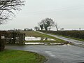
 Hopsford Aqueduct - geograph.org.uk - 201404.jpg 640 × 480 ; 84 kio
-
 Oxford Canal near Ansty - geograph.org.uk - 661519.jpg 640 × 480 ; 92 kio
-
 Shilton - geograph.org.uk - 208908.jpg 640 × 480 ; 114 kio
-
 Shilton - geograph.org.uk - 208911.jpg 640 × 480 ; 105 kio
-
 View towards Nettle Hill - geograph.org.uk - 191335.jpg 640 × 480 ; 89 kio


