Category:Shipton-under-Wychwood
Aller à la navigation
Aller à la recherche
localité britannique du comté anglais d'Oxfordshire  | |||||
| Téléverser des médias | |||||
| Nature de l’élément | |||||
|---|---|---|---|---|---|
| Lieu | Shipton-under-Wychwood, West Oxfordshire, Oxfordshire, Angleterre du Sud-Est, Angleterre | ||||
| site officiel | |||||
 | |||||
English: Shipton-under-Wychwood is a village and civil parish in the Evenlode valley about to the east.
Sous-catégories
Cette catégorie comprend 8 sous-catégories, dont les 8 ci-dessous.
Média dans la catégorie « Shipton-under-Wychwood »
Cette catégorie comprend 129 fichiers, dont les 129 ci-dessous.
-
 "Fiveways", Shipton Under Wychwood - geograph.org.uk - 1308472.jpg 640 × 427 ; 97 kio
-
 A tunnel of colour - geograph.org.uk - 1555409.jpg 640 × 480 ; 129 kio
-
 A361 at Blenheim - geograph.org.uk - 4402721.jpg 800 × 316 ; 116 kio
-
 A361 at Fulford Gap - geograph.org.uk - 4402719.jpg 800 × 450 ; 181 kio
-
 A361 in Shipton Under Wychwood. - geograph.org.uk - 1564587.jpg 640 × 480 ; 111 kio
-
 A361 near Fulford Gap - geograph.org.uk - 4402720.jpg 800 × 450 ; 150 kio
-
 A361 nearing Shipton Under Wychwood - geograph.org.uk - 1215963.jpg 640 × 427 ; 36 kio
-
 A361 through Shipton Under Wychwood - geograph.org.uk - 1308594.jpg 640 × 427 ; 98 kio
-
 A361 through Shipton Under Wychwood - geograph.org.uk - 1550058.jpg 640 × 427 ; 77 kio
-
 A361 through Shipton Under Wychwood - geograph.org.uk - 1591631.jpg 640 × 480 ; 70 kio
-
 Allotments, Shipton Under Wychwood - geograph.org.uk - 1308487.jpg 640 × 427 ; 63 kio
-
 Approaching a bend on the A361 - geograph.org.uk - 1591568.jpg 640 × 480 ; 61 kio
-
 Approaching Shipton-Under-Wychwood - geograph.org.uk - 1215978.jpg 640 × 427 ; 41 kio
-
 Approaching the crossroads - geograph.org.uk - 1094685.jpg 640 × 480 ; 53 kio
-
 Avenue of polled lime trees - geograph.org.uk - 1945431.jpg 3 296 × 2 472 ; 1,84 Mio
-
 B4437 Burford to Charlbury road - geograph.org.uk - 4402696.jpg 800 × 450 ; 169 kio
-
 Beaconsfield Hall, Shipton-under-Wychwood - geograph.org.uk - 994037.jpg 640 × 426 ; 78 kio
-
 Charlbury Road at Shipton Down - geograph.org.uk - 4402716.jpg 800 × 450 ; 186 kio
-
 Church of St Mary the Virgin, Shipton-under-Wychwood - geograph.org.uk - 1945440.jpg 2 472 × 3 296 ; 1,59 Mio
-
 Church Rd entrance to St Mary's Church, Shipton-under-Wychwood - geograph.org.uk - 1945448.jpg 2 472 × 3 296 ; 2,66 Mio
-
 Church Rd, Shipton-under-Wychwood - geograph.org.uk - 1945452.jpg 3 296 × 2 472 ; 1,84 Mio
-
 Church Street in Shipton-under-Wychwood - geograph.org.uk - 6252220.jpg 2 700 × 2 025 ; 594 kio
-
 Church Street in Shipton-under-Wychwood - geograph.org.uk - 6252227.jpg 2 700 × 2 025 ; 517 kio
-
 Clump of trees beside the A361 - geograph.org.uk - 1650902.jpg 640 × 480 ; 99 kio
-
 Coming into Shipton Under Wychwood - geograph.org.uk - 1578677.jpg 640 × 480 ; 34 kio
-
 Cotswold lane - geograph.org.uk - 4402703.jpg 800 × 450 ; 212 kio
-
 Cotswolds field edge - geograph.org.uk - 4402729.jpg 800 × 450 ; 181 kio
-
 Cottage by the bend - geograph.org.uk - 1511573.jpg 640 × 427 ; 75 kio
-
 Cottages on Church Street - geograph.org.uk - 6252226.jpg 2 700 × 2 025 ; 509 kio
-
 Crossroads on Shipton Downs - geograph.org.uk - 5879878.jpg 1 024 × 768 ; 218 kio
-
 Crossroads on Shipton Downs - geograph.org.uk - 5879881.jpg 1 024 × 768 ; 163 kio
-
 Crossroads on the edge of Shipton - geograph.org.uk - 1308521.jpg 640 × 427 ; 53 kio
-
 Crossroads on the way to Leafield - geograph.org.uk - 1982224.jpg 640 × 480 ; 73 kio
-
 Dog Kennel Lane - geograph.org.uk - 1031776.jpg 480 × 640 ; 127 kio
-
 Downhill on the A361 - geograph.org.uk - 1591580.jpg 640 × 480 ; 62 kio
-
 Driveway to Downs Lodge - geograph.org.uk - 1230883.jpg 640 × 480 ; 101 kio
-
 Fairspear Farm - geograph.org.uk - 4402691.jpg 800 × 450 ; 170 kio
-
 Fernhill Farm - geograph.org.uk - 4402687.jpg 800 × 451 ; 163 kio
-
 Fiddlers Hill, Shipton Under Wychwood - geograph.org.uk - 1308537.jpg 640 × 427 ; 57 kio
-
 Field with sheep, Shipton Under Wychwood - geograph.org.uk - 2656573.jpg 640 × 478 ; 147 kio
-
 Flour mill, Shipton-under-Wychwood - geograph.org.uk - 991016.jpg 640 × 426 ; 79 kio
-
 Footpath in Shipton Under Wychwood - geograph.org.uk - 1511601.jpg 427 × 640 ; 119 kio
-
 Footpath to Milton Under Wychwood - geograph.org.uk - 1308570.jpg 640 × 427 ; 115 kio
-
 High St, Shipton-under-Wychwood - geograph.org.uk - 1945454.jpg 3 296 × 2 472 ; 1,87 Mio
-
 Judd's Grave crossroads - geograph.org.uk - 4402694.jpg 800 × 450 ; 193 kio
-
 Junction with the B4437 - geograph.org.uk - 6392646.jpg 800 × 450 ; 81 kio
-
 Lane at Fernhill Farm - geograph.org.uk - 4402689.jpg 800 × 450 ; 192 kio
-
 Leafield Road - geograph.org.uk - 272560.jpg 640 × 480 ; 107 kio
-
 Leafield Road - geograph.org.uk - 4402693.jpg 800 × 450 ; 192 kio
-
 Leafield Road - geograph.org.uk - 6392654.jpg 800 × 450 ; 68 kio
-
 Leafield Road - geograph.org.uk - 6392659.jpg 800 × 450 ; 95 kio
-
 Lone tree in a field - geograph.org.uk - 2260117.jpg 480 × 640 ; 97 kio
-
 Mawles Lane, Shipton Under Wychwood - geograph.org.uk - 2096601.jpg 640 × 480 ; 106 kio
-
 Milton Road, Shipton Under Wychwood - geograph.org.uk - 1469281.jpg 640 × 427 ; 72 kio
-
 Minor road to Shipton Under Wychwood. - geograph.org.uk - 1485059.jpg 640 × 427 ; 31 kio
-
 Narrow road through the trees - geograph.org.uk - 1511582.jpg 640 × 427 ; 105 kio
-
 Nearing the A361 - geograph.org.uk - 1230896.jpg 640 × 480 ; 81 kio
-
 No through road in Shipton Under Wychwood - geograph.org.uk - 1511506.jpg 640 × 427 ; 83 kio
-
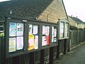 Notice boards in Shipton Under Wychwood - geograph.org.uk - 1549826.jpg 640 × 480 ; 76 kio
-
 Old dry stone wall - geograph.org.uk - 4402701.jpg 800 × 450 ; 224 kio
-
 Old Toll House, Shipton-Under-Wychwood - geograph.org.uk - 6114420.jpg 640 × 531 ; 156 kio
-
 On Shipton Down - geograph.org.uk - 4402715.jpg 800 × 450 ; 174 kio
-
 Oxfordshire fieldscape - geograph.org.uk - 272568.jpg 640 × 480 ; 122 kio
-
 Oxfordshire Way - geograph.org.uk - 4787338.jpg 640 × 480 ; 96 kio
-
 Path leading to Shipton-under-Wychwood - geograph.org.uk - 3301128.jpg 2 048 × 1 536 ; 542 kio
-
 Path to the B4437 - geograph.org.uk - 6392643.jpg 800 × 450 ; 90 kio
-
 Plum Lane, Shipton Under Wychwood - geograph.org.uk - 2096605.jpg 640 × 480 ; 128 kio
-
 Post box in the wall - geograph.org.uk - 1511528.jpg 640 × 427 ; 91 kio
-
 Poultry Farm near Round Pound - geograph.org.uk - 309041.jpg 640 × 480 ; 117 kio
-
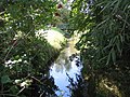
 River Evenlode at Shipton-under-Wychwood - geograph.org.uk - 3301129.jpg 2 048 × 1 536 ; 658 kio
-
 River Evenlode in Shipton under Wychwood - geograph.org.uk - 550945.jpg 640 × 480 ; 126 kio
-

-

-
 Road to Ascott-Under-Wychwood - geograph.org.uk - 1633622.jpg 640 × 480 ; 91 kio
-
 Road to Fifield. - geograph.org.uk - 1215997.jpg 640 × 427 ; 97 kio
-
 Seat beside a road on Shipton Down - geograph.org.uk - 5879874.jpg 1 024 × 768 ; 251 kio
-
 Sharp bend in the A361 - geograph.org.uk - 1564576.jpg 640 × 480 ; 84 kio
-
 Sharp bend in the A361 - geograph.org.uk - 1591618.jpg 640 × 480 ; 108 kio
-
 Shed at Shipton-under-Wychwood - geograph.org.uk - 991033.jpg 640 × 426 ; 74 kio
-
 Shipton Barrow - geograph.org.uk - 1230888.jpg 640 × 480 ; 49 kio
-
 Shipton Court - geograph.org.uk - 6371220.jpg 768 × 1 024 ; 191 kio
-
 Shipton Down crossroads - geograph.org.uk - 4402717.jpg 800 × 450 ; 169 kio
-
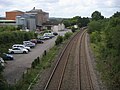
 Shipton railway station - geograph.org.uk - 4929192.jpg 1 024 × 576 ; 207 kio
-
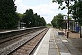
 Shipton railway station, Oxfordshire - geograph.org.uk - 3751588.jpg 1 024 × 768 ; 205 kio
-
 Shipton Station - geograph.org.uk - 4787328.jpg 640 × 480 ; 84 kio
-
 Shipton Station and Mill - geograph.org.uk - 1958512.jpg 640 × 442 ; 92 kio
-
-
 Shipton Under Wychwood cricket club entrance - geograph.org.uk - 1578720.jpg 640 × 480 ; 117 kio
-
 Shipton Under Wychwood village green (2) - geograph.org.uk - 2440573.jpg 640 × 480 ; 91 kio
-
 Shipton Under Wychwood village green - geograph.org.uk - 2440563.jpg 640 × 480 ; 89 kio
-
 Shipton under Wychwood, Littlestock Brook - geograph.org.uk - 550975.jpg 640 × 480 ; 142 kio
-
 Milestone at Shipton-under-Wychwood - geograph.org.uk - 991029.jpg 426 × 640 ; 111 kio
-
 Old Milestone (geograph 6114520).jpg 954 × 1 672 ; 296 kio
-

-
 Shipton-under-Wychwood Cricket Club (Geograph 6565380 by Bill Boaden).jpg 6 000 × 4 000 ; 5,03 Mio
-
 Shipton-under-Wychwood.jpg 640 × 426 ; 32 kio
-
 Signposts for the Oxfordshire Way at Shipton-under-Wychwood - geograph.org.uk - 3301131.jpg 2 048 × 1 536 ; 531 kio
-
 Snowy Wychwood Business Centre - geograph.org.uk - 1650886.jpg 640 × 480 ; 76 kio
-
 St Mary's Church - geograph.org.uk - 6392634.jpg 800 × 450 ; 79 kio
-
 St. Michael's Store, Shipton Under Wychwood - geograph.org.uk - 2569342.jpg 640 × 480 ; 65 kio
-
 Straight road at the foot of Shipton Down - geograph.org.uk - 4397836.jpg 800 × 450 ; 266 kio
-
 Stubble fields, near Shipton Under Wychwood - geograph.org.uk - 1448044.jpg 640 × 480 ; 188 kio
-
 Swinbrook Road - geograph.org.uk - 5879889.jpg 1 024 × 768 ; 247 kio
-

-

-
-
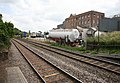
 The Cotswold Line, Shipton-under-Wychwood - geograph.org.uk - 991025.jpg 426 × 640 ; 93 kio
-
 The Lamb Inn, Shipton Under Wychwood - geograph.org.uk - 1469220.jpg 640 × 427 ; 68 kio
-

-
 The Oxfordshire Way, Shipton-under-Wychwood - geograph.org.uk - 994075.jpg 640 × 426 ; 104 kio
-
 The Parsonage Farm, Shipton-under-Wychwood (2).png 1 375 × 684 ; 1,45 Mio
-
 The Parsonage Farm, Shipton-under-Wychwood.png 658 × 950 ; 979 kio
-
 The Shaven Crown - geograph.org.uk - 2778349.jpg 640 × 480 ; 96 kio
-
 The Shaven Crown on High Street - geograph.org.uk - 6252221.jpg 2 700 × 2 025 ; 359 kio
-
 The village green in Shipton-under-Wychwood - geograph.org.uk - 6252228.jpg 2 700 × 2 025 ; 575 kio
-
 Top of the hill - geograph.org.uk - 2260158.jpg 640 × 480 ; 60 kio
-
 Track to Hill Buildings - geograph.org.uk - 1469175.jpg 640 × 427 ; 48 kio
-
 Trees in the field - geograph.org.uk - 1230891.jpg 640 × 480 ; 67 kio
-
 View across the fields - geograph.org.uk - 1469344.jpg 640 × 427 ; 45 kio
-
 View from Blenheim - geograph.org.uk - 3254092.jpg 5 888 × 3 926 ; 2,53 Mio
-
 View to Notteridge Copse - geograph.org.uk - 4402699.jpg 800 × 450 ; 213 kio
-
 View towards Shipton under Wychwood - geograph.org.uk - 232777.jpg 640 × 480 ; 54 kio
-
 Wall repair, Shipton-under-Wychwood - geograph.org.uk - 1923031.jpg 3 296 × 2 472 ; 1,83 Mio
-
 Wall repair, Shipton-under-Wychwood - geograph.org.uk - 1923037.jpg 3 296 × 2 472 ; 1,83 Mio
-
 Wheat crop, west of Leafield - geograph.org.uk - 1447673.jpg 640 × 480 ; 154 kio
-
 Woodland in Shipton Under Wychwood - geograph.org.uk - 1578710.jpg 640 × 480 ; 108 kio
-
 Back road through Shipton Under Wychwood - geograph.org.uk - 1511544.jpg 640 × 427 ; 93 kio
-
 Zebra crossing on the A361 - geograph.org.uk - 1511697.jpg 640 × 427 ; 72 kio
-
 Leafield Road - geograph.org.uk - 7097.jpg 640 × 480 ; 118 kio


_-_geograph.org.uk_-_2440573.jpg)


.jpg)
_-_geograph.org.uk_-_1031780.jpg)
.jpg)


.png)


