Category:Shirburn
Zur Navigation springen
Zur Suche springen
English: Shirburn is a village and civil parish about south of Thame in Oxfordshire. The eastern part of the parish is in the Chiltern Hills.
Gemeinde in der englischen Grafschaft Oxfordshire _All_Saints_Church_-_geograph.org.uk_-_69744.jpg) | |||||
| Medium hochladen | |||||
| Ist ein(e) | |||||
|---|---|---|---|---|---|
| Ort | South Oxfordshire, Oxfordshire, Südostengland, England | ||||
| Fläche |
| ||||
 | |||||
Unterkategorien
Es werden 4 von insgesamt 4 Unterkategorien in dieser Kategorie angezeigt:
In Klammern die Anzahl der enthaltenen Kategorien (K), Seiten (S), Dateien (D)
Medien in der Kategorie „Shirburn“
Folgende 59 Dateien sind in dieser Kategorie, von 59 insgesamt.
-
 A misty Ridgeway - geograph.org.uk - 1172969.jpg 640 × 480; 112 KB
-
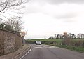
 B4009 approaching Shirburn - geograph.org.uk - 3924011.jpg 640 × 391; 81 KB
-
-
 Barn at New Gardens - geograph.org.uk - 3452016.jpg 4.688 × 3.072; 2,89 MB
-
 Barn at Portobello Farm, Shirburn - geograph.org.uk - 6024666.jpg 1.024 × 716; 172 KB
-
 Brookside Covert - geograph.org.uk - 2784649.jpg 1.024 × 600; 183 KB
-
 Castle Road, Shirburn - geograph.org.uk - 6366489.jpg 1.920 × 1.280; 900 KB
-
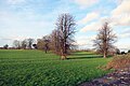
 Farmland, Shirburn - geograph.org.uk - 2818794.jpg 640 × 480; 170 KB
-

-
 Footpath Junction - geograph.org.uk - 1174403.jpg 640 × 480; 139 KB
-
 Footpath Over The Brook - geograph.org.uk - 2784659.jpg 1.024 × 624; 281 KB
-
 Hillside, Shirburn - geograph.org.uk - 2333188.jpg 640 × 427; 126 KB
-
 In Blackmoor Wood - geograph.org.uk - 1435223.jpg 427 × 640; 239 KB
-
 In Blackmoor Wood - geograph.org.uk - 1435225.jpg 640 × 426; 203 KB
-
 K6 Telephone Box and Post Box in Shirburn - geograph.org.uk - 5462982.jpg 1.944 × 2.592; 944 KB
-
 Look back at a path going up Shirburn Hill - geograph.org.uk - 3301096.jpg 2.048 × 1.536; 576 KB
-
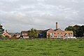
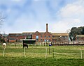 Model Farm - geograph.org.uk - 4874138.jpg 1.024 × 807; 216 KB
-
 Model Farm, Shirburn - geograph.org.uk - 720438.jpg 640 × 480; 150 KB
-
 Model Farm, Shirburn.jpg 3.456 × 2.304; 1,6 MB
-
 Mouse nest - Flickr - gailhampshire.jpg 3.608 × 3.352; 2,71 MB
-
 Not In My Woods.... - geograph.org.uk - 3495792.jpg 2.560 × 1.920; 1,56 MB
-
 Over the wall in Shirburn Park - geograph.org.uk - 4776970.jpg 4.000 × 2.664; 2,67 MB
-
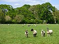 Pasture, Shirburn - geograph.org.uk - 6165419.jpg 1.024 × 768; 280 KB
-
 Pasture, Shirburn - geograph.org.uk - 720439.jpg 640 × 480; 142 KB
-
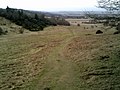 Path down Shirburn Hill - geograph.org.uk - 3301094.jpg 2.048 × 1.536; 631 KB
-
 Path down Shirburn Hill - geograph.org.uk - 3558901.jpg 4.000 × 3.000; 2,23 MB
-
 Public footpath to Lewknor - geograph.org.uk - 3301092.jpg 2.048 × 1.536; 801 KB
-
 Road Closed (23670163833).jpg 1.280 × 720; 263 KB
-
 Shirburn Hill - geograph.org.uk - 110077.jpg 640 × 480; 173 KB
-
 Shirburn Hill - geograph.org.uk - 1416870.jpg 640 × 427; 79 KB
-
 Shirburn Hill from the Ridgeway - geograph.org.uk - 3301098.jpg 2.048 × 1.536; 567 KB
-
 Shirburn Hill from Watlington Hill - geograph.org.uk - 6367368.jpg 1.920 × 1.280; 1,31 MB
-
 Shirburn Hill, Shirburn - geograph.org.uk - 6024672.jpg 1.024 × 768; 279 KB
-
 Shirburn Wood - geograph.org.uk - 1308405.jpg 640 × 480; 125 KB
-
 Shotridge Wood - geograph.org.uk - 1435229.jpg 640 × 425; 213 KB
-
 The Back of Blenheim Road (geograph 4200632).jpg 1.600 × 1.132; 471 KB
-
 The entrance to Shirburn Castle - geograph.org.uk - 6366488.jpg 1.892 × 1.236; 1,02 MB
-
 The Marl Brook near South Weston - geograph.org.uk - 4873138.jpg 785 × 1.024; 387 KB
-
 The Oxfordshire Way near Shirburn - geograph.org.uk - 4456655.jpg 4.000 × 2.856; 3,51 MB
-
 The Ridgeway - geograph.org.uk - 1435572.jpg 640 × 426; 204 KB
-
 This way towards Watlington - geograph.org.uk - 3301099.jpg 2.048 × 1.536; 691 KB
-
 Towards Brookside Covert - geograph.org.uk - 2784637.jpg 1.024 × 560; 256 KB
-
 Trees on Shirburn Hill - geograph.org.uk - 3301097.jpg 2.048 × 1.536; 422 KB
-
 Trig point on Shirburn Hill - geograph.org.uk - 3301093.jpg 2.048 × 1.536; 774 KB
-
 Shirburn benchmark - geograph.org.uk - 3507967.jpg 533 × 800; 108 KB
-
 Watlington Road - geograph.org.uk - 3507966.jpg 1.024 × 683; 154 KB
-
 Watlington Road - geograph.org.uk - 815406.jpg 640 × 480; 63 KB
-
 Woodland and pasture, Shirburn - geograph.org.uk - 2333179.jpg 640 × 480; 150 KB
-
 Woodland, Shirburn - geograph.org.uk - 6003541.jpg 1.024 × 768; 318 KB
-
 Yard at Portobello Farm - geograph.org.uk - 3668696.jpg 1.024 × 673; 153 KB
-
 Farmland and copse, Shirburn - geograph.org.uk - 720436.jpg 640 × 480; 163 KB
-
 Farmland and woodland, Shirburn - geograph.org.uk - 720442.jpg 640 × 480; 120 KB
-
 Farmland, Shirburn - geograph.org.uk - 718777.jpg 640 × 480; 155 KB
-
 Field off the Ridgeway - geograph.org.uk - 1435565.jpg 640 × 426; 201 KB
-
 Ridgeway below Shirburn Hill - geograph.org.uk - 585779.jpg 640 × 480; 135 KB
-
 Ridgeway near Shirburn - geograph.org.uk - 123128.jpg 640 × 480; 206 KB
-
 The road to Model Farm - geograph.org.uk - 93430.jpg 640 × 481; 41 KB
-
 Timber Yard, Pyrton Hill - geograph.org.uk - 110025.jpg 640 × 395; 117 KB
-
 Track to Shirburn - geograph.org.uk - 585782.jpg 640 × 480; 74 KB


.jpg)


.jpg)


