Category:Shirland
Aller à la navigation
Aller à la recherche
localité britannique du comté anglais de Derbyshire  | |||||
| Téléverser des médias | |||||
| Nature de l’élément | |||||
|---|---|---|---|---|---|
| Lieu | Shirland and Higham, North East Derbyshire, Derbyshire, Midlands de l'Est, Angleterre | ||||
 | |||||
Sous-catégories
Cette catégorie comprend seulement la sous-catégorie ci-dessous.
L
Média dans la catégorie « Shirland »
Cette catégorie comprend 53 fichiers, dont les 53 ci-dessous.
-
 43052 , Ogston (1).jpg 3 590 × 2 532 ; 3,22 Mio
-
 43052 , Ogston.jpg 4 000 × 1 899 ; 2,71 Mio
-
 Across the fields to Stonebroom - geograph.org.uk - 221553.jpg 640 × 480 ; 118 kio
-
 Hallfield Gate - geograph.org.uk - 153138.jpg 640 × 480 ; 77 kio
-
 Higham Farm Ponds - geograph.org.uk - 1015203.jpg 640 × 480 ; 146 kio
-
 Old Milepost by the B6013, Carr Hill (geograph 5623789).jpg 922 × 1 554 ; 179 kio
-
 Railway Bridge - geograph.org.uk - 501576.jpg 640 × 480 ; 129 kio
-
 River Amber - Footbridge View - geograph.org.uk - 565970.jpg 640 × 480 ; 170 kio
-
 Shirland - Church View from Pit Lane - geograph.org.uk - 692610.jpg 640 × 480 ; 68 kio
-

-
 Shirland - Red Lion - geograph.org.uk - 1205925.jpg 640 × 480 ; 76 kio
-
 Shirland - Red Lion - geograph.org.uk - 603510.jpg 640 × 480 ; 55 kio
-
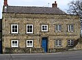 Shirland - Shirland House - geograph.org.uk - 1205931.jpg 640 × 472 ; 87 kio
-
 Shirland - The Hay - geograph.org.uk - 1205916.jpg 640 × 480 ; 60 kio
-
 Shirland - The Woolpack - geograph.org.uk - 1205936.jpg 480 × 640 ; 58 kio
-
 Shirland Lodge Farm - geograph.org.uk - 224128.jpg 640 × 480 ; 93 kio
-
 Shirland play park - geograph.org.uk - 317005.jpg 640 × 480 ; 118 kio
-
 Westhouses - Shirland Park Farm - geograph.org.uk - 1152860.jpg 640 × 506 ; 75 kio
-
 Alfreton Brook near Water Treatment Works - geograph.org.uk - 1141151.jpg 640 × 480 ; 81 kio
-
 Amber Valley - Viewed from B6013 Belper Road - geograph.org.uk - 313688.jpg 640 × 480 ; 106 kio
-
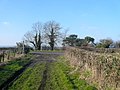 Bridleway meets B6013 - geograph.org.uk - 691590.jpg 640 × 480 ; 94 kio
-

-
 Brook Farm - geograph.org.uk - 153122.jpg 640 × 480 ; 102 kio
-

-

-
 Dale Bridge - geograph.org.uk - 87738.jpg 640 × 480 ; 239 kio
-
 Derelict church hall, Shirland - geograph.org.uk - 316991.jpg 640 × 464 ; 101 kio
-
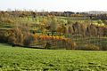
 Farmland - Shirland and Higham - geograph.org.uk - 317011.jpg 640 × 480 ; 85 kio
-
 Footpath leading towards Green - geograph.org.uk - 692112.jpg 640 × 480 ; 154 kio
-
 Footpath near Meadow Farm - geograph.org.uk - 243829.jpg 640 × 480 ; 156 kio
-
 Footpath off Mickley Lane - geograph.org.uk - 598873.jpg 640 × 449 ; 155 kio
-

-
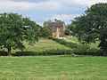
 Hallfield Hall from Footpath - geograph.org.uk - 692162.jpg 640 × 480 ; 73 kio
-
 Higham - Belper Road - geograph.org.uk - 565521.jpg 640 × 480 ; 100 kio
-
 Higham Dairy Farm - Footpath View - geograph.org.uk - 565975.jpg 640 × 480 ; 146 kio
-
 Leaving Footpath at Hallfield Gate - geograph.org.uk - 692149.jpg 640 × 480 ; 152 kio
-
 Lilac Way, Shirland - geograph.org.uk - 317017.jpg 640 × 480 ; 84 kio
-
 Looking down into the Valley from the A61 - geograph.org.uk - 599044.jpg 640 × 480 ; 119 kio
-
 Mickley Lane - Junction with Main Road (A61) - geograph.org.uk - 578036.jpg 640 × 480 ; 95 kio
-
 Millpond - Next to Higham Dairy Farm - geograph.org.uk - 565983.jpg 640 × 480 ; 120 kio
-
 Nursery Rhymes, day nursery - geograph.org.uk - 317015.jpg 640 × 480 ; 91 kio
-
 Railway near Toadhole Furnace - geograph.org.uk - 153128.jpg 640 × 480 ; 68 kio
-

-

-

-
 Shirland - Pond to south of Church - geograph.org.uk - 595603.jpg 640 × 480 ; 161 kio
-
 Shirland Golf Course - geograph.org.uk - 140406.jpg 640 × 385 ; 65 kio
-
 Shirland Golf Course - geograph.org.uk - 270130.jpg 640 × 480 ; 115 kio
-
 Shirland Golf Course - View from Footpath - geograph.org.uk - 692124.jpg 640 × 480 ; 103 kio
-
 Shirland Golf Course Footpath Junction - geograph.org.uk - 692096.jpg 640 × 480 ; 130 kio
-
 Shirland Golf Course in autumn - geograph.org.uk - 281873.jpg 640 × 429 ; 148 kio
-
 Shirland Primary School, Juniors - geograph.org.uk - 316998.jpg 640 × 440 ; 63 kio
-
 Strettea Lane junction with the A61 - geograph.org.uk - 318380.jpg 640 × 480 ; 65 kio
.jpg)


.jpg)


_-_View_from_BP_Garage_Forecourt_-_geograph.org.uk_-_778102.jpg)
_-_View_towards_Shirland_from_the_BP_Garage_-_geograph.org.uk_-_778094.jpg)


_-_geograph.org.uk_-_578036.jpg)


_and_Hallfieldgate_Lane_-_geograph.org.uk_-_603522.jpg)
_and_Park_Lane_-_geograph.org.uk_-_603500.jpg)


