Category:Shiroishi, Saga
Vai alla navigazione
Vai alla ricerca

town in Kishima district, Saga prefecture, Japan  | |||||
| Carica un file multimediale | |||||
| Istanza di | |||||
|---|---|---|---|---|---|
| Luogo |
| ||||
| Forma giuridica |
| ||||
| Data di fondazione o creazione |
| ||||
| Popolazione |
| ||||
| Superficie |
| ||||
| Ha sostituito |
| ||||
| sito web ufficiale | |||||
 | |||||
Sottocategorie
Questa categoria contiene le 8 sottocategorie indicate di seguito, su un totale di 8.
F
- Fureai Kantaku-kan (7 F)
H
- Hizen-Ryūō Station (1 F)
- Hizen-Shiroishi Station (2 F)
I
- Inasa-jinja (3 F)
P
S
- Shiota River (Saga) (24 F)
File nella categoria "Shiroishi, Saga"
Questa categoria contiene 84 file, indicati di seguito, su un totale di 84.
-
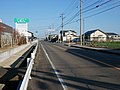
 An altitude 1 meter sign at Route 444 in Suminoe, Shiroishi.jpg 4 400 × 2 933; 7,19 MB
-
 Anpukuji Kannondo in Shiroishi.jpg 5 448 × 3 632; 15,63 MB
-
 Anpukuji Reisuido in Shiroishi.jpg 4 648 × 3 486; 11,77 MB
-
 Ariake Skypark Fureai-kyo park and tower.jpg 5 448 × 3 632; 7,92 MB
-
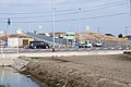 Ariake-Engan Fukudomi Interchange 2022-01-28.jpg 3 300 × 2 200; 4,14 MB
-
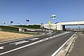 Ariake-Engan Fukudomikita Interchange entrance.jpg 3 900 × 2 600; 1,98 MB
-
 Emblem of Shiroishi, Saga (1971–2005).svg 512 × 429; 958 byte
-
 Emblem of Shiroishi, Saga.svg 512 × 511; 983 byte
-
 Fields on Shiroishi Plain and old reclamation dikes from Fukudomi Myland Park.jpg 4 842 × 3 632; 10,94 MB
-
 Flag of Former Shiroishi Saga.png 358 × 216; 12 KB
-
 Flag of Shiroishi Saga.JPG 370 × 230; 11 KB
-
 Flag of Shiroishi, Saga.svg 512 × 318; 1 KB
-
 Former Shiroishi Saga chapter.JPG 170 × 150; 8 KB
-
 Fukudomi Yuaikan.jpg 4 032 × 2 688; 2,78 MB
-
 Fukutomi Meteorite.jpg 3 084 × 1 736; 3 MB
-
 Growing paddy fields in Shintaku, Shiroishi.jpg 5 448 × 3 632; 14,07 MB
-
 Hizen Inuyama Castle observation platform in Shiroishi.jpg 5 456 × 2 728; 8,16 MB
-
 Hyakkan Bridge in Fukaura, Shiroishi.jpg 3 300 × 2 200; 1,56 MB
-
 Kaido Shrine near Ryuozaki in Shiroishi.jpg 5 448 × 3 632; 11,31 MB
-
 Kishimaburi monument in Utagaki Park Shiroishi.jpg 5 448 × 3 632; 13,4 MB
-
 Land reclamated fields of Shiroishi Plain.jpg 5 456 × 2 728; 7,83 MB
-
 Lotus fields on reclaimed plain in Shintaku, Shiroishi.jpg 5 448 × 3 632; 11,1 MB
-
 Lotus roots pre-harvest fields in Fukudomi, Shiroishi, Saga.jpg 4 842 × 3 632; 14,45 MB
-
 Megurie River.jpg 3 200 × 2 400; 3,42 MB
-
 Michinoeki Shiroishi building and logotype.jpg 4 500 × 3 000; 6,63 MB
-
 Michinoeki Shiroishi bus stop.jpg 2 200 × 3 300; 4,41 MB
-
 Mount Kishima from Fukuda, Shroishi.jpg 5 456 × 1 364; 3,75 MB
-
 Mutsugoro cc in Shiroishi Saga.jpg 5 448 × 3 632; 11,58 MB
-
 Nagasaki Line Shiotagawa Bridge.jpg 3 600 × 2 400; 2,26 MB
-
 Nekozuka at Shurinji Temple.jpg 3 632 × 4 842; 4,03 MB
-
 Nekozuka seven tails cat at Shurinji Temple close up.jpg 1 950 × 2 600; 3,17 MB
-
 Nuinoike Pond and Shrine, trees front.jpg 4 608 × 3 456; 6,39 MB
-
 Nuinoike Pond and Shrine, trees west side.jpg 3 456 × 4 608; 5,92 MB
-
 Omachi Bridge of Saga Pref r214 in Owatari.jpg 4 032 × 3 024; 3,14 MB
-
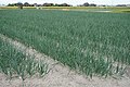 Onion field in Imaizumi, Shiroishi.jpg 5 448 × 3 632; 14,92 MB
-
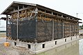 Onions hanging on drying racks in Fukudomi 01.jpg 5 193 × 3 462; 9,39 MB
-
 Outlet of Fukaura Dam spillway tunnel.jpg 3 920 × 2 940; 2,32 MB
-
 Population distribution of Shiroishi, Saga, Japan.svg 512 × 256; 22 KB
-
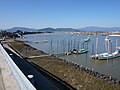 Port of Suminoe in Saga 2017.jpg 4 842 × 3 632; 9,16 MB
-
 Rokkaku River Estuary Weir view from upside right.jpg 3 600 × 2 400; 6,69 MB
-
 Rokkakugawa river.JPG 3 072 × 2 304; 1,17 MB
-
 Ryu Shrine sculpture and inscribed board in Fukudomi, Shiroishi.jpg 4 842 × 3 632; 8,75 MB
-
 Ryu Shrine worship hall in Fukudomi, Shiroishi.jpg 4 842 × 3 632; 12,2 MB
-
 Ryuozaki kofun-gun second mount chamber.jpg 4 842 × 3 632; 12,95 MB
-
 Ryuozaki kofun-gun sixth mount chamber.jpg 5 456 × 3 632; 13,41 MB
-
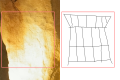 Ryuozaki kofun-gun sixth mount line drawing.svg 1 200 × 800; 878 KB
-
 Saga prefectural road 268 in Tsutsumi Kasegawa, Shiroishi.jpg 4 800 × 3 200; 8,74 MB
-
 Saga Prefectural Road 324 in Furuwatashi.jpg 3 200 × 2 400; 2,17 MB
-
 Saga prefectural road No 36 in Fukuyoshi, Shiroishi.jpg 4 842 × 3 632; 9,36 MB
-
 Saga Shiroishi Police Station 2023.JPG 2 313 × 1 575; 520 KB
-
 SagaKen Shiroishi town.png 160 × 140; 4 KB
-
 Shin-watashi Ohashi from low right bank.jpg 3 900 × 2 600; 8,17 MB
-
 Shiodome Kannon in Fukudomi.jpg 3 632 × 4 842; 3,93 MB
-
 Shiotagawa River from train of Nagasaki Main Line 2.jpg 4 032 × 3 024; 1,2 MB
-
 Shiotagawa River from train of Nagasaki Main Line.jpg 4 032 × 3 024; 1,52 MB
-
 Shiroishi Central Branch of JA Saga.jpg 5 448 × 3 632; 9,94 MB
-
 Shiroishi in Saga Prefecture Ja.svg 520 × 592; 11 KB
-
 Shiroishi in Saga Prefecture.png 981 × 801; 33 KB
-
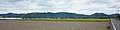
 Shiroishi Plain from Mount Inuyama.jpg 5 456 × 2 728; 9,79 MB
-
 Shiroishi Police Station Saga Japan.JPG 3 072 × 2 304; 1,07 MB
-
 Shiroishi Saga chapter.JPG 189 × 190; 12 KB
-
 Shiroishi Town Ariake Community Center.jpg 2 800 × 2 100; 1,08 MB
-
 Shiroishi town Ariake kantaku.jpg 850 × 800; 174 KB
-
 Shiroishi Town General Community Center.jpg 4 032 × 2 688; 2,14 MB
-
 Shiroishi town hall.JPG 4 000 × 2 250; 2,61 MB
-
 Shiroishi Town Ikocar busstop.jpg 848 × 2 040; 430 KB
-
 Suko Castle hill full view.jpg 5 448 × 3 632; 11,27 MB
-
 Suko Castle main area and rocks.jpg 5 448 × 3 632; 20,21 MB
-
 Suko Castle main area entrance.jpg 5 448 × 3 632; 15,25 MB
-
 Suko River Drainage Pump Station.jpg 4 032 × 3 024; 2,44 MB
-
 Tsumayama Shrine Torii Shiroishi Saga.jpg 4 608 × 3 456; 6,39 MB
-
 Umada Bridge of Saga Pref r351 in Morai.jpg 3 900 × 2 600; 2,28 MB
-
 Utagaki Park instructional center in Shiroishi.jpg 4 500 × 3 000; 9,23 MB
-
 Warehouse's base piles exposed by subsidence in Shiroishi, Saga 01.jpg 5 448 × 3 632; 9,84 MB
-
 Warehouse's base piles exposed by subsidence in Shiroishi, Saga 02.jpg 5 448 × 3 632; 8,73 MB
-
 Wheat and very early rice cultivating in Morai, Shiroishi.jpg 4 032 × 3 024; 2,98 MB
-
 White seawalls of Fukudomi.jpg 5 456 × 2 728; 9,26 MB
-
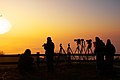 朝日のシャッターポイント - panoramio.jpg 1 800 × 1 196; 570 KB
-
 桜の里公園 - panoramio.jpg 1 540 × 1 024; 781 KB
-
 歌垣公園 - panoramio.jpg 2 485 × 1 651; 891 KB
-
 歌垣公園より白石平野 - panoramio.jpg 1 806 × 1 200; 972 KB
-
 法泉寺大仏.jpg 3 024 × 4 032; 2,32 MB
-
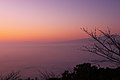 霧に浮かぶ多良岳と雲仙岳 - panoramio.jpg 1 800 × 1 196; 726 KB
-
 霧の山裾 - panoramio.jpg 1 800 × 1 196; 633 KB


.svg)


