Category:Shoals
Vai alla navigazione
Vai alla ricerca
fondo marino poco profondo | |||||
| Carica un file multimediale | |||||
| Sottoclasse di |
| ||||
|---|---|---|---|---|---|
| Aspetto di | |||||
| Distinto da | |||||
| Considerato essere uguale a | bar | ||||
| |||||
A shoal or sandbar (also called sandbank) is a somewhat linear landform within or extending into a body of water, typically composed of sand, silt or small pebbles. A bar is characteristically long and narrow (linear) and develops where a stream or ocean current promote deposition of granular material, resulting in localized shallowing (shoaling) of the water. Bars can appear in the sea, in a lake, or in a river.
Sottocategorie
Questa categoria contiene le 23 sottocategorie indicate di seguito, su un totale di 23.
- Birds of shoals (7 F)
.
- Wave shoaling (2 F)
A
B
- Barre d'Étel (13 F)
C
- Cartwright Shoals (1 F)
G
- Green Jacket Shoal (19 F)
H
- Hate-no-hama (39 F)
J
- Jiuduansha (3 F)
K
- Karkhof (2 F)
- Koh Nang Yuan (1 P, 52 F)
M
- Mizu Island (Fukui) (19 F)
N
P
S
- Syotenkyo (4 F)
Y
File nella categoria "Shoals"
Questa categoria contiene 72 file, indicati di seguito, su un totale di 72.
-
En-us-shoal.ogg 1,2 s; 13 KB
-
1 Amanohashidate panorama 2014.jpg 6 745 × 3 345; 16,2 MB
-
13-09-29-nordfriesisches-wattenmeer-RalfR-14.jpg 4 288 × 2 848; 3,54 MB
-
2013-05-03 Fotoflug Nordholz Papenburg HP 3561.JPG 5 760 × 3 840; 6,05 MB
-
2013-05-03 Fotoflug Nordholz Papenburg HP 3562.JPG 5 760 × 3 840; 6,04 MB
-
Amanohashidate panorama Wikivoyage banner.jpg 6 745 × 963; 4,52 MB
-
Area ali aliev.jpg 960 × 720; 209 KB
-
Areia Vermelha - Cabedelo - Paraíba - Brasil.jpg 640 × 491; 166 KB
-
Banco de areia 2.png 1 500 × 1 125; 3,22 MB
-
Beach at Ocean Shores, WA - the bar, pano 01.jpg 5 904 × 1 632; 2,13 MB
-
Bimini Islands 2013 2.jpg 4 288 × 2 848; 8,08 MB
-
Bimini Islands 2013 3.jpg 4 288 × 2 848; 8,44 MB
-
Bimini Islands 2013.jpg 2 735 × 3 834; 11,46 MB
-
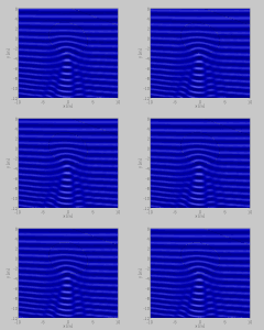
Bous2d berk03 z.gif 480 × 400; 416 KB
-
CedarParkFalls.jpg 4 372 × 3 101; 4,06 MB
-
Clyde sandbanks, Tail of the Bank and Ardmore Point.jpg 3 898 × 2 193; 2,32 MB
-
Conwy River from Conwy Castle.jpg 2 048 × 1 536; 1,84 MB
-
Corangon Shoal.jpg 6 000 × 2 871; 1,64 MB
-
Deutschland-Italien, Euro 2012, DSC3479.JPG 4 288 × 2 848; 6,89 MB
-
DoomBarRiverCamelCornwall2jpg.jpg 640 × 426; 55 KB
-
Duluth Overview-Park Point.jpeg 2 048 × 1 536; 795 KB
-
Dzharylhach near Lazurne.jpg 5 153 × 1 348; 1 015 KB
-
Fanning lagoon sandbar.jpg 1 724 × 1 200; 1,05 MB
-
FISHERMEN EVENING RETURN DAKAR LIGHTHOUSE.jpg 960 × 720; 172 KB
-
FMIB 38003 Chart Showing the Shambles Shoal.jpeg 908 × 701; 142 KB
-
GughSandbar.JPG 2 304 × 1 728; 2,75 MB
-
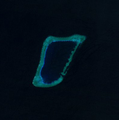
Half Moon Shoal, Spratly Islands.png 394 × 397; 89 KB
-
Hare riffles.jpg 500 × 350; 102 KB
-
Hurricane Sandy impacts Prime Hook National Wildlife Refuge (DE).jpg 1 143 × 432; 155 KB
-
IMGP4146 (5776045073).jpg 800 × 532; 160 KB
-
Kleine Sandbank vor Juist.JPG 3 648 × 2 736; 4,18 MB
-
Luchtopnamen zeehonden op zandbanken-Stichting Natuurbeelden-172651.webm 6 min 46 s, 512 × 288; 48,8 MB
-
Mecklenburg Karte1645.jpg 2 899 × 2 209; 1,38 MB
-
Mikawa Bay and Saku Island.jpg 5 184 × 3 456; 6,15 MB
-
Mississippi River-sand bars.jpg 860 × 539; 313 KB
-
Mississippi-River-Sandbar-Sunset.jpg 1 749 × 1 181; 458 KB
-
Mudbank, River Adur - geograph.org.uk - 1075068.jpg 479 × 640; 71 KB
-
Nantucket Shoals NOAA chart 12300.gif 762 × 746; 46 KB
-
Naturschutzgebiet Holnis Sandbank.jpg 1 600 × 1 200; 1,42 MB
-
No. 113 Yerba Buena Shoals Rock Wall July 9, 1936 Time 12 Noon - NARA - 296375.jpg 3 000 × 2 335; 3,76 MB
-
Nolichucky-river-shoals-tn1.jpg 1 991 × 1 259; 774 KB
-
Nosy Iranja 097.jpg 3 008 × 2 000; 1,36 MB
-
Playing on the sand bar (5232683156).jpg 2 048 × 1 365; 2,5 MB
-
POL Warszawa island.jpg 2 048 × 1 536; 685 KB
-
River mouth of Nanaderagawa River at Hakata Bay 3.JPG 3 264 × 2 448; 2,32 MB
-
River sandbar.jpg 1 745 × 2 625; 262 KB
-
Roggenplaat-Eastern-Scheldt-Zeeland-2020-Luka-Peternel.jpg 4 494 × 3 648; 3,84 MB
-
Sable island-N.png 624 × 301; 363 KB
-
Sable island.jpg 637 × 639; 103 KB
-
Sandbank Csongrad.JPG 1 024 × 768; 423 KB
-
SandbarLongIsland1.jpg 1 544 × 809; 272 KB
-
Sato Shoal.jpg 2 478 × 2 563; 1,27 MB
-
Shoal Creek shoals (2) (5164088335).jpg 3 504 × 2 336; 5,47 MB
-
Shoal Creek shoals (5164695764).jpg 3 504 × 2 336; 5,17 MB
-
Shoals, IN 47581, USA - panoramio (1).jpg 2 592 × 1 764; 1,42 MB
-
Shoals, IN 47581, USA - panoramio.jpg 2 592 × 1 834; 1,05 MB
-
South Luconia Shoals f 12.jpg 1 000 × 566; 187 KB
-
Spencer-Gulf-shoals-between-Whyalla-and-Cowell-aerial-view-1212.jpg 2 048 × 1 536; 1,51 MB
-
Stingray City, Cayman Islands.jpg 1 000 × 645; 205 KB
-
Superiorshoals.jpg 2 884 × 1 768; 683 KB
-
VenRiv Below Santa Anna Brdg 2011 Scott Lewis.jpg 648 × 486; 406 KB
-
Vue du plateau de Cordouan à marée basse en août 2018.jpg 3 264 × 1 836; 2,39 MB
-
WayaWayasewa.jpg 1 153 × 1 745; 470 KB
-
Westerschelde - Hooge Platen - oostelijk deel.jpg 2 925 × 2 333; 3,65 MB
-
Wisła bulwary Powiśle Warszawa 002.jpg 1 620 × 1 080; 636 KB
-
Yarigasaki from Mount Amagoi.jpg 5 184 × 3 456; 7,23 MB
-
Прогулки по воде.JPG 2 048 × 1 536; 1,23 MB


