Category:Shoreham, Kent
Naar navigatie springen
Naar zoeken springen
English: Shoreham is a village and civil parish in the valley of the River Darent six miles north of Sevenoaks in Kent: it is in the District of Sevenoaks. The parish includes the settlements of Badgers Mount and Well Hill.
Nederlands: Shoreham is een plaats in het bestuurlijke gebied Sevenoaks, in het Engelse graafschap Kent.
Kent  L'église du village | |||||
| Media uploaden | |||||
| Is een | |||||
|---|---|---|---|---|---|
| Locatie | Sevenoaks, Kent, South East England, Engeland | ||||
 | |||||
Ondercategorieën
Deze categorie bevat de volgende 10 subcategorieën, van de 10 in totaal.
O
P
R
- Romney Street, Kent (6 B)
S
- Shoreham Cross (3 B)
- Shoreham railway station (21 B)
- Shoreham war memorial (4 B)
- Shoreham Wood (12 B)
W
- Well Hill (9 B)
Media in categorie "Shoreham, Kent"
Deze categorie bevat de volgende 200 bestanden, van in totaal 791.
(vorige pagina) (volgende pagina)-

-
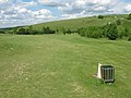 16th Tee Austin Lodge Golf Course - geograph.org.uk - 1315060.jpg 640 × 480; 85 kB
-

-
 A bridleway goes over the M25 - geograph.org.uk - 3008571.jpg 800 × 600; 71 kB
-
 A corner of Shoreham - geograph.org.uk - 3628042.jpg 4.000 × 3.000; 4,1 MB
-
 A dog in the ford - geograph.org.uk - 1978087.jpg 640 × 428; 166 kB
-

-
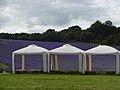
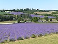
 A field of lavandin at Castle Lavender Farm - geograph.org.uk - 5050765.jpg 4.608 × 3.456; 4,01 MB
-
 A field of lavender at Castle Lavender Farm - geograph.org.uk - 5050776.jpg 4.608 × 3.456; 3,9 MB
-

-
 A lavender field in winter - geograph.org.uk - 4757399.jpg 4.608 × 3.456; 3,4 MB
-
-

-
 A passing shower over Shoreham - geograph.org.uk - 5375567.jpg 4.000 × 3.000; 4,67 MB
-
 A road junction in the woods - geograph.org.uk - 940939.jpg 640 × 430; 86 kB
-
 A seat in Shoreham Woods - geograph.org.uk - 641941.jpg 640 × 480; 140 kB
-

-
-
 A sturdy but rather pointless gate - geograph.org.uk - 3865610.jpg 4.000 × 3.000; 4,27 MB
-
 A way through the woods - geograph.org.uk - 1978287.jpg 640 × 428; 166 kB
-
 A225 - geograph.org.uk - 3545616.jpg 640 × 430; 80 kB
-
 Above the Shoreham Memorial Cross - geograph.org.uk - 3865683.jpg 4.000 × 3.000; 3,97 MB
-
-
 Allotments, High St - geograph.org.uk - 1731923.jpg 640 × 427; 146 kB
-
 Almshouses - geograph.org.uk - 796289.jpg 640 × 426; 94 kB
-
 Almshouses, High St - geograph.org.uk - 1731799.jpg 640 × 427; 85 kB
-
 Along the side of the Darent Valley - geograph.org.uk - 4150769.jpg 4.000 × 3.000; 4,32 MB
-
 Anacamptis pyramidis - geograph.org.uk - 192178.jpg 426 × 640; 117 kB
-
 Approaching junction 4, M25 - geograph.org.uk - 2028756.jpg 640 × 430; 122 kB
-
 Approaching Shoreham - geograph.org.uk - 5204752.jpg 1.280 × 851; 495 kB
-

-
 Are you being served^ - geograph.org.uk - 5050756.jpg 4.608 × 3.456; 3,97 MB
-
 Austin Lodge Golf Course - geograph.org.uk - 4010167.jpg 4.000 × 3.000; 4,08 MB
-
 Autumn colours at Castle Farm - geograph.org.uk - 5181303.jpg 4.608 × 3.456; 3,33 MB
-
 Autumn colours at Magpie Bottom - geograph.org.uk - 5181339.jpg 4.608 × 3.456; 3,59 MB
-
 Autumn countryside - geograph.org.uk - 3206889.jpg 4.000 × 3.000; 4,13 MB
-
 Autumn footpath, Great Wood - geograph.org.uk - 2126476.jpg 640 × 428; 155 kB
-
 Autumn lane at Castle Farm - geograph.org.uk - 5181307.jpg 4.608 × 3.456; 3,39 MB
-

-
 Autumnal lane at Castle Farm - geograph.org.uk - 5181313.jpg 4.608 × 3.456; 3,41 MB
-
 Autumnal woods seen from Magpie Bottom - geograph.org.uk - 5181337.jpg 4.608 × 3.456; 3,56 MB
-
 Bales of hay in the Darent Valley - geograph.org.uk - 5075719.jpg 4.608 × 3.456; 3,36 MB
-
 Bales of straw in the Darent Valley - geograph.org.uk - 5075729.jpg 4.608 × 3.456; 3,39 MB
-
 Bales of straw in the Darent Valley - geograph.org.uk - 5075738.jpg 4.608 × 3.456; 3,96 MB
-
 Barn and silo, Filston Farm - geograph.org.uk - 1978061.jpg 640 × 428; 124 kB
-
 Bench in West Wood - geograph.org.uk - 1331680.jpg 640 × 480; 133 kB
-
 Bench on Preston Hill - geograph.org.uk - 1349897.jpg 640 × 480; 130 kB
-
 Beware - golf buggies - geograph.org.uk - 5204762.jpg 1.280 × 851; 532 kB
-
 Black-bellied sheep, Sepham Farm - geograph.org.uk - 1978006.jpg 640 × 428; 161 kB
-
 Boakes Meadow - geograph.org.uk - 1729545.jpg 640 × 427; 109 kB
-
 Boakes Meadow, Shoreham - geograph.org.uk - 2774579.jpg 640 × 480; 79 kB
-
 Boakes Meadow, Shoreham - geograph.org.uk - 5205465.jpg 1.280 × 851; 423 kB
-
 Born of Leaves Decaying - geograph.org.uk - 191630.jpg 640 × 426; 153 kB
-
 Bower Lane - geograph.org.uk - 1706204.jpg 2.048 × 1.536; 1,03 MB
-
 Bower Lane - geograph.org.uk - 2187976.jpg 640 × 430; 147 kB
-
 Bower Lane - geograph.org.uk - 2187987.jpg 640 × 430; 136 kB
-
 Bower Lane - geograph.org.uk - 2187988.jpg 640 × 430; 133 kB
-
 Bower Lane at the junction of Goodbury Road - geograph.org.uk - 4426688.jpg 2.560 × 1.920; 2 MB
-
 Bower Lane, Romney Street - geograph.org.uk - 4426248.jpg 2.560 × 1.920; 2,09 MB
-
 Bower Lane, Romney Street - geograph.org.uk - 4426772.jpg 2.560 × 1.920; 2,05 MB
-
 Bower Lane, Romney Street - geograph.org.uk - 4428197.jpg 2.560 × 1.920; 2,01 MB
-
 Brick cottage, Mill Lane - geograph.org.uk - 1731959.jpg 640 × 427; 123 kB
-
 Bridge in Shoreham - geograph.org.uk - 1437037.jpg 640 × 425; 90 kB
-
 Bridge over River Darent - geograph.org.uk - 1917446.jpg 1.024 × 768; 310 kB
-
 Bridge over River Darent at Castle Farm - geograph.org.uk - 2335875.jpg 640 × 480; 121 kB
-
 Bridge over the M25 - geograph.org.uk - 3729819.jpg 640 × 402; 48 kB
-
 Bridge Over The M25 - geograph.org.uk - 68449.jpg 640 × 480; 49 kB
-
 Bridge over the M25 at Polhill - geograph.org.uk - 3731089.jpg 640 × 436; 43 kB
-
 Bridge over the M25 at Polhill - geograph.org.uk - 6077053.jpg 3.729 × 1.964; 1,04 MB
-
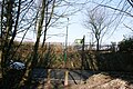
 Bridge over the railway - geograph.org.uk - 3206489.jpg 4.000 × 3.000; 4,31 MB
-
 Bridge over the River Darenth - Shoreham - geograph.org.uk - 2001137.jpg 1.772 × 1.170; 1,39 MB
-
 Bridleway Bridge, M25 - geograph.org.uk - 3307289.jpg 640 × 456; 56 kB
-
 Bridleway in Home Wood - geograph.org.uk - 1349907.jpg 640 × 480; 125 kB
-
 Bridleway into Pilots Wood - geograph.org.uk - 1331609.jpg 640 × 480; 140 kB
-
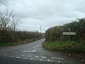
 Bridleway near Romney Street - geograph.org.uk - 940899.jpg 640 × 430; 110 kB
-
-

-
 Bridleway south to Magpie Bottom - geograph.org.uk - 2188024.jpg 640 × 430; 159 kB
-

-
 Bridleway to Shoreham - geograph.org.uk - 940961.jpg 430 × 640; 123 kB
-
 Bridleway to Shoreham Station - geograph.org.uk - 5204520.jpg 6.016 × 4.000; 5,33 MB
-
 Bridleway up White Hill - geograph.org.uk - 5204732.jpg 1.280 × 851; 819 kB
-
 Castle Farm - geograph.org.uk - 1706228.jpg 2.048 × 1.536; 1,3 MB
-
 Castle Farm - geograph.org.uk - 5303399.jpg 4.000 × 3.000; 4,66 MB
-
 Castle Farm near Lullingstone - geograph.org.uk - 2774620.jpg 640 × 480; 134 kB
-
 Castle Farm Road - geograph.org.uk - 3207694.jpg 4.000 × 3.000; 4,39 MB
-
 Castle Farm Road - geograph.org.uk - 3207697.jpg 4.000 × 3.000; 4,48 MB
-
 Castle Farm Road - geograph.org.uk - 3207701.jpg 4.000 × 3.000; 4,45 MB
-
 Castle Farm Road - geograph.org.uk - 3207703.jpg 4.000 × 3.000; 4,09 MB
-
 Castle Farm Road entering Shoreham - geograph.org.uk - 3156988.jpg 2.048 × 1.536; 1,49 MB
-
 Castle Farm Road, Shoreham - geograph.org.uk - 1612127.jpg 640 × 480; 113 kB
-
 Castle Farm shop - geograph.org.uk - 5832270.jpg 4.000 × 3.000; 3,21 MB
-
 Castle Farmhouse (geograph 5832276).jpg 4.000 × 3.000; 3,77 MB
-
 Castle Lane (2) - geograph.org.uk - 1732896.jpg 640 × 427; 94 kB
-
 Castle Lane - geograph.org.uk - 1732890.jpg 640 × 427; 57 kB
-
 Castle Lane - geograph.org.uk - 1733077.jpg 640 × 427; 70 kB
-
 Castle Lane outside Castle Farm (2) - geograph.org.uk - 1732921.jpg 640 × 427; 86 kB
-
 Castle Lane outside Castle Farm - geograph.org.uk - 1732916.jpg 640 × 427; 121 kB
-
 Castle Lavender Farm - geograph.org.uk - 4576086.jpg 4.000 × 3.000; 3,9 MB
-
 Castle Lavender Farm - geograph.org.uk - 5050742.jpg 4.608 × 3.456; 3,32 MB
-
 Castle Lavender Farm - geograph.org.uk - 5050751.jpg 4.608 × 3.456; 3,59 MB
-
 Castle Lavender Farm - geograph.org.uk - 5847378.jpg 4.000 × 3.000; 4,41 MB
-
 Castle Lavender Farm - geograph.org.uk - 5847381.jpg 4.000 × 3.000; 4,8 MB
-
 Castle Lavender Farm - geograph.org.uk - 5847384.jpg 4.000 × 3.000; 4,92 MB
-
 Castle Lavender Farm - geograph.org.uk - 5847386.jpg 4.000 × 3.000; 4,66 MB
-
 Castle Lavender Farm near Shoreham - geograph.org.uk - 4576236.jpg 4.000 × 3.000; 4,31 MB
-
 Castle Lavender Farm near Shoreham - geograph.org.uk - 4578239.jpg 3.631 × 2.860; 1,65 MB
-
 Castle Lavender Farm near Shoreham - geograph.org.uk - 4757404.jpg 4.608 × 3.456; 3,66 MB
-
 Castle Lavender Farm near Shoreham - geograph.org.uk - 4757409.jpg 4.608 × 3.456; 3,63 MB
-
 Castle Lavender Farm near Shoreham - geograph.org.uk - 4757417.jpg 4.608 × 3.456; 3,41 MB
-
 Castle Road, Lullingstone - geograph.org.uk - 2774617.jpg 640 × 480; 82 kB
-
 Castle Road, Lullingstone - geograph.org.uk - 2801747.jpg 1.600 × 1.200; 579 kB
-
 Cattle grazing by Bower Lane - geograph.org.uk - 2187972.jpg 640 × 430; 106 kB
-
 Cattle grazing by Bower Lane - geograph.org.uk - 2187979.jpg 640 × 430; 110 kB
-
 Cattle near Magpie Bottom - geograph.org.uk - 940919.jpg 640 × 430; 101 kB
-
 Cattle near The Baron's - geograph.org.uk - 2126731.jpg 640 × 428; 90 kB
-
 Cattle sheltering by the River Darent - geograph.org.uk - 4578240.jpg 4.000 × 3.000; 4,12 MB
-
 Cattle, Bower Lane - geograph.org.uk - 2187995.jpg 640 × 430; 133 kB
-
 CBM, Two Brewers, High Street Shoreham - geograph.org.uk - 2743153.jpg 2.304 × 1.728; 554 kB
-

-
 Church St, Shoreham - geograph.org.uk - 1729416.jpg 640 × 427; 49 kB
-
 Church St, Shoreham - geograph.org.uk - 1731785.jpg 640 × 427; 75 kB
-
 Church Street, Shoreham - geograph.org.uk - 2774496.jpg 640 × 480; 73 kB
-
 Church Street, Shoreham - geograph.org.uk - 3627244.jpg 4.000 × 3.000; 4,02 MB
-
 Church Street, Shoreham - geograph.org.uk - 4169299.jpg 4.000 × 3.000; 4,12 MB
-
 Church Street, Shoreham - geograph.org.uk - 4592199.jpg 4.000 × 3.000; 4,28 MB
-
 Church Street, Shoreham, Kent - geograph.org.uk - 788925.jpg 640 × 480; 100 kB
-
 Churchyard gate, Shoreham - geograph.org.uk - 2774345.jpg 640 × 480; 89 kB
-
 Club House, Darent Valley Golf Club - geograph.org.uk - 1726204.jpg 640 × 425; 73 kB
-
 Cockerhurst House - geograph.org.uk - 5873306.jpg 1.024 × 678; 959 kB
-
 Cockerhurst Lane, above Shoreham - geograph.org.uk - 2206440.jpg 1.146 × 765; 641 kB
-
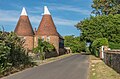 Cockerhurst Oasts - geograph.org.uk - 5873287.jpg 1.024 × 678; 897 kB
-
 Cockerhurst Oasts, Redmans Lane, Shoreham - geograph.org.uk - 5069829.jpg 5.184 × 3.456; 6,62 MB
-
 Cockerhurst Road - geograph.org.uk - 3207549.jpg 4.000 × 3.000; 4,1 MB
-
 Cockerhurst Road - geograph.org.uk - 3207680.jpg 4.000 × 3.000; 4,27 MB
-
 Cockerhurst Road, Shoreham - geograph.org.uk - 1593843.jpg 640 × 480; 106 kB
-
 Cockerhurst Road, Well Hill - geograph.org.uk - 1593841.jpg 640 × 480; 57 kB
-
 Coffee trailer at Castle Farm - geograph.org.uk - 5832274.jpg 4.000 × 3.000; 3,74 MB
-
 Conifers, Great Wood - geograph.org.uk - 2189525.jpg 640 × 430; 200 kB
-

-
 Coppiced area, Home Wood - geograph.org.uk - 3801666.jpg 640 × 428; 156 kB
-
 Corner of old orchard, Sepham Farm - geograph.org.uk - 3803740.jpg 640 × 428; 156 kB
-
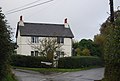
 Cottage on Bower Lane, Romney Street - geograph.org.uk - 4427841.jpg 2.560 × 1.920; 1,98 MB
-

-
 Cottage, Romney Street - geograph.org.uk - 2187992.jpg 640 × 430; 129 kB
-
 Cottages next to the River Darent - geograph.org.uk - 3865575.jpg 4.000 × 3.000; 4,05 MB
-
 Cottages next to the River Darent - geograph.org.uk - 3865576.jpg 4.000 × 3.000; 4,19 MB
-

-
 Country lanes near Otford - geograph.org.uk - 2769895.jpg 640 × 480; 120 kB
-
 Country lanes near Otford - geograph.org.uk - 2771094.jpg 640 × 480; 111 kB
-
 Cow parsley near Castle Farm - geograph.org.uk - 6170142.jpg 3.663 × 2.747; 2,22 MB
-
 Cow parsley near Castle Farm - geograph.org.uk - 6170144.jpg 4.000 × 3.000; 5,04 MB
-

-
 Cricket match, Shoreham - geograph.org.uk - 1978105.jpg 640 × 428; 99 kB
-

-
 Crop field above Shoreham - geograph.org.uk - 3606922.jpg 640 × 427; 85 kB
-
 Crossing Darenth Valley Golf Course - geograph.org.uk - 5204944.jpg 1.280 × 851; 589 kB
-
 Crossroads and bench in Meenfield Woods - geograph.org.uk - 1333160.jpg 640 × 480; 124 kB
-
 Crossroads near Porter's Farm - geograph.org.uk - 1315117.jpg 640 × 480; 79 kB
-
 Crown Rd, Shoreham - geograph.org.uk - 1731931.jpg 640 × 427; 65 kB
-
 Crown Road - geograph.org.uk - 796293.jpg 640 × 426; 82 kB
-
 Crown Road, Shoreham - geograph.org.uk - 1612138.jpg 640 × 480; 45 kB
-
 Curved Garden Wall - geograph.org.uk - 1918849.jpg 1.024 × 768; 278 kB
-
 Darent Golf Clubhouse - geograph.org.uk - 1331380.jpg 640 × 480; 76 kB
-
 Darent Valley - geograph.org.uk - 6126772.jpg 1.024 × 768; 179 kB
-
 Darent Valley from Castle Farm Road - geograph.org.uk - 3207685.jpg 4.000 × 3.000; 4,37 MB
-
 Darent Valley from Fackenden Lane - geograph.org.uk - 5205691.jpg 1.280 × 851; 530 kB
-
 Darent Valley from High Street, Shoreham - geograph.org.uk - 3207671.jpg 4.000 × 3.000; 4,05 MB
-
 Darent Valley Golf Club - geograph.org.uk - 1726196.jpg 640 × 427; 72 kB
-
 Darent Valley Golf Course - geograph.org.uk - 1725245.jpg 640 × 427; 93 kB
-
 Darent Valley Golf Course - geograph.org.uk - 1725252.jpg 640 × 427; 73 kB
-
 Darent Valley Golf Course - geograph.org.uk - 1726199.jpg 640 × 427; 89 kB
-

-

-
 Darent Valley Path - geograph.org.uk - 1725204.jpg 640 × 427; 83 kB
-
 Darent Valley Path - geograph.org.uk - 1725217.jpg 640 × 427; 90 kB
-
 Darent Valley Path - geograph.org.uk - 1725239.jpg 640 × 427; 122 kB
-

-
 Darent Valley Path along Castle Lane - geograph.org.uk - 1733083.jpg 640 × 427; 97 kB
-

-

-
 Darent Valley Path heading north - geograph.org.uk - 1732103.jpg 640 × 427; 85 kB
-
 Darent valley Path heading north - geograph.org.uk - 1732707.jpg 640 × 427; 86 kB
-
 Darent valley Path heading north - geograph.org.uk - 1732794.jpg 640 × 427; 70 kB
-
-
 Darent Valley Path near Lullingstone - geograph.org.uk - 2774619.jpg 640 × 480; 70 kB
-

-

-

-

-

-

-
 Darent Valley Path, Shoreham - geograph.org.uk - 2774298.jpg 480 × 640; 137 kB
-
 Darent Valley Path, Shoreham - geograph.org.uk - 2774328.jpg 640 × 480; 119 kB
-
 Darent Valley Path, Shoreham - geograph.org.uk - 2774607.jpg 640 × 480; 148 kB
-

-
 Darent valley, east side - geograph.org.uk - 5002563.jpg 640 × 427; 80 kB
-
 Darent valley, west side - geograph.org.uk - 5002537.jpg 640 × 427; 79 kB
-
 Darenth Hulme Cottage - geograph.org.uk - 3802914.jpg 640 × 428; 162 kB
-
 Darenth Valley Golf Club - geograph.org.uk - 3168432.jpg 1.600 × 1.200; 348 kB


.jpg)
_-_geograph.org.uk_-_1732896.jpg)


_-_geograph.org.uk_-_1732921.jpg)


